Ibitinga
| Ibitinga | ||
|---|---|---|
| Municipality | ||
| ||
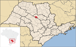 Location in São Paulo state | ||
 Ibitinga Location in Brazil | ||
| Coordinates: 21°45′28″S 48°49′44″W / 21.75778°S 48.82889°WCoordinates: 21°45′28″S 48°49′44″W / 21.75778°S 48.82889°W | ||
| Country |
| |
| Region | Southeast Region | |
| State | São Paulo | |
| Area | ||
| • Total | 689 km2 (266 sq mi) | |
| Population (2015) | ||
| • Total | 57,649 | |
| • Density | 84/km2 (220/sq mi) | |
| Time zone | BRT/BRST (UTC-3/-2) | |
| Website |
www | |

Ibitinga is a municipality in the state of São Paulo in Brazil. The population is 57,649 (2015 est.) in an area of 689 km².[1] The elevation is 491m. This place name comes from the Tupi language, and it means "White Lands". The main rivers near Ibitinga are the Tietê River and its tributaries Jacaré-Pepira River and Jacaré-Guaçu River.
This town is commonly referred at the "Embroidery National Capital", for its large embroidery industry, which started in the 1960s with descendants from Madeira Island, and really developed after 1974, when the City Hall promoted the first "Embroidery Fair", at the City Stadium. Year after year, the town passed from being dependent on agriculture and cattle to its current situation, where the economy mostly depends on embroidery and tourism.
At the Tietê river in Ibitinga, it is also located a dam (at the Ibitinga Hydroelectric Power Station) and one lock. This lock, together with many others at other Tietê dams, allows the navigation of Tietê river along most of its length.