Itápolis
| Itápolis | |||
|---|---|---|---|
| Municipality | |||
| |||
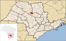 Location in São Paulo state | |||
 Itápolis Location in Brazil | |||
| Coordinates: 21°35′45″S 48°48′46″W / 21.59583°S 48.81278°WCoordinates: 21°35′45″S 48°48′46″W / 21.59583°S 48.81278°W | |||
| Country |
| ||
| Region | Southeast Region | ||
| State | São Paulo | ||
| Mesoregion | Araraquara | ||
| Microregion | Araraquara | ||
| Government | |||
| • Mayor | Júlio César Nigro Mazzo | ||
| Area | |||
| • Total | 997 km2 (385 sq mi) | ||
| Elevation | 481 m (1,578 ft) | ||
| Population (2015) | |||
| • Total | 42,343 | ||
| • Density | 42/km2 (110/sq mi) | ||
| Time zone | BRT/BRST (UTC-3/-2) | ||
| Website | Official website | ||


Itápolis is a municipality in the state of São Paulo in Brazil. The population is 42,343 (2015 est.) in an area of 997 km².[1]
Sports
Oeste is the city's football (soccer) team. The club plays their home matches at Estádio dos Amaros, which has a maximum capacity of 16,143 people.[2]
Twin towns
 Pomezia, Italy
References
- ↑ Instituto Brasileiro de Geografia e Estatística
- ↑ "Estádio dos Amaros" (in Portuguese). Federação Paulista de Futebol. Retrieved February 22, 2009.
| Wikimedia Commons has media related to Itápolis. |
This article is issued from Wikipedia - version of the 5/15/2016. The text is available under the Creative Commons Attribution/Share Alike but additional terms may apply for the media files.