Iskander Pora, Jammu and Kashmir
| Iskander Pora اسکندر پورہ (Urdu) اسکندر پور (Kashmiri) इस्कंदर पुरा (Hindi) | |
|---|---|
| Rural Area | |
| Iskander Pora, Jammu and Kashmir, India | |
| Nickname(s): Iskander Pur | |
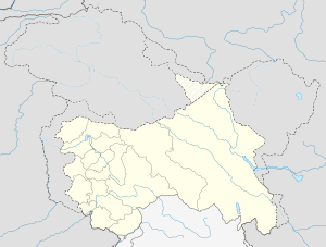
 Iskander Pora  Iskander Pora Location in Jammu and Kashmir | |
| Coordinates: IN 34°1′37″N 74°34′10″E / 34.02694°N 74.56944°ECoordinates: IN 34°1′37″N 74°34′10″E / 34.02694°N 74.56944°E[1] | |
| Country |
|
| State |
|
| District | Budgam |
| Government | |
| • Sarpanch | Ghulam Ali Mir |
| • Numberdar | Ghulam Hussain Beigh |
| • Village Guard | Ghulam Qadir Ganie |
| Elevation | 1,748 m (5,735 ft) |
| Population (2011)[2] | |
| • Total | 2,482 |
| Languages | |
| • Official | English and Urdu |
| • Spoken | Kashmiri |
| Time zone | IST (UTC+5:30) |
| PIN | 193411 |
| Area code(s) | +91-1954-xxxxxx |
Iskander Pora (Urdu: اسکندر پورہ , Kashmiri: اسکندر پور, Hindi: इस्कंदर पुरा), Jammu and Kashmir is a village in district Budgam, tehsil Beerwah of Jammu and Kashmir State. It is located about 29 km towards West from district headquarters Budgam and about 34 km towards West from State capital Sinagar.
Demographics
According to the 2011 census Iskander Pora has a population of 2484,[2] 1314 males and 1168 femaes. The village has a sex ratio of 889 females for every 1000 males.
Geography
Iskander Pora is located at 34°01′35″N 74°34′10″E / 34.0264°N 74.5694°E.[1] It has an average elevation of 1748 metres (5735 ft). It is situated at plateau like land mass, it is surrounded by karewas on south, west and north with its east surrounded by plains.
Iskander Pora is connected with the Srinagar city via Magam town and Budgam district headquarters via Beerwah town. It is 10 km away from Magam and 2.5 km away from Beerwah. It is also connected to tehsil Khag via Malpora which is also 10 km distant.
Mazhom Railway Station is the nearby railway stations to Magam for a person arriving from north or south.
Education
Schools
- Government Middle School, Iskander Pora](Est.1962)
- Imamia Public High School, Iskander Pora
Religious Education
Religious education is imparted in local maktabs. These impart education on a part-time basis to the children.
References
- 1 2 Falling Rain Genomics, Inc
- 1 2 Official Census 2012 Census of India: View Population Details