Le Mayet-de-Montagne
| Le Mayet-de-Montagne | ||
|---|---|---|
|
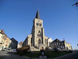
The church in Le Mayet-de-Montagne | ||
| ||
 Le Mayet-de-Montagne | ||
|
Location within Auvergne-Rhône-Alpes region  Le Mayet-de-Montagne | ||
| Coordinates: 46°04′18″N 3°40′03″E / 46.0717°N 3.6675°ECoordinates: 46°04′18″N 3°40′03″E / 46.0717°N 3.6675°E | ||
| Country | France | |
| Region | Auvergne-Rhône-Alpes | |
| Department | Allier | |
| Arrondissement | Vichy | |
| Canton | Lapalisse | |
| Intercommunality | Montagne Bourbonnaise | |
| Government | ||
| • Mayor (2014–2020) | Gilles Durantet[1] | |
| Area1 | 29.03 km2 (11.21 sq mi) | |
| Population (2012)2 | 1,519 | |
| • Density | 52/km2 (140/sq mi) | |
| Time zone | CET (UTC+1) | |
| • Summer (DST) | CEST (UTC+2) | |
| INSEE/Postal code | 03165 / 03250 | |
| Elevation |
415–880 m (1,362–2,887 ft) (avg. 543 m or 1,781 ft) | |
|
1 French Land Register data, which excludes lakes, ponds, glaciers > 1 km² (0.386 sq mi or 247 acres) and river estuaries. 2 Population without double counting: residents of multiple communes (e.g., students and military personnel) only counted once. | ||

Le Mayet-de-Montagne is a commune in the Allier department in central France.
Geography
Le Mayet-de-Montagne is situated 16.6 miles south of Vichy in the north part of the Massif Central. It is situated at an altitude of around 1,800 feet.
History
In 1334, le Mayet de Montagne belonged to Auvergne. The counts of Auvergne considered Le Mayet to be of great strategic value, and they held onto the town until 1589, when Henri IV decided to alter the borders of Bourbonnais to include Le Mayet.
Le Mayet became the chef-lieu of its eponymous canton in 1790.
Population
| Historical population | ||
|---|---|---|
| Year | Pop. | ±% |
| 1962 | 1,577 | — |
| 1968 | 1,694 | +7.4% |
| 1975 | 1,761 | +4.0% |
| 1982 | 1,664 | −5.5% |
| 1990 | 1,609 | −3.3% |
| 1999 | 1,598 | −0.7% |
| 2008 | 1,537 | −3.8% |
| 2012 | 1,519 | −1.2% |
| Source: INSEE (1968–2012) | ||

Old view of the church and square
See also
References
- ↑ "Liste nominative des communes de l'Allier" [Nominative list of communes of Allier] (PDF). Association of Mayors and Presidents of Communities of Allier (in French). 1 April 2015. Retrieved 23 October 2015.
| Wikimedia Commons has media related to Le Mayet-de-Montagne. |
This article is issued from Wikipedia - version of the 10/23/2015. The text is available under the Creative Commons Attribution/Share Alike but additional terms may apply for the media files.