Neuilly-le-Réal
| Neuilly-le-Réal | ||
|---|---|---|
|
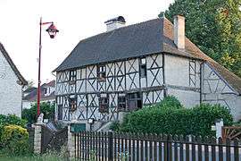
Logis d'Henri IV in Neuilly-le-Réal | ||
| ||
 Neuilly-le-Réal | ||
|
Location within Auvergne-Rhône-Alpes region  Neuilly-le-Réal | ||
| Coordinates: 46°27′54″N 3°25′57″E / 46.465°N 3.4325°ECoordinates: 46°27′54″N 3°25′57″E / 46.465°N 3.4325°E | ||
| Country | France | |
| Region | Auvergne-Rhône-Alpes | |
| Department | Allier | |
| Arrondissement | Moulins | |
| Canton | Moulins-2 | |
| Intercommunality | Moulins | |
| Government | ||
| • Mayor (2014–2020) | Lucien Gonnot[1] | |
| Area1 | 46.97 km2 (18.14 sq mi) | |
| Population (2012)2 | 1,450 | |
| • Density | 31/km2 (80/sq mi) | |
| Time zone | CET (UTC+1) | |
| • Summer (DST) | CEST (UTC+2) | |
| INSEE/Postal code | 03197 / 03340 | |
| Elevation |
227–293 m (745–961 ft) (avg. 260 m or 850 ft) | |
|
1 French Land Register data, which excludes lakes, ponds, glaciers > 1 km² (0.386 sq mi or 247 acres) and river estuaries. 2 Population without double counting: residents of multiple communes (e.g., students and military personnel) only counted once. | ||

Neuilly-le-Réal is a commune in the Allier department in Auvergne in central France.
Population
| Historical population | ||
|---|---|---|
| Year | Pop. | ±% |
| 1962 | 1,156 | — |
| 1968 | 1,205 | +4.2% |
| 1975 | 1,084 | −10.0% |
| 1982 | 1,201 | +10.8% |
| 1990 | 1,287 | +7.2% |
| 1999 | 1,303 | +1.2% |
| 2008 | 1,362 | +4.5% |
| 2012 | 1,450 | +6.5% |
| Source: INSEE (1968–2012) | ||
See also
References
- ↑ "Liste nominative des communes de l'Allier" [Nominative list of communes of Allier] (PDF). Association of Mayors and Presidents of Communities of Allier (in French). 1 April 2015. Retrieved 6 December 2015.
| Wikimedia Commons has media related to Neuilly-le-Réal. |
This article is issued from Wikipedia - version of the 12/6/2015. The text is available under the Creative Commons Attribution/Share Alike but additional terms may apply for the media files.