Saint-Pourçain-sur-Sioule
| Saint-Pourçain-sur-Sioule | ||
|---|---|---|
|
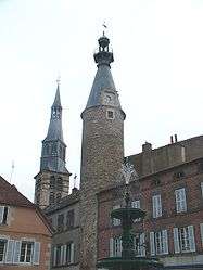
The belfry of the church and the clock tower | ||
| ||
 Saint-Pourçain-sur-Sioule | ||
|
Location within Auvergne-Rhône-Alpes region  Saint-Pourçain-sur-Sioule | ||
| Coordinates: 46°18′30″N 3°17′24″E / 46.3083°N 3.29°ECoordinates: 46°18′30″N 3°17′24″E / 46.3083°N 3.29°E | ||
| Country | France | |
| Region | Auvergne-Rhône-Alpes | |
| Department | Allier | |
| Arrondissement | Moulins | |
| Canton | Saint-Pourçain-sur-Sioule | |
| Intercommunality | Pays Saint-Pourcinois | |
| Government | ||
| • Mayor (2014–2020) | Bernard Coulon[1] | |
| Area1 | 35.67 km2 (13.77 sq mi) | |
| Population (2013)2 | 4,971 | |
| • Density | 140/km2 (360/sq mi) | |
| Time zone | CET (UTC+1) | |
| • Summer (DST) | CEST (UTC+2) | |
| INSEE/Postal code | 03254 / 03500 | |
| Elevation |
226–306 m (741–1,004 ft) (avg. 237 m or 778 ft) | |
|
1 French Land Register data, which excludes lakes, ponds, glaciers > 1 km² (0.386 sq mi or 247 acres) and river estuaries. 2 Population without double counting: residents of multiple communes (e.g., students and military personnel) only counted once. | ||

Saint-Pourçain-sur-Sioule is a commune in the Allier department in Auvergne-Rhône-Alpes in central France.
Geography
The commune is located 28 km (17 mi) north of Vichy and 32 km (20 mi) south of Moulins on the former Route nationale 9 (departmental road 2009).
The river Bouble forms part of the commune's southern border, then flows into the Sioule, which flows north-northeast through the commune and crosses the town.
Population
| Historical population | ||
|---|---|---|
| Year | Pop. | ±% |
| 1793 | 3,458 | — |
| 1800 | 3,395 | −1.8% |
| 1806 | 3,559 | +4.8% |
| 1821 | 3,975 | +11.7% |
| 1831 | 4,376 | +10.1% |
| 1836 | 4,731 | +8.1% |
| 1841 | 4,636 | −2.0% |
| 1846 | 4,961 | +7.0% |
| 1851 | 4,938 | −0.5% |
| 1856 | 4,873 | −1.3% |
| 1861 | 5,006 | +2.7% |
| 1866 | 5,001 | −0.1% |
| 1872 | 4,997 | −0.1% |
| 1876 | 4,998 | +0.0% |
| 1881 | 5,025 | +0.5% |
| 1886 | 5,106 | +1.6% |
| 1891 | 4,998 | −2.1% |
| 1896 | 5,001 | +0.1% |
| 1901 | 4,943 | −1.2% |
| 1906 | 5,101 | +3.2% |
| 1911 | 4,921 | −3.5% |
| 1921 | 4,579 | −6.9% |
| 1926 | 4,810 | +5.0% |
| 1931 | 4,598 | −4.4% |
| 1936 | 4,560 | −0.8% |
| 1946 | 4,430 | −2.9% |
| 1954 | 4,414 | −0.4% |
| 1962 | 4,799 | +8.7% |
| 1968 | 5,088 | +6.0% |
| 1975 | 5,345 | +5.1% |
| 1982 | 5,199 | −2.7% |
| 1990 | 5,159 | −0.8% |
| 1999 | 5,263 | +2.0% |
| 2008 | 5,065 | −3.8% |
| 2013 | 4,971 | −1.9% |
| Source: INSEE (1968–2013)[2] | ||
Wine
Saint-Pourçain wine is made in an area around the commune.
Personalities
- French diplomat and cryptographer Blaise de Vigenère was born in the town in 1523.
See also
References
External links
| Wikimedia Commons has media related to Saint-Pourçain-sur-Sioule. |
- Official website (French)
This article is issued from Wikipedia - version of the 4/17/2016. The text is available under the Creative Commons Attribution/Share Alike but additional terms may apply for the media files.