Saint-Félix, Allier
| Saint-Félix | |
|---|---|
|
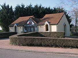
Town hall | |
 Saint-Félix | |
|
Location within Auvergne-Rhône-Alpes region  Saint-Félix | |
| Coordinates: 46°13′42″N 3°28′54″E / 46.2283°N 3.4817°ECoordinates: 46°13′42″N 3°28′54″E / 46.2283°N 3.4817°E | |
| Country | France |
| Region | Auvergne-Rhône-Alpes |
| Department | Allier |
| Arrondissement | Vichy |
| Canton | Saint-Pourçain-sur-Sioule |
| Intercommunality | Varennes-Forterre |
| Government | |
| • Mayor (2014–2020) | Odile Franchisseur[1] |
| Area1 | 5.2 km2 (2.0 sq mi) |
| Population (2013)2 | 335 |
| • Density | 64/km2 (170/sq mi) |
| Time zone | CET (UTC+1) |
| • Summer (DST) | CEST (UTC+2) |
| INSEE/Postal code | 03232 / 03260 |
| Elevation |
285–373 m (935–1,224 ft) (avg. 350 m or 1,150 ft) |
|
1 French Land Register data, which excludes lakes, ponds, glaciers > 1 km² (0.386 sq mi or 247 acres) and river estuaries. 2 Population without double counting: residents of multiple communes (e.g., students and military personnel) only counted once. | |
Saint-Félix is a commune in the Allier department in Auvergne-Rhône-Alpes in central France.
Population
| Historical population | ||
|---|---|---|
| Year | Pop. | ±% |
| 1962 | 116 | — |
| 1968 | 150 | +29.3% |
| 1975 | 148 | −1.3% |
| 1982 | 167 | +12.8% |
| 1990 | 248 | +48.5% |
| 1999 | 252 | +1.6% |
| 2008 | 334 | +32.5% |
| 2013 | 335 | +0.3% |
| Source: INSEE (1968–2013) 2013[2] | ||
See also
References
- ↑ "Liste nominative des communes de l'Allier" [Nominative list of communes of Allier] (PDF) (in French). Association of Mayors and Presidents of Communities of Allier. 23 November 2015. Retrieved 22 March 2016.
- ↑ 2013 census, Insee (in French).
| Wikimedia Commons has media related to Saint-Félix. |
This article is issued from Wikipedia - version of the 3/22/2016. The text is available under the Creative Commons Attribution/Share Alike but additional terms may apply for the media files.