McIntosh, South Dakota
| McIntosh, South Dakota Maktáža | |
|---|---|
| City | |
 Location in Corson County and the state of South Dakota | |
| Coordinates: 45°55′18″N 101°21′1″W / 45.92167°N 101.35028°WCoordinates: 45°55′18″N 101°21′1″W / 45.92167°N 101.35028°W | |
| Country | United States |
| State | South Dakota |
| County | Corson |
| Area[1] | |
| • Total | 0.77 sq mi (1.99 km2) |
| • Land | 0.73 sq mi (1.89 km2) |
| • Water | 0.04 sq mi (0.10 km2) |
| Elevation | 2,316 ft (706 m) |
| Population (2010)[2] | |
| • Total | 173 |
| • Estimate (2012[3]) | 175 |
| • Density | 237.0/sq mi (91.5/km2) |
| Time zone | Mountain (MST) (UTC-7) |
| • Summer (DST) | MDT (UTC-6) |
| ZIP code | 57641 |
| Area code(s) | 605 |
| FIPS code | 46-39940[4] |
| GNIS feature ID | 1256381[5] |
McIntosh (Lakota: Maktáža[6]) is a city in and the county seat of Corson County, South Dakota, United States.[7] The population was 173 at the 2010 census.
History
McIntosh was named for a sibling duo who worked for the railroad.[8]
Geography
McIntosh is located at 45°55′18″N 101°21′1″W / 45.92167°N 101.35028°W (45.921649, -101.350171).[9] According to the United States Census Bureau, the city has a total area of 0.77 square miles (1.99 km2), of which, 0.73 square miles (1.89 km2) is land and 0.04 square miles (0.10 km2) is water.[1] McIntosh has been assigned the ZIP code 57641 and the FIPS place code 39940.
Climate
McIntosh holds the record for the coldest record temperature in South Dakota (-58 degrees Fahrenheit), set February 17, 1936.
Demographics
| Historical population | |||
|---|---|---|---|
| Census | Pop. | %± | |
| 1910 | 409 | — | |
| 1920 | 727 | 77.8% | |
| 1930 | 663 | −8.8% | |
| 1940 | 626 | −5.6% | |
| 1950 | 628 | 0.3% | |
| 1960 | 568 | −9.6% | |
| 1970 | 563 | −0.9% | |
| 1980 | 418 | −25.8% | |
| 1990 | 302 | −27.8% | |
| 2000 | 217 | −28.1% | |
| 2010 | 173 | −20.3% | |
| Est. 2015 | 175 | [10] | 1.2% |

2010 census
As of the census[2] of 2010, there were 173 people. The city had 84 households, and 49 families residing in the city. Between 2000 and 2010, the city's population declined by 20%.[4] The population density was 237.0 inhabitants per square mile (91.5/km2). There were 111 housing units at an average density of 152.1 per square mile (58.7/km2).
Racially, the city has 132 White people, 33 Native Americans, 4 of Hispanic or Latino decent, 1 Asian, and 3 from other races.
There were 84 households of which 21 households had children under the age of 18 living with them, 34 households were married couples living together, 5 households had a female householder with no husband present, 5 households had a male householder with no wife present, and 35 households were non-families. 34 households were made up of individuals. 20 households had someone living alone who was 65 years of age or older. The average household size was 2.06 and the average family size was 2.65.
The median age in the city was 50.8 years. 39 residents were under the age of 18. 5 residents were between the ages of 18 and 24. 32 residents were from between the ages of 25 to 44. 49 residents were between the ages of 45 to 64. 48 residents were 65 years of age or older. The gender makeup of the city was 49.7% male and 50.3% female.
References
- 1 2 "US Gazetteer files 2010". United States Census Bureau. Archived from the original on January 24, 2012. Retrieved 2012-06-21.
- 1 2 "American FactFinder". United States Census Bureau. Retrieved 2012-06-21.
- ↑ "Population Estimates". United States Census Bureau. Archived from the original on June 17, 2013. Retrieved 2013-05-29.
- 1 2 "American FactFinder". United States Census Bureau. Archived from the original on September 11, 2013. Retrieved 2008-01-31.
- ↑ "US Board on Geographic Names". United States Geological Survey. 2007-10-25. Retrieved 2008-01-31.
- ↑ Ullrich, Jan F. (2014). New Lakota Dictionary (2nd ed.). Bloomington, IN: Lakota Language Consortium. ISBN 978-0-9761082-9-0.
- ↑ "Find a County". National Association of Counties. Archived from the original on May 31, 2011. Retrieved 2011-06-07.
- ↑ Federal Writers' Project (1940). South Dakota place-names, v.1-3. University of South Dakota. p. 49.
- ↑ "US Gazetteer files: 2010, 2000, and 1990". United States Census Bureau. 2011-02-12. Retrieved 2011-04-23.
- ↑ "Annual Estimates of the Resident Population for Incorporated Places: April 1, 2010 to July 1, 2015". Retrieved July 2, 2016.
- ↑ "Census of Population and Housing". Census.gov. Archived from the original on May 11, 2015. Retrieved June 4, 2015.
External links
Municipalities and communities of Corson County, South Dakota, United States | ||
|---|---|---|
| Cities | 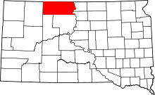 | |
| Town | ||
| CDPs | ||
| Unincorporated communities | ||
| Indian reservation | ||
| Ghost town | ||
| Footnotes | ‡This populated place also has portions in an adjacent county or counties | |