Nagaon district
| Nagaon district নগাঁও জিলা | |
|---|---|
 Location of Nagaon district in Assam | |
| Country |
|
| State | Assam |
| Headquarters | Nagaon |
| ISO 3166 code | IN-AS |
| Website | http://nagaon.nic.in/ |
Nagaon (Pron: nəˈgãʊ) (Assamese: নগাঁও জিলা Nôgaû Zila, IPA: nɔgaʊ zila) is an administrative district in the state of Assam in India. As of 2011 it is the most populous district of Assam (out of 27)[1] and one of the largest in area.
History
Batadrowa gave birth to the famous Vaishnavite reformer Sankardeva, who brought about a Renaissance in Assamese society. Located in the very heartland of Assam, it falls directly at the center of the entire northeast of India. An old district which dates back to 1833, it is Assam’s most populous district, which probably prompted its old British administrators to jocularly describe Nagaon as a district of 3 c’s: chickens, children and cases.
The region was called Khagarijan in older records.[2]
In 1983, the district was rocked by the Nellie massacre, which killed at least 2,191 people.
On 29 September 1989, Marigaon district was split from Nagaon.[3]
Geography
The district headquarters are located at Nagaon. Nagaon district occupies an area of 3,831 square kilometres (1,479 sq mi),[4] comparatively equivalent to the Philippines' Bohol Island.[5]

National protected area
- Kaziranga National Park (Part)
Economy
The Agar perfume industry is also at Hojai, making Nagaon, in its many undiscovered facets, Assam’s best kept secret. It is known as the RICE BOWL of Assam. Economy of Nagaon District, in terms of natural resources endowment, is purely agrarian. In fact, agriculture is the backbone of the entire economy of this district of Assam. It is providing livelihood to almost 78 percent of the total population. Rice is the staple food of the inhabitants and paddy is the principal crop cultivated in the district. Floods, however, are a major obstruction in the development of this sector. However, measures for the development of this prime sector of economy have been taken. Besides agriculture, economy of Nagaon District also includes another major sector that is fisheries.
Assam gets a lot of rainfall still the state produces just about 5.7 percent of the total freshwater fish production in India. Nagaon district accounts for near about 9 percent of the total fish production of the state. Further, there is a visible dominance of imported fish in the organized markets. There are around 20 small and big rivers, large areas of water bodies, swamps and beels in Nagaon District having unique potential for development of inland fisheries. The district also has strong fishermen population. Another advantage that the district enjoys is high water table. Moreover, it has been observed that more and more people are opting for fisheries as a livelihood option.
The economy of Nagaon District also suggests that there has been a lot of development in aquaculture technologies during the last few decades. However, absence of fishing on commercial principles characterizes the low level of productivity. As the productivity levels are low, profits in the sector get reduced. Further, this sector also lacks proper funding. Animal husbandry is another major sector contributing to the economy of Nagaon District. Production is less than the demand in the district. The climatic condition of the district is suitable for poultry farming. Most of the poultry birds are reared in small units. Non availability of quality poultry feed in the local market along with high cost of ingredients and limited supply of essential medicines are the major constraints for development of this sector. The low productivity of the dairy animals is apparently due to poor genetic character of the local cows. However, considering demand and supply in the district, there is ample scope for development of animal husbandry in the district, particularly in rural areas adjacent to urban and semi-urban areas.
The handloom industry is the most important cottage industry in Assam and it is also a major part of the economy of Nagaon District. It is closely associated with art and culture of the society. Weaving of fabrics is a way of livelihood of large number of rural families and artisans. However, this important sector is yet to be exploited commercially. Economy of Nagaon District comprises several industries like tea industry, jute industry, sugar mills, etc. Tea manufacturing is the predominant industry in the district. In Nagaon District, there is good scope for agro-based industries including pisciculture and sericulture. But several factors like power shortage, seasonal floods, shortage of industrial labour, etc. hinder the development of the various economic activities in this district.
Last but not the least; handicraft is an important cottage and household industry sector and a significant part of the district`s economy. It is largely emphasized for providing self-employment opportunities in the rural areas.
Demographics
According to the 2011 census Nagaon district has a population of 2,826,006,[1] roughly equal to the nation of Jamaica[6] or the US state of Kansas.[7] This gives it a ranking of 135th in India (out of a total of 640).[1] The district has a population density of 711 inhabitants per square kilometre (1,840/sq mi) .[1] Its population growth rate over the decade 2001-2011 was 22.09%.[1] Nagaon has a sex ratio of 962 females for every 1000 males,[1] and a literacy rate of 74%.[1]
Accord to 2001 census, Hindu (1,106,354) and Muslims (1,180,267) each constitutes half the population.[8] Nagaon presents a mix of cultures of Hinduism, Islam, Sikhism, Jainism, and Buddhism. It has different language speakers including Assamese, Bengali, Hindi, Bodo, Tiwa, Karbi, Dimasa, Manipuri. Major Communities in the district are Bengali Muslims, Assamese Muslims, Assamese Brahmins, Kalita, Bengali Hindus, Tiwa (Lalung), Tea tribes(Adivasi) and Koch Rajbongshis. Assamese is the lingua franca and the communicating language in the district.
Culture
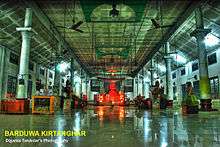
Namghars and associated temples: There are many namghars in Nagaon, the main are - The Bharali Namghar, which is situated in Hatbar and Borduwa Namghar. This Namghar is situated in Nagaon Sattra, where Mahapurush Sankardev was born. Saubhagya Madhav, Dulal Madhav and Gopal Madhav are three ancient temples built during the reign of the Ahom King Shiba Singha.
Tourism
Places of attraction
- Bordowa

- The Birthplace of Mahapurush Srimanta Sankardeva, the great Artist, Author, founder of Vaishnavism Religion, Dramatist etc. of Assam. The place is situated 18 km North – West from Nagaon town, There are two Sattras one is Narowa Sattra and other is Salaguri Sattras. The mini Museum is there in Narowa Sattras.

- Samaguri Bill
- Also known as Pokhi Tirtha, this is where Migratory Birds from different place of the world comes in winter Season. The distance of the place is 16 km towards East from Hojai
- Rock garden amusement park and Tanz water park
- Situated near Samaguri,it is a new attraction for the Nagaon public.
- Lowkhowa Avayaranya
- The Laokhowa Wildlife Sanctuary is situated at Lowkhowa namely covering an area of 70.13 km² at a distance of 25 km from Nagaon Town. Its main attraction is the Great Indian One-horned Rhinoceros. Other animals are Tiger, Leopard, Asiatic Buffalo, Wild Boar, Civet Cat, Leopard Cat, Hog Deer etc. Various species of birds and reptiles are also found in Laokhowa.
- Champawati Kunda
- Champawati Kunda is a famous falls situated in Chapanala in Nagaon district.
 Waterfalls near Chapanala in Nagaon district of Assam
- Kaliabor
- The Sub-division town situated at a distance of 48 km east of Nagaon is a historic place. As it initially was the headquarters of Barphukans during the Ahom days. It was also the scene of several battles against the Muslim invaders.
- Silghat
- Situated at a road distance of almost 50 km from Nagaon is a vital and picturesque river port lying on the South bank of the mighty Brahmaputra. Pre-communication links of Central Assam across the Brahmaputra are maintained through this port town. Besides, playing host to the Assam Co-operative Jute Mill, Silghat also has several temples to enthrall visitors. A big Samantagiri hillock draws big crowds from everywhere.
- Hojai
- This sub-divisional town is situated at a distance of 61 km from nagaon and is renowned as the granary of Assam, besides its more allusive claim to being the centre of the Agar perfume industry. It is also the principal whole-sale market for rice in assam. Besides rice, sugar-cane, mustard and jute,vegetables are also grown in abundance.It is the home of perfume baron Badruddin .
- Jugijan

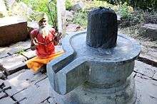
- Situated at about 6 km from Hojai has become well known after the recent discovery of remnants of a fort and three stone temples decorated with carvings and base -reliefs. Seven Siva Lingas have also been excavated and preserved here. An 11th-century idol of Chamunda(Kaali) has been discovered at Navanga village, 2 km from Jugijan.
- Doboka
- Situated 34 km, south-east of Nagaon was the seat of the Doboka kingdom, mentioned in the Allahabad inscription of Gutpta Emperor Samudragupta according to some historians. The Akashiganga waterfall, near Dabaka is a favourite with many picknickers.It is now predominantly a Muslim dominated area.
- RAHA
- Situated at about 22 km west of Nagaon it was an important Chowki during the Ahom Days. Today, Raha is an important trade centre for agricultural products such as paddy, jute and mustard. An important institution here is the Fishery Training College - the first of its kind in Nagaon.
- Kamakhya Temple (Not to be confused with the Kamakhya Temple in Guwahati)
- The famous Kamakhya Temple is situated in Silghat (Bank of the river Brahmaputra). The Ashok Astami Melas held every year near Kamakhya Temple.
- LUMDING AND CHAPARMUKH
- These are two very important railway junctions and naturally serve as trading centres as well. Lumding is also the divisional headquarters of the NF railway. Various small scale industries including candle works and trunk factories are also located at Lumding.
- RANTHALI
- This is a village famous for its local Assamese gold plated ( traditional ) ornaments. The distance of Ranthali is 4 km from Nagaon town towards the West.
- JAMUNAMUKH
- Located at 35 km from Nagaon, it is famous for its earthen wares.It is also a Muslim dominated area.
- PHULAGURI:
- Place of war between British and Assamese. one can get its details in PHULAGURI DHEWA.
Flora and fauna
In 1974 Nagaon district became home to Kaziranga National Park, which has an area of 175 km2 (67.6 sq mi)[9] within nagaon district. It shares the park with Golaghat district. It is also home to the Laokhowa Wildlife Sanctuary.[9]
Sports
Football matches held in Jubilee Field in Nagaon still attract large crowds. Many important National and regional events are hosted in Nurul Amin Stadium, Nagaon.
References
- 1 2 3 4 5 6 7 "District Census 2011". Census2011.co.in. 2011. Retrieved 2011-09-30.
- ↑ Edward Gait (1906) A History of Assam, p293
- ↑ Law, Gwillim (2011-09-25). "Districts of India". Statoids. Retrieved 2011-10-11.
- ↑ Srivastava, Dayawanti et al. (ed.) (2010). "States and Union Territories: Assam: Government". India 2010: A Reference Annual (54th ed.). New Delhi, India: Additional Director General, Publications Division, Ministry of Information and Broadcasting (India), Government of India. p. 1116. ISBN 978-81-230-1617-7.
- ↑ "Island Directory Tables: Islands by Land Area". United Nations Environment Program. 1998-02-18. Retrieved 2011-10-11.
Bohol 3,821km2
- ↑ US Directorate of Intelligence. "Country Comparison:Population". Retrieved 2011-10-01.
Jamaica 2,868,380 July 2011 est
- ↑ "2010 Resident Population Data". U. S. Census Bureau. Retrieved 2011-09-30.
Kansas 2,853,118
- ↑ censusindia.gov.in/Census_And_You/religion.aspx
- 1 2 Indian Ministry of Forests and Environment. "Protected areas: Assam". Retrieved September 25, 2011.
External links
 |
Sonitpur district | Golaghat district |  | |
| Morigaon district | |
Karbi Anglong district (Eastern) | ||
| ||||
| | ||||
| Karbi Anglong district (Western) | Dima Hasao district |
Coordinates: 26°21′00″N 92°40′00″E / 26.3500°N 92.6667°E