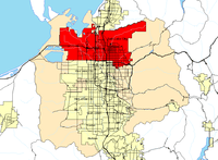
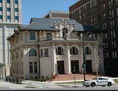
| [3] |
Name on the Register[4] |
Image |
Date listed[5] |
Location |
Neighborhood |
Description |
|---|
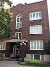
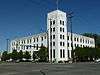
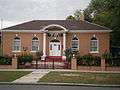
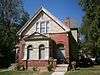
| 1 |
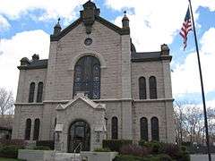
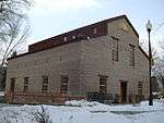
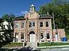
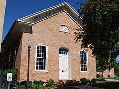
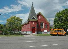
19th Ward Meetinghouse and Relief Society Hall |
|
000000001976-05-28-0000May 28, 1976
(#76001820) |
168 W. 500 North
40°46′49″N 111°53′42″W / 40.780278°N 111.895°W / 40.780278; -111.895 (19th Ward Meetinghouse and Relief Society Hall) |
Capitol Hill |
|
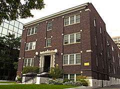
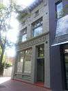
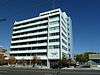
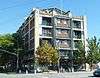
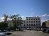
| 2 |
Altadena Apartments |
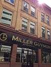
|
000000002010-01-27-0000January 27, 2010
(#09001291) |
310 S. 300 East
40°45′45″N 111°52′58″W / 40.76245°N 111.882822°W / 40.76245; -111.882822 (Altadena Apartments) |
Central City |
|
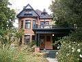
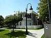
| 3 |
Fortunato Anselmo House |
|
000000001979-05-21-0000May 21, 1979
(#79002499) |
164 S. 900 East
40°45′56″N 111°51′54″W / 40.765556°N 111.865°W / 40.765556; -111.865 (Fortunato Anselmo House) |
Central City |
|
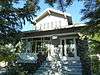
| 4 |
George Arbuckle House |
|
000000001982-02-12-0000February 12, 1982
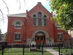
(#82004130) |
747 E. 1700 South
40°44′02″N 111°52′08″W / 40.733889°N 111.868889°W / 40.733889; -111.868889 (George Arbuckle House) |
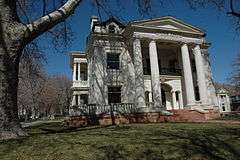
Sugar House |
|
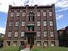
| 5 |
Armista Apartments |
|
000000001989-10-20-0000October 20, 1989
(#89001736) |
555 E. 100 South
40°46′04″N 111°52′02″W / 40.767778°N 111.867222°W / 40.767778; -111.867222 (Armista Apartments) |
Central City |
|
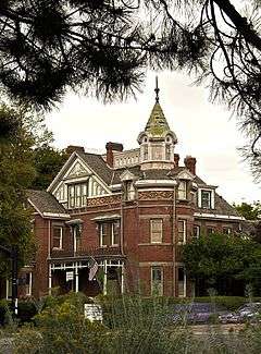
| 6 |
Francis Armstrong House |
|
000000001980-05-23-0000May 23, 1980
(#80003914) |
667 E. 100 South
40°46′03″N 111°52′16″W / 40.7675°N 111.871111°W / 40.7675; -111.871111 (Francis Armstrong House) |
Central City |
|
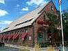
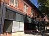
| 7 |
Ashby Apartments |
|
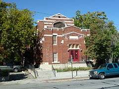
000000002006-11-16-0000November 16, 2006
(#06001067) |
358 E. 100 South
40°46′01″N 111°52′49″W / 40.766944°N 111.880278°W / 40.766944; -111.880278 (Ashby Apartments) |
Central City |
|
| 8 |
Avenues Historic District |
|
000000001980-08-27-0000August 27, 1980
(#80003915) |
Roughly bounded by 1st and 9th Aves. and State and Virginia Sts.
40°46′23″N 111°52′10″W / 40.773056°N 111.869444°W / 40.773056; -111.869444 (Avenues Historic District) |
Avenues |
|
| 9 |
B'nai Israel Temple |
|
000000001978-11-16-0000November 16, 1978
(#78002666) |
249 S. 400 East
40°45′48″N 111°52′42″W / 40.763333°N 111.878333°W / 40.763333; -111.878333 (B'nai Israel Temple) |
Central City |
|
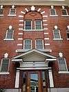
| 10 |
Charles Baldwin House |
|
000000001982-02-11-0000February 11, 1982
(#82004131) |
229 S. 1200 East
40°45′52″N 111°51′21″W / 40.764444°N 111.855833°W / 40.764444; -111.855833 (Charles Baldwin House) |
University |
|
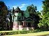
| 11 |
Simon Bamberger House |
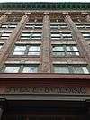
|
000000001975-05-30-0000May 30, 1975
(#75001814) |
623 E. 100 South
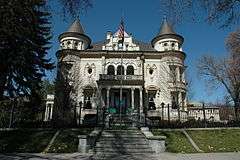
40°46′03″N 111°52′19″W / 40.7675°N 111.871944°W / 40.7675; -111.871944 (Simon Bamberger House) |
Central City |
Simon Bamberger was governor of Utah 1917–1921.
|
| 12 |
Jeremiah Beattie House |
|
000000001983-07-07-0000July 7, 1983
(#83004421) |
655 E. 200 South
40°45′55″N 111°52′19″W / 40.765278°N 111.871944°W / 40.765278; -111.871944 (Jeremiah Beattie House) |
Central City |
|
| 13 |
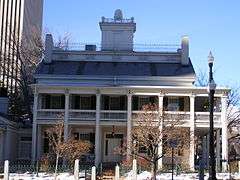
Beehive House |
|
000000001970-02-26-0000February 26, 1970
(#70000626) |
67 E. South Temple St.
40°46′11″N 111°53′19″W / 40.769721°N 111.888544°W / 40.769721; -111.888544 (Beehive House) |
Downtown |
|
| 14 |
William F. Beer Estate |
Upload image |
000000001977-12-06-0000December 6, 1977
(#77001306) |
181 B St. and 222 4th Ave.
40°46′24″N 111°52′52″W / 40.773333°N 111.881111°W / 40.773333; -111.881111 (William F. Beer Estate) |
Avenues |
|
| 15 |
Ebenezer Beesley House |
|
000000001979-07-16-0000July 16, 1979
(#79002500) |
80 W. 300 North
40°46′35″N 111°53′34″W / 40.776389°N 111.892778°W / 40.776389; -111.892778 (Ebenezer Beesley House) |
Capitol Hill |
|
| 16 |
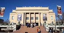
Belvedere Apartments |
|
000000002012-05-08-0000May 8, 2012
(#12000271) |
29 S. State St.
40°46′07″N 111°53′17″W / 40.7685°N 111.888126°W / 40.7685; -111.888126 (Belvedere Apartments) |
Downtown |
Salt Lake City Multiple Property Submission
|
| 17 |
Howard and Marian Bennion House |
Upload image |
000000002013-08-27-0000August 27, 2013
(#13000640) |
2136 E. Hubbard Ave.
40°44′55″N 111°49′49″W / 40.748744°N 111.830167°W / 40.748744; -111.830167 (Howard and Marian Bennion House) |
Foothill |
|
| 18 |
Benworth-Chapman Apartments and Chapman Cottages |
|
000000002004-12-30-0000December 30, 2004
(#04001417) |
227 S. 400 East
40°45′51″N 111°52′45″W / 40.764167°N 111.879167°W / 40.764167; -111.879167 (Benworth-Chapman Apartments and Chapman Cottages) |
Central City |
|
| 19 |
Bertolini Block |
|
000000001976-09-29-0000September 29, 1976
(#76001822) |
143½ W. 200 South
40°45′53″N 111°53′41″W / 40.764722°N 111.894722°W / 40.764722; -111.894722 (Bertolini Block) |
Downtown |
|
| 20 |
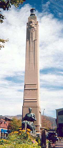
Best-Cannon House |
|
000000001980-10-03-0000October 3, 1980
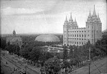
(#80003916) |
1146 S. 900 East
40°44′42″N 111°51′32″W / 40.745°N 111.858889°W / 40.745; -111.858889 (Best-Cannon House) |
9th and 9th |
|
| 21 |
Bigelow Apartments |
|
000000002004-12-30-0000December 30, 2004
(#04001418) |
225 S. 400 East
40°45′50″N 111°52′43″W / 40.763889°N 111.878611°W / 40.763889; -111.878611 (Bigelow Apartments) |
Central City |
|
| 22 |
Booth-Parsons House |
|
000000002012-05-09-0000May 9, 2012
(#12000272) |
1884 S. 900 East
40°43′45″N 111°51′56″W / 40.729251°N 111.865681°W / 40.729251; -111.865681 (Booth-Parsons House) |
Sugar House |
|
| 23 |
Broadway Hotel |
|
000000001982-08-17-0000August 17, 1982
(#82004132) |
222 W. 300 South
40°45′47″N 111°53′49″W / 40.763056°N 111.896944°W / 40.763056; -111.896944 (Broadway Hotel) |
Downtown |
|
| 24 |
Building at Rear, 537 West 200 South |
|
000000001982-12-27-0000December 27, 1982
(#82004849) |
Rear, 537 W. 200 South
40°45′52″N 111°54′21″W / 40.764444°N 111.905833°W / 40.764444; -111.905833 (Building at Rear, 537 West 200 South) |
Central City West |
|
| 25 |
Building at 561 West 200 South |
|
000000001982-12-27-0000December 27, 1982
(#82004848) |
561 W. 200 South
40°45′54″N 111°54′24″W / 40.765°N 111.906667°W / 40.765; -111.906667 (Building at 561 West 200 South) |
Central City West |
|
| 26 |
George M. Cannon House |
|
000000001983-07-18-0000July 18, 1983
(#83004419) |
720 E. Ashton Ave.
40°43′10″N 111°52′11″W / 40.719444°N 111.869722°W / 40.719444; -111.869722 (George M. Cannon House) |
Sugar House |
|
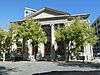
| 27 |
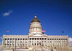
Capitol Building |
|
000000001978-10-11-0000October 11, 1978
(#78002667) |
Capitol Hill
40°46′38″N 111°53′17″W / 40.777222°N 111.888056°W / 40.777222; -111.888056 (Capitol Building) |
Capitol Hill |
|
| 28 |
Capitol Hill Historic District |
|
000000001982-08-02-0000August 2, 1982
(#82004135) |
Roughly bounded by Beck, Main and Wall Sts., 300 North, Victory Rd., and Capitol Blvd.; also roughly bounded by 300 North, 400 West, 800 North, Wall St., and 200 West
40°46′43″N 111°53′33″W / 40.778611°N 111.8925°W / 40.778611; -111.8925 (Capitol Hill Historic District) |
Capitol Hill |
Second set of boundaries represents a boundary increase
|
| 29 |
Cathedral of the Madeleine |
|
000000001971-03-11-0000March 11, 1971
(#71000845) |
331 E. South Temple St.
40°46′12″N 111°52′52″W / 40.77°N 111.881111°W / 40.77; -111.881111 (Cathedral of the Madeleine) |
Avenues |
|
| 30 |
Centennial Home |
Upload image |
000000002001-09-07-0000September 7, 2001
(#01000960) |
307 Virginia St.
40°46′31″N 111°51′06″W / 40.775278°N 111.851667°W / 40.775278; -111.851667 (Centennial Home) |
Avenues |
|
| 31 |
Central Warehouse |
|
000000001982-08-17-0000August 17, 1982
(#82004136) |
520 W. 200 South
40°45′55″N 111°54′20″W / 40.765278°N 111.905556°W / 40.765278; -111.905556 (Central Warehouse) |
Central City West |
|
| 32 |
Chapman Branch Library |
|
000000001980-01-20-0000January 20, 1980
(#80003918) |
577 S. 900 West
40°45′24″N 111°54′58″W / 40.756667°N 111.916111°W / 40.756667; -111.916111 (Chapman Branch Library) |
Poplar Grove |
|
| 33 |
Isaac Chase Mill |
|
000000001970-06-15-0000June 15, 1970
(#70000627) |
Liberty Park, 600 East
40°44′36″N 111°52′25″W / 40.743333°N 111.873611°W / 40.743333; -111.873611 (Isaac Chase Mill) |
Liberty Wells |
|
| 34 |
City Creek Canyon Historic District |
Upload image |
000000001980-03-12-0000March 12, 1980
(#80003919) |
Bounded by Capitol Boulevard, A St., 4th Ave. and Canyon Rd.
40°46′49″N 111°52′59″W / 40.780278°N 111.883056°W / 40.780278; -111.883056 (City Creek Canyon Historic District) |
City Creek Canyon |
|
| 35 |
Isaac C. and Dorothy S. Clark House |
Upload image |
000000002002-01-11-0000January 11, 2002
(#01001452) |
1430 E. Federal Way
40°46′05″N 111°50′57″W / 40.768056°N 111.849167°W / 40.768056; -111.849167 (Isaac C. and Dorothy S. Clark House) |
Federal Heights |
|
| 36 |
Clift Building |
|
000000001982-08-17-0000August 17, 1982
(#82004139) |
272 S. Main St.
40°45′47″N 111°53′27″W / 40.763056°N 111.890833°W / 40.763056; -111.890833 (Clift Building) |
Downtown |
|
| 37 |
Cluff Apartments |
|
000000001989-10-20-0000October 20, 1989
(#89001739) |
1270–1280 E. 200 South
40°45′53″N 111°51′12″W / 40.764722°N 111.853333°W / 40.764722; -111.853333 (Cluff Apartments) |
University |
|
| 38 |
Henry A. and Tile S. Cohn House |
|
000000001996-08-05-0000August 5, 1996
(#96000871) |
1369 E. Westminister Ave.
40°43′46″N 111°51′02″W / 40.729444°N 111.850556°W / 40.729444; -111.850556 (Henry A. and Tile S. Cohn House) |
Sugar House |
|
| 39 |
Congregation Montefiore |
|
000000001985-06-27-0000June 27, 1985
(#85001395) |
355 S. 300 East
40°45′41″N 111°52′53″W / 40.761389°N 111.881389°W / 40.761389; -111.881389 (Congregation Montefiore) |
Central City |
|
| 40 |
Congregation Sharey Tzedek Synagogue |
|
000000001985-06-27-0000June 27, 1985
(#85001396) |
833 S. 200 East
40°45′04″N 111°53′03″W / 40.751111°N 111.884167°W / 40.751111; -111.884167 (Congregation Sharey Tzedek Synagogue) |
Central City |
|
| 41 |
Continental Bank Building |
|
000000001982-12-27-0000December 27, 1982
(#82004850) |
200 S. Main St.
40°45′53″N 111°53′27″W / 40.764722°N 111.890833°W / 40.764722; -111.890833 (Continental Bank Building) |
Downtown |
|
| 42 |
Converse Hall |
|
000000001978-04-20-0000April 20, 1978
(#78002685) |
1840 S. 1300 East
40°43′55″N 111°51′14″W / 40.731944°N 111.853889°W / 40.731944; -111.853889 (Converse Hall) |
Sugar House |
The oldest building at Westminster College
|
| 43 |
Cornell Apartments |
|
000000001989-10-20-0000October 20, 1989
(#89001741) |
101 S. 600 East
40°46′01″N 111°52′25″W / 40.766944°N 111.873611°W / 40.766944; -111.873611 (Cornell Apartments) |
Central City |
|
| 44 |
Corona Apartments |
|
000000001989-10-20-0000October 20, 1989
(#89001742) |
335 S. 200 East
40°45′43″N 111°53′03″W / 40.761944°N 111.884167°W / 40.761944; -111.884167 (Corona Apartments) |
Central City |
|
| 45 |
Council Hall |
|
000000001971-05-14-0000May 14, 1971
(#71000846) |
Capitol Hill at head of State St.
40°46′33″N 111°53′13″W / 40.775833°N 111.886944°W / 40.775833; -111.886944 (Council Hall) |
Capitol Hill |
|
| 46 |
Almon A. Covey House |
|
000000001980-10-03-0000October 3, 1980
(#80003920) |
1211 E. 100 South
40°46′03″N 111°51′21″W / 40.7675°N 111.855833°W / 40.7675; -111.855833 (Almon A. Covey House) |
University |
|
| 47 |
Hyrum T. Covey House |
|
000000001980-10-03-0000October 3, 1980
(#80003921) |
1229 E. 100 South
40°46′03″N 111°51′19″W / 40.7675°N 111.855278°W / 40.7675; -111.855278 (Hyrum T. Covey House) |
University |
|
| 48 |
Cramer House |
|
000000001982-08-17-0000August 17, 1982
(#82004140) |
241 Floral St.
40°45′50″N 111°53′13″W / 40.763889°N 111.886944°W / 40.763889; -111.886944 (Cramer House) |
Central City |
|
| 49 |
Crown Cleaning and Dyeing Company Building |
|
000000002003-07-11-0000July 11, 2003
(#03000633) |
1989 S. 1100 East
40°43′40″N 111°51′31″W / 40.727778°N 111.858611°W / 40.727778; -111.858611 (Crown Cleaning and Dyeing Company Building) |
Sugar House |
|
| 50 |
William Culmer House |
|
000000001974-04-18-0000April 18, 1974
(#74001935) |
33 C St.
40°46′14″N 111°52′43″W / 40.770556°N 111.878611°W / 40.770556; -111.878611 (William Culmer House) |
Avenues |
Now the Sacred Heart Center of the Roman Catholic Diocese of Salt Lake City
|
| 51 |
Byron Cummings House |
|
000000001983-10-13-0000October 13, 1983
(#83003949) |
936 E. 1700 South
40°44′00″N 111°51′49″W / 40.733333°N 111.863611°W / 40.733333; -111.863611 (Byron Cummings House) |
Perkins Addition |
|
| 52 |
Genevieve & Alexander Curtis House |
|
000000002010-09-09-0000September 9, 2010
(#10000730) |
1119 E. Westminster Ave.
40°43′46″N 111°51′32″W / 40.729444°N 111.858889°W / 40.729444; -111.858889 (Genevieve & Alexander Curtis House) |
Sugar House |
|
| 53 |
Daft Block |
|
000000001976-05-28-0000May 28, 1976
(#76001823) |
128 S. Main St.
40°45′59″N 111°53′26″W / 40.766389°N 111.890556°W / 40.766389; -111.890556 (Daft Block) |
Downtown |
|
| 54 |
Davis Deaconess Home |
|
000000001995-01-24-0000January 24, 1995
(#94001583) |
347 S. 400 East
40°45′41″N 111°52′44″W / 40.761389°N 111.878889°W / 40.761389; -111.878889 (Davis Deaconess Home) |
Central City |
|
| 55 |
Denver and Rio Grande Railroad Station |
|
000000001975-09-25-0000September 25, 1975
(#75001815) |
300 South and Rio Grande
40°45′46″N 111°54′14″W / 40.762778°N 111.903889°W / 40.762778; -111.903889 (Denver and Rio Grande Railroad Station) |
Central City West |
|
| 56 |
Devereaux House |
|
000000001971-03-11-0000March 11, 1971
(#71000847) |
334 W. South Temple St.
40°46′13″N 111°54′02″W / 40.770278°N 111.900556°W / 40.770278; -111.900556 (Devereaux House) |
Downtown |
|
| 57 |
Harper J. Dininny House |
Upload image |
000000001983-10-13-0000October 13, 1983
(#83003950) |
925 E. Logan Ave.
40°44′04″N 111°51′49″W / 40.734444°N 111.863611°W / 40.734444; -111.863611 (Harper J. Dininny House) |
Perkins Addition |
|
| 58 |
Henry Dinwoody House |
|
000000001974-07-24-0000July 24, 1974
(#74001936) |
411 E. 100 South
40°46′04″N 111°52′42″W / 40.767778°N 111.878333°W / 40.767778; -111.878333 (Henry Dinwoody House) |
Central City |
|
| 59 |
Exchange Place Historic District |
|
000000001978-08-10-0000August 10, 1978
(#78002669) |
Exchange Place and S. Main St.
40°45′38″N 111°53′22″W / 40.760556°N 111.889444°W / 40.760556; -111.889444 (Exchange Place Historic District) |
Downtown |
|
| 60 |
J. Leo Fairbanks House |
|
000000001984-04-26-0000April 26, 1984
(#84002198) |
1228 Bryan Ave.
40°44′08″N 111°51′19″W / 40.735556°N 111.855278°W / 40.735556; -111.855278 (J. Leo Fairbanks House) |
Sugar House |
|
| 61 |
Felt Electric |
|
000000001982-08-17-0000August 17, 1982
(#82004141) |
165 S. Regent St.
40°45′55″N 111°53′20″W / 40.765278°N 111.888889°W / 40.765278; -111.888889 (Felt Electric) |
Downtown |
|
| 62 |
Fifth Ward Meetinghouse |
|
000000001978-12-08-0000December 8, 1978
(#78002670) |
740 S. 300 West
40°45′11″N 111°54′00″W / 40.752917°N 111.9°W / 40.752917; -111.9 (Fifth Ward Meetinghouse) |
Central City West |
|
| 63 |
Firestation No. 8 |
|
000000001983-07-28-0000July 28, 1983
(#83004423) |
258 S. 1300 East
40°45′49″N 111°51′13″W / 40.763611°N 111.853611°W / 40.763611; -111.853611 (Firestation No. 8) |
University |
|
| 64 |
First Church of Christ, Scientist |
|
000000001976-07-30-0000July 30, 1976
(#76001824) |
352 E. 300 South
40°45′45″N 111°52′49″W / 40.7625°N 111.880278°W / 40.7625; -111.880278 (First Church of Christ, Scientist) |
Central City |
|
| 65 |
First Methodist Episcopal Church |
|
000000001995-01-24-0000January 24, 1995
(#94001582) |
200 S. 200 East
40°45′53″N 111°53′06″W / 40.764722°N 111.885°W / 40.764722; -111.885 (First Methodist Episcopal Church) |
Central City |
|
| 66 |
First National Bank |
|
000000001976-05-24-0000May 24, 1976
(#76001825) |
163 S. Main St.
40°45′56″N 111°53′24″W / 40.765556°N 111.89°W / 40.765556; -111.89 (First National Bank) |
Downtown |
|
| 67 |
First Security Bank Building |
|
000000002005-09-28-0000September 28, 2005
(#05001107) |
405 S. Main St.
40°45′36″N 111°53′23″W / 40.76°N 111.889722°W / 40.76; -111.889722 (First Security Bank Building) |
Downtown |
The first International Style building in Utah, built in 1955
|
| 68 |
Albert Fisher Mansion and Carriage House |
|
000000002008-10-08-0000October 8, 2008
(#83004675) |
1206 W. 200 South
40°45′55″N 111°55′33″W / 40.765278°N 111.925833°W / 40.765278; -111.925833 (Albert Fisher Mansion and Carriage House) |
Poplar Grove |
|
| 69 |
Ford Motor Company Service Building |
|
000000002000-11-02-0000November 2, 2000
(#00001302) |
280 S. 400 West
40°45′47″N 111°54′08″W / 40.763056°N 111.902222°W / 40.763056; -111.902222 (Ford Motor Company Service Building) |
Central City West |
|
| 70 |
Forest Dale Historic District |
|
000000002009-04-23-0000April 23, 2009
(#09000241) |
Roughly bounded by 700 East, Interstate 80, Commonwealth Ave., and 900 East
40°43′20″N 111°52′05″W / 40.7222°N 111.868119°W / 40.7222; -111.868119 (Forest Dale Historic District) |
Sugar House |
|
| 71 |
Fort Douglas |
|
000000001970-06-15-0000June 15, 1970
(#70000628) |
Fort Douglas Military Reservation
40°45′52″N 111°49′58″W / 40.764444°N 111.832778°W / 40.764444; -111.832778 (Fort Douglas) |
Foothill |
|
| 72 |
J. A. Fritsch Block |
|
000000001976-07-30-0000July 30, 1976
(#76001826) |
158 E. 200 South
40°45′53″N 111°53′07″W / 40.764722°N 111.885278°W / 40.764722; -111.885278 (J. A. Fritsch Block) |
Central City |
|
| 73 |
W.P. Fuller Paint Company Office and Warehouse |
|
000000002005-09-15-0000September 15, 2005
(#05001037) |
404 W. 400 South
40°45′40″N 111°54′08″W / 40.761111°N 111.902222°W / 40.761111; -111.902222 (W.P. Fuller Paint Company Office and Warehouse) |
Central City West |
|
| 74 |
George and Ellen Furgis House |
Upload image |
000000002015-07-07-0000July 7, 2015
(#15000399) |
2474 East 9th South Cir.
40°44′59″N 111°49′13″W / 40.7496°N 111.8203°W / 40.7496; -111.8203 (George and Ellen Furgis House) |
Foothill |
|
| 75 |
General Engineering Company Building |
|
000000001980-01-21-0000January 21, 1980
(#80003922) |
159 W. Pierpont Ave.
40°45′49″N 111°53′44″W / 40.763611°N 111.895556°W / 40.763611; -111.895556 (General Engineering Company Building) |
Downtown |
|
| 76 |
Gibbs-Thomas House |
|
000000001984-07-12-0000July 12, 1984
(#84002202) |
137 N. West Temple St.
40°46′22″N 111°53′36″W / 40.772778°N 111.893333°W / 40.772778; -111.893333 (Gibbs-Thomas House) |
Capitol Hill |
|
| 77 |
Gilmer Park Historic District |
|
000000001996-03-28-0000March 28, 1996
(#96000314) |
Roughly bounded by 1100 East, 900 South, 1300 East, and Harvard Ave.
40°44′48″N 111°51′21″W / 40.746667°N 111.855833°W / 40.746667; -111.855833 (Gilmer Park Historic District) |
East Central |
|
| 78 |
Greenwald Furniture Company Building |
|
000000001982-12-27-0000December 27, 1982
(#82004851) |
35 W. 300 South
40°45′45″N 111°53′29″W / 40.7625°N 111.891389°W / 40.7625; -111.891389 (Greenwald Furniture Company Building) |
Downtown |
|
| 79 |
Nels G. Hall House |
Upload image |
000000001980-10-03-0000October 3, 1980
(#80003923) |
1340 2nd Ave.
40°46′18″N 111°50′56″W / 40.771667°N 111.848889°W / 40.771667; -111.848889 (Nels G. Hall House) |
Federal Heights |
|
| 80 |
Nephi J. Hansen House |
|
000000001999-12-09-0000December 9, 1999
(#99001562) |
1797 S. 1400 East
40°43′51″N 111°51′00″W / 40.730833°N 111.85°W / 40.730833; -111.85 (Nephi J. Hansen House) |
Sugar House |
|
| 81 |
Harris Apartments |
|
000000001991-09-24-0000September 24, 1991
(#91001445) |
836 S. 500 East
40°45′03″N 111°52′34″W / 40.750833°N 111.876111°W / 40.750833; -111.876111 (Harris Apartments) |
Central City |
|
| 82 |
William Hawk Cabin |
|
000000001978-12-29-0000December 29, 1978
(#78002671) |
458 N. 300 West
40°46′54″N 111°53′53″W / 40.781667°N 111.898056°W / 40.781667; -111.898056 (William Hawk Cabin) |
Capitol Hill |
|
| 83 |
Henderson Block |
|
000000001978-01-30-0000January 30, 1978
(#78002672) |
375 W. 200 South
40°45′52″N 111°54′05″W / 40.764444°N 111.901389°W / 40.764444; -111.901389 (Henderson Block) |
Central City West |
|
| 84 |
Thomas and Mary Hepworth House |
|
000000002000-04-21-0000April 21, 2000
(#00000404) |
725 W. 200 North
40°46′25″N 111°54′40″W / 40.773611°N 111.911111°W / 40.773611; -111.911111 (Thomas and Mary Hepworth House) |
Fairpark |
|
| 85 |
Herald Building |
|
000000001976-07-30-0000July 30, 1976
(#76001827) |
165–169 S. Main St.
40°45′56″N 111°53′24″W / 40.765556°N 111.89°W / 40.765556; -111.89 (Herald Building) |
Downtown |
|
| 86 |
Highland Park Historic District |
Upload image |
000000001998-04-23-0000April 23, 1998
(#98000405) |
Roughly bounded by Parkway Ave., 1500 East, 2700 South, and Elizabeth St.
40°42′56″N 111°51′07″W / 40.715556°N 111.851944°W / 40.715556; -111.851944 (Highland Park Historic District) |
Sugar House |
|
| 87 |
Lewis S. Hills House |
|
000000001977-08-18-0000August 18, 1977
(#77001307) |
126 S. 200 West
40°46′00″N 111°53′47″W / 40.766667°N 111.896389°W / 40.766667; -111.896389 (Lewis S. Hills House) |
Downtown |
|
| 88 |
Lewis S. Hills House |
|
000000001990-08-03-0000August 3, 1990
(#90001141) |
425 E. 100 South
40°46′03″N 111°52′41″W / 40.7675°N 111.878056°W / 40.7675; -111.878056 (Lewis S. Hills House) |
Central City |
|
| 89 |
Hollywood Apartments |
|
000000001994-04-07-0000April 7, 1994
(#94000302) |
234 E. 100 South
40°46′01″N 111°53′02″W / 40.766944°N 111.883889°W / 40.766944; -111.883889 (Hollywood Apartments) |
Central City |
|
| 90 |
Holy Trinity Greek Orthodox Church |
|
000000001975-07-08-0000July 8, 1975
(#75001816) |
279 S. 200 West
40°45′49″N 111°53′54″W / 40.763611°N 111.898333°W / 40.763611; -111.898333 (Holy Trinity Greek Orthodox Church) |
Downtown |
|
| 91 |
Hotel Albert |
|
000000001982-08-17-0000August 17, 1982
(#82004142) |
123 S. West Temple St.
40°46′00″N 111°53′35″W / 40.766667°N 111.893056°W / 40.766667; -111.893056 (Hotel Albert) |
Downtown |
|
| 92 |
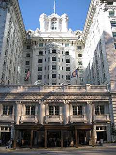
Hotel Utah |
|
000000001978-01-03-0000January 3, 1978
(#78002673) |
South Temple and Main St.
40°46′11″N 111°53′23″W / 40.769722°N 111.889722°W / 40.769722; -111.889722 (Hotel Utah) |
Downtown |
Now the Joseph Smith Memorial Building
|
| 93 |
Hotel Victor |
|
000000001982-08-17-0000August 17, 1982
(#82004143) |
155 W. 200 South
40°45′53″N 111°53′42″W / 40.764722°N 111.895°W / 40.764722; -111.895 (Hotel Victor) |
Downtown |
|
| 94 |
Immanuel Baptist Church |
|
000000001978-12-12-0000December 12, 1978
(#78002668) |
401 E. 200 South
40°45′55″N 111°52′45″W / 40.765351°N 111.879233°W / 40.765351; -111.879233 (Immanuel Baptist Church) |
Central City |
|
| 95 |
Independent Order of Odd Fellows Hall |
|
000000001977-11-07-0000November 7, 1977
(#77001308) |
39 W. Market St.
40°45′41″N 111°53′30″W / 40.761389°N 111.891667°W / 40.761389; -111.891667 (Independent Order of Odd Fellows Hall) |
Downtown |
Originally at 26 W. Market St., moved in August 2009
|
| 96 |
Irving Junior High School |
|
000000001978-12-22-0000December 22, 1978
(#78002674) |
1179 E. 2100 South
40°43′34″N 111°51′25″W / 40.726111°N 111.856944°W / 40.726111; -111.856944 (Irving Junior High School) |
Sugar House |
|
| 97 |
Ivanhoe Apartments |
|
000000001989-10-20-0000October 20, 1989
(#89001738) |
417 E. 300 South
40°45′47″N 111°52′41″W / 40.763056°N 111.878056°W / 40.763056; -111.878056 (Ivanhoe Apartments) |
Central City |
|
| 98 |
Japanese Church of Christ |
|
000000001982-08-17-0000August 17, 1982
(#82004144) |
268 W. 100 South
40°46′03″N 111°53′54″W / 40.7675°N 111.898333°W / 40.7675; -111.898333 (Japanese Church of Christ) |
Downtown |
|
| 99 |
John W. Judd House |
|
000000001983-10-13-0000October 13, 1983
(#83003952) |
918 E. Logan Ave.
40°44′03″N 111°51′50″W / 40.734167°N 111.863889°W / 40.734167; -111.863889 (John W. Judd House) |
Perkins Addition |
|
| 100 |
Judge Building |
|
000000001979-12-26-0000December 26, 1979
(#79002502) |
8 E. 300 South
40°45′46″N 111°53′24″W / 40.762778°N 111.89°W / 40.762778; -111.89 (Judge Building) |
Downtown |
|
| 101 |
Emanuel Kahn House |
|
000000001977-07-21-0000July 21, 1977
(#77001309) |
678 E. South Temple St.
40°46′09″N 111°52′15″W / 40.769167°N 111.870833°W / 40.769167; -111.870833 (Emanuel Kahn House) |
Central City |
Now the Anniversary Inn bed and breakfast
|
| 102 |
Karrick Block |
|
000000001976-06-16-0000June 16, 1976
(#76001828) |
236 S. Main St.
40°45′49″N 111°53′26″W / 40.763611°N 111.890556°W / 40.763611; -111.890556 (Karrick Block) |
Downtown |
|
| 103 |
Kearns Building |
|
000000001982-08-17-0000August 17, 1982
(#82004145) |
132 S. Main St.
40°45′58″N 111°53′27″W / 40.766111°N 111.890833°W / 40.766111; -111.890833 (Kearns Building) |
Downtown |
|
| 104 |
Thomas Kearns Mansion and Carriage House |
|
000000001970-02-26-0000February 26, 1970
(#70000631) |
603 E. South Temple St.
40°46′11″N 111°52′23″W / 40.769722°N 111.873056°W / 40.769722; -111.873056 (Thomas Kearns Mansion and Carriage House) |
Avenues |
Serves as the Utah Governor's Mansion
|
| 105 |
David Keith Mansion and Carriage House |
|
000000001971-05-14-0000May 14, 1971
(#71000849) |
529 E. South Temple St.
40°46′11″N 111°52′30″W / 40.769722°N 111.875°W / 40.769722; -111.875 (David Keith Mansion and Carriage House) |
Avenues |
|
| 106 |
Keith-O'Brien Building |
|
000000001977-08-16-0000August 16, 1977
(#77001310) |
242–256 S. Main St.
40°45′49″N 111°53′27″W / 40.763611°N 111.890833°W / 40.763611; -111.890833 (Keith-O'Brien Building) |
Downtown |
|
| 107 |
Albert H. Kelly House |
|
000000001983-07-20-0000July 20, 1983
(#83004420) |
418 S. 200 West
40°45′36″N 111°53′49″W / 40.76°N 111.896944°W / 40.76; -111.896944 (Albert H. Kelly House) |
Downtown |
|
| 108 |
John B. Kelly House |
|
000000001983-07-20-0000July 20, 1983
(#83003172) |
422 S. 200 West
40°45′36″N 111°53′49″W / 40.76°N 111.896944°W / 40.76; -111.896944 (John B. Kelly House) |
Downtown |
|
| 109 |
Keyser-Cullen House |
Upload image |
000000001999-12-09-0000December 9, 1999
(#99001561) |
941 E. 500 South
40°45′32″N 111°51′48″W / 40.758889°N 111.863333°W / 40.758889; -111.863333 (Keyser-Cullen House) |
Central City |
|
| 110 |
Malcolm and Elizabeth Keyser House |
|
000000002008-09-12-0000September 12, 2008
(#08000881) |
381 E. 11th Ave.
40°46′57″N 111°52′41″W / 40.78252°N 111.87801°W / 40.78252; -111.87801 (Malcolm and Elizabeth Keyser House) |
Avenues |
|
| 111 |
Ladies Literary Club Clubhouse |
|
000000001978-10-11-0000October 11, 1978
(#78002675) |
850 E. South Temple St.
40°46′10″N 111°51′58″W / 40.769444°N 111.866111°W / 40.769444; -111.866111 (Ladies Literary Club Clubhouse) |
Central City |
|
| 112 |
John C. and Mary Landenberger House |
Upload image |
000000002005-01-26-0000January 26, 2005
(#04001567) |
58 N. Virginia St.
40°46′14″N 111°51′07″W / 40.770694°N 111.852083°W / 40.770694; -111.852083 (John C. and Mary Landenberger House) |
Federal Heights |
|
| 113 |
James and Susan R. Langton House |
|
000000001982-11-19-0000November 19, 1982
(#82001750) |
648 E. 100 South
40°46′01″N 111°52′19″W / 40.766944°N 111.871944°W / 40.766944; -111.871944 (James and Susan R. Langton House) |
Central City |
|
| 114 |
Lefler-Woodman Building |
|
000000001992-12-17-0000December 17, 1992
(#92001687) |
859 E. 900 South
40°45′00″N 111°51′55″W / 40.75°N 111.865278°W / 40.75; -111.865278 (Lefler-Woodman Building) |
9th and 9th |
|
| 115 |
Dr. David and Juanita Lewis House |
|
000000002001-11-29-0000November 29, 2001
(#01001283) |
1403 E. Westminster Ave.
40°43′45″N 111°51′01″W / 40.729167°N 111.850278°W / 40.729167; -111.850278 (Dr. David and Juanita Lewis House) |
Sugar House |
|
| 116 |
Liberty Park |
|
000000001980-12-11-0000December 11, 1980
(#80003926) |
Roughly bounded by 500 East, 700 East, 900 South, and 1300 South
40°44′45″N 111°52′26″W / 40.745708°N 111.873917°W / 40.745708; -111.873917 (Liberty Park) |
Liberty Wells |
|
| 117 |
Liberty Wells Historic District |
|
000000002010-04-21-0000April 21, 2010
(#10000210) |
Roughly bounded by 700 East, State St., 1300 South, and 2100 South; also bounded by State St., 900 South, 500 East, and 1300 South
40°44′01″N 111°52′47″W / 40.733544°N 111.879747°W / 40.733544; -111.879747 (Liberty Wells Historic District) |
Liberty Wells |
Originally listed as "Wells Historic District"; second set of boundaries represents the Liberty Wells Historic District boundary increase of 000000002012-01-27-0000January 27, 2012
|
| 118 |
Lincoln Arms Apartments |
|
000000001989-10-20-0000October 20, 1989
(#89001737) |
242 E. 100 South
40°46′01″N 111°52′59″W / 40.766944°N 111.883056°W / 40.766944; -111.883056 (Lincoln Arms Apartments) |
Central City |
|
| 119 |
Lollin Block |
|
000000001977-08-18-0000August 18, 1977
(#77001311) |
238 S. Main St.
40°45′51″N 111°53′27″W / 40.764167°N 111.890833°W / 40.764167; -111.890833 (Lollin Block) |
Downtown |
|
| 120 |
Henry Luce House |
|
000000001983-10-13-0000October 13, 1983
(#83003953) |
921 E. 1700 South
40°44′01″N 111°51′50″W / 40.733611°N 111.863889°W / 40.733611; -111.863889 (Henry Luce House) |
Perkins Addition |
|
| 121 |
Walter C. Lyne House |
|
000000001979-03-09-0000March 9, 1979
(#79003495) |
1135 E. South Temple St.
40°46′11″N 111°51′28″W / 40.769722°N 111.857778°W / 40.769722; -111.857778 (Walter C. Lyne House) |
Avenues |
|
| 122 |
Mabry-Van Pelt House |
|
000000001983-10-13-0000October 13, 1983
(#83003954) |
946 E. 1700 South
40°44′00″N 111°51′47″W / 40.733333°N 111.863056°W / 40.733333; -111.863056 (Mabry-Van Pelt House) |
Perkins Addition |
|
| 123 |
Millard F. Malin House |
Upload image |
000000001983-07-07-0000July 7, 1983
(#83003173) |
233 S. 400 East
40°45′51″N 111°52′45″W / 40.764097°N 111.879167°W / 40.764097; -111.879167 (Millard F. Malin House) |
Central City |
|
| 124 |
James G. McAllister House |
|
000000001982-12-17-0000December 17, 1982
(#82001751) |
306 Douglas St.
40°45′45″N 111°51′17″W / 40.7625°N 111.854722°W / 40.7625; -111.854722 (James G. McAllister House) |
University |
|
| 125 |
McCornick Building |
|
000000001977-08-24-0000August 24, 1977
(#77001312) |
10 W. 100 South
40°46′03″N 111°53′26″W / 40.7675°N 111.890556°W / 40.7675; -111.890556 (McCornick Building) |
Downtown |
|
| 126 |
Alfred W. McCune Mansion |
|
000000001974-06-13-0000June 13, 1974
(#74001937) |
200 N. Main St.
40°46′26″N 111°53′24″W / 40.773889°N 111.89°W / 40.773889; -111.89 (Alfred W. McCune Mansion) |
Capitol Hill |
|
| 127 |
J. G. McDonald Chocolate Company Building |
|
000000001978-03-29-0000March 29, 1978
(#78002676) |
155–159 W. 300 South
40°45′45″N 111°53′44″W / 40.7625°N 111.895556°W / 40.7625; -111.895556 (J. G. McDonald Chocolate Company Building) |
Downtown |
|
| 128 |
McIntyre Building |
|
000000001977-07-15-0000July 15, 1977
(#77001313) |
68–72 S. Main St.
40°46′04″N 111°53′26″W / 40.767778°N 111.890556°W / 40.767778; -111.890556 (McIntyre Building) |
Downtown |
|
| 129 |
McIntyre House |
|
000000001978-07-17-0000July 17, 1978
(#78002677) |
259 7th Ave.
40°46′39″N 111°52′54″W / 40.7774°N 111.8817°W / 40.7774; -111.8817 (McIntyre House) |
Avenues |
|
| 130 |
Joseph and Marie N. McRae House |
|
000000002002-12-20-0000December 20, 2002
(#02001555) |
452 E. 500 South
40°45′30″N 111°52′38″W / 40.758333°N 111.877222°W / 40.758333; -111.877222 (Joseph and Marie N. McRae House) |
Central City |
|
| 131 |
Frederick A.E. Meyer House |
|
000000001983-07-07-0000July 7, 1983
(#83003174) |
929 E. 200 South
40°45′55″N 111°51′49″W / 40.765278°N 111.863611°W / 40.765278; -111.863611 (Frederick A.E. Meyer House) |
Central City |
|
| 132 |
Alexander Mitchell House |
|
000000001983-10-13-0000October 13, 1983
(#83003955) |
1620 S. 1000 East
40°44′03″N 111°51′43″W / 40.734167°N 111.861944°W / 40.734167; -111.861944 (Alexander Mitchell House) |
Perkins Addition |
|
| 133 |
Richard Vaughen Morris House |
|
000000001980-04-29-0000April 29, 1980
(#80003929) |
314 Quince St.
40°46′34″N 111°53′40″W / 40.776111°N 111.894444°W / 40.776111; -111.894444 (Richard Vaughen Morris House) |
Capitol Hill |
|
| 134 |
Morrison-Merrill Lumber Company Office and Warehouse |
|
000000001998-12-17-0000December 17, 1998
(#98001534) |
205 N. 400 West
40°46′26″N 111°54′07″W / 40.773889°N 111.901944°W / 40.773889; -111.901944 (Morrison-Merrill Lumber Company Office and Warehouse) |
Capitol Hill |
|
| 135 |
Mountain States Telephone and Telegraph Co. Garage |
|
000000001998-11-24-0000November 24, 1998
(#98000827) |
1075 E. Hollywood Ave.
40°43′39″N 111°51′36″W / 40.7275°N 111.86°W / 40.7275; -111.86 (Mountain States Telephone and Telegraph Co. Garage) |
Sugar House |
|
| 136 |
William A. Nelden House |
|
000000001978-10-19-0000October 19, 1978
(#78002678) |
1172 E. 100 South
40°46′01″N 111°51′23″W / 40.766944°N 111.856389°W / 40.766944; -111.856389 (William A. Nelden House) |
University |
|
| 137 |
Nelson-Beesley House |
|
000000001980-06-20-0000June 20, 1980
(#80003931) |
533 11th Ave.
40°46′56″N 111°52′22″W / 40.782222°N 111.872778°W / 40.782222; -111.872778 (Nelson-Beesley House) |
Avenues |
|
| 138 |
Carl M. Neuhausen House |
|
000000001980-10-03-0000October 3, 1980
(#80003932) |
1265 E. 100 South
40°46′04″N 111°51′15″W / 40.767778°N 111.854167°W / 40.767778; -111.854167 (Carl M. Neuhausen House) |
University |
|
| 139 |
New York Hotel |
|
000000001980-03-10-0000March 10, 1980
(#80003933) |
42 Post Office Pl.
40°45′42″N 111°53′31″W / 40.761667°N 111.891944°W / 40.761667; -111.891944 (New York Hotel) |
Downtown |
|
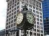
| 140 |
Old Clock at Zion's First National Bank |
|
000000001982-12-27-0000December 27, 1982
(#82001752) |
Southwestern corner of 100 South and Main St.
40°46′01″N 111°53′27″W / 40.766944°N 111.890833°W / 40.766944; -111.890833 (Old Clock at Zion's First National Bank) |
Downtown |
|
| 141 |
Old Pioneer Fort Site |
|
000000001974-10-15-0000October 15, 1974
(#74001938) |
400 South and 200 West
40°45′43″N 111°54′01″W / 40.761944°N 111.900278°W / 40.761944; -111.900278 (Old Pioneer Fort Site) |
Downtown |
|
| 142 |
Oquirrh School |
|
000000002008-12-04-0000December 4, 2008
(#08001156) |
350 S. 400 East
40°45′41″N 111°52′50″W / 40.76151°N 111.88047°W / 40.76151; -111.88047 (Oquirrh School) |
Central City |
|
| 143 |
Oregon Shortline Railroad Company Building |
|
000000001976-06-23-0000June 23, 1976
(#76001829) |
126–140 Pierpont Ave.
40°45′51″N 111°53′39″W / 40.764167°N 111.894167°W / 40.764167; -111.894167 (Oregon Shortline Railroad Company Building) |
Downtown |
|
| 144 |
Frank M. Orem House |
|
000000001983-08-05-0000August 5, 1983
(#83003175) |
274 S. 1200 East
40°45′48″N 111°51′24″W / 40.763333°N 111.856667°W / 40.763333; -111.856667 (Frank M. Orem House) |
University |
|
| 145 |
Orpheum Theatre |
|
000000001976-09-30-0000September 30, 1976
(#76002257) |
46 W. 200 South
40°45′55″N 111°53′32″W / 40.765278°N 111.892222°W / 40.765278; -111.892222 (Orpheum Theatre) |
Downtown |
|
| 146 |
Ottinger Hall |
|
000000001971-04-16-0000April 16, 1971
(#71000851) |
233 Canyon Rd.
40°46′32″N 111°53′07″W / 40.775556°N 111.885278°W / 40.775556; -111.885278 (Ottinger Hall) |
City Creek Canyon |
|
| 147 |
Pacific Northwest Pipeline Building |
|
000000002011-01-24-0000January 24, 2011
(#10001159) |
315 E. 200 South
40°45′56″N 111°52′54″W / 40.765556°N 111.881667°W / 40.765556; -111.881667 (Pacific Northwest Pipeline Building) |
Central City |
Built in 1958 in International Style, it was the Salt Lake City Public Safety Building from 1979 to 2013.
|
| 148 |
Peter Pan Apartments |
|
000000002008-09-12-0000September 12, 2008
(#08000880) |
445 E. 300 South
40°45′45″N 111°52′41″W / 40.76245°N 111.87817°W / 40.76245; -111.87817 (Peter Pan Apartments) |
Central City |
|
| 149 |
Park Hotel |
|
000000001992-12-17-0000December 17, 1992
(#92001690) |
422–432 W. 300 South
40°45′47″N 111°54′10″W / 40.763056°N 111.902778°W / 40.763056; -111.902778 (Park Hotel) |
Central City West |
|
| 150 |
Clifford R. Pearsall House |
|
000000001983-10-13-0000October 13, 1983
(#83003957) |
950 E. Logan Ave.
40°44′03″N 111°51′46″W / 40.734167°N 111.862778°W / 40.734167; -111.862778 (Clifford R. Pearsall House) |
Perkins Addition |
|
| 151 |
Piccardy Apartments |
|
000000002008-09-12-0000September 12, 2008
(#08000879) |
115 S. 300 East
40°46′00″N 111°52′56″W / 40.76666°N 111.88227°W / 40.76666; -111.88227 (Piccardy Apartments) |
Central City |
|
| 152 |
Peery Hotel |
|
000000001978-02-17-0000February 17, 1978
(#78002679) |
270–280 S. West Temple, 102–120 W. 300 South
40°45′47″N 111°53′36″W / 40.763056°N 111.893333°W / 40.763056; -111.893333 (Peery Hotel) |
Downtown |
|
| 153 |
John Platts House |
|
000000001972-08-25-0000August 25, 1972
(#72001259) |
364 Quince St.
40°46′40″N 111°53′39″W / 40.777778°N 111.894167°W / 40.777778; -111.894167 (John Platts House) |
Capitol Hill |
|
| 154 |
John and Margaret Price House |
Upload image |
000000002015-01-07-0000January 7, 2015
(#14001140) |
2691 E. St. Mary's Way
40°44′34″N 111°48′49″W / 40.7427°N 111.8135°W / 40.7427; -111.8135 (John and Margaret Price House) |
Foothill |
|
| 155 |
Lorenzo and Emma Price House and Barn |
Upload image |
000000001998-08-06-0000August 6, 1998
(#98001016) |
1205 E. 1300 South
40°44′31″N 111°51′20″W / 40.741944°N 111.855556°W / 40.741944; -111.855556 (Lorenzo and Emma Price House and Barn) |
East Central |
|
| 156 |
Lewis A. Ramsey House |
Upload image |
000000001999-05-28-0000May 28, 1999
(#99000621) |
128 S. 1000 East
40°45′59″N 111°51′44″W / 40.766389°N 111.862222°W / 40.766389; -111.862222 (Lewis A. Ramsey House) |
Central City |
|
| 157 |
Richardson-Bower Building |
|
000000002003-07-11-0000July 11, 2003
(#03000636) |
1019 E. 2100 South
40°43′32″N 111°51′41″W / 40.725556°N 111.861389°W / 40.725556; -111.861389 (Richardson-Bower Building) |
Sugar House |
|
| 158 |
Rowland Hall-St. Mark's School |
|
000000001979-07-26-0000July 26, 1979
(#79002504) |
205 1st Ave.
40°46′17″N 111°52′55″W / 40.771389°N 111.881944°W / 40.771389; -111.881944 (Rowland Hall-St. Mark's School) |
Avenues |
Now the Madeleine Choir School
|
| 159 |
Jonathan C. and Eliza K. Royle House |
|
000000001983-01-03-0000January 3, 1983
(#83003176) |
635 E. 100 South
40°46′03″N 111°52′21″W / 40.7675°N 111.8725°W / 40.7675; -111.8725 (Jonathan C. and Eliza K. Royle House) |
Central City |
|
| 160 |
Eliza Gray Rumel House |
|
000000001983-07-07-0000July 7, 1983
(#83003177) |
358 S. 500 East
40°45′41″N 111°52′35″W / 40.761389°N 111.876389°W / 40.761389; -111.876389 (Eliza Gray Rumel House) |
Central City |
|
| 161 |
St. Mark's Episcopal Cathedral |
|
000000001970-09-22-0000September 22, 1970
(#70000630) |
231 E. 100 South
40°46′04″N 111°53′00″W / 40.767778°N 111.883333°W / 40.767778; -111.883333 (St. Mark's Episcopal Cathedral) |
Central City |
|
| 162 |
Salt Lake City and County Building |
|
000000001970-06-15-0000June 15, 1970
(#70000629) |
451 Washington Sq.
40°45′35″N 111°53′09″W / 40.759722°N 111.885833°W / 40.759722; -111.885833 (Salt Lake City and County Building) |
Central City |
|
| 163 |
Salt Lake City East Side Historic District |
|
000000001996-08-22-0000August 22, 1996
(#96000940) |
Roughly bounded by South Temple, 1100 East, 400 South, University Ave., 900 South, and 500 East
40°45′31″N 111°52′05″W / 40.758611°N 111.868056°W / 40.758611; -111.868056 (Salt Lake City East Side Historic District) |
Central City |
Originally the Central City Historic District, a two-block wide strip from South Temple to 900 South; boundaries greatly increased in 2001 and 2003, the last of which included a name change[6]
|
| 164 |
Salt Lake City Public Library |
|
000000001979-08-07-0000August 7, 1979
(#79002505) |
15 S. State St.
40°46′07″N 111°53′13″W / 40.768611°N 111.886944°W / 40.768611; -111.886944 (Salt Lake City Public Library) |
Downtown |
Housed the Hansen Planetarium 1965–2003, O.C. Tanner Jewelry since 2009
|
| 165 |
Salt Lake Country Club and Golf Course |
|
000000002015-07-07-0000July 7, 2015
(#15000400) |
2375 South 900 East
40°43′07″N 111°51′55″W / 40.7186°N 111.8653°W / 40.7186; -111.8653 (Salt Lake Country Club and Golf Course) |
Sugar House |
|
| 166 |
Salt Lake Engineering Works-Bogue Supply Company Building |
|
000000002003-08-14-0000August 14, 2003
(#03000156) |
741 W. 400 South
40°45′37″N 111°54′46″W / 40.760278°N 111.912778°W / 40.760278; -111.912778 (Salt Lake Engineering Works-Bogue Supply Company Building) |
Central City West |
|
| 167 |
Salt Lake Hardware Company Warehouse |
|
000000002001-10-04-0000October 4, 2001
(#01001082) |
155 N. 400 West
40°46′19″N 111°54′09″W / 40.771944°N 111.9025°W / 40.771944; -111.9025 (Salt Lake Hardware Company Warehouse) |
Capitol Hill |
|
| 168 |
Salt Lake Northwest Historic District |
|
000000002001-03-29-0000March 29, 2001
(#01000320) |
Roughly bounded by 1100 West, 600 North, 500 West, and North Temple
40°46′48″N 111°54′58″W / 40.78°N 111.916111°W / 40.78; -111.916111 (Salt Lake Northwest Historic District) |
Fairpark |
|
| 169 |
Salt Lake Stamp Company Building |
|
000000001982-12-27-0000December 27, 1982
(#82001753) |
380 W. 200 South
40°45′55″N 111°54′08″W / 40.765278°N 111.902222°W / 40.765278; -111.902222 (Salt Lake Stamp Company Building) |
Central City West |
|
| 170 |
Salt Lake Stock and Mining Exchange Building |
|
000000001976-07-30-0000July 30, 1976
(#76001830) |
39 Exchange Place
40°45′42″N 111°53′21″W / 40.761667°N 111.889167°W / 40.761667; -111.889167 (Salt Lake Stock and Mining Exchange Building) |
Downtown |
|
| 171 |
Salt Lake Union Pacific Railroad Station |
|
000000001975-07-09-0000July 9, 1975
(#75001818) |
South Temple at 400 West
40°46′10″N 111°54′09″W / 40.769444°N 111.9025°W / 40.769444; -111.9025 (Salt Lake Union Pacific Railroad Station) |
Central City West |
|
| 172 |
Sampson Apartments |
|
000000002010-01-27-0000January 27, 2010
(#09001292) |
276 E. 300 South
40°45′46″N 111°53′00″W / 40.762775°N 111.883289°W / 40.762775; -111.883289 (Sampson Apartments) |
Central City |
|
| 173 |
Sarah Daft Home for the Aged |
|
000000002002-09-12-0000September 12, 2002
(#02001041) |
737 S. 1300 East
40°45′11″N 111°51′12″W / 40.753056°N 111.853333°W / 40.753056; -111.853333 (Sarah Daft Home for the Aged) |
Central City |
|
| 174 |
Seventh-day Adventist Meetinghouse and School |
|
000000002007-02-06-0000February 6, 2007
(#06000930) |
1840 S. 800 East
40°43′47″N 111°52′04″W / 40.729722°N 111.867778°W / 40.729722; -111.867778 (Seventh-day Adventist Meetinghouse and School) |
Sugar House |
|
| 175 |
Silver Brothers' Iron Works Office and Warehouse |
|
000000001999-05-20-0000May 20, 1999
(#99000622) |
550 W. 700 South
40°45′16″N 111°54′20″W / 40.754444°N 111.905556°W / 40.754444; -111.905556 (Silver Brothers' Iron Works Office and Warehouse) |
Central City West |
|
| 176 |
Smith Apartments |
|
000000001989-10-20-0000October 20, 1989
(#89001740) |
228 S. 300 East
40°45′51″N 111°52′58″W / 40.764167°N 111.882778°W / 40.764167; -111.882778 (Smith Apartments) |
Central City |
|
| 177 |
George Albert Smith House |
|
000000001993-03-12-0000March 12, 1993
(#93000066) |
1302 E. Yale Ave.
40°44′44″N 111°51′11″W / 40.745556°N 111.853056°W / 40.745556; -111.853056 (George Albert Smith House) |
Yalecrest |
|
| 178 |
Smith-Bailey Drug Company Building |
|
000000001982-08-17-0000August 17, 1982
(#82004146) |
171 W. 200 South
40°45′53″N 111°53′45″W / 40.764722°N 111.895833°W / 40.764722; -111.895833 (Smith-Bailey Drug Company Building) |
Downtown |
|
| 179 |
South Temple Historic District |
|
000000001982-07-14-0000July 14, 1982
(#82004147) |
100 E. to 1350 E. South Temple St.
40°46′10″N 111°52′11″W / 40.769444°N 111.869722°W / 40.769444; -111.869722 (South Temple Historic District) |
|
|
| 180 |
Sprague Branch of the Salt Lake City Public Library |
|
000000002003-07-11-0000July 11, 2003
(#03000637) |
2131 S. Highland Dr.
40°43′30″N 111°51′30″W / 40.725°N 111.858333°W / 40.725; -111.858333 (Sprague Branch of the Salt Lake City Public Library) |
Sugar House |
|
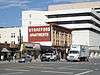
| 181 |
Stratford Hotel |
|
000000001982-12-27-0000December 27, 1982
(#82001754) |
175 E. 200 South
40°45′55″N 111°53′06″W / 40.765278°N 111.885°W / 40.765278; -111.885 (Stratford Hotel) |
Central City |
|
| 182 |
Sugar House LDS Ward Building |
|
000000002003-07-11-0000July 11, 2003
(#03000631) |
1950 S. 1200 East
40°43′40″N 111°51′24″W / 40.727778°N 111.856667°W / 40.727778; -111.856667 (Sugar House LDS Ward Building) |
Sugar House |
|
| 183 |
Sugar House Monument |
|
000000002003-07-11-0000July 11, 2003
(#03000638) |
1100 East and 2100 South
40°43′32″N 111°51′34″W / 40.725556°N 111.859444°W / 40.725556; -111.859444 (Sugar House Monument) |
Sugar House |
|
| 184 |
Sweet Candy Company Building |
|
000000002000-12-28-0000December 28, 2000
(#00001584) |
224 S. 200 West
40°45′52″N 111°53′48″W / 40.764444°N 111.896667°W / 40.764444; -111.896667 (Sweet Candy Company Building) |
Downtown |
|
| 185 |
Temple Square |
|
000000001966-10-15-0000October 15, 1966
(#66000738) |
Temple Square
40°46′14″N 111°53′29″W / 40.770556°N 111.891389°W / 40.770556; -111.891389 (Temple Square) |
Downtown |
|
| 186 |
Tenth Ward Square |
|
000000001977-11-11-0000November 11, 1977
(#77001314) |
400 South and 800 East
40°45′37″N 111°52′05″W / 40.760278°N 111.868056°W / 40.760278; -111.868056 (Tenth Ward Square) |
Central City |
|
| 187 |
Third Presbyterian Church Parsonage |
|
000000002000-05-19-0000May 19, 2000
(#00000522) |
1068 E. Blaine Ave.
40°43′56″N 111°51′35″W / 40.732222°N 111.859722°W / 40.732222; -111.859722 (Third Presbyterian Church Parsonage) |
Sugar House |
|
| 188 |
Tracy Loan and Trust Company Building |
|
000000001978-10-10-0000October 10, 1978
(#78002681) |
151 S. Main St.
40°45′57″N 111°53′24″W / 40.765833°N 111.89°W / 40.765833; -111.89 (Tracy Loan and Trust Company Building) |
Downtown |
|
| 189 |
Tribune Building |
|
000000002012-07-30-0000July 30, 2012
(#82005108) |
137 S. Main St.
40°45′58″N 111°53′27″W / 40.766083°N 111.89075°W / 40.766083; -111.89075 (Tribune Building) |
Downtown |
|
| 190 |
Trinity A.M.E. Church |
|
000000001976-07-30-0000July 30, 1976
(#76001831) |
239 E. 600 South
40°45′24″N 111°53′01″W / 40.756667°N 111.883611°W / 40.756667; -111.883611 (Trinity A.M.E. Church) |
Central City |
|
| 191 |
Twenty-Ninth Ward LDS Meetinghouse |
|
000000002015-04-06-0000April 6, 2015
(#15000132) |
1102 W. 400 North
40°46′42″N 111°55′23″W / 40.778422°N 111.922932°W / 40.778422; -111.922932 (Twenty-Ninth Ward LDS Meetinghouse) |
Fairpark |
|
| 192 |
Frank M. and Susan E. Ulmer House |
|
000000002002-12-20-0000December 20, 2002
(#02001556) |
1458 S. 1300 East
40°44′16″N 111°51′12″W / 40.737778°N 111.853333°W / 40.737778; -111.853333 (Frank M. and Susan E. Ulmer House) |
Sugar House |
|
| 193 |
University Neighborhood Historic District |
Upload image |
000000001995-12-13-0000December 13, 1995
(#95001430) |
Roughly bounded by 500 South, South Temple, 1100 East and University St.
40°45′50″N 111°51′20″W / 40.763889°N 111.855556°W / 40.763889; -111.855556 (University Neighborhood Historic District) |
University |
|
| 194 |
University of Utah Circle |
|
000000001978-04-20-0000April 20, 1978
(#78002682) |
University of Utah campus
40°45′54″N 111°50′59″W / 40.765°N 111.849722°W / 40.765; -111.849722 (University of Utah Circle) |
University |
|
| 195 |
US Post Office-Sugar House |
|
000000001994-02-18-0000February 18, 1994
(#93000409) |
2155 S. Highland Dr.
40°43′27″N 111°51′30″W / 40.724167°N 111.858333°W / 40.724167; -111.858333 (US Post Office-Sugar House) |
Sugar House |
|
| 196 |
Utah Commercial and Savings Bank Building |
|
000000001975-06-18-0000June 18, 1975
(#75001819) |
22 E. 100 South
40°46′01″N 111°53′23″W / 40.766944°N 111.889722°W / 40.766944; -111.889722 (Utah Commercial and Savings Bank Building) |
Downtown |
|
| 197 |
Utah State Fair Grounds |
|
000000001981-01-27-0000January 27, 1981
(#81000583) |
1000 West and North Temple Sts.
40°46′30″N 111°55′30″W / 40.775°N 111.925°W / 40.775; -111.925 (Utah State Fair Grounds) |
Fairpark |
|
| 198 |
Utah State Liquor Agency No. 22 |
|
000000002003-07-11-0000July 11, 2003
(#03000639) |
1938 S. 1100 East
40°43′41″N 111°51′31″W / 40.728056°N 111.858611°W / 40.728056; -111.858611 (Utah State Liquor Agency No. 22) |
Sugar House |
This building is no longer here.
|
| 199 |
Veterans Administration Hospital |
|
000000001996-06-16-0000June 16, 1996
(#96000630) |
401 E. 12th Ave.
40°47′04″N 111°52′40″W / 40.784444°N 111.877778°W / 40.784444; -111.877778 (Veterans Administration Hospital) |
Avenues |
|
| 200 |
Walker Bank Building |
|
000000002006-10-04-0000October 4, 2006
(#06000929) |
175 S. Main St.
40°45′55″N 111°53′24″W / 40.765278°N 111.89°W / 40.765278; -111.89 (Walker Bank Building) |
Downtown |
|
| 201 |
Warehouse District |
|
000000001982-08-17-0000August 17, 1982
(#82004149) |
200 South and Pierpont Ave. between 300 and 400 West; also oughly bounded by I-15, US 50 S., W. Temple St., 300 West & 1000 South
40°45′47″N 111°54′10″W / 40.763056°N 111.902778°W / 40.763056; -111.902778 (Warehouse District) |
Central City West |
Second set of addresses represent a boundary increase March 22, 2016
|
| 202 |
Wasatch Springs Plunge |
|
000000001980-05-15-0000May 15, 1980
(#80003936) |
840 N. 300 West
40°47′21″N 111°53′57″W / 40.789167°N 111.899167°W / 40.789167; -111.899167 (Wasatch Springs Plunge) |
Capitol Hill |
Housed the Children's Museum of Utah 1983–2006
|
| 203 |
Charles H. Weeks House |
|
000000001983-10-13-0000October 13, 1983
(#83003959) |
935 E. Logan Ave.
40°44′04″N 111°51′48″W / 40.734444°N 111.863333°W / 40.734444; -111.863333 (Charles H. Weeks House) |
Perkins Addition |
|
| 204 |
Western General Agency Building |
|
000000002015-09-29-0000September 29, 2015
(#15000678) |
780 E. South Temple St.
40°46′09″N 111°52′08″W / 40.7693°N 111.8689°W / 40.7693; -111.8689 (Western General Agency Building) |
East Central |
|
| 205 |
Western Macaroni Manufacturing Company Factory |
|
000000002015-04-07-0000April 7, 2015
(#15000133) |
244 S. 500 West
40°45′49″N 111°54′24″W / 40.763702°N 111.906658°W / 40.763702; -111.906658 (Western Macaroni Manufacturing Company Factory) |
Central City West |
|
| 206 |
Westminster College President's House |
|
000000002001-09-07-0000September 7, 2001
(#01000961) |
1733 S. 1300 East
40°43′59″N 111°51′09″W / 40.733056°N 111.8525°W / 40.733056; -111.8525 (Westminster College President's House) |
Sugar House |
|
| 207 |
Westmoreland Place Historic District |
Upload image |
000000002011-04-27-0000April 27, 2011
(#11000234) |
Roughly bounded by 1300 South, 1500 East, Sherman Ave. & 1600 East Sts.
40°44′27″N 111°50′48″W / 40.740833°N 111.846667°W / 40.740833; -111.846667 (Westmoreland Place Historic District) |
Foothill |
|
| 208 |
Nelson Wheeler Whipple House |
|
000000001979-09-26-0000September 26, 1979
(#79002506) |
564 W. 400 North
40°46′42″N 111°54′27″W / 40.778333°N 111.907500°W / 40.778333; -111.907500 (Nelson Wheeler Whipple House) |
Fairpark |
|
| 209 |
John M. Whitaker House |
|
000000001978-03-30-0000March 30, 1978
(#78002684) |
975 Garfield Ave.
40°43′48″N 111°51′43″W / 40.73°N 111.861944°W / 40.73; -111.861944 (John M. Whitaker House) |
Sugar House |
|
| 210 |
Woodruff Villa |
|
000000001982-07-14-0000July 14, 1982
(#82004150) |
1622 S. 500 East
40°44′03″N 111°52′34″W / 40.734167°N 111.876111°W / 40.734167; -111.876111 (Woodruff Villa) |
Liberty Wells |
|
| 211 |
Asahel Hart Woodruff House |
Upload image |
000000001982-07-14-0000July 14, 1982
(#82004151) |
1636 S. 500 East
40°44′02″N 111°52′34″W / 40.733889°N 111.876111°W / 40.733889; -111.876111 (Asahel Hart Woodruff House) |
Liberty Wells |
|
| 212 |
Wilford Woodruff Farm House |
Upload image |
000000001982-07-14-0000July 14, 1982
(#82004152) |
1604 S. 500 East
40°44′04″N 111°52′34″W / 40.734444°N 111.876111°W / 40.734444; -111.876111 (Wilford Woodruff Farm House) |
Liberty Wells |
|
| 213 |
Woodruff-Riter House |
|
000000001979-07-26-0000July 26, 1979
(#79002507) |
225 N. State St.
40°46′27″N 111°53′16″W / 40.774167°N 111.887778°W / 40.774167; -111.887778 (Woodruff-Riter House) |
Capitol Hill |
|
| 214 |
Yalecrest Historic District |
|
000000002007-11-08-0000November 8, 2007
(#07001168) |
Roughly bounded by Sunnyside Ave. (840 South) to 1300 South, and 1300 East to 1800 East
40°44′48″N 111°50′43″W / 40.746778°N 111.845278°W / 40.746778; -111.845278 (Yalecrest Historic District) |
Yalecrest |
|
| 215 |
Thomas Yardley House |
|
000000001983-10-13-0000October 13, 1983
(#83003961) |
955 E. Logan Ave.
40°44′04″N 111°51′45″W / 40.734444°N 111.8625°W / 40.734444; -111.8625 (Thomas Yardley House) |
Perkins Addition |
|
| 216 |
Brigham Young Complex |
|
000000001966-10-15-0000October 15, 1966
(#66000739) |
63–67 E. South Temple St.
40°46′11″N 111°53′17″W / 40.769722°N 111.888056°W / 40.769722; -111.888056 (Brigham Young Complex) |
Downtown |
|
| 217 |
Z.C.M.I. Cast Iron Front |
|
000000001970-09-22-0000September 22, 1970
(#70000632) |
15 S. Main St.
40°46′08″N 111°53′24″W / 40.768889°N 111.89°W / 40.768889; -111.89 (Z.C.M.I. Cast Iron Front) |
Downtown |
|
| 218 |
ZCMI General Warehouse |
|
000000002005-12-28-0000December 28, 2005
(#05001487) |
230 S. 500 West
40°45′52″N 111°54′19″W / 40.764444°N 111.905278°W / 40.764444; -111.905278 (ZCMI General Warehouse) |
Central City West |
|