National Register of Historic Places listings in San Juan County, Utah
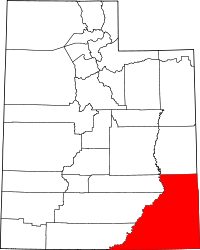
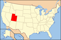
Location of San Juan County in Utah
This is a list of the National Register of Historic Places listings in San Juan County, Utah.
This is intended to be a complete list of the properties and districts on the National Register of Historic Places in San Juan County, Utah, United States. Latitude and longitude coordinates are provided for many National Register properties and districts; these locations may be seen together in a map.[1]
There are 35 properties and districts listed on the National Register in the county, including 1 National Historic Landmark.
- This National Park Service list is complete through NPS recent listings posted December 2, 2016.[2]
Current listings
| [3] | Name on the Register[4] | Image | Date listed[5] | Location | City or town | Description |
|---|---|---|---|---|---|---|
| 1 | Joseph Frederick Adams House | Upload image | (#85003390) |
Approximately 150 N. 700 East 37°17′07″N 109°33′00″W / 37.285139°N 109.55°W |
Bluff | |
| 2 | Alkali Ridge |  |
(#66000740) |
Along County Road 204 (Alkali Point Rd.), south of Monticello[6] 37°40′50″N 109°22′40″W / 37.680556°N 109.377778°W |
Monticello | A major proto-Pueblo archaeological site[4] |
| 3 | Aneth Terrace Archeological District | Upload image | (#80003937) |
Address Restricted[7] |
Aneth | |
| 4 | Big Westwater Ruin | Upload image | (#80003938) |
Address Restricted[7] |
Blanding | |
| 5 | Bluff Historic District |  |
(#95001273) |
Roughly bounded by Main St., U.S. Route 191, 2nd E. St., and the bluffs 37°17′16″N 109°33′03″W / 37.287778°N 109.550833°W |
Bluff | |
| 6 | Butler Wash Archeological District |  |
(#81000584) |
Address Restricted[7] |
Blanding | |
| 7 | Carhart Pueblo | Upload image | (#15000401) |
Address Restricted[7] |
Monticello | |
| 8 | Cave Springs Cowboy Camp | 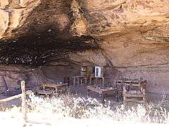 |
(#88001233) |
Cave Springs vicinity 38°09′34″N 109°45′12″W / 38.159444°N 109.753333°W |
Moab | In the Needles district of Canyonlands National Park |
| 9 | James Bean Decker House | Upload image | (#83003180) |
189 N. 300 East 37°17′06″N 109°33′26″W / 37.285°N 109.557222°W |
Bluff | |
| 10 | Defiance House | Upload image | (#78000347) |
Address Restricted[7] |
Blanding | |
| 11 | Edge of Cedars Indian Ruin | 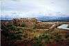 |
(#71000853) |
West of Blanding 37°37′48″N 109°29′20″W / 37.63°N 109.488889°W |
Blanding | Part of the Edge of the Cedars State Park Museum |
| 12 | Goulding's Trading Post | 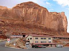 |
(#80003941) |
Off State Route 47 37°00′24″N 110°12′09″W / 37.006667°N 110.2025°W |
Gouldings | A lodge, trading post, and museum located just north of the Arizona–Utah border, adjacent to the Navajo Tribal Park in Monument Valley. |
| 13 | Grand Gulch Archeological District | 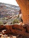 |
(#82004154) |
Address Restricted[7] |
Blanding | |
| 14 | Hole-in-the-Rock Trail | 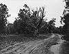 |
(#82004792) |
A trail commencing at Escalante and terminating at Bluff 37°25′18″N 110°39′51″W / 37.421667°N 110.664167°W |
Escalante | Split between Garfield, Kane, and San Juan counties |
| 15 | Hyland Hotel | 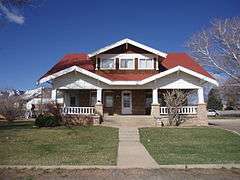 |
(#94000785) |
116 S. 100 West 37°52′14″N 109°20′38″W / 37.870556°N 109.343889°W |
Monticello | A Craftsman Style bungalow |
| 16 | Indian Creek State Park | 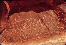 |
(#76001833) |
14 miles (23 km) north of Monticello 37°59′18″N 109°31′00″W / 37.988333°N 109.516667°W |
Monticello | Also known as Newspaper Rock State Historic Monument since 1961[8] |
| 17 | Frederick Isaac and Mary M. Jones House | 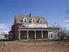 |
(#03000154) |
117 E. 200 South 37°52′N 109°20′W / 37.87°N 109.34°W |
Monticello | |
| 18 | Julien Inscription | Upload image | (#88001248) |
Lower Red Lake vicinity 38°09′16″N 109°55′32″W / 38.154444°N 109.925556°W |
Moab | Rock-carved graffito reportedly left by French-American trapper Denis Julien |
| 19 | Kirk's Cabin Complex | 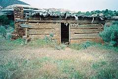 |
(#88001252) |
Upper Salt Walsh 37°59′16″N 109°44′27″W / 37.987778°N 109.740833°W |
Moab | A log cabin and corrals built circa 1890, located in present-day Canyonlands National Park |
| 20 | Lost Canyon Cowboy Camp | 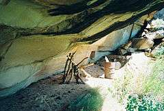 |
(#88001232) |
Lost Canyon vicinity 38°08′13″N 109°45′32″W / 38.136944°N 109.758889°W |
Moab | |
| 21 | Murphy Trail and Bridge | Upload image | (#88001236) |
Murphy Point vicinity 38°20′37″N 109°52′15″W / 38.343611°N 109.870833°W |
Moab | Livestock trail located in what is now Canyonlands National Park; the original bridge was replaced a decade after the site was NRHP-listed |
| 22 | Natural Bridges Archeological District | 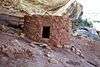 |
(#04000784) |
Address Restricted[7] |
Blanding | |
| 23 | Neck and Cabin Springs Grazing Area | Upload image | (#09001108) |
Grand View Point Rd. 38°25′09″N 109°50′04″W / 38.419178°N 109.834572°W |
Moab | |
| 24 | Jens Nielson House | 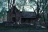 |
(#82004155) |
600 E. Black Locust Ave. 37°17′05″N 109°32′23″W / 37.284722°N 109.539722°W |
Bluff | |
| 25 | Oljato Trading Post | Upload image | (#80003939) |
Southwest of Blanding 37°02′11″N 110°19′03″W / 37.036389°N 110.3175°W |
Blanding | |
| 26 | Owachomo Bridge Trail | 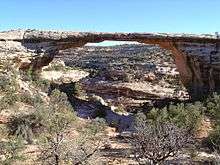 |
(#88001166) |
Armstrong Canyon 37°34′49″N 110°00′49″W / 37.580278°N 110.013611°W |
Blanding | |
| 27 | Nancy Patterson Site | Upload image | (#80004495) |
Address Restricted[7] |
Blanding | |
| 28 | Poncho House | Upload image | (#75001821) |
Address Restricted[7] |
Mexican Hat | |
| 29 | Lemuel H. Redd, Jr. House | 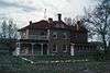 |
(#83003181) |
300 E. Mulberry Ave. 37°17′06″N 109°33′16″W / 37.285°N 109.554444°W |
Bluff | |
| 30 | St. Christopher's Episcopal Mission | Upload image | (#02001042) |
Mission Road (SR-162), east of Bluff 37°17′06″N 109°30′49″W / 37.285°N 109.513611°W |
Bluff | |
| 31 | Salt Creek Archeological District | Upload image | (#75000164) |
Address Restricted[7] |
Monticello | |
| 32 | Sand Island Petroglyph Site | Upload image | (#81000585) |
Address Restricted[7] |
Bluff | |
| 33 | John Albert Scorup House | 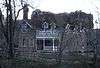 |
(#83003182) |
210 N. 700 East 37°17′09″N 109°32′57″W / 37.285833°N 109.549167°W |
Bluff | |
| 34 | Swallow's Nest | Upload image | (#96000164) |
2 N. Grayson Parkway 37°37′30″N 109°28′18″W / 37.625°N 109.471667°W |
Blanding | One-room sandstone building on the Nicklovis Ranch, built in 1925 |
| 35 | Westwater Canyon Archeological District | Upload image | (#80003940) |
Address Restricted[7] |
Blanding |
See also
References
- ↑ The latitude and longitude information provided in this table was derived originally from the National Register Information System, which has been found to be fairly accurate for about 99% of listings. For about 1% of NRIS original coordinates, experience has shown that one or both coordinates are typos or otherwise extremely far off; some corrections may have been made. A more subtle problem causes many locations to be off by up to 150 yards, depending on location in the country: most NRIS coordinates were derived from tracing out latitude and longitudes off of USGS topographical quadrant maps created under the North American Datum of 1927, which differs from the current, highly accurate WGS84 GPS system used by most on-line maps. Chicago is about right, but NRIS longitudes in Washington are higher by about 4.5 seconds, and are lower by about 2.0 seconds in Maine. Latitudes differ by about 1.0 second in Florida. Some locations in this table may have been corrected to current GPS standards.
- ↑ "National Register of Historic Places: Weekly List Actions". National Park Service, United States Department of the Interior. Retrieved on December 2, 2016.
- ↑ Numbers represent an ordering by significant words. Various colorings, defined here, differentiate National Historic Landmarks and historic districts from other NRHP buildings, structures, sites or objects.
- 1 2 National Park Service (2008-04-24). "National Register Information System". National Register of Historic Places. National Park Service.
- ↑ The eight-digit number below each date is the number assigned to each location in the National Register Information System database, which can be viewed by clicking the number.
- ↑ Location derived from the GNIS feature record for a historical marker on Alkali Ridge (USGS maps show this location in an area marked as "Alkali Point"); the NRIS lists the site as "Address Restricted"
- 1 2 3 4 5 6 7 8 9 10 11 12 Some listings on the NRHP are highly sensitive sites and may be subject to looting or vandalism. The NRHP lists this site as "Address Restricted."
- ↑ "Newspaper Rock". Markers and Monuments Database. Utah Department of Heritage and Arts. Retrieved 2013-03-02.
External links
![]() Media related to National Register of Historic Places in San Juan County, Utah at Wikimedia Commons
Media related to National Register of Historic Places in San Juan County, Utah at Wikimedia Commons
 |  | ||
| Topics | |
|---|---|
| Lists by states |
|
| Lists by insular areas | |
| Lists by associated states | |
| Other areas | |
| |
Municipalities and communities of San Juan County, Utah, United States | ||
|---|---|---|
| Cities | | |
| CDPs | ||
| Unincorporated community | ||
| Indian reservations | ||
| Ghost towns | ||
| Footnotes | ‡This populated place also has portions in an adjacent county or counties | |
This article is issued from Wikipedia - version of the 11/22/2016. The text is available under the Creative Commons Attribution/Share Alike but additional terms may apply for the media files.