| [3] |
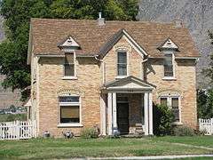
Name on the Register[4] |
Image |
Date listed[5] |
Location |
City or town |
Description |
|---|
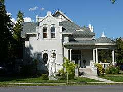
| 1 |
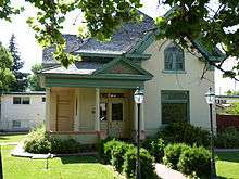
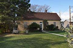
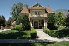
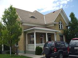
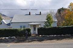
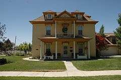
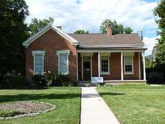
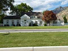
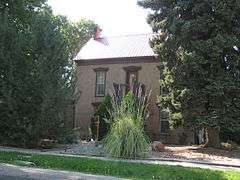
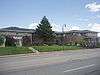
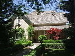
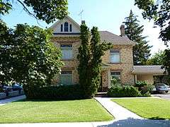
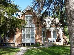
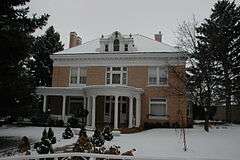
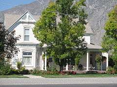
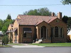
George and Temperance Adams House |
Upload image |
000000001999-12-30-0000December 30, 1999
(#99001628) |
196 West 400 South
40°17′25″N 111°41′58″W / 40.290278°N 111.699444°W / 40.290278; -111.699444 (George and Temperance Adams House) |
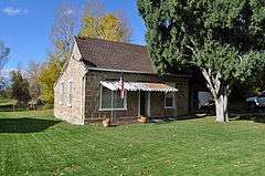
Orem |
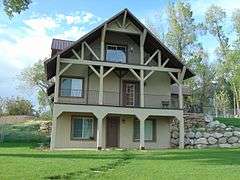
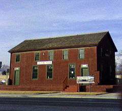
Late Victorian style home built in 1895, expanded in 1903. Brick upon adobe with detail showing economic prosperity in Orem.
|
| 2 |
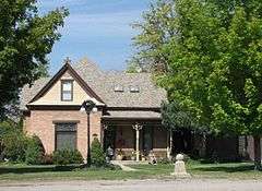
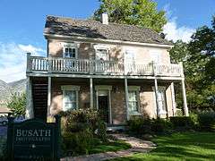
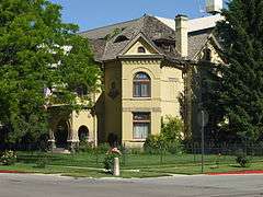
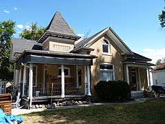
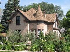
John Alma Adams House |
Upload image |
000000001987-06-09-0000June 9, 1987
(#87000825) |
625 East 200 South
40°21′42″N 111°43′34″W / 40.361667°N 111.726111°W / 40.361667; -111.726111 (John Alma Adams House) |
Pleasant Grove |
|
| 3 |
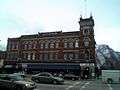
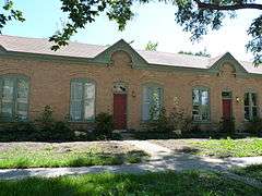
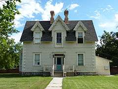
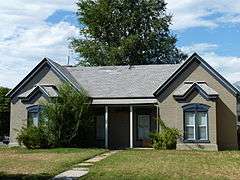
William D. Alexander House |
|
000000001983-07-28-0000July 28, 1983
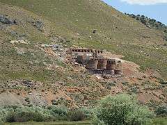
(#83003195) |
91 West 200 South
40°13′51″N 111°39′33″W / 40.230833°N 111.659167°W / 40.230833; -111.659167 (William D. Alexander House) |
Provo |
Asserted to be the only period example of Stick Style architecture in the state.
|
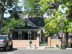
| 4 |
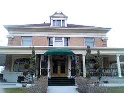
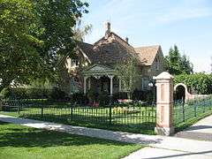
Dr. Samuel H. Allen House and Carriage House |
|
000000001979-05-18-0000May 18, 1979
(#79002515) |
135 East 200 North
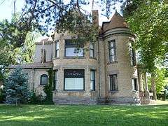
40°14′12″N 111°39′19″W / 40.236667°N 111.655278°W / 40.236667; -111.655278 (Dr. Samuel H. Allen House and Carriage House) |
Provo |
|
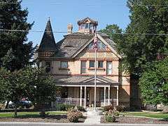
| 5 |
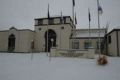
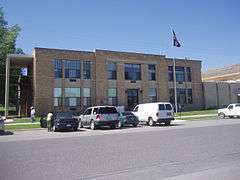
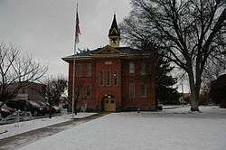
Alpine City Hall |
|
000000001991-12-19-0000December 19, 1991
(#91001820) |
20 North Main Street
40°27′12″N 111°46′36″W / 40.453333°N 111.776667°W / 40.453333; -111.776667 (Alpine City Hall) |
Alpine |
|
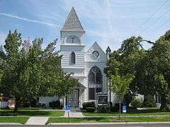
| 6 |
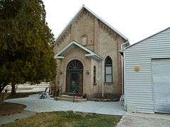
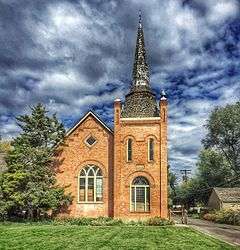
Alpine LDS Church Meetinghouse |
Upload image |
000000001990-05-24-0000May 24, 1990
(#90000794) |
50 North Main Street
40°27′14″N 111°46′37″W / 40.453889°N 111.776944°W / 40.453889; -111.776944 (Alpine LDS Church Meetinghouse) |
Alpine |
|
| 7 |
American Fork Cemetery Rock Wall |
Upload image |
000000001994-10-07-0000October 7, 1994
(#94001207) |
600 North 100 East
40°23′21″N 111°47′47″W / 40.389167°N 111.796389°W / 40.389167; -111.796389 (American Fork Cemetery Rock Wall) |
American Fork |
|
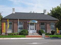
| 8 |
American Fork City Hall |
|
000000001994-04-07-0000April 7, 1994
(#94000298) |
31 Church Street
40°22′39″N 111°47′53″W / 40.3775°N 111.798056°W / 40.3775; -111.798056 (American Fork City Hall) |
American Fork |
|
| 9 |
American Fork Historic District |
|
000000001998-12-10-0000December 10, 1998
(#98001447) |
Roughly along 100 South from 300 West to 200 East
40°22′29″N 111°47′59″W / 40.374722°N 111.799722°W / 40.374722; -111.799722 (American Fork Historic District) |
American Fork |
|
| 10 |
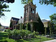
American Fork Presbyterian Church |
|
000000001980-05-23-0000May 23, 1980
(#80003975) |
75 North 100 East
40°22′41″N 111°47′44″W / 40.378056°N 111.795556°W / 40.378056; -111.795556 (American Fork Presbyterian Church) |
American Fork |
|
| 11 |
American Fork Second Ward Meetinghouse |
|
000000001992-03-10-0000March 10, 1992
(#92000101) |
130 West 100 South
40°22′32″N 111°48′05″W / 40.375556°N 111.801389°W / 40.375556; -111.801389 (American Fork Second Ward Meetinghouse) |
American Fork |
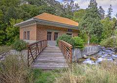
|
| 12 |
American Fork Third Ward Meetinghouse |
Upload image |
000000002002-12-20-0000December 20, 2002
(#02001554) |
190 West 300 North
40°23′01″N 111°48′09″W / 40.383611°N 111.8025°W / 40.383611; -111.8025 (American Fork Third Ward Meetinghouse) |
American Fork |
|
| 13 |
Ashton-Driggs House |
|
000000001972-04-14-0000April 14, 1972
(#72001261) |
119 East Battle Creek Drive (200 South)
40°21′42″N 111°44′13″W / 40.361667°N 111.736944°W / 40.361667; -111.736944 (Ashton-Driggs House) |
Pleasant Grove |
|
| 14 |
Thomas Austin House |
|
000000001982-07-26-0000July 26, 1982
(#82004168) |
427 East 500 North
40°23′39″N 111°50′32″W / 40.394167°N 111.842222°W / 40.394167; -111.842222 (Thomas Austin House) |
Lehi |
|
| 15 |
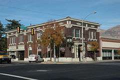
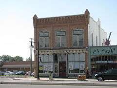
Bank of American Fork |
|
000000001993-03-09-0000March 9, 1993
(#93000065) |
1 East Main Street
40°22′37″N 111°47′51″W / 40.376944°N 111.7975°W / 40.376944; -111.7975 (Bank of American Fork) |
American Fork |
|
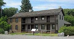
| 16 |
Barrett-Homer-Larsen Farmstead |
Upload image |
000000002016-01-05-0000January 5, 2016
(#15000960) |
63 North 400 West
40°17′54″N 111°42′20″W / 40.298410°N 111.705474°W / 40.298410; -111.705474 (Barrett-Homer-Larsen Farmstead) |
Orem |
|
| 17 |
David and Drusilla Baxter House |
|
000000001998-06-11-0000June 11, 1998
(#98000653) |
206 West 1600 North
40°19′37″N 111°42′01″W / 40.326944°N 111.700278°W / 40.326944; -111.700278 (David and Drusilla Baxter House) |
Orem |
|
| 18 |
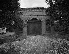
Beck No. 2 Mine |
Upload image |
000000001979-03-14-0000March 14, 1979
(#79003483) |
Burristan Pass Road
39°56′38″N 112°05′48″W / 39.943889°N 112.096667°W / 39.943889; -112.096667 (Beck No. 2 Mine) |
Dividend |
|
| 19 |
George Angus and Martha Ansil Beebe House |
|
000000001980-10-31-0000October 31, 1980
(#80003979) |
489 West 100 South
40°13′56″N 111°39′58″W / 40.232222°N 111.666111°W / 40.232222; -111.666111 (George Angus and Martha Ansil Beebe House) |
Provo |
|
| 20 |
Beers House-Hotel |
|
000000001994-04-07-0000April 7, 1994
(#94000296) |
65 North 100 East
40°21′54″N 111°44′16″W / 40.365°N 111.737778°W / 40.365; -111.737778 (Beers House-Hotel) |
Pleasant Grove |
|
| 21 |
Roswell Darius Bird, Sr., House |
|
000000001980-11-28-0000November 28, 1980
(#80003977) |
115 South Main Street
40°07′46″N 111°34′40″W / 40.129444°N 111.577778°W / 40.129444; -111.577778 (Roswell Darius Bird, Sr., House) |
Mapleton |
|
| 22 |
John E. Booth House |
|
000000001982-02-11-0000February 11, 1982
(#82004171) |
59 West 500 North
40°14′25″N 111°39′32″W / 40.240278°N 111.658889°W / 40.240278; -111.658889 (John E. Booth House) |
Provo |
|
| 23 |
William and Ann Bringhurst House |
|
000000001998-01-05-0000January 5, 1998
(#97001567) |
306 South 200 West
40°09′45″N 111°36′49″W / 40.1625°N 111.613611°W / 40.1625; -111.613611 (William and Ann Bringhurst House) |
Springville |
|
| 24 |
George M. Brown House |
|
000000001982-12-01-0000December 1, 1982
(#82001759) |
284 East 100 North
40°14′06″N 111°39′10″W / 40.235°N 111.652778°W / 40.235; -111.652778 (George M. Brown House) |
Provo |
|
| 25 |
Stephen and Mary Bunnell House |
Upload image |
000000001996-10-22-0000October 22, 1996
(#96001171) |
970 South 800 West on the campus of Utah Valley University
40°16′48″N 111°42′55″W / 40.28°N 111.715278°W / 40.28; -111.715278 (Stephen and Mary Bunnell House) |
Orem |
|
| 26 |
Caffrey and Davis Furniture Company-Senior Hotel |
|
000000001998-01-05-0000January 5, 1998
(#97001578) |
296 South Main Street
40°09′48″N 111°36′37″W / 40.163333°N 111.610278°W / 40.163333; -111.610278 (Caffrey and Davis Furniture Company-Senior Hotel) |
Springville |
|
| 27 |
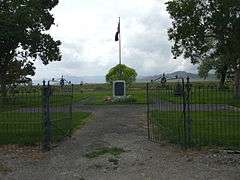
Camp Floyd Site |
|
000000001974-11-11-0000November 11, 1974
(#74001939) |
Off North 18150 West
40°15′26″N 112°06′14″W / 40.257222°N 112.103889°W / 40.257222; -112.103889 (Camp Floyd Site) |
Fairfield |
|
| 28 |
Camp Williams Hostess House/Officers' Club |
|
000000001985-04-01-0000April 1, 1985
(#85000816) |
810 Officer Street
40°26′03″N 111°55′19″W / 40.434167°N 111.921944°W / 40.434167; -111.921944 (Camp Williams Hostess House/Officers' Club) |
Camp W. G. Williams |
|
| 29 |
Carter-Terry-Call House |
Upload image |
000000001998-06-11-0000June 11, 1998
(#98000658) |
815 East 800 South
40°16′57″N 111°40′31″W / 40.2825°N 111.675278°W / 40.2825; -111.675278 (Carter-Terry-Call House) |
Orem |
|
| 30 |
Cedar Fort School |
|
000000002000-04-06-0000April 6, 2000
(#00000357) |
40 East Center Street
40°19′37″N 112°06′19″W / 40.326944°N 112.105278°W / 40.326944; -112.105278 (Cedar Fort School) |
Cedar Fort |
|
| 31 |
Charcoal Kilns |
Upload image |
000000001979-03-14-0000March 14, 1979
(#79003491) |
Homansville Canyon
39°58′25″N 112°04′00″W / 39.973611°N 112.066667°W / 39.973611; -112.066667 (Charcoal Kilns) |
Dividend |
|
| 32 |
Delbert and Ora Chipman House |
Upload image |
000000001995-01-25-0000January 25, 1995
(#94001563) |
317 East Main Street
40°22′25″N 111°47′21″W / 40.373611°N 111.789167°W / 40.373611; -111.789167 (Delbert and Ora Chipman House) |
American Fork |
|
| 33 |
Henry & Elizabeth Parker Chipman House |
Upload image |
000000002010-02-01-0000February 1, 2010
(#09001293) |
846 East 300 North
40°22′58″N 111°46′30″W / 40.382814°N 111.775017°W / 40.382814; -111.775017 (Henry & Elizabeth Parker Chipman House) |
American Fork |
|
| 34 |
Christeele Acres Historic District |
Upload image |
000000001999-12-30-0000December 30, 1999
(#99001626) |
Roughly bounded by South State Street, East 900 South, South 450 East, and East 1010 South
40°16′46″N 111°41′06″W / 40.279444°N 111.685°W / 40.279444; -111.685 (Christeele Acres Historic District) |
Orem |
|
| 35 |
Clark-Taylor House |
|
000000001975-10-07-0000October 7, 1975
(#75001829) |
306 North 500 West
40°14′17″N 111°39′59″W / 40.238056°N 111.666389°W / 40.238056; -111.666389 (Clark-Taylor House) |
Provo |
|
| 36 |
Clinger-Booth House |
|
000000001998-06-11-0000June 11, 1998
(#98000660) |
468 South Main Street
40°17′19″N 111°41′42″W / 40.288611°N 111.695°W / 40.288611; -111.695 (Clinger-Booth House) |
Orem |
|
| 37 |
Harvey H. Cluff House |
|
000000001982-08-04-0000August 4, 1982
(#82004172) |
174 North 100 East
40°14′10″N 111°39′21″W / 40.236111°N 111.655833°W / 40.236111; -111.655833 (Harvey H. Cluff House) |
Provo |
|
| 38 |
Alexander and Nellie P. Cordner House |
Upload image |
000000001998-06-11-0000June 11, 1998
(#98000649) |
415 South 400 East
40°17′22″N 111°41′06″W / 40.289444°N 111.685°W / 40.289444; -111.685 (Alexander and Nellie P. Cordner House) |
Orem |
|
| 39 |
William James and Edna Cordner House |
|
000000001998-06-11-0000June 11, 1998
(#98000647) |
440 South State Street
40°17′21″N 111°41′28″W / 40.289167°N 111.691111°W / 40.289167; -111.691111 (William James and Edna Cordner House) |
Orem |
|
| 40 |
Cordner-Calder House |
Upload image |
000000001998-06-11-0000June 11, 1998
(#98000648) |
305 South 900 East
40°17′29″N 111°40′22″W / 40.291389°N 111.672778°W / 40.291389; -111.672778 (Cordner-Calder House) |
Orem |
|
| 41 |
Crandall Houses |
|
000000001983-01-19-0000January 19, 1983
(#83003196) |
112 and 136 East 200 North
40°10′09″N 111°36′28″W / 40.169167°N 111.607778°W / 40.169167; -111.607778 (Crandall Houses) |
Springville |
|
| 42 |
William J. and Lizzie Cullimore House |
|
000000001998-06-11-0000June 11, 1998
(#98000643) |
396 West 1600 North
40°19′40″N 111°42′17″W / 40.327778°N 111.704722°W / 40.327778; -111.704722 (William J. and Lizzie Cullimore House) |
Orem |
|
| 43 |
Thomas R. Cutler Mansion |
|
000000001984-07-12-0000July 12, 1984
(#84002427) |
150 East State Street
40°23′45″N 111°50′42″W / 40.395833°N 111.845°W / 40.395833; -111.845 (Thomas R. Cutler Mansion) |
Lehi |
|
| 44 |
Dallin House |
|
000000001994-03-31-0000March 31, 1994
(#94000346) |
253 South 300 East
40°09′45″N 111°36′11″W / 40.1625°N 111.603056°W / 40.1625; -111.603056 (Dallin House) |
Springville |
|
| 45 |
Charles E. Davies House |
|
000000001982-08-04-0000August 4, 1982
(#82004173) |
388 West 300 North
40°14′17″N 111°39′52″W / 40.238056°N 111.664444°W / 40.238056; -111.664444 (Charles E. Davies House) |
Provo |
|
| 46 |
Joshua Davis House |
Upload image |
000000001998-06-11-0000June 11, 1998
(#98000642) |
1888 South Main Street.
40°15′46″N 111°41′39″W / 40.262778°N 111.694167°W / 40.262778; -111.694167 (Joshua Davis House) |
Orem |
|
| 47 |
Davis-Ercanbrack Farmstead |
Upload image |
000000001998-10-02-0000October 2, 1998
(#98001213) |
2044 South Main Street
40°15′37″N 111°41′40″W / 40.260278°N 111.694444°W / 40.260278; -111.694444 (Davis-Ercanbrack Farmstead) |
Orem |
|
| 48 |
Roe A. and Louise R. Deal House |
|
000000001998-01-05-0000January 5, 1998
(#97001568) |
39 East 200 North
40°09′52″N 111°36′34″W / 40.164444°N 111.609444°W / 40.164444; -111.609444 (Roe A. and Louise R. Deal House) |
Springville |
|
| 49 |
Deal-Mendenhall Hall |
|
000000001998-01-05-0000January 5, 1998
(#97001569) |
163 East 200 North
40°10′12″N 111°36′24″W / 40.17°N 111.606667°W / 40.17; -111.606667 (Deal-Mendenhall Hall) |
Springville |
|
| 50 |
Cecil I. and Mildred H. Dimick House |
Upload image |
000000001998-06-11-0000June 11, 1998
(#98000638) |
575 West 800 North
40°18′43″N 111°42′33″W / 40.311944°N 111.709167°W / 40.311944; -111.709167 (Cecil I. and Mildred H. Dimick House) |
Orem |
|
| 51 |
Christopher F. Dixon, Jr., House |
|
000000001977-11-07-0000November 7, 1977
(#77001319) |
248 North Main Street
40°02′46″N 111°43′52″W / 40.046111°N 111.731111°W / 40.046111; -111.731111 (Christopher F. Dixon, Jr., House) |
Payson |
|
| 52 |
John Dixon House |
|
000000001978-02-17-0000February 17, 1978
(#78002701) |
218 North Main Street
40°02′45″N 111°43′53″W / 40.045833°N 111.731389°W / 40.045833; -111.731389 (John Dixon House) |
Payson |
|
| 53 |
Samuel Douglass House |
|
000000001992-08-21-0000August 21, 1992
(#92001059) |
215 North Main Street
40°02′45″N 111°43′54″W / 40.045833°N 111.731667°W / 40.045833; -111.731667 (Samuel Douglass House) |
Payson |
|
| 54 |
Frederick and Della Dunn House |
|
000000001990-08-03-0000August 3, 1990
(#90001142) |
145 North Main Street
40°10′09″N 111°36′37″W / 40.169167°N 111.610278°W / 40.169167; -111.610278 (Frederick and Della Dunn House) |
Springville |
|
| 55 |
Dunn-Binnall House & Farmstead |
Upload image |
000000002010-02-01-0000February 1, 2010
(#09001294) |
352 North 200 East
40°23′02″N 111°47′33″W / 40.384003°N 111.792364°W / 40.384003; -111.792364 (Dunn-Binnall House & Farmstead) |
American Fork |
|
| 56 |
Dr. Elmo and Rhea Eddington House |
Upload image |
000000001998-12-04-0000December 4, 1998
(#98001459) |
617 North 100 East
40°23′46″N 111°50′46″W / 40.396111°N 111.846111°W / 40.396111; -111.846111 (Dr. Elmo and Rhea Eddington House) |
Lehi |
|
| 57 |
Simon P. Eggertsen, Sr., House |
|
000000001977-09-13-0000September 13, 1977
(#77001321) |
390 South 500 West
40°13′43″N 111°40′01″W / 40.228611°N 111.666944°W / 40.228611; -111.666944 (Simon P. Eggertsen, Sr., House) |
Provo |
|
| 58 |
Eureka Lilly Headframe |
Upload image |
000000001979-03-14-0000March 14, 1979
(#79003487) |
Dividend Road
39°57′09″N 112°04′07″W / 39.9525°N 112.068611°W / 39.9525; -112.068611 (Eureka Lilly Headframe) |
Dividend |
|
| 59 |
Fairfield District School |
|
000000001987-08-06-0000August 6, 1987
(#87000992) |
59 North Church Street
40°15′42″N 112°05′24″W / 40.261667°N 112.09°W / 40.261667; -112.09 (Fairfield District School) |
Fairfield |
|
| 60 |
Joseph H. Frisby House |
|
000000001984-07-13-0000July 13, 1984
(#84002428) |
209 North 400 West
40°14′12″N 111°39′58″W / 40.236667°N 111.666111°W / 40.236667; -111.666111 (Joseph H. Frisby House) |
Provo |
|
| 61 |
Fugal Blacksmith Shop |
|
000000001994-04-07-0000April 7, 1994
(#94000297) |
Approximately 680 North 400 East
40°22′15″N 111°43′54″W / 40.370833°N 111.731667°W / 40.370833; -111.731667 (Fugal Blacksmith Shop) |
Pleasant Grove |
|
| 62 |
Fugal Dugout House |
Upload image |
000000001986-03-27-0000March 27, 1986
(#86000611) |
630 North 400 East
40°22′14″N 111°43′55″W / 40.370556°N 111.731944°W / 40.370556; -111.731944 (Fugal Dugout House) |
Pleasant Grove |
|
| 63 |
Roy H. and Florence B. Gappmayer House |
Upload image |
000000001998-06-11-0000June 11, 1998
(#98000672) |
95 East 1200 South
40°16′31″N 111°41′32″W / 40.275278°N 111.692222°W / 40.275278; -111.692222 (Roy H. and Florence B. Gappmayer House) |
Orem |
|
| 64 |
Ira W. Gardner House |
|
000000001977-07-28-0000July 28, 1977
(#77001323) |
10 North Main Street
40°03′17″N 111°40′20″W / 40.054722°N 111.672222°W / 40.054722; -111.672222 (Ira W. Gardner House) |
Salem |
|
| 65 |
James H. and Rhoda H. Gardner House |
Upload image |
000000001998-12-04-0000December 4, 1998
(#98001454) |
187 East 300 North
40°23′30″N 111°50′47″W / 40.391667°N 111.846389°W / 40.391667; -111.846389 (James H. and Rhoda H. Gardner House) |
Lehi |
|
| 66 |
Charles T.H. Goode House |
Upload image |
000000001987-06-09-0000June 9, 1987
(#87000826) |
1215 East Main Street
40°22′33″N 111°46′05″W / 40.375833°N 111.768056°W / 40.375833; -111.768056 (Charles T.H. Goode House) |
American Fork |
|
| 67 |
Samuel I. and Olena J. Goodwin House |
|
000000001998-12-04-0000December 4, 1998
(#98001453) |
80 West 400 North
40°23′34″N 111°50′59″W / 40.392778°N 111.849722°W / 40.392778; -111.849722 (Samuel I. and Olena J. Goodwin House) |
Lehi |
|
| 68 |
Samuel Green House |
Upload image |
000000001987-06-09-0000June 9, 1987
(#87000827) |
264 East 200 South
40°21′40″N 111°44′07″W / 40.361111°N 111.735278°W / 40.361111; -111.735278 (Samuel Green House) |
Pleasant Grove |
|
| 69 |
John Hafen House |
|
000000001982-07-23-0000July 23, 1982
(#82004182) |
1002 South Main Street
40°09′14″N 111°36′33″W / 40.153889°N 111.609167°W / 40.153889; -111.609167 (John Hafen House) |
Springville |
|
| 70 |
Alfred William Harper House |
Upload image |
000000001987-06-09-0000June 9, 1987
(#87000828) |
125 West 400 North
40°20′40″N 111°43′01″W / 40.344444°N 111.716944°W / 40.344444; -111.716944 (Alfred William Harper House) |
Lindon |
|
| 71 |
Harrington Elementary School |
|
000000001993-03-04-0000March 4, 1993
(#93000064) |
50 North Center Street
40°22′40″N 111°47′50″W / 40.377778°N 111.797222°W / 40.377778; -111.797222 (Harrington Elementary School) |
American Fork |
|
| 72 |
Hines Mansion |
|
000000001978-07-12-0000July 12, 1978
(#78002702) |
125 South 400 West
40°14′03″N 111°39′51″W / 40.234167°N 111.664167°W / 40.234167; -111.664167 (Hines Mansion) |
Provo |
|
| 73 |
Lars and Agnes Jensen House |
Upload image |
000000001999-12-30-0000December 30, 1999
(#99001627) |
87 North 800 West
40°17′55″N 111°42′54″W / 40.298611°N 111.715°W / 40.298611; -111.715 (Lars and Agnes Jensen House) |
Orem |
|
| 74 |
Mont and Harriet Johnson House |
|
000000001998-01-05-0000January 5, 1998
(#97001570) |
153 East 400 North
40°10′22″N 111°36′25″W / 40.172778°N 111.606944°W / 40.172778; -111.606944 (Mont and Harriet Johnson House) |
Springville |
|
| 75 |
Peter Axel Johnson House |
|
000000001984-10-22-0000October 22, 1984
(#84000164) |
1075 North 100 East
40°22′30″N 111°44′21″W / 40.375°N 111.739167°W / 40.375; -111.739167 (Peter Axel Johnson House) |
Pleasant Grove |
|
| 76 |
Johnson-Hansen House |
|
000000001994-12-01-0000December 1, 1994
(#94001346) |
485 East 400 South
40°13′43″N 111°38′50″W / 40.228611°N 111.647222°W / 40.228611; -111.647222 (Johnson-Hansen House) |
Provo |
|
| 77 |
Johnson-Kearns Hotel |
|
000000001998-01-05-0000January 5, 1998
(#97001571) |
94 West 200 South
40°09′52″N 111°36′40″W / 40.164444°N 111.611111°W / 40.164444; -111.611111 (Johnson-Kearns Hotel) |
Springville |
|
| 78 |
David H. Jones House |
|
000000001985-10-24-0000October 24, 1985
(#85003392) |
143 South Main Street
40°06′29″N 111°38′54″W / 40.108056°N 111.648333°W / 40.108056; -111.648333 (David H. Jones House) |
Spanish Fork |
|
| 79 |
T.R. Kelly House |
|
000000001983-12-09-0000December 9, 1983
(#83003972) |
164 West 200 South
40°09′51″N 111°36′46″W / 40.164167°N 111.612778°W / 40.164167; -111.612778 (T.R. Kelly House) |
Springville |
|
| 80 |
Nephi and Annie Kindred House |
|
000000001998-01-05-0000January 5, 1998
(#97001573) |
188 West Center Street
40°10′01″N 111°36′46″W / 40.166944°N 111.612778°W / 40.166944; -111.612778 (Nephi and Annie Kindred House) |
Springville |
|
| 81 |
Knight Block |
|
000000001977-12-02-0000December 2, 1977
(#77001322) |
1-13 East Center Street and 20-24 North University Avenue
40°14′03″N 111°39′27″W / 40.234167°N 111.6575°W / 40.234167; -111.6575 (Knight Block) |
Provo |
|
| 82 |
Jesse Knight House |
|
000000001982-07-23-0000July 23, 1982
(#82004174) |
185 East Center Street
40°14′02″N 111°39′16″W / 40.233889°N 111.654444°W / 40.233889; -111.654444 (Jesse Knight House) |
Provo |
|
| 83 |
Knight-Finch House |
|
000000001998-06-11-0000June 11, 1998
(#98000673) |
212 South State Street
40°17′35″N 111°41′34″W / 40.293056°N 111.692778°W / 40.293056; -111.692778 (Knight-Finch House) |
Orem |
|
| 84 |
Knight-Allen House |
|
000000001982-07-23-0000July 23, 1982
(#82004175) |
390 East Center Street
40°14′00″N 111°39′04″W / 40.233333°N 111.651111°W / 40.233333; -111.651111 (Knight-Allen House) |
Provo |
|
| 85 |
Knight-Mangum House |
|
000000001982-07-23-0000July 23, 1982
(#82004176) |
381 East Center Street
40°14′02″N 111°39′04″W / 40.233889°N 111.651111°W / 40.233889; -111.651111 (Knight-Mangum House) |
Provo |
|
| 86 |
Christian and Sarah Knudsen House |
Upload image |
000000001998-12-04-0000December 4, 1998
(#98001458) |
123 South Center Street
40°23′14″N 111°50′43″W / 40.387222°N 111.845278°W / 40.387222; -111.845278 (Christian and Sarah Knudsen House) |
Lehi |
|
| 87 |
Lakeview Tithing Office |
|
000000001985-01-25-0000January 25, 1985
(#85000289) |
1675 North Geneva Road
40°15′21″N 111°42′35″W / 40.255833°N 111.709722°W / 40.255833; -111.709722 (Lakeview Tithing Office) |
Provo |
|
| 88 |
Christen Larsen House |
|
000000001987-07-13-0000July 13, 1987
(#87001178) |
990 North 400 East
40°22′29″N 111°43′54″W / 40.374722°N 111.731667°W / 40.374722; -111.731667 (Christen Larsen House) |
Pleasant Grove |
|
| 89 |
Neils Peter Larsen House |
|
000000001987-06-09-0000June 9, 1987
(#87000829) |
1146 North 100 East
40°22′35″N 111°44′18″W / 40.376389°N 111.738333°W / 40.376389; -111.738333 (Neils Peter Larsen House) |
Pleasant Grove |
|
| 90 |
Lehi City Hall |
|
000000001982-03-01-0000March 1, 1982
(#82004169) |
51 North Center Street
40°23′19″N 111°50′56″W / 40.388611°N 111.848889°W / 40.388611; -111.848889 (Lehi City Hall) |
Lehi |
|
| 91 |
Lehi Commercial and Savings Bank-Lehi Hospital |
|
000000001998-12-17-0000December 17, 1998
(#98001537) |
206 East State Street
40°23′46″N 111°50′42″W / 40.396111°N 111.845°W / 40.396111; -111.845 (Lehi Commercial and Savings Bank-Lehi Hospital) |
Lehi |
Demolished in 2009
|
| 92 |
Lehi Main Street Historic District |
Upload image |
000000001998-12-10-0000December 10, 1998
(#98001450) |
Roughly along Main Street, between 200 West and Center Street, and 51 North Center Street
40°23′17″N 111°51′00″W / 40.388056°N 111.85°W / 40.388056; -111.85 (Lehi Main Street Historic District) |
Lehi |
|
| 93 |
Lehi North Branch Meetinghouse |
|
000000001998-12-04-0000December 4, 1998
(#98001455) |
1190 North 500 West
40°23′34″N 111°51′19″W / 40.392778°N 111.855278°W / 40.392778; -111.855278 (Lehi North Branch Meetinghouse) |
Lehi |
|
| 94 |
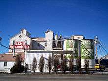
Lehi Roller Mills |
|
000000001994-05-26-0000May 26, 1994
(#94000535) |
700 East Main Street
40°23′21″N 111°50′08″W / 40.389167°N 111.835556°W / 40.389167; -111.835556 (Lehi Roller Mills) |
Lehi |
|
| 95 |
Lehi Ward Tithing Barn-Centennial Hall |
|
000000001998-12-04-0000December 4, 1998
(#98001456) |
651 North 200 East, rear
40°23′45″N 111°50′42″W / 40.395833°N 111.845°W / 40.395833; -111.845 (Lehi Ward Tithing Barn-Centennial Hall) |
Lehi |
|
| 96 |
Lewis Terrace |
Upload image |
000000001983-04-07-0000April 7, 1983
(#83003197) |
68-82 North 700 East
40°14′34″N 111°39′22″W / 40.242778°N 111.656111°W / 40.242778; -111.656111 (Lewis Terrace) |
Provo |
|
| 97 |
John S. and Izola Lewis House |
Upload image |
000000001998-06-11-0000June 11, 1998
(#98000671) |
343 East 720 South
40°17′04″N 111°41′12″W / 40.284444°N 111.686667°W / 40.284444; -111.686667 (John S. and Izola Lewis House) |
Orem |
|
| 98 |
Lime Kilns |
Upload image |
000000001979-03-14-0000March 14, 1979
(#79003490) |
Homansville Canyon
39°58′40″N 112°04′37″W / 39.977778°N 112.076944°W / 39.977778; -112.076944 (Lime Kilns) |
Dividend |
|
| 99 |
Loveless House |
Upload image |
000000002010-09-09-0000September 9, 2010
(#10000729) |
509 East 800 South
40°16′57″N 111°40′59″W / 40.2825°N 111.683056°W / 40.2825; -111.683056 (Loveless House) |
Orem |
Orem, Utah MPS
|
| 100 |
Maeser School |
|
000000001982-07-26-0000July 26, 1982
(#82004177) |
150 South 500 East
40°13′52″N 111°38′57″W / 40.231111°N 111.649167°W / 40.231111; -111.649167 (Maeser School) |
Provo |
|
| 101 |
McBride-Sims Garage |
Upload image |
000000001998-06-11-0000June 11, 1998
(#98000664) |
600 North State Street
40°18′30″N 111°41′56″W / 40.308333°N 111.698889°W / 40.308333; -111.698889 (McBride-Sims Garage) |
Orem |
|
| 102 |
William H. and Sarah D. Meneray House |
|
000000001998-01-05-0000January 5, 1998
(#97001574) |
190 South 200 West
40°09′52″N 111°36′49″W / 40.164444°N 111.613611°W / 40.164444; -111.613611 (William H. and Sarah D. Meneray House) |
Springville |
|
| 103 |
Harry B. Merrihew Drugstore |
|
000000001982-07-23-0000July 23, 1982
(#82004170) |
100 West and Main Street
40°23′16″N 111°51′10″W / 40.387778°N 111.852778°W / 40.387778; -111.852778 (Harry B. Merrihew Drugstore) |
Lehi |
|
| 104 |
David Morgan House |
|
000000001982-02-19-0000February 19, 1982
(#82004167) |
Center Street and 200 South
39°56′54″N 111°54′01″W / 39.948333°N 111.900278°W / 39.948333; -111.900278 (David Morgan House) |
Goshen |
|
| 105 |
Moyle House and Indian Tower |
Upload image |
000000001992-12-23-0000December 23, 1992
(#92001689) |
606 East 770 North
40°27′52″N 111°45′58″W / 40.464444°N 111.766111°W / 40.464444; -111.766111 (Moyle House and Indian Tower) |
Alpine |
|
| 106 |
Ami and Amanda Oakley House |
|
000000001998-01-05-0000January 5, 1998
(#97001575) |
219 East 400 North
40°10′21″N 111°36′20″W / 40.1725°N 111.605556°W / 40.1725; -111.605556 (Ami and Amanda Oakley House) |
Springville |
|
| 107 |
Old Goshen Site |
|
000000001980-08-26-0000August 26, 1980
(#80003976) |
Address Restricted[6]
|
Goshen |
|
| 108 |
Olmsted Station Powerhouse |
|
000000001972-06-26-0000June 26, 1972
(#72001262) |
1018 North 1630 East
40°18′57″N 111°39′14″W / 40.315833°N 111.653889°W / 40.315833; -111.653889 (Olmsted Station Powerhouse) |
Orem |
|
| 109 |
Joseph Olpin House |
|
000000001977-11-07-0000November 7, 1977
(#77001320) |
510 Locust Avenue
40°21′28″N 111°43′41″W / 40.357778°N 111.728056°W / 40.357778; -111.728056 (Joseph Olpin House) |
Pleasant Grove |
|
| 110 |
Lars and Christina Olsen House |
Upload image |
000000001998-06-11-0000June 11, 1998
(#98000669) |
417 South 800 East
40°17′22″N 111°40′50″W / 40.289444°N 111.680556°W / 40.289444; -111.680556 (Lars and Christina Olsen House) |
Orem |
|
| 111 |
Milan and Margaret Packard House |
|
000000001998-01-05-0000January 5, 1998
(#97001576) |
110 West 100 South
40°09′56″N 111°36′43″W / 40.165556°N 111.611944°W / 40.165556; -111.611944 (Milan and Margaret Packard House) |
Springville |
|
| 112 |
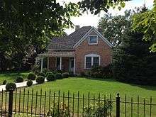
Payson Historic District |
|
000000002007-07-03-0000July 3, 2007
(#07000666) |
Roughly bounded by 500 North, 300 East, 500 South, and 400 West
40°02′37″N 111°43′56″W / 40.043567°N 111.732258°W / 40.043567; -111.732258 (Payson Historic District) |
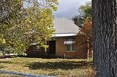
Payson |
The district includes the Christopher Dixon house (pictured) and the John Dixon and Samuel Douglass houses as contributing properties.
|
| 113 |
Payson Presbyterian Church |
|
000000001986-03-27-0000March 27, 1986
(#86000610) |
160 South Main Street
40°02′07″N 111°43′54″W / 40.035278°N 111.731667°W / 40.035278; -111.731667 (Payson Presbyterian Church) |
Payson |
|
| 114 |
People's Co-op Building |
|
000000001998-12-04-0000December 4, 1998
(#98001457) |
151 East State Street
40°23′50″N 111°50′47″W / 40.397222°N 111.846389°W / 40.397222; -111.846389 (People's Co-op Building) |
Lehi |
|
| 115 |
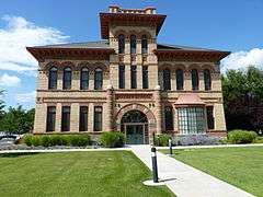
Peteetneet School |
|
000000001990-05-30-0000May 30, 1990
(#90000795) |
50 North 500 East
40°02′36″N 111°43′24″W / 40.043333°N 111.723333°W / 40.043333; -111.723333 (Peteetneet School) |
Payson |
|
| 116 |
Pleasant Grove Historic District |
|
000000001995-12-13-0000December 13, 1995
(#95001434) |
Roughly bounded by 100 North, 500 South, 300 East, and 100 West
40°21′43″N 111°44′17″W / 40.361944°N 111.738056°W / 40.361944; -111.738056 (Pleasant Grove Historic District) |
Pleasant Grove |
|
| 117 |
Pleasant Grove School |
|
000000001980-02-20-0000February 20, 1980
(#80003978) |
65 South 100 East
40°21′48″N 111°44′14″W / 40.363333°N 111.737222°W / 40.363333; -111.737222 (Pleasant Grove School) |
Pleasant Grove |
|
| 118 |
Pleasant Grove Tithing Office |
|
000000001985-01-25-0000January 25, 1985
(#85000288) |
7 South 300 East
40°21′50″N 111°44′04″W / 40.363889°N 111.734444°W / 40.363889; -111.734444 (Pleasant Grove Tithing Office) |
Pleasant Grove |
|
| 119 |
Pleasant Grove Town Hall |
|
000000001985-06-27-0000June 27, 1985
(#85001391) |
107 South 100 East
40°21′44″N 111°44′15″W / 40.362222°N 111.7375°W / 40.362222; -111.7375 (Pleasant Grove Town Hall) |
Pleasant Grove |
|
| 120 |
Provo Canyon Guard Quarters |
Upload image |
000000001986-06-12-0000June 12, 1986
(#86001291) |
Off U.S. Route 189
40°20′23″N 111°36′44″W / 40.33974°N 111.61234°W / 40.33974; -111.61234 (Provo Canyon Guard Quarters) |
Provo Canyon |
|
| 121 |
Provo Downtown Historic District |
|
000000001980-05-01-0000May 1, 1980
(#80003980) |
Center Street and University Avenue
40°14′00″N 111°39′32″W / 40.233333°N 111.658889°W / 40.233333; -111.658889 (Provo Downtown Historic District) |
Provo |
|
| 122 |
Provo East Central Historic District |
Upload image |
000000001998-11-24-0000November 24, 1998
(#98000281) |
Roughly bounded by 100 East, 600 East, 500 North, and 500 South
40°14′01″N 111°39′09″W / 40.233611°N 111.6525°W / 40.233611; -111.6525 (Provo East Central Historic District) |
Provo |
|
| 123 |
Provo Tabernacle |
|
000000001975-09-09-0000September 9, 1975
(#75001830) |
50 South University Avenue
40°13′58″N 111°39′30″W / 40.232778°N 111.658333°W / 40.232778; -111.658333 (Provo Tabernacle) |
Provo |
|
| 124 |
Provo Third Ward Chapel and Amusement Hall |
|
000000001979-04-02-0000April 2, 1979
(#79002518) |
105 North 500 West
40°14′08″N 111°40′01″W / 40.235556°N 111.666944°W / 40.235556; -111.666944 (Provo Third Ward Chapel and Amusement Hall) |
Provo |
|
| 125 |
Provo West Co-op |
|
000000001984-07-13-0000July 13, 1984
(#84002429) |
450 West Center Street
40°14′03″N 111°39′56″W / 40.234167°N 111.665556°W / 40.234167; -111.665556 (Provo West Co-op) |
Provo |
|
| 126 |
William H. Ray House |
|
000000001982-07-23-0000July 23, 1982
(#82004178) |
415 South University Avenue
40°13′41″N 111°39′27″W / 40.228056°N 111.6575°W / 40.228056; -111.6575 (William H. Ray House) |
Provo |
|
| 127 |
Recreation Center for the Utah State Hospital |
Upload image |
000000001986-04-09-0000April 9, 1986
(#86000746) |
1300 East Center Street
40°14′01″N 111°37′50″W / 40.233611°N 111.630556°W / 40.233611; -111.630556 (Recreation Center for the Utah State Hospital) |
Provo |
|
| 128 |
Henry T. and Rebecca Reynolds House |
|
000000001998-01-05-0000January 5, 1998
(#97001577) |
270 West 200 South
40°09′52″N 111°36′53″W / 40.164444°N 111.614722°W / 40.164444; -111.614722 (Henry T. and Rebecca Reynolds House) |
Springville |
|
| 129 |
John T. and Henry T. Reynolds, Jr., House |
|
000000001985-06-27-0000June 27, 1985
(#85001393) |
101 East 200 South
40°09′51″N 111°36′28″W / 40.164167°N 111.607778°W / 40.164167; -111.607778 (John T. and Henry T. Reynolds, Jr., House) |
Springville |
|
| 130 |
Thomas A. Richins House |
|
000000001987-06-09-0000June 9, 1987
(#87000831) |
405 North 500 East
40°22′06″N 111°43′47″W / 40.368333°N 111.729722°W / 40.368333; -111.729722 (Thomas A. Richins House) |
Pleasant Grove |
|
| 131 |
William D. Roberts House |
|
000000001984-07-24-0000July 24, 1984
(#84002430) |
212 North 500 West
40°14′12″N 111°39′58″W / 40.236667°N 111.666111°W / 40.236667; -111.666111 (William D. Roberts House) |
Provo |
|
| 132 |
Santaquin Junior High School |
|
000000001985-04-01-0000April 1, 1985
(#85000817) |
75 West 100 South
39°58′26″N 111°46′26″W / 39.973889°N 111.773889°W / 39.973889; -111.773889 (Santaquin Junior High School) |
Santaquin |
|
| 133 |
Silver Row |
|
000000001982-08-04-0000August 4, 1982
(#82004179) |
621-645 West 100 North
40°14′06″N 111°40′08″W / 40.235°N 111.668889°W / 40.235; -111.668889 (Silver Row) |
Provo |
|
| 134 |
Alfred and Rosy Skinner House |
Upload image |
000000001998-06-11-0000June 11, 1998
(#98000662) |
232 West 800 South
40°16′57″N 111°42′02″W / 40.2825°N 111.700556°W / 40.2825; -111.700556 (Alfred and Rosy Skinner House) |
Orem |
|
| 135 |
Hannah Maria Libby Smith House |
|
000000001980-02-14-0000February 14, 1980
(#80003981) |
315 East Center Street
40°14′02″N 111°39′07″W / 40.233889°N 111.651944°W / 40.233889; -111.651944 (Hannah Maria Libby Smith House) |
Provo |
|
| 136 |
John Y. and Emerette C. Smith House |
Upload image |
000000001998-12-04-0000December 4, 1998
(#98001452) |
518 North 100 East
40°23′39″N 111°50′47″W / 40.394167°N 111.846389°W / 40.394167; -111.846389 (John Y. and Emerette C. Smith House) |
Lehi |
|
| 137 |
Warren B. Smith House |
Upload image |
000000001979-06-19-0000June 19, 1979
(#79002513) |
589 East Main Street
40°22′37″N 111°46′55″W / 40.376944°N 111.781944°W / 40.376944; -111.781944 (Warren B. Smith House) |
American Fork |
|
| 138 |
Reed Smoot House |
|
000000001975-10-14-0000October 14, 1975
(#75001831) |
183 East 100 South
40°13′58″N 111°39′16″W / 40.232778°N 111.654444°W / 40.232778; -111.654444 (Reed Smoot House) |
Provo |
|
| 139 |
Spanish Fork High School Gymnasium |
|
000000001985-04-01-0000April 1, 1985
(#85000819) |
300 South Main Street
40°06′20″N 111°39′16″W / 40.105556°N 111.654444°W / 40.105556; -111.654444 (Spanish Fork High School Gymnasium) |
Spanish Fork |
|
| 140 |
Springville Carnegie Library |
|
000000001991-12-13-0000December 13, 1991
(#91001821) |
175 South Main Street
40°09′51″N 111°36′36″W / 40.164167°N 111.61°W / 40.164167; -111.61 (Springville Carnegie Library) |
Springville |
|
| 141 |
Springville High School Art Gallery |
|
000000001986-04-09-0000April 9, 1986
(#86000750) |
126 East 400 South
40°09′39″N 111°36′28″W / 40.160833°N 111.607778°W / 40.160833; -111.607778 (Springville High School Art Gallery) |
Springville |
|
| 142 |
Springville High School Mechanical Arts Building |
|
000000001993-05-14-0000May 14, 1993
(#93000415) |
443 South 200 East
40°09′37″N 111°36′22″W / 40.160278°N 111.606111°W / 40.160278; -111.606111 (Springville High School Mechanical Arts Building) |
Springville |
|
| 143 |
Springville Historic District |
Upload image |
000000002004-01-21-0000January 21, 2004
(#03000157) |
Roughly bounded by 400 North, 400 East, 800 South, Main Street, 400 South, and 400 West
40°10′19″N 111°36′43″W / 40.171944°N 111.611944°W / 40.171944; -111.611944 (Springville Historic District) |
Springville |
|
| 144 |
Springville Presbyterian Church |
|
000000001980-10-24-0000October 24, 1980
(#80003983) |
251 South 200 East
40°09′47″N 111°36′21″W / 40.163056°N 111.605833°W / 40.163056; -111.605833 (Springville Presbyterian Church) |
Springville |
|
| 145 |
Stagecoach Inn |
|
000000001971-05-14-0000May 14, 1971
(#71000857) |
18035 West 1540 North
40°15′41″N 112°05′34″W / 40.261389°N 112.092778°W / 40.261389; -112.092778 (Stagecoach Inn) |
Fairfield |
|
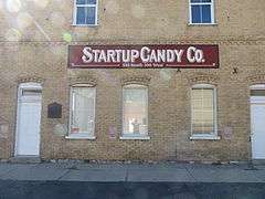
| 146 |
Startup Candy Factory |
|
000000001983-10-28-0000October 28, 1983
(#83003973) |
534 South 100 West
40°13′34″N 111°39′35″W / 40.226111°N 111.659722°W / 40.226111; -111.659722 (Startup Candy Factory) |
Provo |
|
| 147 |
Stewart-Hills House |
Upload image |
000000002004-01-21-0000January 21, 2004
(#03001483) |
275 East 2000 South
40°15′40″N 111°41′16″W / 40.261111°N 111.687778°W / 40.261111; -111.687778 (Stewart-Hills House) |
Orem |
|
| 148 |
James P. and Lydia Strang House |
|
000000001998-01-05-0000January 5, 1998
(#97001579) |
293 East 400 North
40°10′23″N 111°36′15″W / 40.173056°N 111.604167°W / 40.173056; -111.604167 (James P. and Lydia Strang House) |
Springville |
|
| 149 |
Superintendent's Residence at the Utah State Hospital |
|
000000001986-04-09-0000April 9, 1986
(#86000748) |
1079 East Center Street
40°14′02″N 111°38′20″W / 40.233889°N 111.638889°W / 40.233889; -111.638889 (Superintendent's Residence at the Utah State Hospital) |
Provo |
|
| 150 |
George Taylor, Jr., House |
|
000000001983-08-09-0000August 9, 1983
(#83004185) |
187 North 400 West
40°14′06″N 111°39′54″W / 40.235°N 111.665°W / 40.235; -111.665 (George Taylor, Jr., House) |
Provo |
|
| 151 |
Thomas N. Taylor House |
|
000000001982-07-23-0000July 23, 1982
(#82004180) |
342 North 500 West
40°14′18″N 111°40′03″W / 40.238369°N 111.667417°W / 40.238369; -111.667417 (Thomas N. Taylor House) |
Provo |
|
| 152 |
Timpanogos Cave Historic District |
|
000000001982-10-13-0000October 13, 1982
(#82001760) |
2038 Alpine Loop Road
40°26′25″N 111°42′44″W / 40.440278°N 111.712222°W / 40.440278; -111.712222 (Timpanogos Cave Historic District) |
American Fork |
|
| 153 |
Timpanogos Cooperative Marketing Association Building |
Upload image |
000000002008-07-05-0000July 5, 2008
(#08000385) |
380 South Orem Boulevard
40°17′25″N 111°41′40″W / 40.2902°N 111.69447°W / 40.2902; -111.69447 (Timpanogos Cooperative Marketing Association Building) |
Orem |
|
| 154 |
Tintic Standard Reduction Mill |
|
000000001978-09-13-0000September 13, 1978
(#78002700) |
Off U.S. Route 6
39°57′26″N 111°51′10″W / 39.957222°N 111.852778°W / 39.957222; -111.852778 (Tintic Standard Reduction Mill) |
Genola |
|
| 155 |
John R. Twelves House |
|
000000001982-07-23-0000July 23, 1982
(#82004181) |
287 East 100 North
40°14′07″N 111°39′10″W / 40.235278°N 111.652778°W / 40.235278; -111.652778 (John R. Twelves House) |
Provo |
|
| 156 |
Upper American Fork Hydroelectric Power Plant Historic District |
|
000000001989-04-20-0000April 20, 1989
(#89000278) |
Alpine Loop Road
40°26′16″N 111°43′22″W / 40.437778°N 111.722778°W / 40.437778; -111.722778 (Upper American Fork Hydroelectric Power Plant Historic District) |
Highland |
|
| 157 |
US Post Office-Springville Main |
|
000000001989-11-27-0000November 27, 1989
(#89002000) |
309 South Main Street
40°09′44″N 111°36′35″W / 40.162222°N 111.609722°W / 40.162222; -111.609722 (US Post Office-Springville Main) |
Springville |
|
| 158 |
Utah Southern Railroad Depot |
|
000000001994-06-08-0000June 8, 1994
(#94000536) |
222 East State Street
40°23′51″N 111°50′42″W / 40.3975°N 111.845°W / 40.3975; -111.845 (Utah Southern Railroad Depot) |
Lehi |
|
| 159 |
Utah State Training School Amphitheater and Wall |
Upload image |
000000001994-10-07-0000October 7, 1994
(#94001206) |
Roughly 845 East 700 North
40°23′39″N 111°46′31″W / 40.394167°N 111.775278°W / 40.394167; -111.775278 (Utah State Training School Amphitheater and Wall) |
American Fork |
|
| 160 |
Verd's Fruit Market Complex |
Upload image |
000000002010-09-09-0000September 9, 2010
(#10000731) |
1320 North State Street
40°19′17″N 111°42′16″W / 40.321389°N 111.704444°W / 40.321389; -111.704444 (Verd's Fruit Market Complex) |
Orem |
Orem, Utah MPS
|
| 161 |
Veterans Memorial Building |
|
000000001994-04-14-0000April 14, 1994
(#94000299) |
53 North Center Street
40°22′41″N 111°47′54″W / 40.378056°N 111.798333°W / 40.378056; -111.798333 (Veterans Memorial Building) |
American Fork |
|
| 162 |
Edward Wadley House |
Upload image |
000000001987-06-09-0000June 9, 1987
(#87000832) |
2445 North Canyon Road
40°23′25″N 111°44′23″W / 40.390278°N 111.739722°W / 40.390278; -111.739722 (Edward Wadley House) |
Pleasant Grove |
|
| 163 |
Patrick L. and Rose O. Ward House |
|
000000001998-01-05-0000January 5, 1998
(#97001580) |
511 South Main Street
40°09′35″N 111°36′34″W / 40.159722°N 111.609444°W / 40.159722; -111.609444 (Patrick L. and Rose O. Ward House) |
Springville |
|
| 164 |
Alvin and Grace Washburn House |
Upload image |
000000001999-12-30-0000December 30, 1999
(#99001629) |
753 North 100 West
40°18′41″N 111°41′53″W / 40.311389°N 111.698056°W / 40.311389; -111.698056 (Alvin and Grace Washburn House) |
Orem |
|
| 165 |
Water Lily Shaft |
Upload image |
000000001979-03-14-0000March 14, 1979
(#79003489) |
North of Dividend
39°59′04″N 112°03′13″W / 39.984444°N 112.053611°W / 39.984444; -112.053611 (Water Lily Shaft) |
Pinon Creek Canyon |
|
| 166 |
Thomas and Mary Webb House |
Upload image |
000000001998-12-04-0000December 4, 1998
(#98001451) |
388 North 200 East
40°23′33″N 111°50′42″W / 40.3925°N 111.845°W / 40.3925; -111.845 (Thomas and Mary Webb House) |
Lehi |
|
| 167 |
Peter Wentz House |
|
000000001978-04-26-0000April 26, 1978
(#78002703) |
575 North University Avenue
40°14′28″N 111°39′30″W / 40.241111°N 111.658333°W / 40.241111; -111.658333 (Peter Wentz House) |
Provo |
|
| 168 |
Jacob Hanmer White House |
Upload image |
000000001987-06-09-0000June 9, 1987
(#87000833) |
599 East 100 South
40°21′46″N 111°43′39″W / 40.362778°N 111.7275°W / 40.362778; -111.7275 (Jacob Hanmer White House) |
Pleasant Grove |
|
| 169 |
Joseph and Margaret Wilkinson House |
Upload image |
000000002013-10-16-0000October 16, 2013
(#13000843) |
318 South 100 West
40°17′29″N 111°41′52″W / 40.291507°N 111.697912°W / 40.291507; -111.697912 (Joseph and Margaret Wilkinson House) |
Orem |
Part of the Orem, Utah MPS
|
| 170 |
Wood-Harrison House |
|
000000001983-01-19-0000January 19, 1983
(#83003198) |
310 South 300 West
40°09′44″N 111°36′56″W / 40.162222°N 111.615556°W / 40.162222; -111.615556 (Wood-Harrison House) |
Springville |
|
| 171 |
Yankee Headframe |
Upload image |
000000001979-03-14-0000March 14, 1979
(#79003484) |
Burriston Pass Road
39°56′52″N 112°05′49″W / 39.947778°N 112.096944°W / 39.947778; -112.096944 (Yankee Headframe) |
East Tintic Mountains |
|
| 172 |
Yard-Groesbeck House |
|
000000001998-01-05-0000January 5, 1998
(#97001581) |
157 West 200 South
40°09′51″N 111°36′44″W / 40.164167°N 111.612222°W / 40.164167; -111.612222 (Yard-Groesbeck House) |
Springville |
|
| 173 |
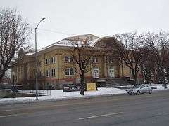
Brigham Young Academy |
|
000000001976-01-01-0000January 1, 1976
(#76001839) |
550 North University Avenue
40°14′28″N 111°39′24″W / 40.241111°N 111.656667°W / 40.241111; -111.656667 (Brigham Young Academy) |
Provo |
Now the Provo City Library
|
| 174 |
William Friend Young House |
Upload image |
000000001987-06-09-0000June 9, 1987
(#87000834) |
550 East 500 North
40°22′08″N 111°43′42″W / 40.368889°N 111.728333°W / 40.368889; -111.728333 (William Friend Young House) |
Pleasant Grove |
|


_Schoolhouse.jpg)