Patoka Township, Marion County, Illinois
| Patoka Township | |
| Township | |
| Country | United States |
|---|---|
| State | Illinois |
| County | Marion |
| Elevation | 499 ft (152.1 m) |
| Coordinates | 38°47′N 89°5′W / 38.783°N 89.083°WCoordinates: 38°47′N 89°5′W / 38.783°N 89.083°W |
| Area | 34.97 sq mi (90.6 km2) |
| - land | 34.95 sq mi (91 km2) |
| - water | 0.03 sq mi (0 km2) |
| Population | 1,038 (2010) |
| Density | 29.7/sq mi (11.5/km2) |
| Settled | November 4, 1873 |
| Timezone | CST (UTC-6) |
| - summer (DST) | CDT (UTC-5) |
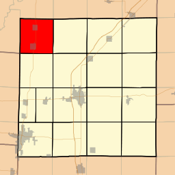 Location in Marion County | |
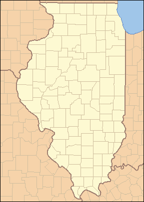 Location of Patoka Township in Illinois | |
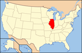 Location of Illinois in the United States | |
Patoka Township is located in Marion County, Illinois. As of the 2010 census, its population was 1,038 and it contained 523 housing units.[1]
Geography
Patoka Township (T4N R1E) is centered at 38°47'N 89°5'W (38.780, -89.086). It is traversed north-south by U.S. Route 51 and east-west by the North Fork of the Kaskaskia River. The city of Patoka is located near the south end of the township. According to the 2010 census, the township has a total area of 34.97 square miles (90.6 km2), of which 34.95 square miles (90.5 km2) (or 99.94%) is land and 0.03 square miles (0.078 km2) (or 0.09%) is water.[1]
Adjacent townships
- Kaskaskia Township, Fayette County (north)
- Wilberton Township, Fayette County (northeast)
- Foster Township (east)
- Tonti Township (southeast)
- Carrigan Township (south)
- East Fork Township, Clinton County (southwest)
- Pope Township, Fayette County (west)
- Pope Township, Fayette County (northwest)
References
- 1 2 "Population, Housing Units, Area, and Density: 2010 - County -- County Subdivision and Place -- 2010 Census Summary File 1". United States Census. Retrieved 2013-05-28.
External links
Municipalities and communities of Marion County, Illinois, United States | ||
|---|---|---|
| Cities | ||
| Villages | ||
| Townships | ||
| Unincorporated communities | ||
| Footnotes | ‡This populated place also has portions in an adjacent county or counties | |

This article is issued from Wikipedia - version of the 9/10/2016. The text is available under the Creative Commons Attribution/Share Alike but additional terms may apply for the media files.