Microregion of Andradina
| Microregion of Andradina | |
|---|---|
| Microregion | |
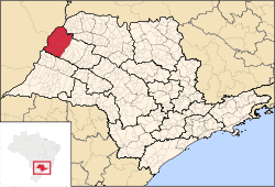 Location of the Microregion of Andradina | |
| Coordinates: 21°12′32″S 50°25′58″W / 21.20889°S 50.43278°WCoordinates: 21°12′32″S 50°25′58″W / 21.20889°S 50.43278°W | |
| Country |
|
| Region | Southeast |
| State |
|
| Mesoregion | Araçatuba |
| Area | |
| • Total | 6,891.6 km2 (2,660.9 sq mi) |
| Population (2010/IBGE) | |
| • Total | 181,710 |
| • Density | 26/km2 (68/sq mi) |
| Time zone | UTC-3 (UTC-3) |
| • Summer (DST) | UTC-2 (UTC-2) |
| Postal Code | 16000-000 |
| Area code(s) | +55 18 |
The Microregion of Andradina (Portuguese: Microrregião de Andradina) is located on the northwest of São Paulo state, Brazil, and is made up of 11 municipalities. It belongs to the Mesoregion of Araçatuba.
The population of the Microregion is 181,710 inhabitants, in an area of 6,891.6 km²[1]
Municipalities
The microregion consists of the following municipalities,[2] listed below with their 2010 Census populations (IBGE/2010):[3]
- Andradina: 55,334
- Castilho: 18,003
- Guaraçaí: 8,435
- Ilha Solteira: 25,064
- Itapura: 4,357
- Mirandópolis: 27,483
- Murutinga do Sul: 4,186
- Nova Independência: 22,576
- Pereira Barreto: 24,962
- Sud Mennucci: 7,435
- Suzanápolis: 3,383
References
- ↑ "2010 Census of the IBGE - Synopsis - Tables 761 and 1301" (in Portuguese). IBGE.gov.br. Retrieved 30 January 2012.
- ↑ Instituto Brasileiro de Geografia e Estatística, territorial division.
- ↑ "2010 Census of the IBGE - Population - Table 2.1.20" (PDF). IBGE.gov.br. Retrieved 30 January 2012.
| Mesoregions |
|
|---|---|
| Microregions |
|
This article is issued from Wikipedia - version of the 10/20/2015. The text is available under the Creative Commons Attribution/Share Alike but additional terms may apply for the media files.