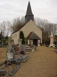
Barjouville
| Barjouville | ||
|---|---|---|
 | ||
| ||
 Barjouville | ||
|
Location within Centre-Val de Loire region  Barjouville | ||
| Coordinates: 48°24′34″N 1°28′41″E / 48.4094°N 1.4781°ECoordinates: 48°24′34″N 1°28′41″E / 48.4094°N 1.4781°E | ||
| Country | France | |
| Region | Centre-Val de Loire | |
| Department | Eure-et-Loir | |
| Arrondissement | Chartres | |
| Canton | Chartres-Sud-Ouest | |
| Intercommunality | Communauté d'agglomération Chartres métropole | |
| Government | ||
| • Mayor (2008–2014) | Alain Toutay | |
| Area1 | 4.1 km2 (1.6 sq mi) | |
| Population (2009)2 | 1,599 | |
| • Density | 390/km2 (1,000/sq mi) | |
| Time zone | CET (UTC+1) | |
| • Summer (DST) | CEST (UTC+2) | |
| INSEE/Postal code | 28024 / 28630 | |
| Elevation |
126–157 m (413–515 ft) (avg. 130 m or 430 ft) | |
|
1 French Land Register data, which excludes lakes, ponds, glaciers > 1 km² (0.386 sq mi or 247 acres) and river estuaries. 2 Population without double counting: residents of multiple communes (e.g., students and military personnel) only counted once. | ||
.svg.png)
Barjouville is a commune in the Eure-et-Loir department in north-central France.
Population
| Historical population | ||
|---|---|---|
| Year | Pop. | ±% |
| 1962 | 240 | — |
| 1968 | 354 | +47.5% |
| 1975 | 697 | +96.9% |
| 1982 | 975 | +39.9% |
| 1990 | 1,306 | +33.9% |
| 1999 | 1,392 | +6.6% |
| 2008 | 1,607 | +15.4% |
| 2009 | 1,599 | −0.5% |
See also
References
| Wikimedia Commons has media related to Barjouville. |
This article is issued from Wikipedia - version of the 7/21/2016. The text is available under the Creative Commons Attribution/Share Alike but additional terms may apply for the media files.