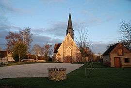
Méréglise
| Méréglise | |
|---|---|
 | |
 Méréglise | |
|
Location within Centre-Val de Loire region  Méréglise | |
| Coordinates: 48°17′27″N 1°11′10″E / 48.2908°N 1.1861°ECoordinates: 48°17′27″N 1°11′10″E / 48.2908°N 1.1861°E | |
| Country | France |
| Region | Centre-Val de Loire |
| Department | Eure-et-Loir |
| Arrondissement | Chartres |
| Canton | Illiers-Combray |
| Intercommunality | Pays de Combray |
| Government | |
| • Mayor (2008–2014) | Gérard Huet |
| Area1 | 4 km2 (2 sq mi) |
| Population (2008)2 | 90 |
| • Density | 23/km2 (58/sq mi) |
| Time zone | CET (UTC+1) |
| • Summer (DST) | CEST (UTC+2) |
| INSEE/Postal code | 28242 / 28120 |
| Elevation |
155–183 m (509–600 ft) (avg. 120 m or 390 ft) |
|
1 French Land Register data, which excludes lakes, ponds, glaciers > 1 km² (0.386 sq mi or 247 acres) and river estuaries. 2 Population without double counting: residents of multiple communes (e.g., students and military personnel) only counted once. | |
Méréglise is a commune in the Eure-et-Loir department in northern France.
Population
| Historical population | ||
|---|---|---|
| Year | Pop. | ±% |
| 1793 | 130 | — |
| 1800 | 134 | +3.1% |
| 1806 | 146 | +9.0% |
| 1821 | 115 | −21.2% |
| 1831 | 137 | +19.1% |
| 1836 | 152 | +10.9% |
| 1841 | 163 | +7.2% |
| 1846 | 176 | +8.0% |
| 1851 | 191 | +8.5% |
| 1856 | 190 | −0.5% |
| 1861 | 191 | +0.5% |
| 1866 | 157 | −17.8% |
| 1872 | 144 | −8.3% |
| 1876 | 146 | +1.4% |
| 1881 | 128 | −12.3% |
| 1886 | 141 | +10.2% |
| 1891 | 137 | −2.8% |
| 1896 | 136 | −0.7% |
| 1901 | 144 | +5.9% |
| 1906 | 146 | +1.4% |
| 1911 | 123 | −15.8% |
| 1921 | 118 | −4.1% |
| 1926 | 123 | +4.2% |
| 1931 | 108 | −12.2% |
| 1936 | 106 | −1.9% |
| 1946 | 120 | +13.2% |
| 1954 | 114 | −5.0% |
| 1962 | 72 | −36.8% |
| 1968 | 85 | +18.1% |
| 1975 | 67 | −21.2% |
| 1982 | 65 | −3.0% |
| 1990 | 74 | +13.8% |
| 1999 | 70 | −5.4% |
| 2008 | 90 | +28.6% |
See also
References
| Wikimedia Commons has media related to Méréglise. |
This article is issued from Wikipedia - version of the 10/5/2015. The text is available under the Creative Commons Attribution/Share Alike but additional terms may apply for the media files.