Cloyes-sur-le-Loir
| Cloyes-sur-le-Loir | ||
|---|---|---|
 | ||
| ||
 Cloyes-sur-le-Loir | ||
|
Location within Centre-Val de Loire region  Cloyes-sur-le-Loir | ||
| Coordinates: 47°59′52″N 1°14′09″E / 47.9978°N 1.2358°ECoordinates: 47°59′52″N 1°14′09″E / 47.9978°N 1.2358°E | ||
| Country | France | |
| Region | Centre-Val de Loire | |
| Department | Eure-et-Loir | |
| Arrondissement | Châteaudun | |
| Canton | Cloyes-sur-le-Loir | |
| Intercommunality | Trois Rivières | |
| Government | ||
| • Mayor (2008–2014) | Philippe Vigier (NC) | |
| Area1 | 19.85 km2 (7.66 sq mi) | |
| Population (2008)2 | 2,676 | |
| • Density | 130/km2 (350/sq mi) | |
| Time zone | CET (UTC+1) | |
| • Summer (DST) | CEST (UTC+2) | |
| INSEE/Postal code | 28103 / 28220 | |
| Elevation |
92–152 m (302–499 ft) (avg. 105 m or 344 ft) | |
|
1 French Land Register data, which excludes lakes, ponds, glaciers > 1 km² (0.386 sq mi or 247 acres) and river estuaries. 2 Population without double counting: residents of multiple communes (e.g., students and military personnel) only counted once. | ||

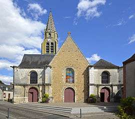
Cloyes-sur-le-Loir is a commune on the River Loir, a few kilometres south of the town of Châteaudun in the department of Eure-et-Loir in northern France.
Population
| Historical population | ||
|---|---|---|
| Year | Pop. | ±% |
| 1962 | 2,315 | — |
| 1968 | 2,478 | +7.0% |
| 1975 | 2,552 | +3.0% |
| 1982 | 2,653 | +4.0% |
| 1990 | 2,593 | −2.3% |
| 1999 | 2,636 | +1.7% |
| 2008 | 2,676 | +1.5% |
Personalities
It was the home of Stephen of Cloyes, a leader of the Children's Crusade.
See also
References
External links
| Wikimedia Commons has media related to Cloyes-sur-le-Loir. |
- Official website (in French)
This article is issued from Wikipedia - version of the 2/10/2016. The text is available under the Creative Commons Attribution/Share Alike but additional terms may apply for the media files.