Unverre
| Unverre | |
|---|---|
 | |
 Unverre | |
|
Location within Centre-Val de Loire region  Unverre | |
| Coordinates: 48°12′01″N 1°05′39″E / 48.2003°N 1.0942°ECoordinates: 48°12′01″N 1°05′39″E / 48.2003°N 1.0942°E | |
| Country | France |
| Region | Centre-Val de Loire |
| Department | Eure-et-Loir |
| Arrondissement | Châteaudun |
| Canton | Brou |
| Intercommunality | Perche-Gouët |
| Government | |
| • Mayor (2008–2014) | Robert Weber |
| Area1 | 62.33 km2 (24.07 sq mi) |
| Population (2008)2 | 1,172 |
| • Density | 19/km2 (49/sq mi) |
| Time zone | CET (UTC+1) |
| • Summer (DST) | CEST (UTC+2) |
| INSEE/Postal code | 28398 / 28160 |
| Elevation |
153–235 m (502–771 ft) (avg. 160 m or 520 ft) |
|
1 French Land Register data, which excludes lakes, ponds, glaciers > 1 km² (0.386 sq mi or 247 acres) and river estuaries. 2 Population without double counting: residents of multiple communes (e.g., students and military personnel) only counted once. | |
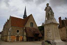
Unverre is a commune in the Eure-et-Loir department in northern France.
Population
| Historical population | ||
|---|---|---|
| Year | Pop. | ±% |
| 1847 | 2,478 | — |
| 1851 | 2,442 | −1.5% |
| 1881 | 2,104 | −13.8% |
| 1962 | 1,083 | −48.5% |
| 1968 | 1,294 | +19.5% |
| 1975 | 1,238 | −4.3% |
| 1982 | 1,109 | −10.4% |
| 1990 | 1,022 | −7.8% |
| 1999 | 977 | −4.4% |
| 2008 | 1,172 | +20.0% |
See also
References
External links
| Wikimedia Commons has media related to Unverre. |
This article is issued from Wikipedia - version of the 11/13/2014. The text is available under the Creative Commons Attribution/Share Alike but additional terms may apply for the media files.