Dangeau
| Dangeau | ||
|---|---|---|
 | ||
| ||
 Dangeau | ||
|
Location within Centre-Val de Loire region  Dangeau | ||
| Coordinates: 48°12′33″N 1°17′09″E / 48.2092°N 1.2858°ECoordinates: 48°12′33″N 1°17′09″E / 48.2092°N 1.2858°E | ||
| Country | France | |
| Region | Centre-Val de Loire | |
| Department | Eure-et-Loir | |
| Arrondissement | Châteaudun | |
| Canton | Brou | |
| Intercommunality | Bonnevalais | |
| Government | ||
| • Mayor (2008–2014) | Philippe Villedieu | |
| Area1 | 39.63 km2 (15.30 sq mi) | |
| Population (2008)2 | 936 | |
| • Density | 24/km2 (61/sq mi) | |
| Time zone | CET (UTC+1) | |
| • Summer (DST) | CEST (UTC+2) | |
| INSEE/Postal code | 28127 / 28160 | |
| Elevation |
130–184 m (427–604 ft) (avg. 136 m or 446 ft) | |
|
1 French Land Register data, which excludes lakes, ponds, glaciers > 1 km² (0.386 sq mi or 247 acres) and river estuaries. 2 Population without double counting: residents of multiple communes (e.g., students and military personnel) only counted once. | ||

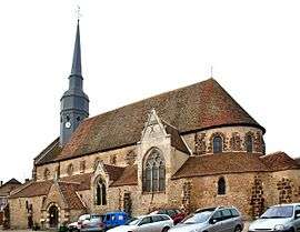
Dangeau is a commune in the Eure-et-Loir department in northern France.
Population
| Historical population | ||
|---|---|---|
| Year | Pop. | ±% |
| 1962 | 1,006 | — |
| 1968 | 915 | −9.0% |
| 1975 | 829 | −9.4% |
| 1982 | 749 | −9.7% |
| 1990 | 742 | −0.9% |
| 1999 | 775 | +4.4% |
| 2008 | 936 | +20.8% |
See also
References
| Wikimedia Commons has media related to Dangeau. |
This article is issued from Wikipedia - version of the 3/15/2016. The text is available under the Creative Commons Attribution/Share Alike but additional terms may apply for the media files.