Beacon Falls, Connecticut
| Beacon Falls, Connecticut | ||
|---|---|---|
| Town | ||
| ||
|
Location in New Haven County, Connecticut | ||
| Coordinates: 41°26′19″N 73°03′20″W / 41.43861°N 73.05556°WCoordinates: 41°26′19″N 73°03′20″W / 41.43861°N 73.05556°W | ||
| Country | United States | |
| State | Connecticut | |
| NECTA | Waterbury | |
| Region | Central Naugatuck Valley | |
| County | New Haven | |
| Incorporated | 1871 | |
| Government | ||
| • Type | Selectman-town meeting | |
| • First Selectman | Christopher J. Bielik (D) | |
| Area | ||
| • Total | 9.9 sq mi (25.6 km2) | |
| • Land | 9.8 sq mi (25.3 km2) | |
| • Water | 0.1 sq mi (0.2 km2) | |
| Elevation | 207 ft (63 m) | |
| Population (2010) | ||
| • Total | 6,049 | |
| Time zone | Eastern (UTC-5) | |
| • Summer (DST) | Eastern (UTC-4) | |
| ZIP code | 06403 | |
| Area code(s) | 203 | |
| FIPS code | 09-03250 | |
| GNIS feature ID | 0213387 | |
| Website |
www | |
Beacon Falls is a town in New Haven County, Connecticut, United States. The population was 5,246 at the 2000 census. The population increased to 6,049 at the 2010 census. Beacon Falls is also home to the national-known Meteorologist Jim Cantore and U.S. Congressman Ronald A. Sarasin.
Settlers from Derby, Connecticut settled Beacon Falls in 1678. The town was incorporated in 1871 on lands carved from the neighboring towns of Bethany, Seymour, Naugatuck and Oxford.
Geography
According to the United States Census Bureau, the town has a total area of 9.9 square miles (26 km2), of which, 9.8 square miles (25 km2) of it is land and 0.1 square miles (0.26 km2) of it (1.01%) is water.
The village of Pine Bridge, once known as Pines Bridge, is located within the town, south of the town center. Beacon Falls has been known as Beacon Falls Station, Beacon Falls Village, and the Beacon Falls Postal District within Bethany.[1][2][3]
The Beacon Falls (Metro-North station) is on the Waterbury branch of the New Haven line.
On the National Register of Historic Places
- Depot Street Bridge - added March 9, 2007
- Home Woolen Company - added November 29, 1984
On the State Register of Historic Places
- Rimmon School - One room schoolhouse ca. 1830, Pinesbridge Road (RT-42)
- Tracy S. Lewis House - Home of the Beacon Falls Rubber Shoe Company President. Originally built ca. 1855 by the American Hard Rubber Company, 35-37 Wolfe Avenue)
Demographics
| Historical population | |||
|---|---|---|---|
| Census | Pop. | %± | |
| 1880 | 379 | — | |
| 1890 | 505 | 33.2% | |
| 1900 | 623 | 23.4% | |
| 1910 | 1,160 | 86.2% | |
| 1920 | 1,593 | 37.3% | |
| 1930 | 1,693 | 6.3% | |
| 1940 | 1,756 | 3.7% | |
| 1950 | 2,067 | 17.7% | |
| 1960 | 2,886 | 39.6% | |
| 1970 | 3,546 | 22.9% | |
| 1980 | 3,995 | 12.7% | |
| 1990 | 5,083 | 27.2% | |
| 2000 | 5,246 | 3.2% | |
| 2010 | 6,049 | 15.3% | |
| Est. 2014 | 6,055 | [4] | 0.1% |
As of the census of 2010, there were 6,049 people, divided into 2,509 total households, with 2,360 occupied households in the town. The racial makeup (population) of the town was 5,741 White, 95 African American, 2 Native American, 70 Asian, 2 Pacific Islander, 52 from other races, and 0.76% from two or more races. There are 300 Hispanic or Latino.[6]
As of the census[7] of 2000, there were 5,246 people, 2,032 households, and 1,450 families residing in the town. The population density was 536.6 people per square mile (207.1/km²). There were 2,104 housing units at an average density of 215.2 per square mile (83.1/km²). The racial makeup of the town was 96.97% White, 0.72% African American, 0.08% Native American, 1.03% Asian, 0.04% Pacific Islander, 0.40% from other races, and 0.76% from two or more races. Hispanic or Latino of any race were 2.13% of the population.
There were 2,032 households out of which 34.1% had children under the age of 18 living with them, 58.2% were married couples living together, 9.5% had a female householder with no husband present, and 28.6% were non-families. 23.0% of all households were made up of individuals and 6.3% had someone living alone who was 65 years of age or older. The average household size was 2.58 and the average family size was 3.08.
In the town the population was spread out with 25.2% under the age of 18, 6.5% from 18 to 24, 35.1% from 25 to 44, 23.6% from 45 to 64, and 9.6% who were 65 years of age or older. The median age was 37 years. For every 100 females there were 100.6 males. For every 100 females age 18 and over, there were 96.5 males.
The median income for a household in the town was $56,592, and the median income for a family was $62,461. Males had a median income of $41,696 versus $34,844 for females. The per capita income for the town was $25,285. About 4.2% of families and 5.9% of the population were below the poverty line, including 9.8% of those under age 18 and 4.6% of those age 65 or over.
Beacon Falls is home to Woodland Regional High School, which opened in 2001. Woodland is part of Regional School District #16 (Beacon Falls and Prospect), which also consists of Long River Middle School (P), Laurel Ledge Elementary School (BF), Community School (P), and Algonquin School (P).
| Voter registration and party enrollment as of October 27, 2015[8] | |||||
|---|---|---|---|---|---|
| Party | Active voters | Inactive voters | Total voters | Percentage | |
| Democratic | 976 | 35 | 1,011 | 24.99% | |
| Republican | 909 | 33 | 942 | 23.29% | |
| Unaffiliated | 1,957 | 91 | 2,048 | 50.63% | |
| Minor Parties | 44 | 0 | 44 | 1.09% | |
| Total | 3,886 | 159 | 4,045 | 100% | |
References
- ↑ Geographic Names Information System database
- ↑ "The Valley of the Naugatuck", National Magazine, January 1858, pg 11-20
- ↑ "Indians of the Housatonic and Naugatuck Valleys", Samuel Orcutt, Case, Lockwood & Brainard Company, pg 44, 1882
- ↑ "Annual Estimates of the Resident Population for Incorporated Places: April 1, 2010 to July 1, 2014". Retrieved June 4, 2015.
- ↑ "Census of Population and Housing". Census.gov. Archived from the original on May 11, 2015. Retrieved June 4, 2015.
- ↑ Connecticut State Data Center. (2011). Connecticut Town Population 2010 & 2000. Retrieved from "Archived copy". Archived from the original on 2011-03-21. Retrieved 2011-04-03.
- ↑ "American FactFinder". United States Census Bureau. Archived from the original on 2013-09-11. Retrieved 2008-01-31.
- ↑ = http://www.sots.ct.gov/sots/lib/sots/electionservices/registration_and_enrollment_stats/nov15re.pdf "Registration and Party Enrollment Statistics as of October 27, 2015" Check
|url=value (help) (PDF). Connecticut Secretary of State. Retrieved 2015-10-27.
External links
- Official Website for the Town of Beacon Falls, CT
- Greater Valley Chamber of Commerce
- The Beacon Falls Public Library
- Northwest Connecticut Convention & Visitors Bureau
- Regional School District #16
- Beacon Falls Historical Society

Municipalities and communities of New Haven County, Connecticut, United States | ||
|---|---|---|
| Cities | 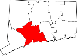 | |
| Towns |
*Consolidated borough and town | |
| Borough | ||
| Other communities | ||