Brentwood, Missouri
| Brentwood, Missouri | |
|---|---|
| City | |
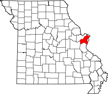
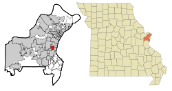 Location of Brentwood, Missouri | |
| Coordinates: 38°37′9″N 90°20′55″W / 38.61917°N 90.34861°WCoordinates: 38°37′9″N 90°20′55″W / 38.61917°N 90.34861°W | |
| Country | United States |
| State | Missouri |
| County | St. Louis |
| Government | |
| • Mayor | Christopher Thornton |
| Area[1] | |
| • Total | 1.96 sq mi (5.08 km2) |
| • Land | 1.96 sq mi (5.08 km2) |
| • Water | 0 sq mi (0 km2) |
| Elevation | 479 ft (146 m) |
| Population (2010)[2] | |
| • Total | 8,055 |
| • Estimate (2012[3]) | 8,035 |
| • Density | 4,109.7/sq mi (1,586.8/km2) |
| Time zone | Central (CST) (UTC-6) |
| • Summer (DST) | CDT (UTC-5) |
| ZIP code | 63144 |
| Area code(s) | 314 |
| FIPS code | 29-08236[4] |
| GNIS feature ID | 0755812[5] |
| Website | City of Brentwood official website |
Brentwood is an inner-ring suburb of St. Louis, located in St. Louis County, Missouri. The population was 8,055 at the 2010 census.[6] Brentwood is home to Brentwood High School, a 2006 National Blue Ribbon Award winner, and Mark Twain Elementary School, a 2009 National Blue Ribbon Award winner.
Geography
Brentwood is located at 38°37′9″N 90°20′55″W / 38.61917°N 90.34861°W (38.619102, -90.348715).[7]
According to the United States Census Bureau, the city has a total area of 1.96 square miles (5.08 km2), all of it land.[1]
History
The area that is Brentwood consists of three land purchases: that of Louis J. Bompart who acquired his lot first in 1804, that of the Gay family, and that of the Marshall family. In the 1870s a man by the name of Thomas Madden arrived and soon became the businessman of the community. He operated a rock quarry, and constructed a tavern, a barbershop, a grocery store, and a blacksmith shop. Due to Madden's prominence in the community the town was then named Maddenville.
With a location on the Manchester Trail, a route that was mostly frequented by mail coaches and prairie schooners going west, Maddenville in the 1800s became a prosperous little town on the outskirts of St. Louis, to which it was connected by a streetcar line.
In 1919, it was discovered by the residents of Maddenville that the inhabitants of the neighboring Maplewood were planning to elect whether or not annex their town. To avoid annexation and to establish their own school district, the residents decided to incorporate Maddenville into a village. On December 15, 1919, the town of Maddenville officially became the village of Brentwood.
During the late 1920s the village earned an unhealthy reputation for its numerous gambling houses and illegal activities that took place around the intersection of Manchester Road and Brentwood Boulevard. The first mayor, James L. Willingham (in office from 1929–1931), ran on the promise to clean Brentwood up and eliminate the casinos, along with the hoodlums who hung around them, which he did. The town then became once again attractive for families. On April 12, 1929, Willingham signed ordinance 1A, which established Brentwood as a city and determined its boundaries.[8]
Brentwood School District
Brentwood's school district operates two elementary schools, a middle school, and a high school. One of the elementary schools, Mark Twain, received the Missouri Gold Star and is a current Missouri School of Character. The high school is a multi-time recipient of the Blue Ribbon Award, a top award for schools in Missouri.
Brentwood is also home to Brentwood High School, a 2006 and 2013 National Blue Ribbon Award winner, and Mark Twain Elementary School, a 2009 and 2010 National Blue Ribbon Award winner. "Excellence in education matters, and we should honor the schools that are leading the way to prepare students for success in college and careers", said Secretary Duncan. "National Blue Ribbon schools represent examples of educational excellence, and their work reflects the belief that every child in America deserves a world-class education".
One of the main aspects of the character of Brentwood High School is its rivalry with neighboring school Maplewood-Richmond Heights dating back to 1919. Recently, Brentwood played Maplewood twice in the 2010 season, the latter being a win in the playoffs for Missouri division 2A football, where Brentwood eventually made it to the final at the Edward Jones Dome. Teachers try to take the rivalry into the classroom by prompting students to beat one another in the annual Missouri Achievement Program standardized test.
Demographics
| Historical population | |||
|---|---|---|---|
| Census | Pop. | %± | |
| 1930 | 2,819 | — | |
| 1940 | 4,383 | 55.5% | |
| 1950 | 7,504 | 71.2% | |
| 1960 | 12,250 | 63.2% | |
| 1970 | 11,248 | −8.2% | |
| 1980 | 8,209 | −27.0% | |
| 1990 | 8,150 | −0.7% | |
| 2000 | 7,693 | −5.6% | |
| 2010 | 8,055 | 4.7% | |
| Est. 2015 | 8,057 | [9] | 0.0% |
2010 census
As of the census[2] of 2010, there were 8,055 people, 4,136 households, and 1,832 families residing in the city. The population density was 4,109.7 inhabitants per square mile (1,586.8/km2). There were 4,410 housing units at an average density of 2,250.0 per square mile (868.7/km2). The racial makeup of the city was 87.5% White, 3.1% African American, 0.1% Native American, 6.8% Asian, 0.6% from other races, and 1.9% from two or more races. Hispanic or Latino of any race were 2.8% of the population.
There were 4,136 households of which 20.8% had children under the age of 18 living with them, 33.6% were married couples living together, 8.0% had a female householder with no husband present, 2.8% had a male householder with no wife present, and 55.7% were non-families. 46.1% of all households were made up of individuals and 9.5% had someone living alone who was 65 years of age or older. The average household size was 1.94 and the average family size was 2.86.
The median age in the city was 35 years. 18.4% of residents were under the age of 18; 7.9% were between the ages of 18 and 24; 37.4% were from 25 to 44; 24% were from 45 to 64; and 12.4% were 65 years of age or older. The gender makeup of the city was 46.1% male and 53.9% female.
2000 census
As of the census[4] of 2000, there were 7,693 people, 3,929 households, and 1,775 families residing in the city. The population density was 3,948.4 people per square mile (1,523.2/km²). There were 4,088 housing units at an average density of 2,098.1 per square mile (809.4/km²). The racial makeup of the city was 92.68% White, 1.81% African American, 0.19% Native American, 3.48% Asian, 0.32% from other races, .0278 Hispanic or Latino of any race were 1.73% of the population.
There were 3,929 households out of which 19.7% had children under the age of 18 living with them, 35.3% were married couples living together, 7.8% had a female householder with no husband present, and 54.8% were non-families. 46.5% of all households were made up of individuals and 11.2% had someone living alone who was 65 years of age or older. The average household size was 1.96 and the average family size was 2.88.
In the city the population was spread out with 19.2% under the age of 18, 7.2% from 18 to 24, 40.2% from 25 to 44, 19.0% from 45 to 64, and 14.4% who were 65 years of age or older. The median age was 36 years.
The median income for a household in the city was $60,643, and the median income for a family was $63,311. Males had a median income of $47,113 versus $38,924 for females. The per capita income for the city was $30,645. About 3.4% of families and 5.5% of the population were below the poverty line, including 5.7% of those under age 18 and 7.7% of those age 65 or over.
References
- 1 2 "US Gazetteer files 2010". United States Census Bureau. Archived from the original on 2012-01-24. Retrieved 2012-07-08.
- 1 2 "American FactFinder". United States Census Bureau. Retrieved 2012-07-08.
- ↑ "Population Estimates". United States Census Bureau. Archived from the original on 2013-06-17. Retrieved 2013-05-30.
- 1 2 "American FactFinder". United States Census Bureau. Archived from the original on 2013-09-11. Retrieved 2008-01-31.
- ↑ "US Board on Geographic Names". United States Geological Survey. 2007-10-25. Retrieved 2008-01-31.
- ↑ "Race, Hispanic or Latino, Age, and Housing Occupancy: 2010 Census Redistricting Data (Public Law 94-171) Summary File (QT-PL), Brentwood city, Missouri". U.S. Census Bureau, American FactFinder 2. Archived from the original on September 11, 2013. Retrieved October 19, 2011.
- ↑ "US Gazetteer files: 2010, 2000, and 1990". United States Census Bureau. 2011-02-12. Retrieved 2011-04-23.
- ↑ Brentwood Historical Society (2002). Images of America: Brentwood Missouri. Charleston, SC: Arcadia Publishing. pp. 8–9. ISBN 978-0-7385-2021-6.
- ↑ "Annual Estimates of the Resident Population for Incorporated Places: April 1, 2010 to July 1, 2015". Retrieved July 2, 2016.
- ↑ "Census of Population and Housing". Census.gov. Archived from the original on May 11, 2015. Retrieved June 4, 2015.