Edmundson, Missouri
| Edmundson, Missouri | |
|---|---|
| City (since January 4, 1993[1]) | |
|
Motto: "Front Door to Saint Louis Lambert International Airport"[2] | |
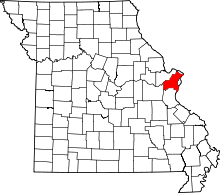
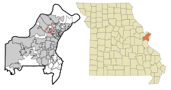 Location of Edmundson, Missouri | |
| Coordinates: 38°44′7″N 90°21′51″W / 38.73528°N 90.36417°WCoordinates: 38°44′7″N 90°21′51″W / 38.73528°N 90.36417°W | |
| Country | United States |
| State | Missouri |
| County | St. Louis |
| Government | |
| • Type | Mayor and Board of Aldermen[2] |
| • Mayor | John Gwaltney[2] |
| Area[3] | |
| • Total | 0.26 sq mi (0.67 km2) |
| • Land | 0.26 sq mi (0.67 km2) |
| • Water | 0 sq mi (0 km2) |
| Elevation | 581 ft (177 m) |
| Population (2010)[4] | |
| • Total | 834 |
| • Estimate (2012[5]) | 836 |
| • Density | 3,207.7/sq mi (1,238.5/km2) |
| Time zone | Central (CST) (UTC-6) |
| • Summer (DST) | CDT (UTC-5) |
| FIPS code | 29-21376[6] |
| GNIS feature ID | 0756015[7] |
| Website | http://www.cityofedmundson.com/ |
Edmundson is a city in St. Louis County, Missouri, United States. The population was 834 at the 2010 census.[8]
Geography
Edmundson is located at 38°44′7″N 90°21′51″W / 38.73528°N 90.36417°W (38.735351, -90.364052).[9] According to the United States Census Bureau, the city has a total area of 0.26 square miles (0.67 km2), all of it land.[3]
History
In 1941, four days before the attack on Pearl Harbor, a subdivision of 156 homes named "Edmundson Terrace" was offered for sale to the public; it was one of St. Louis County's first subdivisions.[1] On May 12, 1948, Edmundson Terrace was incorporated as the Village of Edmundson, a village under Missouri law.[1] By 1965, Edmundson had tripled or quadrupled in area; it had a population of 2500, which included 415 single-family homes, a row of duplexes, and 315 units at the Bobbie Downs Apartments.[1] On the ballot for the 1992 election, Edmundson residents chose to become a fourth class city, effective January 4, 1993.[1]
Demographics
| Historical population | |||
|---|---|---|---|
| Census | Pop. | %± | |
| 1950 | 621 | — | |
| 1960 | 1,428 | 130.0% | |
| 1970 | 2,298 | 60.9% | |
| 1980 | 1,374 | −40.2% | |
| 1990 | 1,111 | −19.1% | |
| 2000 | 840 | −24.4% | |
| 2010 | 834 | −0.7% | |
| Est. 2015 | 837 | [10] | 0.4% |
2010 census
As of the census[4] of 2010, there were 834 people, 310 households, and 197 families residing in the city. The population density was 3,207.7 inhabitants per square mile (1,238.5/km2). There were 345 housing units at an average density of 1,326.9 per square mile (512.3/km2). The racial makeup of the city was 56.5% White (54.3% non-Hispanic white), 26.4% African American, 1.6% Native American, 1.6% Asian, 0.1% Pacific Islander, 8.6% from other races, and 5.3% from two or more races. Hispanic or Latino of any race were 12.0% of the population.
There were 310 households of which 40.0% had children under the age of 18 living with them, 32.9% were married couples living together, 24.2% had a female householder with no husband present, 6.5% had a male householder with no wife present, and 36.5% were non-families. 29.4% of all households were made up of individuals and 11.6% had someone living alone who was 65 years of age or older. The average household size was 2.69 and the average family size was 3.37.
The median age in the city was 30.1 years. 31.3% of residents were under the age of 18; 8.9% were between the ages of 18 and 24; 30.5% were from 25 to 44; 19.6% were from 45 to 64; and 9.8% were 65 years of age or older. The gender makeup of the city was 48.7% male and 51.3% female.
2000 census
As of the census[6] of 2000, there were 840 people, 330 households, and 211 families residing in the city. The population density was 3,018 people per square mile (1,158.3/km²). There were 356 housing units at an average density of 1,279.1 per square mile (490.9/km²). The racial makeup of the city was 73.81% White, 18.81% African American, 1.19% Asian, 0.60% Pacific Islander, 0.48% Native American, 2.62% from other races, and 2.50% from two or more races. Hispanic or Latino of any race were 5.60% of the population.
There were 330 households out of which 35.2% had children under the age of 18 living with them, 42.1% were married couples living together, 19.1% had a female householder with no husband present, and 35.8% were non-families. 28.8% of all households were made up of individuals and 9.1% had someone living alone who was 65 years of age or older. The average household size was 2.55 and the average family size was 3.16.
In the city the population was spread out with 28.5% under the age of 18, 10.0% from 18 to 24, 28.3% from 25 to 44, 22.6% from 45 to 64, and 10.6% who were 65 years of age or older. The median age was 34 years. For every 100 females there were 88.3 males. For every 100 females age 18 and over, there were 86.6 males.
The median income for a household in the city was $37,083, and the median income for a family was $39,531. Males had a median income of $29,417 versus $25,000 for females. The per capita income for the city was $14,123. About 20.6% of families and 20.3% of the population were below the poverty line, including 29.5% of those under age 18 and 10.8% of those age 65 or over.
Public Safety
Edmundson is served by the Edmundson Police Department located at 4440 Holman Lane. 9 full-time officers protect this small city as well as operate a speed trap on I-70 near the airport. The Department has about 6 cars, 2 Ford Police Interceptors and 4 Dodge Chargers ranging from 2008 to 2012 Model Years that are frequently seen operating speed traps on Interstate 70. Community Fire Protection District operates fire and EMS from its stations in neighboring Saint Ann and Woodson Terrace that service Edmundson residents.
In April 2014, Edmundson Mayor John Gwaltney encouraged the city's police officers to write more tickets in order to fund the city's budget, while reminding officers that their pay adjustments would also be affected. [12]
Organizations
Ascension Health has its headquarters in Edmundson.[13]
References
- 1 2 3 4 5 "The History of Edmundson". City of Edmundson. Retrieved 2012-02-21.
- 1 2 3 "City Administration". City of Edmundson. Retrieved 2012-02-21.
- 1 2 "US Gazetteer files 2010". United States Census Bureau. Retrieved 2012-07-08.
- 1 2 "American FactFinder". United States Census Bureau. Retrieved 2012-07-08.
- ↑ "Population Estimates". United States Census Bureau. Retrieved 2013-05-30.
- 1 2 "American FactFinder". United States Census Bureau. Retrieved 2008-01-31.
- ↑ "US Board on Geographic Names". United States Geological Survey. 2007-10-25. Retrieved 2008-01-31.
- ↑ "Race, Hispanic or Latino, Age, and Housing Occupancy: 2010 Census Redistricting Data (Public Law 94-171) Summary File (QT-PL), Edmundson city, Missouri". U.S. Census Bureau, American FactFinder 2. Retrieved 2011-10-21.
- ↑ "US Gazetteer files: 2010, 2000, and 1990". United States Census Bureau. 2011-02-12. Retrieved 2011-04-23.
- ↑ "Annual Estimates of the Resident Population for Incorporated Places: April 1, 2010 to July 1, 2015". Retrieved July 2, 2016.
- ↑ "Census of Population and Housing". Census.gov. Retrieved June 4, 2015.
- ↑ Mayor: Write more tickets, KSDK.
- ↑ Doyle, Jim. "Edmundson-based Ascension Health takes over Marian Health System." St. Louis Post-Dispatch. April 1, 2013. Retrieved on July 4, 2013.