Charlack, Missouri
| Charlack, Missouri | |
|---|---|
| City | |
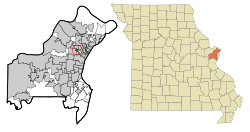
 Location of Charlack, Missouri | |
| Coordinates: 38°42′13″N 90°20′33″W / 38.70361°N 90.34250°WCoordinates: 38°42′13″N 90°20′33″W / 38.70361°N 90.34250°W | |
| Country | United States |
| State | Missouri |
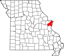
| County | St. Louis |
| Government | |
| • Mayor | Frank Mattingly |
| • Chief of Police | Steve Runge |
| Area[1] | |
| • Total | 0.26 sq mi (0.67 km2) |
| • Land | 0.26 sq mi (0.67 km2) |
| • Water | 0 sq mi (0 km2) |
| Elevation | 600 ft (183 m) |
| Population (2010)[2] | |
| • Total | 1,363 |
| • Estimate (2012[3]) | 1,362 |
| • Density | 5,242.3/sq mi (2,024.1/km2) |
| Time zone | Central (CST) (UTC-6) |
| • Summer (DST) | CDT (UTC-5) |
| FIPS code | 29-13330[4] |
| GNIS feature ID | 0755879[5] |
| Website | City of Charlack official website |
Charlack is a city in St. Louis County, Missouri, USA. The population was 1,363 at the 2010 census.[6]
Geography
Charlack is located at 38°42′13″N 90°20′33″W / 38.70361°N 90.34250°W (38.703651, -90.342619).[7] The name of the city comes from its location, at the intersection of St. Charles Rock Road with Lackland Road.
According to the United States Census Bureau, the city has a total area of 0.26 square miles (0.67 km2), all of it land.[1]
Police department
The city operates its own police department providing 24-hour service to the community.
In 1945, the village was patrolled by Charlack's first own sheriff accompanied by 2 deputies. The Police Department now has 8 full-time employees, a chief, a pair of sergeants and six patrolmen as well as 5 reserve officers. The department has around nine patrol vehicles ranging from 4-5 Dodge Chargers, a Ford Explorer, a Dodge Sprinter Van, and a Ford Escape Hybrid outfitted as a Mobile Radar Photo Enforcement Unit made by Redflex Systems and acquired in late 2011. It also has a Chevy van used to set up photo enforcement cameras. Dispatch is provided by St. Louis County.
Charlack was the second city to begin using speed cameras, March 20, 2010. The cameras are provided by B&W Sensors, a company located in St. Louis. The speed cameras are on a mobile trailer which is located on top of I-170 on the Lackland Road Overpass.[8] Charlack's then-police chief, Tony Umbertino, claims that traffic fines account for about 29% of Charlack's operating budget.[9] According to the then- Police Chief Umbertino, "The cameras have also been used on Lackland Road and Midland Road earlier in the year." Umbertino also served as the town manager.[9]
Charlack has been criticized by the St. Louis Post-Dispatch for painting speed camera calibration lines on the highway without obtaining the proper permission.[10] The Post-Dispatch has also reported that Charlack has complied with a previous agreement to man the speed camera stations.[11][12] The department contracts with an outside vendor to collect traffic fines online.
In March 2013, former police chief and city administrator Umbertino was charged with financial abuse of a senior. Press reports are unclear as to the outcome of the case. [13]
In October 2014, Umbertino was found guilty on corruption charges that he used government funds to pay for meals and a trip to Hawaii. [14][15]
Demographics
| Historical population | |||
|---|---|---|---|
| Census | Pop. | %± | |
| 1950 | 1,528 | — | |
| 1960 | 1,493 | −2.3% | |
| 1970 | 1,872 | 25.4% | |
| 1980 | 1,537 | −17.9% | |
| 1990 | 1,388 | −9.7% | |
| 2000 | 1,431 | 3.1% | |
| 2010 | 1,363 | −4.8% | |
| Est. 2015 | 1,371 | [16] | 0.6% |
2010 census
As of the census[2] of 2010, there were 1,363 people, 565 households, and 337 families residing in the city. The population density was 5,242.3 inhabitants per square mile (2,024.1/km2). There were 616 housing units at an average density of 2,369.2 per square mile (914.8/km2). The racial makeup of the city was 55.8% White, 35.4% African American, 0.3% Native American, 1.5% Asian, 3.3% from other races, and 3.7% from two or more races. Hispanic or Latino of any race were 7.2% of the population.
There were 565 households of which 35.6% had children under the age of 18 living with them, 30.3% were married couples living together, 21.4% had a female householder with no husband present, 8.0% had a male householder with no wife present, and 40.4% were non-families. 30.6% of all households were made up of individuals and 6.9% had someone living alone who was 65 years of age or older. The average household size was 2.41 and the average family size was 3.02.
The median age in the city was 30.1 years. 25.8% of residents were under the age of 18; 13.3% were between the ages of 18 and 24; 31.5% were from 25 to 44; 22.4% were from 45 to 64; and 6.9% were 65 years of age or older. The gender makeup of the city was 48.1% male and 51.9% female.
2000 census
As of the census[4] of 2000, there were 1,431 people, 572 households, and 364 families residing in the city. The population density was 5,463.1 people per square mile (2,125.0/km²). There were 631 housing units at an average density of 2,409.0 per square mile (937.0/km²). The racial makeup of the city was 61.50% White, 32.56% African American, 0.70% Native American, 0.77% Asian, 1.05% from other races, and 3.42% from two or more races. Hispanic or Latino of any race were 2.52% of the population.
There were 572 households out of which 35.3% had children under the age of 18 living with them, 35.8% were married couples living together, 21.9% had a female householder with no husband present, and 36.2% were non-families. 27.6% of all households were made up of individuals and 7.2% had someone living alone who was 65 years of age or older. The average household size was 2.50 and the average family size was 3.05.
In the city the population was spread out with 28.9% under the age of 18, 11.3% from 18 to 24, 34.4% from 25 to 44, 17.0% from 45 to 64, and 8.4% who were 65 years of age or older. The median age was 30 years. For every 100 females there were 95.0 males. For every 100 females age 18 and over, there were 87.6 males.
The median income for a household in the city was $36,493, and the median income for a family was $39,412. Males had a median income of $32,604 versus $25,143 for females. The per capita income for the city was $18,147. About 9.0% of families and 11.5% of the population were below the poverty line, including 15.1% of those under age 18 and 3.9% of those age 65 or over.
References
- 1 2 "US Gazetteer files 2010". United States Census Bureau. Archived from the original on 2012-01-24. Retrieved 2012-07-08.
- 1 2 "American FactFinder". United States Census Bureau. Retrieved 2012-07-08.
- ↑ "Population Estimates". United States Census Bureau. Archived from the original on 2013-06-17. Retrieved 2013-05-30.
- 1 2 "American FactFinder". United States Census Bureau. Archived from the original on 2013-09-11. Retrieved 2008-01-31.
- ↑ "US Board on Geographic Names". United States Geological Survey. 2007-10-25. Retrieved 2008-01-31.
- ↑ "Race, Hispanic or Latino, Age, and Housing Occupancy: 2010 Census Redistricting Data (Public Law 94-171) Summary File (QT-PL), Charlack city, Missouri". U.S. Census Bureau, American FactFinder 2. Archived from the original on September 11, 2013. Retrieved October 19, 2011.
- ↑ "US Gazetteer files: 2010, 2000, and 1990". United States Census Bureau. 2011-02-12. Retrieved 2011-04-23.
- ↑ http://www.kmov.com/news/local/Charlack-issues-11000-worth-of-tickets-in-4-months-with-new-speed-camera-101131134.html
- 1 2 http://www.stltoday.com/news/local/crime-and-courts/article_f9935652-07e8-5eab-8d77-8868b821a083.html
- ↑ http://www.stltoday.com/news/local/crime-and-courts/article_b9f603bc-e820-5d3e-a96f-65a66bc3b4f8.html
- ↑ http://www.stltoday.com/news/local/crime-and-courts/article_21105301-8d9b-57bb-a2cc-a599a95609a1.html
- ↑ Missouri Vehicle Stops Reports
- ↑ Former Charlack police chief charged with exploiting a senior; Staff reports, Saint Lousi Post-Dispatch, 9 March 2013
- ↑ Former police chief faces corruption charges;by John Henry, KSDK, 27 October 2014
- ↑ Jury finds former Charlack official guilty of stealing; by Ken Leiser, Saint Louis Post-Dispatch, 1 October 2014
- ↑ "Annual Estimates of the Resident Population for Incorporated Places: April 1, 2010 to July 1, 2015". Retrieved July 2, 2016.
- ↑ "Census of Population and Housing". Census.gov. Archived from the original on May 11, 2015. Retrieved June 4, 2015.
