Oakland, Missouri
| Oakland, Missouri | |
|---|---|
| City | |
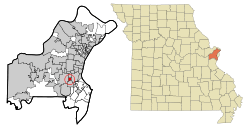 Location of Oakland, Missouri | |
| Coordinates: 38°34′33″N 90°23′4″W / 38.57583°N 90.38444°WCoordinates: 38°34′33″N 90°23′4″W / 38.57583°N 90.38444°W | |
| Country | United States |
| State | Missouri |
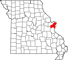
| County | St. Louis |
| Area[1] | |
| • Total | 0.61 sq mi (1.58 km2) |
| • Land | 0.61 sq mi (1.58 km2) |
| • Water | 0 sq mi (0 km2) |
| Elevation | 614 ft (187 m) |
| Population (2010)[2] | |
| • Total | 1,381 |
| • Estimate (2012[3]) | 1,379 |
| • Density | 2,263.9/sq mi (874.1/km2) |
| Time zone | Central (CST) (UTC-6) |
| • Summer (DST) | CDT (UTC-5) |
| FIPS code | 29-53750[4] |
| GNIS feature ID | 0756470[5] |
| Website | Oaklandmo.org |
Oakland is a city in St. Louis County, Missouri, United States. The population was 1,381 at the 2010 census.[6]
Geography
Oakland is located at 38°34′33″N 90°23′04″W / 38.575869°N 90.384539°W (38.575869, -90.384539).[7]
According to the United States Census Bureau, the city has a total area of 0.61 square miles (1.58 km2), all of it land.[1]
Demographics
| Historical population | |||
|---|---|---|---|
| Census | Pop. | %± | |
| 1930 | 557 | — | |
| 1940 | 789 | 41.7% | |
| 1960 | 1,552 | — | |
| 1970 | 1,609 | 3.7% | |
| 1980 | 1,728 | 7.4% | |
| 1990 | 1,593 | −7.8% | |
| 2000 | 1,540 | −3.3% | |
| 2010 | 1,381 | −10.3% | |
| Est. 2015 | 1,382 | [8] | 0.1% |
2010 census
As of the census[2] of 2010, there were 1,381 people, 452 households, and 324 families residing in the city. The population density was 2,263.9 inhabitants per square mile (874.1/km2). There were 494 housing units at an average density of 809.8 per square mile (312.7/km2). The racial makeup of the city was 96.2% White, 2.2% African American, 0.1% Native American, 0.4% Asian, and 1.1% from two or more races. Hispanic or Latino of any race were 1.0% of the population.
There were 452 households of which 32.3% had children under the age of 18 living with them, 61.1% were married couples living together, 8.8% had a female householder with no husband present, 1.8% had a male householder with no wife present, and 28.3% were non-families. 24.3% of all households were made up of individuals and 11.5% had someone living alone who was 65 years of age or older. The average household size was 2.43 and the average family size was 2.90.
The median age in the city was 52.7 years. 18.2% of residents were under the age of 18; 3.5% were between the ages of 18 and 24; 18.7% were from 25 to 44; 27.7% were from 45 to 64; and 32.1% were 65 years of age or older. The gender makeup of the city was 40.0% male and 60.0% female.
2000 census
As of the census[4] of 2000, there were 1,540 people, 448 households, and 340 families residing in the city. The population density was 2,545.7 people per square mile (991.0/km2). There were 459 housing units at an average density of 758.7 per square mile (295.4/km2). The racial makeup of the city was 97.34% White, 1.69% African American, 0.52% Asian, 0.19% from other races, and 0.26% from two or more races. Hispanic or Latino of any race were 0.65% of the population.
There were 448 households out of which 33.3% had children under the age of 18 living with them, 66.5% were married couples living together, 8.0% had a female householder with no husband present, and 23.9% were non-families. 21.4% of all households were made up of individuals and 9.2% had someone living alone who was 65 years of age or older. The average household size was 2.48 and the average family size was 2.87.
In the city the population was spread out with 16.8% under the age of 18, 3.1% from 18 to 24, 20.7% from 25 to 44, 20.9% from 45 to 64, and 38.5% who were 65 years of age or older. The median age was 52 years. For every 100 females there were 67.2 males. For every 100 females age 18 and over, there were 59.1 males.
The median income for a household in the city was $65,000, and the median income for a family was $71,250. Males had a median income of $60,063 versus $37,132 for females. The per capita income for the city was $27,583. About 2.3% of families and 3.1% of the population were below the poverty line, including 3.5% of those under age 18 and 5.2% of those age 65 or over.
Education
St. Louis County Library operates the Oak Bend Branch in Oakland.[10][11]
References
- 1 2 "US Gazetteer files 2010". United States Census Bureau. Archived from the original on January 24, 2012. Retrieved 2012-07-08.
- 1 2 "American FactFinder". United States Census Bureau. Retrieved 2012-07-08.
- ↑ "Population Estimates". United States Census Bureau. Archived from the original on June 17, 2013. Retrieved 2013-05-30.
- 1 2 "American FactFinder". United States Census Bureau. Archived from the original on September 11, 2013. Retrieved 2008-01-31.
- ↑ "US Board on Geographic Names". United States Geological Survey. 2007-10-25. Retrieved 2008-01-31.
- ↑ "Race, Hispanic or Latino, Age, and Housing Occupancy: 2010 Census Redistricting Data (Public Law 94-171) Summary File (QT-PL), Oakland city, Missouri". U.S. Census Bureau, American FactFinder 2. Archived from the original on September 11, 2013. Retrieved October 24, 2011.
- ↑ "US Gazetteer files: 2010, 2000, and 1990". United States Census Bureau. 2011-02-12. Retrieved 2011-04-23.
- ↑ "Annual Estimates of the Resident Population for Incorporated Places: April 1, 2010 to July 1, 2015". Retrieved July 2, 2016.
- ↑ "Census of Population and Housing". Census.gov. Archived from the original on May 11, 2015. Retrieved June 4, 2015.
- ↑ "Oak Bend Branch." St. Louis County Library. Retrieved on August 18, 2009.
- ↑ "Oakland city, Missouri." U.S. Census Bureau. Retrieved on August 18, 2009.