Carson, North Dakota
| Carson, North Dakota | |
|---|---|
| City | |
|
Business District of Carson | |
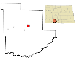 Location of Carson, North Dakota | |
| Coordinates: 46°25′15″N 101°34′1″W / 46.42083°N 101.56694°WCoordinates: 46°25′15″N 101°34′1″W / 46.42083°N 101.56694°W | |
| Country | United States |
| State | North Dakota |
| County | Grant |
| Area[1] | |
| • Total | 4.02 sq mi (10.41 km2) |
| • Land | 4.02 sq mi (10.41 km2) |
| • Water | 0 sq mi (0 km2) |
| Elevation | 2,300 ft (701 m) |
| Population (2010)[2] | |
| • Total | 293 |
| • Estimate (2015)[3] | 290 |
| • Density | 72.9/sq mi (28.1/km2) |
| Time zone | Mountain (MST) (UTC-7) |
| • Summer (DST) | MDT (UTC-6) |
| ZIP code | 58529 |
| Area code(s) | 701 |
| FIPS code | 38-12460 |
| GNIS feature ID | 1028290[4] |

Carson is a city in Grant County, North Dakota, United States. It is the county seat of Grant County, North Dakota.[5] The population was 293 at the 2010 census.[6]
History
Carson was laid out in 1910 when the Great Northern Railway was extended to that point.[7] The city's name is an amalgamation of the names of two settlers: Frank Carter and Simon Pederson.[8]
Geography
Carson is located at 46°25′15″N 101°34′1″W / 46.42083°N 101.56694°W (46.420706, -101.567025).[9] According to the United States Census Bureau, the city has a total area of 4.02 square miles (10.41 km2), all of it land.[1]
Climate
This climatic region is typified by large seasonal temperature differences, with warm to hot summers and cold winters. According to the Köppen Climate Classification system, Carson has a humid continental climate, abbreviated "Dfb" on climate maps.[10]
Demographics
| Historical population | |||
|---|---|---|---|
| Census | Pop. | %± | |
| 1920 | 277 | — | |
| 1930 | 356 | 28.5% | |
| 1940 | 473 | 32.9% | |
| 1950 | 493 | 4.2% | |
| 1960 | 501 | 1.6% | |
| 1970 | 466 | −7.0% | |
| 1980 | 469 | 0.6% | |
| 1990 | 383 | −18.3% | |
| 2000 | 319 | −16.7% | |
| 2010 | 293 | −8.2% | |
| Est. 2015 | 290 | [11] | −1.0% |
| U.S. Decennial Census[12] 2015 Estimate[3] | |||
2010 census
As of the census[2] of 2010, there were 293 people, 154 households, and 70 families residing in the city. The population density was 72.9 inhabitants per square mile (28.1/km2). There were 194 housing units at an average density of 48.3 per square mile (18.6/km2). The racial makeup of the city was 99.3% White, 0.3% Native American, and 0.3% from two or more races. Hispanic or Latino of any race were 0.7% of the population.
There were 154 households of which 20.1% had children under the age of 18 living with them, 37.0% were married couples living together, 7.1% had a female householder with no husband present, 1.3% had a male householder with no wife present, and 54.5% were non-families. 53.2% of all households were made up of individuals and 24.6% had someone living alone who was 65 years of age or older. The average household size was 1.90 and the average family size was 2.91.
The median age in the city was 49.1 years. 20.8% of residents were under the age of 18; 6.6% were between the ages of 18 and 24; 17% were from 25 to 44; 28% were from 45 to 64; and 27.6% were 65 years of age or older. The gender makeup of the city was 47.1% male and 52.9% female.
2000 census
As of the census of 2000, there were 319 people, 154 households, and 83 families residing in the city. The population density was 79.4 people per square mile (30.6/km²). There were 201 housing units at an average density of 50.1 per square mile (19.3/km²). The racial makeup of the city was 96.87% White, 1.25% from other races, and 1.88% from two or more races. Hispanic or Latino of any race were 1.25% of the population.
There were 154 households out of which 23.4% had children under the age of 18 living with them, 44.2% were married couples living together, 8.4% had a female householder with no husband present, and 45.5% were non-families. 44.8% of all households were made up of individuals and 30.5% had someone living alone who was 65 years of age or older. The average household size was 2.07 and the average family size was 2.92.
In the city the population was spread out with 23.5% under the age of 18, 5.6% from 18 to 24, 22.6% from 25 to 44, 16.9% from 45 to 64, and 31.3% who were 65 years of age or older. The median age was 43 years. For every 100 females there were 85.5 males. For every 100 females age 18 and over, there were 78.1 males.
The median income for a household in the city was $19,722, and the median income for a family was $23,056. Males had a median income of $16,806 versus $21,000 for females. The per capita income for the city was $11,754. About 16.3% of families and 21.7% of the population were below the poverty line, including 26.3% of those under age 18 and 19.0% of those age 65 or over.
References
- 1 2 "US Gazetteer files 2010". United States Census Bureau. Archived from the original on 2012-07-14. Retrieved 2012-06-14.
- 1 2 "American FactFinder". United States Census Bureau. Retrieved 2012-06-14.
- 1 2 "Population Estimates". United States Census Bureau. Retrieved July 16, 2016.
- ↑ "US Board on Geographic Names". United States Geological Survey. 2007-10-25. Retrieved 2008-01-31.
- ↑ "Find a County". National Association of Counties. Archived from the original on 2011-05-31. Retrieved 2011-06-07.
- ↑ "2010 Census Redistricting Data (Public Law 94-171) Summary File". American FactFinder. United States Census Bureau. Archived from the original on 21 July 2011. Retrieved 2 May 2011.
- ↑ Hellmann, Paul T. (May 13, 2013). Historical Gazetteer of the United States. Routledge. p. 834. Retrieved 30 November 2013.
- ↑ Federal Writers' Project (1938). North Dakota, a Guide to the Northern Prairie State. Works Progress Administration. p. 231. Retrieved 18 November 2013.
- ↑ "US Gazetteer files: 2010, 2000, and 1990". United States Census Bureau. 2011-02-12. Retrieved 2011-04-23.
- ↑ Climate Summary for Carson, North Dakota
- ↑ "Annual Estimates of the Resident Population for Incorporated Places: April 1, 2010 to July 1, 2015". Retrieved July 2, 2016.
- ↑ United States Census Bureau. "Census of Population and Housing". Archived from the original on May 11, 2015. Retrieved August 23, 2013.
External links
Municipalities and communities of Grant County, North Dakota, United States | ||
|---|---|---|
| Cities | 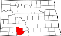 | |
| Townships |
| |
| CDPs | ||
| Unorganized territories |
| |
| Unincorporated communities | ||
| Ghost town | ||
| Counties |  | |
|---|---|---|
| Core cities | ||
| Surrounding areas |
| |