Magnae Carvetiorum
| Magnae Carvetiorum | |
|---|---|
_Roman_Fort_-_north_boundary%2C_and_Corvoran_Roman_Army_Museum_-_geograph.org.uk_-_1374187.jpg) | |
 | |
| Location | |
| Coordinates | 54°59′06″N 2°31′28″W / 54.9849°N 2.5244°W |
| Place name | Carvoran |
| County | Northumberland |
| Country | England |
| Reference | |
| UK-OSNG reference | NY665656 |
Magnae, fully Magnae Carvetiorum (Latin for "The Greats of the Carvetii"),[1] was a Roman fort on Hadrian's Wall in northern Britain. Its ruins are now known as Carvoran Roman Fort and are located near Carvoran, Northumberland, in northern England. It is thought to have been sited with reference to the Stanegate Roman road, before the building of Hadrian's Wall, to which it is not physically attached. In fact the Vallum ditch unusually goes north of the fort, separating it from the Wall.
The fort is now the site of the Roman Army Museum.
Name
The fort at Carvoran is generally identified with the "Magnis" which appears both in the Ravenna Cosmography and the Notitia Dignitatum.[2] Further evidence for the name comes from a fragmentary inscription (RIB 1825) apparently seen by William Hutchinson in 1766 but which is now lost, which referred to "numerus Magne<c>e(n)s(ium)" ("of the unit of Magn[...] ....").[3][4] The name could be a Latin nominative form Magni, or Magna,[5] and the fort is today sometimes referred to under the name "Magna".[3] The name is rather inappropriate for a relatively small fort,[6] and one suggestion is that it could ultimately derive from the Celtic word maen meaning 'stone' or 'rock'.[7][8]
Roman fort
Magnae was originally built to guard the junction of the Maiden Way with the Stanegate, the key supply route linking Coria (Corbridge) in the east to Luguvalium (Carlisle) in the west. As such it predates Hadrian's Wall. Its ruins are located at Carvoran in the civil parish of Greenhead in the English county of Northumberland. Magnae is one of 16 Roman forts along Hadrian's Wall; there are also 80 smaller milecastle forts and 158 turrets along its length. The Maiden Way ran south from Magnae to Bravoniacum (Kirkby Thore near Penrith).
Archaeology
Artifacts recovered at Magnae include a 2-foot-long (0.61 m) iron spearhead, found at a depth of 36 feet (11 m) in a well, and the well-known modius, a bronze grain-measure.[9]
Roman Army Museum
Magnae is the location of the Roman Army Museum run by the Vindolanda Trust. Like the museum at Vindolanda, the Roman Army Museum was modernised and reopened in 2011. The museum illustrates frontier life on the northern edge of the Roman Empire. The museum displays genuine Roman artifacts including weapons and tools; life-size replicas; a 3D film showing Hadrian's Wall past and present, and a large timeline of Hadrian's Wall. There is a gallery devoted to the emperor Hadrian himself. A large gallery describes daily life in the Roman army as seen through the eyes of a team of eight auxiliary soldiers, complete with a film showing their activities. Notable exhibits include a rare surviving helmet crest.[10]
Further reading
- Birley, Robin (1998). The fort at the rock: On Hadrian's Wall: Magna and Carvoran. Vindolanda Trust. ISBN 1873136560.
References
- ↑ The names are sometimes misspelled in the singular as Magna as well. The fort sometimes appears as Magnis in some itineraries, owing to Latin's declensions.
- ↑ Frere, S. S. (1987). Tabvla Imperii Romani: Britannia Septentrionalis. Oxford University Press. p. 19. ISBN 0197260594.
- 1 2 Taylor, David (2000). The Forts on Hadrian's Wall: A Comparative Analysis of the Form and Construction of Some Buildings. Archeopress. p. 118. ISBN 1841710768.
- ↑ De la Bédoyère, Guy (1999). Companion to Roman Britain. Archeopress. p. 82. ISBN 0752414577.
- ↑ Bevan, James Oliver (1917). The towns of Roman Britain. Chapman & Hall.
- ↑ Historic England. "Carvoran Roman fort and Hadrian's Wall and vallum (1010991)". National Heritage List for England. Retrieved 17 March 2015.
- ↑ McClure, Edmund. British place-names in their historical setting. E.S. Gorham. p. 331.
- ↑ Wilson, Roger John Anthony (2002). A guide to the Roman remains in Britain. Constable. ISBN 0094686807.
- ↑ John Collingwood Bruce, The Roman wall, 1853
- ↑ Birley, R. (2012). Vindolanda Guide: the home of Britain's finest treasures. Roman Army Museum Publications. pp. 2 and 43.
External links
| Wikimedia Commons has media related to Magnae Carvetiorum. |
- "Magnis Carvetiorum" at Roman Britain Online
- "Hadrian's Wall: Carovoran Fort (Magna)" at North of the Tyne
| Wall Forts (East to West) |  | |
|---|---|---|
| Outpost Forts | ||
| Stanegate Forts |
| |
| Supply Forts | ||
| Cumbrian Coast Forts (North to South) |
| |
Roman visitor sites in the UK | ||
|---|---|---|
| Villas | 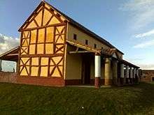 | |
| Forts & military | ||
| Towns | ||
| Museums | ||
| Other sites | ||
Coordinates: 54°59′06″N 2°31′28″W / 54.9849°N 2.5244°W