Srikakulam
| Srikakulam శ్రీకాకుళం Chicacole | |
|---|---|
| City | |
|
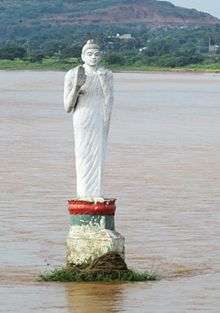
Arasavilli Temple in Srikakulam | |
 Srikakulam | |
| Coordinates: 18°18′N 83°54′E / 18.3°N 83.9°ECoordinates: 18°18′N 83°54′E / 18.3°N 83.9°E | |
| Country | India |
| State | Andhra Pradesh |
| Region | Coastal Andhra |
| District | Srikakulam |
| Founded by | Balarama |
| Government | |
| • Type | Municipal council |
| • Body | Srikakulam Municipal Corporation |
| Area[1] | |
| • City | 20.89 km2 (8.07 sq mi) |
| Area rank | 24th |
| Population (2011)[2] | |
| • City | 125,939 |
| • Density | 6,000/km2 (16,000/sq mi) |
| • Metro[3] | 147,015 |
| Languages | |
| • Official | Telugu |
| Time zone | IST (UTC+5:30) |
| PIN | 532 001 |
| Vehicle registration | AP–30 |
| Website | Srikakulam Municipality |

Srikakulam is a city and the district headquarters of Srikakulam district in the Indian state of Andhra Pradesh. It is a municipal corporation and also the mandal headquarters of Srikakulam mandal in Srikakulam revenue division.[4][5] As of 2011 census, it was most populous city of Srikaulam district and 24th populous city of the state with a population of 125,939. The city is believed to have been founded by Balarama.[6]
Etymology
The city was known as Chicacole before Indian Independence.[6]
History

This region of Andhra Pradesh was part of Kalinga region at first, and later a part of Gajapati kingdom of Odisha up to the medieval period. Srikakulam was integral part of the domain of Eastern Chalukyas of Vengi during the rule of Kubja Vishnuvardhana (624- 641). During his rule the Vengi kingdom had expanded from Srikakulam in the north to Nellore in the south. They patronised Telugu.[7] It was under the rule of Kakatiya Dynasty of Warangal during the rule of Ganapati Deva in 13th century CE. Srikakulam was under the rule of illustrious Krishna Deva Raya of Vijayanagara Empire too. Srikakulam was under the rule of Nizam state of Hyderabad for only a brief period, namely from 1707 to 1753. It was the headquarters for revenue collection of Rajahmundry, Eluru and Kondapalli as well as Srikakulam district itself. The French defeated and ended the brief rule of Nizam in 1753, these all districts were thereafter part of French India in 1753. However French imperialists too could not hold their sway over here for a long time, and were soon driven out from here by British imperialists, during 1756 in Anglo-French wars. Thereafter Srikakulam was under was soon a part of British – Northern Circars.
In 1759 the Fauzdhari ruling was ended and British ruling started, and Srikakulam town has been made part of Ganjam district and Palakonda and Rajam areas were included in Vizag district in the undivided Madras province. In 1936 the combined Madras-Odisha state was divided to Madras and Odisha and Parlakimidi Taluk was separated from combined Madras state. Srikakulam was renamed as Srikaklam taluk, Srikakulam town as Srikakulam municipality since 1857 under British rule. In 1947 after Indian independence, many including Potti Sriramulu fought for separate Andhra State. In 1948 many demanded for Srikakulam district as it was in combined vizag district. First 'chintada' village was proposed as district headquarters by some central leaders. On 17 July 1950, a representation was given by Challa Narasimhu naidu, an eminent leader, Pullela Vemkataramanayya (P.V. Ramanayya), who was an eminent advocate, public prosecutor, and freedom fighter, to the then revenue minister H. Sitaramareddy on his visit to this area and requested to select Srikakulam as district headquarters at his camp office in Vizianagaram. Sitaramareddy personally saw some places in Srikakulam for selection.
Demographics
As of 2011 Census of India, the city had a population of 125,939. The total population constitute, 62,546 males and 63,393 females —a sex ratio of 1013 females per 1014 males. 11,607 children are in the age group of 0–6 years. The average literacy rate stands at 84.62% 96,744 literates, significantly higher than the national average of 73.00%.[8][9]
The Urban agglomeration had a population of 147,015, of which males constitute 73,077, females constitute 73,911 —a sex ratio of 931 females per 1000 males and 12,741 children are in the age group of 0–6 years. There are a total of 115,061 literates with an average literacy rate of 85.71%.[3]
Climate
| Climate data for Srikakulam, Andhra Pradesh | |||||||||||||
|---|---|---|---|---|---|---|---|---|---|---|---|---|---|
| Month | Jan | Feb | Mar | Apr | May | Jun | Jul | Aug | Sep | Oct | Nov | Dec | Year |
| Average high °C (°F) | 28.8 (83.8) |
31.0 (87.8) |
33.3 (91.9) |
35.5 (95.9) |
37.9 (100.2) |
36.9 (98.4) |
32.9 (91.2) |
32.4 (90.3) |
32.4 (90.3) |
31.3 (88.3) |
29.7 (85.5) |
28.6 (83.5) |
32.56 (90.59) |
| Average low °C (°F) | 19.3 (66.7) |
20.5 (68.9) |
22.8 (73) |
25.8 (78.4) |
27.9 (82.2) |
27.4 (81.3) |
25.7 (78.3) |
25.5 (77.9) |
25.6 (78.1) |
24.7 (76.5) |
21.7 (71.1) |
19.6 (67.3) |
23.88 (74.97) |
| Average rainfall mm (inches) | 0 (0) |
5 (0.2) |
4 (0.16) |
10 (0.39) |
53 (2.09) |
126 (4.96) |
204 (8.03) |
204 (8.03) |
162 (6.38) |
228 (8.98) |
66 (2.6) |
13 (0.51) |
1,075 (42.33) |
| Source: en.climate-data.org | |||||||||||||
Governance
Civic administration
Srikakulam Municipal Corporation is the civic body of the city. It was constituted as a municipality in the year 1856 and was upgraded to corporation on 9 December 2015.[10] Its jurisdictional area has an extent of 20.89 km2 (8.07 sq mi). In 2012–13, the total income generated per annum by the municipality was ₹50.55 crore (US$7.5 million) and the total expenditure spent during the same year was ₹49.86 crore (US$7.4 million).[1]
The Srikakulam urban agglomeration constituents of the city include, Srikakulam municipality, census town of Balaga, fully out growths of Arasavalli, partly outgrowths of Kusulapuram, Thotapalem, Patrunivalasa and Patha Srikakulam (rural). While, Ponugutivalasa of Santhakavati mandal is now a part of Rajam Nagar Panchayat.[11]
Politics
Srikakulam is a part of Srikakulam (Assembly constituency) for Andhra Pradesh Legislative Assembly. Gunda Lakshmi Devi is the present MLA of the constituency from Telugu Desam Party.[12] It is also a part of Srikakulam (Lok Sabha constituency) which was won by Rammohan Naidu Kinjarapu of Telugu Desam Party.[13][14]
Culture and tourism
.JPG)
The Arasavalli temple is the abode of Sun god and was constructed by Kalinga king. Kalingapatnam also has an old lighthouse. Vamsadhara River empties into the sea. in village Sri Kurmam.
Education
The primary and secondary school education is imparted by government, aided and private schools of the School Education Department of the state.[15][16] The medium of instruction followed by different schools are English, Telugu.
Transport
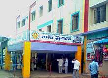
The Andhra Pradesh State Road Transport Corporation operates bus services from Srikakulam bus station.[17]
See also
References
- 1 2 "Basic Information of Municipality". Commissioner & Director of Municipal Administration. Municipal Administration & Urban Development Department, Govt. of Andhra Pradesh. Retrieved 16 February 2015.
- ↑ "Andhra Pradesh (India): Districts, Cities, Towns and Outgrowth Wards – Population Statistics in Maps and Charts". citypopulation.de.
- 1 2 "Andhra Pradesh (India): State, Major Agglomerations & Cities – Population Statistics in Maps and Charts". citypopulation.de.
- ↑ "Srikakulam District Mandals" (PDF). Census of India. pp. 202,219. Retrieved 19 January 2015.
- ↑ "District Census Handbook – Srikakulam" (PDF). Census of India. p. 27. Retrieved 18 January 2015.
- 1 2 "Srikakulam Municipality". Commissioner & Director of Municipal Administration. Municipal Administration and Urban Development Department, Govt. of Andhra Pradesh. Retrieved 16 February 2015.
- ↑ "Site is Down".
- ↑ "Srikakulam City Population Census 2011 - Andhra Pradesh".
- ↑ "Chapter–3 (Literates and Literacy rate)" (PDF). Registrar General and Census Commissioner of India. Retrieved 3 September 2014.
- ↑ "Masula, Srikakulam, Vizianagaram upgraded into corporations". The Hindu. Vijayawada. 10 December 2015. Archived from the original on 9 April 2016. Retrieved 10 December 2015.
- ↑ "District Census Handbook – Srikakulam" (PDF). Census of India. p. 27. Retrieved 18 January 2015.
- ↑ "MLA". AP State Portal. Retrieved 13 October 2014.
- ↑ "MP (Lok Sabha)". Government of AP. Retrieved 4 May 2015.
- ↑ "Delimitation of Parliamentary and Assembly Constituencies Order, 2008" (PDF). Election Commission of India. p. 22,31. Retrieved 11 October 2014.
- ↑ "School Eduvation Department" (PDF). School Education Department, Government of Andhra Pradesh. Retrieved 7 November 2016.
- ↑ "The Department of School Education - Official AP State Government Portal | AP State Portal". www.ap.gov.in. Retrieved 7 November 2016.
- ↑ "Bus Stations in Districts". Andhra Pradesh State Road Transport Corporation. Retrieved 9 March 2016.
External links
| Wikimedia Commons has media related to Srikakulam. |
| Topics | 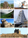 | |
|---|---|---|
| Regions | ||
| Districts | ||
| Million-plus cities | ||
| Cities (population over 1 lakh) | ||
| Tourism |
| |
| Related lists |
| |
| ||