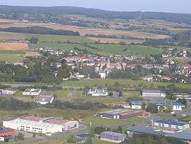
Cliron
| Cliron | ||
|---|---|---|
 | ||
| ||
 Cliron | ||
|
Location within Grand Est region  Cliron | ||
| Coordinates: 49°48′41″N 4°36′51″E / 49.8114°N 4.6142°ECoordinates: 49°48′41″N 4°36′51″E / 49.8114°N 4.6142°E | ||
| Country | France | |
| Region | Grand Est | |
| Department | Ardennes | |
| Arrondissement | Charleville-Mézières | |
| Canton | Renwez | |
| Intercommunality | Plaines et Forêts de l'Ouest ardennais | |
| Government | ||
| • Mayor (2008–2014) | Jean-Luc Pinteaux | |
| Area1 | 6.18 km2 (2.39 sq mi) | |
| Population (2008)2 | 293 | |
| • Density | 47/km2 (120/sq mi) | |
| Time zone | CET (UTC+1) | |
| • Summer (DST) | CEST (UTC+2) | |
| INSEE/Postal code | 08125 / 08090 | |
| Elevation |
149–245 m (489–804 ft) (avg. 182 m or 597 ft) | |
|
1 French Land Register data, which excludes lakes, ponds, glaciers > 1 km² (0.386 sq mi or 247 acres) and river estuaries. 2 Population without double counting: residents of multiple communes (e.g., students and military personnel) only counted once. | ||

Cliron is a commune in the Ardennes department in northern France.
Geography
The Sormonne River forms part of the commune's southern border.
Population
| Historical population | ||
|---|---|---|
| Year | Pop. | ±% |
| 1962 | 171 | — |
| 1968 | 187 | +9.4% |
| 1975 | 186 | −0.5% |
| 1982 | 267 | +43.5% |
| 1990 | 265 | −0.7% |
| 1999 | 280 | +5.7% |
| 2008 | 293 | +4.6% |
See also
References
| Wikimedia Commons has media related to Cliron. |
This article is issued from Wikipedia - version of the 3/30/2014. The text is available under the Creative Commons Attribution/Share Alike but additional terms may apply for the media files.