Montgon
| Montgon | ||
|---|---|---|
|
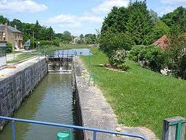
Lock on the Canal des Ardennes | ||
| ||
 Montgon | ||
|
Location within Grand Est region  Montgon | ||
| Coordinates: 49°30′20″N 4°42′54″E / 49.5056°N 4.715°ECoordinates: 49°30′20″N 4°42′54″E / 49.5056°N 4.715°E | ||
| Country | France | |
| Region | Grand Est | |
| Department | Ardennes | |
| Arrondissement | Vouziers | |
| Canton | Chesne | |
| Intercommunality | Argonne Ardennaise | |
| Government | ||
| • Mayor (2008–2014) | Jean-Claude Andrey | |
| Area1 | 8.2 km2 (3.2 sq mi) | |
| Population (2008)2 | 74 | |
| • Density | 9.0/km2 (23/sq mi) | |
| Time zone | CET (UTC+1) | |
| • Summer (DST) | CEST (UTC+2) | |
| INSEE/Postal code | 08301 / 08390 | |
| Elevation |
112–210 m (367–689 ft) (avg. 170 m or 560 ft) | |
|
1 French Land Register data, which excludes lakes, ponds, glaciers > 1 km² (0.386 sq mi or 247 acres) and river estuaries. 2 Population without double counting: residents of multiple communes (e.g., students and military personnel) only counted once. | ||

Montgon is a commune in the Ardennes department in northern France.
Population
| Historical population | ||
|---|---|---|
| Year | Pop. | ±% |
| 1962 | 176 | — |
| 1968 | 176 | +0.0% |
| 1975 | 141 | −19.9% |
| 1982 | 116 | −17.7% |
| 1990 | 97 | −16.4% |
| 1999 | 97 | +0.0% |
| 2008 | 74 | −23.7% |
See also
References
| Wikimedia Commons has media related to Montgon. |
This article is issued from Wikipedia - version of the 3/30/2014. The text is available under the Creative Commons Attribution/Share Alike but additional terms may apply for the media files.