Vireux-Wallerand
| Vireux-Wallerand | ||
|---|---|---|
|
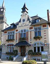
Town hall | ||
| ||
 Vireux-Wallerand | ||
|
Location within Grand Est region  Vireux-Wallerand | ||
| Coordinates: 50°05′04″N 4°43′51″E / 50.0844°N 4.7308°ECoordinates: 50°05′04″N 4°43′51″E / 50.0844°N 4.7308°E | ||
| Country | France | |
| Region | Grand Est | |
| Department | Ardennes | |
| Arrondissement | Charleville-Mézières | |
| Canton | Givet | |
| Intercommunality | Ardennes Rives de Meuse | |
| Government | ||
| • Mayor (2008–2014) | Bernard Dekens | |
| Area1 | 21.07 km2 (8.14 sq mi) | |
| Population (2008)2 | 1,901 | |
| • Density | 90/km2 (230/sq mi) | |
| Time zone | CET (UTC+1) | |
| • Summer (DST) | CEST (UTC+2) | |
| INSEE/Postal code | 08487 / 08320 | |
| Elevation |
107–368 m (351–1,207 ft) (avg. 108 m or 354 ft) | |
|
1 French Land Register data, which excludes lakes, ponds, glaciers > 1 km² (0.386 sq mi or 247 acres) and river estuaries. 2 Population without double counting: residents of multiple communes (e.g., students and military personnel) only counted once. | ||

Vireux-Wallerand is a commune in the Ardennes department in northern France.
Population
| Historical population | ||
|---|---|---|
| Year | Pop. | ±% |
| 1962 | 1,887 | — |
| 1968 | 2,231 | +18.2% |
| 1975 | 2,159 | −3.2% |
| 1982 | 2,035 | −5.7% |
| 1990 | 2,020 | −0.7% |
| 1999 | 2,035 | +0.7% |
| 2008 | 1,901 | −6.6% |
See also
References
| Wikimedia Commons has media related to Vireux-Wallerand. |
This article is issued from Wikipedia - version of the 3/30/2014. The text is available under the Creative Commons Attribution/Share Alike but additional terms may apply for the media files.