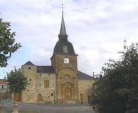
Saint-Menges
| Saint-Menges | ||
|---|---|---|
 | ||
| ||
 Saint-Menges | ||
|
Location within Grand Est region  Saint-Menges | ||
| Coordinates: 49°44′24″N 4°55′30″E / 49.74°N 4.925°ECoordinates: 49°44′24″N 4°55′30″E / 49.74°N 4.925°E | ||
| Country | France | |
| Region | Grand Est | |
| Department | Ardennes | |
| Arrondissement | Sedan | |
| Canton | Sedan-Ouest | |
| Intercommunality | Pays Sedanais | |
| Government | ||
| • Mayor (2008–2014) | Roger Watelet | |
| Area1 | 12.21 km2 (4.71 sq mi) | |
| Population (2008)2 | 1,049 | |
| • Density | 86/km2 (220/sq mi) | |
| Time zone | CET (UTC+1) | |
| • Summer (DST) | CEST (UTC+2) | |
| INSEE/Postal code | 08391 / 08200 | |
| Elevation | 147–420 m (482–1,378 ft) | |
|
1 French Land Register data, which excludes lakes, ponds, glaciers > 1 km² (0.386 sq mi or 247 acres) and river estuaries. 2 Population without double counting: residents of multiple communes (e.g., students and military personnel) only counted once. | ||

Saint-Menges is a commune in the Ardennes department in northern France.
It lies northwest of Sedan, near the border with Belgium.
Population
| Historical population | ||
|---|---|---|
| Year | Pop. | ±% |
| 1962 | 1,154 | — |
| 1968 | 1,133 | −1.8% |
| 1975 | 1,058 | −6.6% |
| 1982 | 976 | −7.8% |
| 1990 | 964 | −1.2% |
| 1999 | 996 | +3.3% |
| 2008 | 1,049 | +5.3% |
See also
References
| Wikimedia Commons has media related to Saint-Menges. |
This article is issued from Wikipedia - version of the 3/15/2016. The text is available under the Creative Commons Attribution/Share Alike but additional terms may apply for the media files.