Dommery
| Dommery | |
|---|---|
 | |
 Dommery | |
|
Location within Grand Est region  Dommery | |
| Coordinates: 49°40′37″N 4°28′27″E / 49.6769°N 4.4742°ECoordinates: 49°40′37″N 4°28′27″E / 49.6769°N 4.4742°E | |
| Country | France |
| Region | Grand Est |
| Department | Ardennes |
| Arrondissement | Charleville-Mézières |
| Canton | Signy-l'Abbaye |
| Intercommunality | Crêtes Préardennaises |
| Government | |
| • Mayor (2008–2014) | Guy Morlet |
| Area1 | 10.66 km2 (4.12 sq mi) |
| Population (2008)2 | 194 |
| • Density | 18/km2 (47/sq mi) |
| Time zone | CET (UTC+1) |
| • Summer (DST) | CEST (UTC+2) |
| INSEE/Postal code | 08141 / 08460 |
|
1 French Land Register data, which excludes lakes, ponds, glaciers > 1 km² (0.386 sq mi or 247 acres) and river estuaries. 2 Population without double counting: residents of multiple communes (e.g., students and military personnel) only counted once. | |
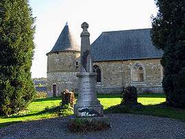
Dommery is a commune in the Ardennes department in northern France.
Population
| Historical population | ||
|---|---|---|
| Year | Pop. | ±% |
| 1962 | 162 | — |
| 1968 | 191 | +17.9% |
| 1975 | 164 | −14.1% |
| 1982 | 150 | −8.5% |
| 1990 | 166 | +10.7% |
| 1999 | 175 | +5.4% |
| 2008 | 194 | +10.9% |
See also
References
| Wikimedia Commons has media related to Dommery. |
This article is issued from Wikipedia - version of the 3/30/2014. The text is available under the Creative Commons Attribution/Share Alike but additional terms may apply for the media files.