Saint-Pierremont, Ardennes
| Saint-Pierremont | ||
|---|---|---|
|
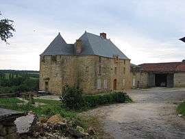
Chateau | ||
| ||
 Saint-Pierremont | ||
|
Location within Grand Est region  Saint-Pierremont | ||
| Coordinates: 49°29′13″N 4°56′18″E / 49.4869°N 4.9383°ECoordinates: 49°29′13″N 4°56′18″E / 49.4869°N 4.9383°E | ||
| Country | France | |
| Region | Grand Est | |
| Department | Ardennes | |
| Arrondissement | Vouziers | |
| Canton | Buzancy | |
| Intercommunality | Argonne Ardennaise | |
| Government | ||
| • Mayor (2008–2014) | Michel Michaux | |
| Area1 | 19.77 km2 (7.63 sq mi) | |
| Population (2008)2 | 95 | |
| • Density | 4.8/km2 (12/sq mi) | |
| Time zone | CET (UTC+1) | |
| • Summer (DST) | CEST (UTC+2) | |
| INSEE/Postal code | 08394 / 08240 | |
| Elevation |
178–294 m (584–965 ft) (avg. 230 m or 750 ft) | |
|
1 French Land Register data, which excludes lakes, ponds, glaciers > 1 km² (0.386 sq mi or 247 acres) and river estuaries. 2 Population without double counting: residents of multiple communes (e.g., students and military personnel) only counted once. | ||

Saint-Pierremont is a commune in the Ardennes department in northern France.
Population
| Historical population | ||
|---|---|---|
| Year | Pop. | ±% |
| 1962 | 115 | — |
| 1968 | 148 | +28.7% |
| 1975 | 114 | −23.0% |
| 1982 | 114 | +0.0% |
| 1990 | 100 | −12.3% |
| 1999 | 112 | +12.0% |
| 2008 | 95 | −15.2% |
See also
References
| Wikimedia Commons has media related to Saint-Pierremont, Ardennes. |
This article is issued from Wikipedia - version of the 2/11/2016. The text is available under the Creative Commons Attribution/Share Alike but additional terms may apply for the media files.