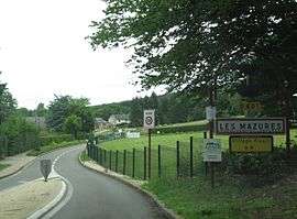
Les Mazures
| Les Mazures | |
|---|---|
 | |
 Les Mazures | |
|
Location within Grand Est region  Les Mazures | |
| Coordinates: 49°53′19″N 4°37′38″E / 49.8886°N 4.6272°ECoordinates: 49°53′19″N 4°37′38″E / 49.8886°N 4.6272°E | |
| Country | France |
| Region | Grand Est |
| Department | Ardennes |
| Arrondissement | Charleville-Mézières |
| Canton | Renwez |
| Intercommunality | Plaines et Forêts de l'Ouest ardennais |
| Government | |
| • Mayor (2008–2014) | Elisabeth Bonillo |
| Area1 | 36.14 km2 (13.95 sq mi) |
| Population (2008)2 | 948 |
| • Density | 26/km2 (68/sq mi) |
| Time zone | CET (UTC+1) |
| • Summer (DST) | CEST (UTC+2) |
| INSEE/Postal code | 08284 / 08500 |
|
1 French Land Register data, which excludes lakes, ponds, glaciers > 1 km² (0.386 sq mi or 247 acres) and river estuaries. 2 Population without double counting: residents of multiple communes (e.g., students and military personnel) only counted once. | |
Les Mazures is a commune in the Ardennes department in northern France.
During the Second World War, Les Mazures was the site of a minor concentration camp, used by the Nazis for the detainment of Jews.
Population
| Historical population | ||
|---|---|---|
| Year | Pop. | ±% |
| 1962 | 798 | — |
| 1968 | 922 | +15.5% |
| 1975 | 789 | −14.4% |
| 1982 | 781 | −1.0% |
| 1990 | 738 | −5.5% |
| 1999 | 774 | +4.9% |
| 2008 | 948 | +22.5% |
See also
References
| Wikimedia Commons has media related to Les Mazures. |
This article is issued from Wikipedia - version of the 7/20/2016. The text is available under the Creative Commons Attribution/Share Alike but additional terms may apply for the media files.