Colleville-sur-Mer
| Colleville-sur-Mer | |
|---|---|
|
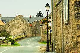
Main street | |
 Colleville-sur-Mer | |
|
Location within Normandy region  Colleville-sur-Mer | |
| Coordinates: 49°20′57″N 0°50′32″W / 49.3492°N 0.8422°WCoordinates: 49°20′57″N 0°50′32″W / 49.3492°N 0.8422°W | |
| Country | France |
| Region | Normandy |
| Department | Calvados |
| Arrondissement | Bayeux |
| Canton | Trévières |
| Intercommunality | Trévières |
| Government | |
| • Mayor (2008–2014) | Patrick Thomines |
| Area1 | 6.93 km2 (2.68 sq mi) |
| Population (2008)2 | 164 |
| • Density | 24/km2 (61/sq mi) |
| Time zone | CET (UTC+1) |
| • Summer (DST) | CEST (UTC+2) |
| INSEE/Postal code | 14165 / 14710 |
|
1 French Land Register data, which excludes lakes, ponds, glaciers > 1 km² (0.386 sq mi or 247 acres) and river estuaries. 2 Population without double counting: residents of multiple communes (e.g., students and military personnel) only counted once. | |
Colleville-sur-Mer is a commune in the Calvados department in Normandie region in northwestern France.
History
It was originally a farm owned by a certain Koli, a Scandinavian settler in the Middle Ages. It shares the same etymology as the other Colleville in Normandy. During the conquest of England by William the Conqueror or following it, Gilbert de Colleville was given lands in England, it was from this Knight that the modern de Colville/Colvin family would develop, including Clan Colville in Scotland and the Barony de Colville, of Castle Bytham in England.
The beach next to the coastal village was one of the principal beachheads during the Normandy landings on 6 June 1944, designated Omaha Beach.
Population
| Historical population | ||
|---|---|---|
| Year | Pop. | ±% |
| 1962 | 225 | — |
| 1968 | 195 | −13.3% |
| 1975 | 180 | −7.7% |
| 1982 | 169 | −6.1% |
| 1990 | 146 | −13.6% |
| 1999 | 172 | +17.8% |
| 2008 | 164 | −4.7% |

Sights
- Normandy American Cemetery and Memorial is located in Colleville-sur-Mer.
- Notre-Dame de l'Assomption de Colleville: dated to the 12th or 13th century, a historical monument since 1840.
See also
References
External links
| Wikimedia Commons has media related to Colleville-sur-Mer. |
- American D-Day: Omaha Beach, Utah Beach & Pointe du Hoc
- Aerial movie of Colleville-sur-Mer, Omaha Beach and the American Cemetery - Film taken from a low flying propellor plane. British Tours.
- How to visit Colleville-sur-Mer in one day from Paris.