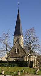
Garcelles-Secqueville
| Garcelles-Secqueville | |
|---|---|
 | |
 Garcelles-Secqueville | |
|
Location within Normandy region  Garcelles-Secqueville | |
| Coordinates: 49°05′57″N 0°17′19″W / 49.0992°N 0.2886°WCoordinates: 49°05′57″N 0°17′19″W / 49.0992°N 0.2886°W | |
| Country | France |
| Region | Normandy |
| Department | Calvados |
| Arrondissement | Caen |
| Canton | Bourguébus |
| Intercommunality | Plaine Sud de Caen |
| Government | |
| • Mayor (2008–2014) | Didier Jeanne |
| Area1 | 5.64 km2 (2.18 sq mi) |
| Population (2008)2 | 761 |
| • Density | 130/km2 (350/sq mi) |
| Time zone | CET (UTC+1) |
| • Summer (DST) | CEST (UTC+2) |
| INSEE/Postal code | 14294 / 14540 |
| Elevation |
57–105 m (187–344 ft) (avg. 79 m or 259 ft) |
|
1 French Land Register data, which excludes lakes, ponds, glaciers > 1 km² (0.386 sq mi or 247 acres) and river estuaries. 2 Population without double counting: residents of multiple communes (e.g., students and military personnel) only counted once. | |
Garcelles-Secqueville is a commune in the Calvados department in the Normandy region in northwestern France.
Population
| Historical population | ||
|---|---|---|
| Year | Pop. | ±% |
| 1962 | 297 | — |
| 1968 | 318 | +7.1% |
| 1975 | 296 | −6.9% |
| 1982 | 301 | +1.7% |
| 1990 | 408 | +35.5% |
| 1999 | 505 | +23.8% |
| 2008 | 761 | +50.7% |
See also
References
| Wikimedia Commons has media related to Garcelles-Secqueville. |
This article is issued from Wikipedia - version of the 3/16/2016. The text is available under the Creative Commons Attribution/Share Alike but additional terms may apply for the media files.