Saint-Omer, Calvados
| Saint-Omer | |
|---|---|
 | |
 Saint-Omer | |
|
Location within Normandy region  Saint-Omer | |
| Coordinates: 48°55′36″N 0°27′07″W / 48.9267°N 0.4519°WCoordinates: 48°55′36″N 0°27′07″W / 48.9267°N 0.4519°W | |
| Country | France |
| Region | Normandy |
| Department | Calvados |
| Arrondissement | Caen |
| Canton | Thury-Harcourt |
| Intercommunality | Suisse Normande |
| Government | |
| • Mayor (2008–2014) | Claudine Courval |
| Area1 | 8.07 km2 (3.12 sq mi) |
| Population (2008)2 | 163 |
| • Density | 20/km2 (52/sq mi) |
| Time zone | CET (UTC+1) |
| • Summer (DST) | CEST (UTC+2) |
| INSEE/Postal code | 14635 / 14220 |
| Elevation |
90–306 m (295–1,004 ft) (avg. 306 m or 1,004 ft) |
|
1 French Land Register data, which excludes lakes, ponds, glaciers > 1 km² (0.386 sq mi or 247 acres) and river estuaries. 2 Population without double counting: residents of multiple communes (e.g., students and military personnel) only counted once. | |
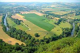
Saint-Omer is a commune in the Calvados department in the Normandy region in northwestern France.
Population
| Historical population | ||
|---|---|---|
| Year | Pop. | ±% |
| 1962 | 188 | — |
| 1968 | 182 | −3.2% |
| 1975 | 184 | +1.1% |
| 1982 | 162 | −12.0% |
| 1990 | 142 | −12.3% |
| 1999 | 157 | +10.6% |
| 2008 | 163 | +3.8% |
See also
References
| Wikimedia Commons has media related to Saint-Omer (Calvados). |
This article is issued from Wikipedia - version of the 3/16/2016. The text is available under the Creative Commons Attribution/Share Alike but additional terms may apply for the media files.