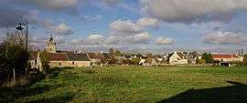
Urville, Calvados
| Urville | |
|---|---|
 | |
 Urville | |
|
Location within Normandy region  Urville | |
| Coordinates: 49°01′35″N 0°17′46″W / 49.0264°N 0.2961°WCoordinates: 49°01′35″N 0°17′46″W / 49.0264°N 0.2961°W | |
| Country | France |
| Region | Normandy |
| Department | Calvados |
| Arrondissement | Caen |
| Canton | Bretteville-sur-Laize |
| Government | |
| • Mayor (2008–2014) | Nicole Goubert |
| Area1 | 6.02 km2 (2.32 sq mi) |
| Population (2008)2 | 465 |
| • Density | 77/km2 (200/sq mi) |
| Time zone | CET (UTC+1) |
| • Summer (DST) | CEST (UTC+2) |
| INSEE/Postal code | 14719 / 14190 |
| Elevation |
66–136 m (217–446 ft) (avg. 100 m or 330 ft) |
|
1 French Land Register data, which excludes lakes, ponds, glaciers > 1 km² (0.386 sq mi or 247 acres) and river estuaries. 2 Population without double counting: residents of multiple communes (e.g., students and military personnel) only counted once. | |
Urville is a commune in the Calvados department in the Normandy region in northwestern France.
Iron mining was an important industry in the village until 1989.[1] The village was at the head of a mineral railway linking the iron mines to the SMN steel mills.[1]
Population
| Historical population | ||
|---|---|---|
| Year | Pop. | ±% |
| 1962 | 470 | — |
| 1968 | 484 | +3.0% |
| 1975 | 501 | +3.5% |
| 1982 | 543 | +8.4% |
| 1990 | 519 | −4.4% |
| 1999 | 478 | −7.9% |
| 2008 | 465 | −2.7% |
See also
References
| Wikimedia Commons has media related to Urville (Calvados). |
This article is issued from Wikipedia - version of the 3/16/2016. The text is available under the Creative Commons Attribution/Share Alike but additional terms may apply for the media files.