Grandcamp-Maisy
| Grandcamp-Maisy | ||
|---|---|---|
 | ||
| ||
 Grandcamp-Maisy | ||
|
Location within Normandy region  Grandcamp-Maisy | ||
| Coordinates: 49°23′N 1°02′W / 49.39°N 1.04°WCoordinates: 49°23′N 1°02′W / 49.39°N 1.04°W | ||
| Country | France | |
| Region | Normandy | |
| Department | Calvados | |
| Arrondissement | Bayeux | |
| Canton | Isigny-sur-Mer | |
| Government | ||
| • Mayor (2008–2014) | Serge Bigot | |
| Area1 | 14.85 km2 (5.73 sq mi) | |
| Population (2008)2 | 1,775 | |
| • Density | 120/km2 (310/sq mi) | |
| Time zone | CET (UTC+1) | |
| • Summer (DST) | CEST (UTC+2) | |
| INSEE/Postal code | 14312 / 14450 | |
| Elevation |
0–34 m (0–112 ft) (avg. 50 m or 160 ft) | |
|
1 French Land Register data, which excludes lakes, ponds, glaciers > 1 km² (0.386 sq mi or 247 acres) and river estuaries. 2 Population without double counting: residents of multiple communes (e.g., students and military personnel) only counted once. | ||

Grandcamp-Maisy is a commune in the Calvados department in the Normandy region in northwestern France.
Geography
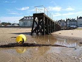
Grandcamp-Maisy is located on the coast, 9 kilometres (5.6 mi) north east of Isigny-sur-Mer and 4 kilometres (2.5 mi) west of Pointe du Hoc. It is an active fishing port, with a fish market located on the harbour side.
History
On 1 November 1972, the commune formerly known as Grandcamp-les-Bains amalgamated with Maisy (Its old INSEE code was 14392) and changed its name to Grandcamp-Maisy.
In 1944 the town of Maisy was the site of a German heavy artillery battery and the headquarters for the sector. Until recently, the site was overgrown and had been covered by US engineers before the end of 1944 - well before any historians had a chance to examine the site. British military historian Gary Sterne rediscovered the site after finding[1] an American invasion map, and has purchased the site and turned it into a museum with over 2 1⁄2 miles of original German trenches and bunkers. From his research and newly released (previously top secret papers), it is obvious that the site is many times larger than was originally thought. The labyrinth of trenches and tunnels had remained hidden for around 60 years. It contains office bunkers, supplies buildings, general quarters, radio rooms, and many other blocks, including an underground hospital (one of three which has been uncovered and can be visited).
It may well be that when all the site is cleared and all the bunkers that are buried are rediscovered, this site will be one of the largest on the Atlantic Wall in the invasion area. The sheer size of the site poses many questions as to why it does not feature more prominently in allied records - or why it was so well camouflaged - equally why the site did not have more attention paid to it by the Allies.
It was bombed, but not hit to any extent before D-Day. On the morning of the 6 June 1944, the HMS Hawkins claimed to have put the guns out of action, but Maisy was hit with shells for a further three days by many navy ships. The three casemates on the left side of the site (La Martiniere) show no sign of damage from the front, only superficial damage from the east when the Rangers attacked across the fields on foot. This was the direction from which the battery was attacked by the men of the 5th Rangers on the morning of June 9 - along with halftracks from the 2nd Btn. Despite this, in the Royal Navy History of D-day it states that HMS Hawkins silenced the battery on D-day, despite the fact that many other ships claimed to have done the same thing over many days. Hawkins also claimed to have put the battery at St. Martin de Varreville out of action, it is a well-known fact that the guns were not there on the morning of D-Day and had been moved further north. The town became the headquarters of General Bradley after it was liberated on June 9.[2]
The site has been excavated and was opened as a museum in April 2007.[3]
Population
| Historical population | ||
|---|---|---|
| Year | Pop. | ±% |
| 1793 | 533 | — |
| 1800 | 627 | +17.6% |
| 1806 | 673 | +7.3% |
| 1821 | 777 | +15.5% |
| 1831 | 1,258 | +61.9% |
| 1836 | 1,260 | +0.2% |
| 1841 | 1,264 | +0.3% |
| 1846 | 1,310 | +3.6% |
| 1851 | 1,436 | +9.6% |
| 1856 | 1,463 | +1.9% |
| 1861 | 1,529 | +4.5% |
| 1866 | 1,613 | +5.5% |
| 1872 | 1,624 | +0.7% |
| 1876 | 1,691 | +4.1% |
| 1881 | 1,704 | +0.8% |
| 1886 | 1,731 | +1.6% |
| 1891 | 1,868 | +7.9% |
| 1896 | 1,847 | −1.1% |
| 1901 | 1,839 | −0.4% |
| 1906 | 1,844 | +0.3% |
| 1911 | 1,774 | −3.8% |
| 1921 | 1,615 | −9.0% |
| 1926 | 1,604 | −0.7% |
| 1931 | 1,621 | +1.1% |
| 1936 | 1,598 | −1.4% |
| 1946 | 1,632 | +2.1% |
| 1954 | 1,576 | −3.4% |
| 1962 | 1,932 | +22.6% |
| 1968 | 1,880 | −2.7% |
| 1975 | 1,809 | −3.8% |
| 1982 | 1,845 | +2.0% |
| 1990 | 1,881 | +2.0% |
| 1999 | 1,831 | −2.7% |
| 2008 | 1,775 | −3.1% |
See also
References
- ↑ Adams, Stephen (4 January 2008). "Amateur historian unearths Nazi battery". telegraph.co.uk. London. Retrieved 6 June 2010.
- ↑ "The Atlantik Wall In Normandy : Grandcamp Maisy". atlantikwall.org.uk. Retrieved 6 June 2010.
- ↑ "Welcome to The Maisy Battery". maisybattery.com. Retrieved 6 June 2010.
| Wikimedia Commons has media related to Grandcamp-Maisy. |