Putot-en-Auge
| Putot-en-Auge | |
|---|---|
 | |
 Putot-en-Auge | |
|
Location within Normandy region  Putot-en-Auge | |
| Coordinates: 49°13′06″N 0°04′02″W / 49.2183°N 0.0672°WCoordinates: 49°13′06″N 0°04′02″W / 49.2183°N 0.0672°W | |
| Country | France |
| Region | Normandy |
| Department | Calvados |
| Arrondissement | Lisieux |
| Canton | Dozulé |
| Intercommunality | Pays d'Auge dozuléen |
| Government | |
| • Mayor (2008–2014) | Alain Asmant |
| Area1 | 6.58 km2 (2.54 sq mi) |
| Population (2008)2 | 286 |
| • Density | 43/km2 (110/sq mi) |
| Time zone | CET (UTC+1) |
| • Summer (DST) | CEST (UTC+2) |
| INSEE/Postal code | 14524 / 14430 |
| Elevation |
3–139 m (9.8–456.0 ft) (avg. 30 m or 98 ft) |
|
1 French Land Register data, which excludes lakes, ponds, glaciers > 1 km² (0.386 sq mi or 247 acres) and river estuaries. 2 Population without double counting: residents of multiple communes (e.g., students and military personnel) only counted once. | |
Putot-en-Auge is a commune in the Calvados department in the Normandy region in northwestern France.
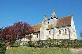
On the hill to the east of Putot a vicious battle was fought on August 19, 1944. The Allied casualties lie in the small churchyard of Putot-en-Auge.
The village features heavily in the book "13 - Lucky For Some" which is about the history of the 13th (Lancashire) Parachute Battalion. There are many then and now photographs as well as maps and diagrams of battles that took place in the region.
Population
| Historical population | ||
|---|---|---|
| Year | Pop. | ±% |
| 1962 | 208 | — |
| 1968 | 202 | −2.9% |
| 1975 | 304 | +50.5% |
| 1982 | 344 | +13.2% |
| 1990 | 352 | +2.3% |
| 1999 | 330 | −6.2% |
| 2008 | 286 | −13.3% |
See also
References
| Wikimedia Commons has media related to Putot-en-Auge. |
This article is issued from Wikipedia - version of the 3/16/2016. The text is available under the Creative Commons Attribution/Share Alike but additional terms may apply for the media files.