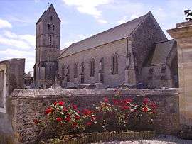
Longueville, Calvados
| Longueville | |
|---|---|
 | |
 Longueville | |
|
Location within Normandy region  Longueville | |
| Coordinates: 49°20′27″N 0°57′31″W / 49.3408°N 0.9586°WCoordinates: 49°20′27″N 0°57′31″W / 49.3408°N 0.9586°W | |
| Country | France |
| Region | Normandy |
| Department | Calvados |
| Arrondissement | Bayeux |
| Canton | Isigny-sur-Mer |
| Intercommunality | Isigny Grandcamp Intercom |
| Government | |
| • Mayor (2008–2014) | Benoît Chatel |
| Area1 | 6.54 km2 (2.53 sq mi) |
| Population (2008)2 | 256 |
| • Density | 39/km2 (100/sq mi) |
| Time zone | CET (UTC+1) |
| • Summer (DST) | CEST (UTC+2) |
| INSEE/Postal code | 14378 / 14230 |
| Elevation | 0–50 m (0–164 ft) |
|
1 French Land Register data, which excludes lakes, ponds, glaciers > 1 km² (0.386 sq mi or 247 acres) and river estuaries. 2 Population without double counting: residents of multiple communes (e.g., students and military personnel) only counted once. | |
Longueville is a commune in the Calvados department in the Normandy region in northwestern France.
Population
| Historical population | ||
|---|---|---|
| Year | Pop. | ±% |
| 1962 | 370 | — |
| 1968 | 308 | −16.8% |
| 1975 | 272 | −11.7% |
| 1982 | 251 | −7.7% |
| 1990 | 239 | −4.8% |
| 1999 | 237 | −0.8% |
| 2008 | 256 | +8.0% |
See also
References
| Wikimedia Commons has media related to Longueville (Calvados). |
This article is issued from Wikipedia - version of the 3/16/2016. The text is available under the Creative Commons Attribution/Share Alike but additional terms may apply for the media files.