Concordia, Missouri
| Concordia, Missouri | |
|---|---|
| City | |
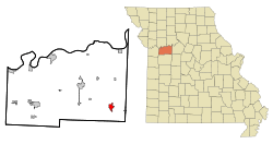 Location of Concordia, Missouri | |
| Coordinates: 38°59′2″N 93°34′8″W / 38.98389°N 93.56889°WCoordinates: 38°59′2″N 93°34′8″W / 38.98389°N 93.56889°W | |
| Country | United States |
| State | Missouri |
| County | Lafayette |
| Area[1] | |
| • Total | 1.79 sq mi (4.64 km2) |
| • Land | 1.78 sq mi (4.61 km2) |
| • Water | 0.01 sq mi (0.03 km2) |
| Elevation | 791 ft (241 m) |
| Population (2010)[2] | |
| • Total | 2,450 |
| • Estimate (2012[3]) | 2,417 |
| • Density | 1,376.4/sq mi (531.4/km2) |
| Time zone | Central (CST) (UTC-6) |
| • Summer (DST) | CDT (UTC-5) |
| ZIP code | 64020 |
| Area code(s) | 660 |
| FIPS code | 29-16102[4] |
| GNIS feature ID | 0716186[5] |
Concordia is a city in Lafayette County, Missouri, United States. The population was 2,450 at the 2010 census.
History
Concordia was platted in 1868.[6] The city was named after a place mentioned in the poem Das Lied der Glocke by Friedrich Schiller.[7] A post office called Concordia has been in operation since 1865.[8]
Geography
Concordia is located at 38°59′2″N 93°34′8″W / 38.98389°N 93.56889°W (38.983927, -93.568776).[9] According to the United States Census Bureau, the city has a total area of 1.79 square miles (4.64 km2), of which, 1.78 square miles (4.61 km2) is land and 0.01 square miles (0.03 km2) is water.[1]
Demographics
| Historical population | |||
|---|---|---|---|
| Census | Pop. | %± | |
| 1880 | 391 | — | |
| 1890 | 715 | 82.9% | |
| 1900 | 889 | 24.3% | |
| 1910 | 931 | 4.7% | |
| 1920 | 962 | 3.3% | |
| 1930 | 1,140 | 18.5% | |
| 1940 | 1,077 | −5.5% | |
| 1950 | 1,218 | 13.1% | |
| 1960 | 1,471 | 20.8% | |
| 1970 | 1,854 | 26.0% | |
| 1980 | 2,129 | 14.8% | |
| 1990 | 2,160 | 1.5% | |
| 2000 | 2,360 | 9.3% | |
| 2010 | 2,450 | 3.8% | |
| Est. 2015 | 2,390 | [10] | −2.4% |
2010 census
As of the census[2] of 2010, there were 2,450 people, 1,002 households, and 645 families residing in the city. The population density was 1,376.4 inhabitants per square mile (531.4/km2). There were 1,131 housing units at an average density of 635.4 per square mile (245.3/km2). The racial makeup of the city was 97.7% White, 0.2% African American, 0.2% Native American, 0.2% Asian, 0.1% Pacific Islander, 0.4% from other races, and 1.1% from two or more races. Hispanic or Latino of any race were 2.1% of the population.
There were 1,002 households of which 32.4% had children under the age of 18 living with them, 49.1% were married couples living together, 11.7% had a female householder with no husband present, 3.6% had a male householder with no wife present, and 35.6% were non-families. 30.7% of all households were made up of individuals and 18.8% had someone living alone who was 65 years of age or older. The average household size was 2.37 and the average family size was 2.94.
The median age in the city was 40.2 years. 25.3% of residents were under the age of 18; 6.9% were between the ages of 18 and 24; 22.9% were from 25 to 44; 22.4% were from 45 to 64; and 22.7% were 65 years of age or older. The gender makeup of the city was 46.0% male and 54.0% female.
2000 census
As of the census[4] of 2000, there were 2,360 people, 929 households, and 614 families residing in the city. The population density was 1,404.0 people per square mile (542.4/km²). There were 1,006 housing units at an average density of 598.5 per square mile (231.2/km²). The racial makeup of the city was 98.56% White, 0.42% African American, 0.04% Native American, 0.17% Asian, and 0.81% from two or more races. Hispanic or Latino of any race were 0.72% of the population.
There were 929 households out of which 29.3% had children under the age of 18 living with them, 54.6% were married couples living together, 9.3% had a female householder with no husband present, and 33.8% were non-families. 31.1% of all households were made up of individuals and 16.4% had someone living alone who was 65 years of age or older. The average household size was 2.38 and the average family size was 2.98.
In the city the population was spread out with 23.5% under the age of 18, 7.7% from 18 to 24, 25.4% from 25 to 44, 18.8% from 45 to 64, and 24.7% who were 65 years of age or older. The median age was 40 years. For every 100 females there were 82.2 males. For every 100 females age 18 and over, there were 76.4 males.
The median income for a household in the city was $33,906, and the median income for a family was $43,605. Males had a median income of $30,302 versus $20,068 for females. The per capita income for the city was $16,813. About 8.0% of families and 10.0% of the population were below the poverty line, including 14.6% of those under age 18 and 8.1% of those age 65 or over.
Trivia
- Concordia, Kansas is named after Concordia, Missouri.
This city contains St. Paul Lutheran High School—the only residential high school affiliated with the Lutheran Church-Missouri Synod in the United States . This city has an annual Fall Festival the First weekend after Labor Day, with the CCC Parade (Concordia Comical Crew) held on Friday night.
Notable natives
- Kathryn Kuhlman (9 May 1907 - 20 February 1976), Bible teacher and evangelist
References
- 1 2 "US Gazetteer files 2010". United States Census Bureau. Archived from the original on 2012-07-14. Retrieved 2012-07-08.
- 1 2 "American FactFinder". United States Census Bureau. Retrieved 2012-07-08.
- ↑ "Population Estimates". United States Census Bureau. Archived from the original on 2013-06-17. Retrieved 2013-05-30.
- 1 2 "American FactFinder". United States Census Bureau. Archived from the original on 2013-09-11. Retrieved 2008-01-31.
- ↑ "US Board on Geographic Names". United States Geological Survey. 2007-10-25. Retrieved 2008-01-31.
- ↑ Eaton, David Wolfe (1916). How Missouri Counties, Towns and Streams Were Named. The State Historical Society of Missouri. p. 183.
- ↑ "Lafayette County Place Names, 1928–1945 (archived)". The State Historical Society of Missouri. Archived from the original on 24 June 2016. Retrieved 24 October 2016.
- ↑ "Post Offices". Jim Forte Postal History. Retrieved 24 October 2016.
- ↑ "US Gazetteer files: 2010, 2000, and 1990". United States Census Bureau. 2011-02-12. Retrieved 2011-04-23.
- ↑ "Annual Estimates of the Resident Population for Incorporated Places: April 1, 2010 to July 1, 2015". Retrieved July 2, 2016.
- ↑ "Census of Population and Housing". Census.gov. Archived from the original on May 11, 2015. Retrieved June 4, 2015.
External links
- Historic maps of Concordia in the Sanborn Maps of Missouri Collection at the University of Missouri
Municipalities and communities of Lafayette County, Missouri, United States | ||
|---|---|---|
| Cities | 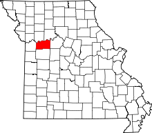 | |
| Villages | ||
| Townships | ||
| Unincorporated communities | ||
| Ghost towns | ||
| Footnotes | ‡This populated place also has portions in an adjacent county or counties | |