Napoleon, Missouri
| Napoleon, Missouri | |
|---|---|
| City | |
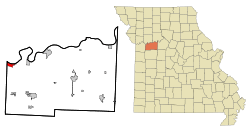 Location of Napoleon, Missouri | |
| Coordinates: 39°7′47″N 94°4′20″W / 39.12972°N 94.07222°WCoordinates: 39°7′47″N 94°4′20″W / 39.12972°N 94.07222°W | |
| Country | United States |
| State | Missouri |
| County | Lafayette |
| Area[1] | |
| • Total | 1.75 sq mi (4.53 km2) |
| • Land | 1.75 sq mi (4.53 km2) |
| • Water | 0 sq mi (0 km2) |
| Elevation | 748 ft (228 m) |
| Population (2010)[2] | |
| • Total | 222 |
| • Estimate (2012[3]) | 220 |
| • Density | 126.9/sq mi (49.0/km2) |
| Time zone | Central (CST) (UTC-6) |
| • Summer (DST) | CDT (UTC-5) |
| ZIP code | 64074 |
| Area code(s) | 816 |
| FIPS code | 29-51140[4] |
| GNIS feature ID | 0723115[5] |
Napoleon is a city in Lafayette County, Missouri, United States. It is located approximately 30 miles east of Kansas City. The population was 222 at the 2010 census.
History
Napoleon was laid out in 1836, and most likely was named after Napoleon Bonaparte.[6] A post office has been in operation at Napoleon since 1858.[7]
In November 2013, Leland Ray Kolkmeyer plead guilty, in federal court, of a fraud scheme in which he embezzled more than $1.5 million from Wellington-Napoleon Fire Protection District and Special Road District while being their former treasurer.[8][9][10]
Geography
Napoleon is located at 39°7′47″N 94°4′20″W / 39.12972°N 94.07222°W (39.129800, -94.072099).[11] According to the United States Census Bureau, the city has a total area of 1.75 square miles (4.53 km2), all of it land.[1]
Napoleon lies just a few miles west of Wellington, Missouri; the two towns having been named after the commanders at the Battle of Waterloo. About halfway between the two towns lies a small, unincorporated crossroads called "Waterloo".
Napoleon, Missouri is located in the northwestern corner of Lafayette County, Missouri and bordered on the north side by the Missouri River and on the south side by U.S. Hwy 24 and on the west side by Jackson County, Missouri. It is about 40 miles east of the Kansas/Missouri line on the south side of the Missouri River and about 6 miles east of the Independence city limits as of this writing. The town measures about 2 & ½ miles east to west and about one mile north to south at its widest point.
Demographics
| Historical population | |||
|---|---|---|---|
| Census | Pop. | %± | |
| 1890 | 106 | — | |
| 1900 | 132 | 24.5% | |
| 1910 | 146 | 10.6% | |
| 1920 | 156 | 6.8% | |
| 1930 | 131 | −16.0% | |
| 1940 | 132 | 0.8% | |
| 1950 | 143 | 8.3% | |
| 1960 | 215 | 50.3% | |
| 1970 | 263 | 22.3% | |
| 1980 | 271 | 3.0% | |
| 1990 | 233 | −14.0% | |
| 2000 | 208 | −10.7% | |
| 2010 | 222 | 6.7% | |
| Est. 2015 | 218 | [12] | −1.8% |
2010 census
As of the census[2] of 2010, there were 222 people, 85 households, and 69 families residing in the city. The population density was 126.9 inhabitants per square mile (49.0/km2). There were 98 housing units at an average density of 56.0 per square mile (21.6/km2). The racial makeup of the city was 99.1% White and 0.9% from two or more races. Hispanic or Latino of any race were 0.5% of the population.
There were 85 households of which 29.4% had children under the age of 18 living with them, 65.9% were married couples living together, 11.8% had a female householder with no husband present, 3.5% had a male householder with no wife present, and 18.8% were non-families. 15.3% of all households were made up of individuals and 5.9% had someone living alone who was 65 years of age or older. The average household size was 2.61 and the average family size was 2.87.
The median age in the city was 43.8 years. 21.6% of residents were under the age of 18; 9.1% were between the ages of 18 and 24; 21.3% were from 25 to 44; 35.2% were from 45 to 64; and 13.1% were 65 years of age or older. The gender makeup of the city was 49.1% male and 50.9% female.
2000 census
As of the census[4] of 2000, there were 208 people, 86 households, and 63 families residing in the city. The population density was 119.3 people per square mile (46.2/km²). There were 99 housing units at an average density of 56.8 per square mile (22.0/km²). The racial makeup of the city was 94.71% White, 1.92% African American, 0.48% Asian, and 2.88% from two or more races.
There were 86 households out of which 24.4% had children under the age of 18 living with them, 65.1% were married couples living together, 7.0% had a female householder with no husband present, and 25.6% were non-families. 22.1% of all households were made up of individuals and 8.1% had someone living alone who was 65 years of age or older. The average household size was 2.42 and the average family size was 2.80.
In the city the population was spread out with 19.7% under the age of 18, 11.5% from 18 to 24, 22.6% from 25 to 44, 32.7% from 45 to 64, and 13.5% who were 65 years of age or older. The median age was 42 years. For every 100 females there were 121.3 males. For every 100 females age 18 and over, there were 114.1 males.
The median income for a household in the city was $36,875, and the median income for a family was $45,625. Males had a median income of $36,042 versus $23,036 for females. The per capita income for the city was $17,546. About 9.0% of families and 7.6% of the population were below the poverty line, including 16.2% of those under the age of eighteen and none of those sixty five or over.
References
- 1 2 "US Gazetteer files 2010". United States Census Bureau. Retrieved 2012-07-08.
- 1 2 "American FactFinder". United States Census Bureau. Retrieved 2012-07-08.
- ↑ "Population Estimates". United States Census Bureau. Retrieved 2013-05-30.
- 1 2 "American FactFinder". United States Census Bureau. Retrieved 2008-01-31.
- ↑ "US Board on Geographic Names". United States Geological Survey. 2007-10-25. Retrieved 2008-01-31.
- ↑ "Lafayette County Place Names, 1928–1945 (archived)". The State Historical Society of Missouri. Retrieved 25 October 2016.
- ↑ "Post Offices". Jim Forte Postal History. Retrieved 25 October 2016.
- ↑ Public servant steals $1.5 million from two tiny towns in Missouri; The Kansas City Star; November 22, 2013.
- ↑ Treasurer admits to embezzling over $1 million from small towns’ funds; Fox4KC; November 22, 2013.
- ↑ Treasurer for road district and fire district pleads guilty to embezzling $1.5 million; justice.gov; November 20, 2013.
- ↑ "US Gazetteer files: 2010, 2000, and 1990". United States Census Bureau. 2011-02-12. Retrieved 2011-04-23.
- ↑ "Annual Estimates of the Resident Population for Incorporated Places: April 1, 2010 to July 1, 2015". Retrieved July 2, 2016.
- ↑ "Census of Population and Housing". Census.gov. Retrieved June 4, 2015.
Municipalities and communities of Lafayette County, Missouri, United States | ||
|---|---|---|
| Cities | 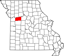 | |
| Villages | ||
| Townships | ||
| Unincorporated communities | ||
| Ghost towns | ||
| Footnotes | ‡This populated place also has portions in an adjacent county or counties | |