Clearfield County, Pennsylvania
| Clearfield County, Pennsylvania | |
|---|---|
|
| |
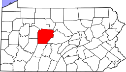 Location in the U.S. state of Pennsylvania | |
 Pennsylvania's location in the U.S. | |
| Founded | January 29, 1822 |
| Seat | Clearfield |
| Largest city | DuBois |
| Area | |
| • Total | 1,154 sq mi (2,989 km2) |
| • Land | 1,145 sq mi (2,966 km2) |
| Population (est.) | |
| • (2015) | 80,994 |
| • Density | 71/sq mi (27/km²) |
| Congressional district | 5th |
| Time zone | Eastern: UTC-5/-4 |
| Website |
www |
|
Footnotes: | |
| Designated | September 17, 1982[1] |
Clearfield County is a sixth-class county located in the U.S. state of Pennsylvania. As of the 2010 census, the population was 81,642.[2] The county seat is Clearfield,[3] and the largest city is DuBois. The county was created in 1804 and later organized in 1822.[4]
Clearfield County comprises the DuBois, PA Micropolitan Statistical Area, which is also included in the State College-DuBois, PA Combined Statistical Area.
History
Clearfield County was formed by the Act of Assembly by the second Governor of Pennsylvania at the time, Thomas McKean on March 26, 1804. The county was created from parts of the already created counties of Huntingdon and Lycoming. The name for the county was most likely derived from the many cleared fields of the valleys surrounding Clearfield Creek and West Branch of the Susquehanna River, formed by the bison herds and also by old corn fields of prior Native Americans tribes.
Location of county government
The first board of county commissioners to the county were Roland Curtin, James Fleming and James Smith, all appointed by Governor McKean in 1805. The first act the commissioners did was to create a local government or seat of the newly created county. They came upon land owned at the time by Abraham Witmer at a village known as Chincleclamousche, named after the Native American chief of the Cornplanter's tribe of Senecas. Clearfield became the new name of the old village.
Early industry
The two major industries of the county in the mid-1800s until the early 1900s was lumber and coal. Lumber was still being floated down the West Branch of the Susquehanna up until 1917. Coal remains the main industry of the county to this day.
Geography
According to the U.S. Census Bureau, the county has a total area of 1,154 square miles (2,990 km2), of which 1,145 square miles (2,970 km2) is land and 9.2 square miles (24 km2) (0.8%) is water.[5] It is the third-largest county in Pennsylvania by land area and fourth-largest by total area. The West Branch Susquehanna River flows through the county bisecting the county seat along the way.
The mountainous terrain of the county made traffic difficult for early settlers. Various Native American paths and trails crossing the area were used intermittently by settlers, invading armies, and escaped slaves travelling north along the Underground Railroad. A major feature located in Bloom Township, Pennsylvania within the county is known as Bilger's rocks and exhibits fine examples of exposed sandstone bedrock that was created during the formation of the Appalachian Mountains.
Major highways
 PA 36
PA 36 PA 53
PA 53 I-80
I-80 US 119
 PA 153
 US 219
 PA 253
 PA 255
 PA 286
 US 322
 PA 410
 PA 453
 PA 729
 PA 830
 PA 865
 PA 879
 PA 969
 PA 970
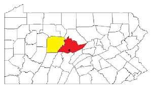
Adjacent counties
- Elk County (north)
- Cameron County (north)
- Clinton County (northeast)
- Centre County (east)
- Blair County (southeast)
- Cambria County (south)
- Indiana County (southwest)
- Jefferson County (west)
Demographics
| Historical population | |||
|---|---|---|---|
| Census | Pop. | %± | |
| 1810 | 875 | — | |
| 1820 | 2,342 | 167.7% | |
| 1830 | 4,803 | 105.1% | |
| 1840 | 7,834 | 63.1% | |
| 1850 | 12,586 | 60.7% | |
| 1860 | 18,759 | 49.0% | |
| 1870 | 25,741 | 37.2% | |
| 1880 | 43,408 | 68.6% | |
| 1890 | 69,565 | 60.3% | |
| 1900 | 80,614 | 15.9% | |
| 1910 | 93,768 | 16.3% | |
| 1920 | 103,236 | 10.1% | |
| 1930 | 86,727 | −16.0% | |
| 1940 | 92,094 | 6.2% | |
| 1950 | 85,957 | −6.7% | |
| 1960 | 81,534 | −5.1% | |
| 1970 | 74,619 | −8.5% | |
| 1980 | 83,578 | 12.0% | |
| 1990 | 78,097 | −6.6% | |
| 2000 | 83,380 | 6.8% | |
| 2010 | 81,642 | −2.1% | |
| Est. 2015 | 80,994 | [6] | −0.8% |
| U.S. Decennial Census[7] 1790-1960[8] 1900-1990[9] 1990-2000[10] 2010-2013[2] | |||
As of the census[11] of 2000, there were 83,382 people, 32,785 households, and 22,916 families residing in the county. The population density was 73 people per square mile (28/km2). There were 37,855 housing units at an average density of 33 per square mile (13/km2). The racial makeup of the county was 97.40% White, 1.49% Black or African American, 0.12% Native American, 0.26% Asian, 0.01% Pacific Islander, 0.26% from other races, and 0.46% from two or more races. 0.56% of the population were Hispanic or Latino of any race. 22.9% were of German, 13.6% American, 10.2% English, 9.9% Irish, 9.1% Italian and 6.0% Polish ancestry according to Census 2000.
There were 32,785 households out of which 29.70% had children under the age of 18 living with them, 56.60% were married couples living together, 9.30% had a female householder with no husband present, and 30.10% were non-families. 26.30% of all households were made up of individuals and 13.10% had someone living alone who was 65 years of age or older. The average household size was 2.44 and the average family size was 2.94.
In the county, the population was spread out with 22.70% under the age of 18, 7.70% from 18 to 24, 28.80% from 25 to 44, 23.90% from 45 to 64, and 16.90% who were 65 years of age or older. The median age was 39 years. For every 100 females there were 99.50 males. For every 100 females age 18 and over, there were 97.50 males.
Micropolitan Statistical Area
The United States Office of Management and Budget[12] has designated Clearfield County as the DuBois, PA Micropolitan Statistical Area (µSA). As of the 2010 U.S. Census[13] the micropolitan area ranked 6th most populous in the State of Pennsylvania and the 64th most populous in the United States with a population of 81,642. Clearfield County is also a part of the State College-DuBois, PA Combined Statistical Area (CSA), which combines the populations of both Clearfield and Centre County areas, as well as the State College area. The Combined Statistical Area ranked 9th in the State of Pennsylvania and 123rd most populous in the United States with a population of 235,632.
Politics and government
As of October 2014, there are 50,846 registered voters in Clearfield County.[14]
- Democratic: 21,565 (42.41%)
- Republican: 23,497 (46.21%)
- Libertarian: 272 (0.53%)
- No Party Affiliation: 2,492 (4.90%)
- Other parties: 3,020 (5.94%)
While the county registration tends to be evenly matched between Democrats and Republicans, the county trends Republican in statewide elections. In 2006, Democrat Bob Casey Jr. received 55% of its vote when he unseated incumbent Republican US Senator Rick Santorum and Ed Rendell received 50.2% of the vote against Lynn Swann. Each of the three row-office statewide winners carried Clearfield in 2008.
County commissioners
- John Sobel, Republican
- Tony Scotto, Republican
- Mark McCracken, Democrat
Other county offices
- Clerk of Courts and Prothonotary, Brian K. Spencer, Republican
- Controller, Antonio Scotto, Republican
- Coroner, J. Michael Morris, Republican
- District Attorney, William A. Shaw Jr., Democrat
- Register of Wills and Recorder of Deeds, Maurene Inlow, Republican
- Sheriff, Wesley Thurston, Republican
- Treasurer, Carol Fox, Democrat
State Senate
| District | Senator | Party |
|---|---|---|
| 25 | Joseph B. Scarnati | Republican |
| 35 | John N. Wozniak | Democrat |
| 41 | Donald C. White | Republican |
State House of Representatives
| District | Representative | Party |
|---|---|---|
| 73 | Tommy Sankey | Republican |
| 75 | Matt Gabler | Republican |
United States House of Representatives
| District | Representative | Party |
|---|---|---|
| 5 | Glenn "G.T." Thompson | Republican |
United States Senate
| Senator | Party |
|---|---|
| Pat Toomey | Republican |
| Bob Casey | Democrat |
Correctional facilities
- Clearfield County Jail
- Quehanna Bootcamp
- SCI Houtzdale
- Moshannon Valley Correctional Center
Education
Colleges and universities
- Lock Haven University of Pennsylvania at Clearfield, Pennsylvania
- Pennsylvania State University at DuBois
Community, junior and technical colleges
- Clearfield County Career and Technology Center
- DuBois Business College, DuBois campus
- Triangle Tech
Public school districts
- Clearfield Area School District
- Curwensville Area School District
- DuBois Area School District (also in Jefferson County)
- Glendale School District (also in Cambria County)
- Harmony Area School District (also in Indiana County)
- Moshannon Valley School District
- Philipsburg-Osceola Area School District (also in Centre County)
- Purchase Line School District (also in Indiana County)
- West Branch Area School District (also in Clinton County)
Intermediate unit
- Central IU 10 - West Decatur
Correctional institution schools
- Quehanna Boot Camp - Karthaus
- SCI-Houtzdale - Houtzdale
Private schools
- Butchers Run Amish School
- Clearfield Alliance Christian School
- DuBois Area Catholic Elementary School
- DuBois Area Catholic High School
- DuBois Christian Schools
- Golden Yoke School
- Milestones Achievement Center
- Mount Calvary Christian Academy
- New Story (DuBois)
- Otterbein Christian Academy
- Paint & Play School (DuBois)
- Scenic View School
- St Francis Grade School
- Weber Road School
Libraries
- Clearfield County Public Library - Curwensville
- Curwensville Public Library
- DuBois Public Library -
- Glendale Public Library - Coalport
- Joseph and Elizabeth Shaw Public Library - Clearfield
Recreation
There are two Pennsylvania state parks in Clearfield County.
Clearfield County is also home to the largest wild area in Pennsylvania, the Quehanna Wild Area. A culturally and historically significant natural formation of massive sandstone megaliths can be found at Bilger's rocks.
Camping
Lodging/Camping[15]
| Campground # | Name | Location | Campsites | Swimming | Fishing | Hunting |
|---|---|---|---|---|---|---|
| 2515 | Woodland Campground | Woodland | 70 | yes | yes | yes |
Hunting/fishing
Hunting[16]
| SGL# | Location | Hunting Area | Acreage | Species |
|---|---|---|---|---|
| 34 | Medix Run | Benezette, Covington, Girard, Goshen Townships | 8,000 | bear, dear, turkey |
| 77 | Clear Run | Sandy Township | 3,038 | bear, dear, rabbit, squirrel |
| 78 | Bigler | Bradford & Graham Townships | 721 | bear, deer, turkey |
| 87 | Irishtown | Bell & Penn Townships | 10,422 | dear, grouse, turkey |
| 90 | Goshen | Goshen & Lawrence Townships | 3,958 | bear, deer, turkey |
| 93 | Sabula | Union & Huston Townships | 4,876 | bear, deer, turkey |
| 94 | Lecontes Mills | Goshen & Lawrence Townships | 2,108 | bear, deer, turkey |
| 98 | Blue Ball (West Decatur) | Boggs & Decatur Townships | 1,172 | dear, rabbit, turkey |
Fishing
Sporting
Golf
| Course # | Name | Location | Holes | Website |
|---|---|---|---|---|
| 3133 | Chetremon Golf Course | 2 miles north of Cherry Tree in Burnside Township Clearfield County | 10 | http://www.chetremon.com/ |
| 3274 | Grandview Golf Club | 1 mile south of Lumber City | 18 | http://www.golfnow.com/course-directory/pennsylvania-golf-courses/curwensville-golf-courses/grandview-golf-club |
Points of interest
- Bilger's Rocks
- Clearfield Armory
- Dimeling Hotel
- McGees Mills Covered Bridge
- St. Severin's Old Log Church
Communities
Under Pennsylvania law, there are four types of incorporated municipalities: cities, boroughs, townships, and, in at most two cases, towns. The following cities, boroughs and townships are located in Clearfield County:
City
Boroughs
Townships
Census-designated places
Census-designated places are geographical areas designated by the U.S. Census Bureau for the purposes of compiling demographic data. They are not actual jurisdictions under Pennsylvania law. Other unincorporated communities, such as villages, may be listed here as well.
Unincorporated communities
Unincorporated areas are region of land that are not parts of any incorporated boroughs, cities, or towns.
- Helvetia
- Lumber City
- New Castle (Clearfield County) – in Decatur Township[17]
- Sylvan Grove
Population ranking
The population ranking of the following table is based on the 2010 census of Clearfield County.[13]
† county seat
| Rank | City/Town/etc. | Population (2010 Census) | Municipal type | Incorporated |
|---|---|---|---|---|
| 1 | DuBois | 7,794 | City | 1881 (borough) 1914 (city) |
| 2 | † Clearfield | 6,215 | Borough | 1840 |
| 3 | Treasure Lake | 3,861 | CDP | |
| 4 | Curwensville | 2,542 | Borough | 1851 |
| 5 | Sandy | 1,429 | CDP | |
| 6 | Hyde | 1,399 | CDP | |
| 7 | Osceola Mills | 1,141 | Borough | 1864 |
| 8 | Falls Creek (mostly in Jefferson County) | 1,037 | Borough | |
| 9 | Plymptonville | 981 | CDP | |
| 10 | Chester Hill | 883 | Borough | 1883 |
| 11 | Houtzdale | 797 | Borough | 1872 |
| 12 | Oklahoma | 782 | CDP | |
| 13 | Morrisdale | 754 | CDP | |
| 14 | Irvona | 647 | Borough | 1890 |
| 15 | Hawk Run | 534 | CDP | |
| 16 | West Decatur | 533 | CDP | |
| 17 | Coalport | 523 | Borough | 1883 |
| 18 | Grassflat | 511 | CDP | |
| 19 | Ramey | 451 | Borough | 1878 |
| 20 | Brisbin | 411 | Borough | 1883 |
| 21 | Bigler | 398 | CDP | |
| 22 | Westover | 390 | Borough | 1895 |
| 23 | Mahaffey | 368 | Borough | 1889 |
| 24 | Grampian | 356 | Borough | 1885 |
| 25 | Kylertown | 340 | CDP | |
| 26 | Wallaceton | 313 | Borough | 1873 |
| 27 | Allport | 264 | CDP | |
| 28 | Troutville | 243 | Borough | 1890 |
| 29 | Burnside | 234 | Borough | 1874 |
| 30 | Glen Hope | 142 | Borough | 1878 |
| 31 | Newburg | 92 | Borough | 1885 |
| 32 | New Washington | 59 | Borough | 1859 |
See also
- Interstate 80 in Pennsylvania#Highest Point on 80
- Indian old field
- National Register of Historic Places listings in Clearfield County, Pennsylvania
References
- ↑ "PHMC Historical Markers Search" (Searchable database). Pennsylvania Historical and Museum Commission. Commonwealth of Pennsylvania. Retrieved 2014-01-25.
- 1 2 "State & County QuickFacts". United States Census Bureau. Retrieved November 16, 2013.
- ↑ "Find a County". National Association of Counties. Archived from the original on 2011-05-31. Retrieved 2011-06-07.
- ↑ "Pennsylvania: Individual County Chronologies". Pennsylvania Atlas of Historical County Boundaries. The Newberry Library. 2008. Retrieved March 11, 2015.
- ↑ "2010 Census Gazetteer Files". United States Census Bureau. August 22, 2012. Retrieved March 6, 2015.
- ↑ "County Totals Dataset: Population, Population Change and Estimated Components of Population Change: April 1, 2010 to July 1, 2015". Retrieved July 2, 2016.
- ↑ "U.S. Decennial Census". United States Census Bureau. Archived from the original on May 11, 2015. Retrieved March 6, 2015.
- ↑ "Historical Census Browser". University of Virginia Library. Retrieved March 6, 2015.
- ↑ Forstall, Richard L., ed. (March 24, 1995). "Population of Counties by Decennial Census: 1900 to 1990". United States Census Bureau. Retrieved March 6, 2015.
- ↑ "Census 2000 PHC-T-4. Ranking Tables for Counties: 1990 and 2000" (PDF). United States Census Bureau. April 2, 2001. Retrieved March 6, 2015.
- ↑ "American FactFinder". United States Census Bureau. Archived from the original on 2013-09-11. Retrieved 2008-01-31.
- ↑ http://www.whitehouse.gov/omb
- 1 2 "Archived copy". Archived from the original on 2013-12-21. Retrieved 2013-02-10.
- ↑ http://www.dos.state.pa.us/portal/server.pt/community/voter_registration_statistics/12725
- ↑ http://www.visitclearfieldcounty.org/lodging/camp-sites/
- ↑ http://www.visitclearfieldcounty.org/outdoors/hunting-fishing/
- ↑ Hometown Locator: New Castle ( Clearfield Co., PA)
External links
| Wikimedia Commons has media related to Clearfield County, Pennsylvania. |
- History of Townships in Clearfield County, PA
- History of Clearfield County
- Clearfield County Fair
Municipalities and communities of Clearfield County, Pennsylvania, United States | ||
|---|---|---|
| City | ||
| Boroughs | ||
| Townships | ||
| CDPs | ||
| Unincorporated communities | ||
| Footnotes | ‡This populated place also has portions in an adjacent county or counties | |
Coordinates: 41°00′N 78°28′W / 41.00°N 78.47°W