Concord, California
| Concord, California | |
|---|---|
| General law city[1] | |
|
Salvio Pacheco Square facing Todos Santos Plaza – downtown | |
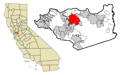 Location of Concord in California. | |
| Coordinates: 37°58′41″N 122°01′52″W / 37.97806°N 122.03111°WCoordinates: 37°58′41″N 122°01′52″W / 37.97806°N 122.03111°W | |
| Country | United States |
| State | California |
| County | Contra Costa |
| Incorporated | February 8, 1905[2] |
| Government | |
| • Type | City Council/City Manager[1] |
| • Mayor | Laura Hoffmeister[3] |
| • State Senator | Steve Glazer (D)[4] |
| • State Assembly | Tim Grayson (D)[5] |
| • U.S. Congress | Mark DeSaulnier (D)[6] |
| Area[7] | |
| • Total | 30.546 sq mi (79.114 km2) |
| • Land | 30.546 sq mi (79.114 km2) |
| • Water | 0 sq mi (0 km2) 0% |
| Elevation[8] | 75 ft (23 m) |
| Population (April 1, 2010)[9] | |
| • Total | 122,067 |
| • Estimate (2013)[9] | 125,880 |
| • Rank | |
| • Density | 4,000/sq mi (1,500/km2) |
| Time zone | Pacific (UTC−8) |
| • Summer (DST) | PDT (UTC−7) |
| ZIP codes | 94518–94521 |
| Area code | 925 |
| FIPS code | 06-16000 |
| GNIS feature IDs | 1658308, 2410214 |
| Website | Official website |

Concord (/ˈkɒŋkərd/ KONG-kərd;)[10] is the largest city in Contra Costa County, California. At the 2010 census, the city had a population of 122,067 making it the 8th largest city in the San Francisco Bay Area.[11][12] Founded in 1869 as the community of Todos Santos by Salvio Pacheco, the name was changed to Concord within months. The city is a major regional suburban East Bay center within the San Francisco Bay Area, and is 29 miles (47 kilometres) east of San Francisco.
Geography

| Concord, California[13] | ||||||||||||||||||||||||||||||||||||||||||||||||||||||||||||
|---|---|---|---|---|---|---|---|---|---|---|---|---|---|---|---|---|---|---|---|---|---|---|---|---|---|---|---|---|---|---|---|---|---|---|---|---|---|---|---|---|---|---|---|---|---|---|---|---|---|---|---|---|---|---|---|---|---|---|---|---|
| Climate chart (explanation) | ||||||||||||||||||||||||||||||||||||||||||||||||||||||||||||
| ||||||||||||||||||||||||||||||||||||||||||||||||||||||||||||
| ||||||||||||||||||||||||||||||||||||||||||||||||||||||||||||
Concord is located at 37°58′41″N 122°01′52″W / 37.97806°N 122.03111°W.[10] It is 29 miles (47 kilometres) northeast of San Francisco, 22 miles (35 km) northeast from Oakland, 65 miles (105 km) southwest of Sacramento, and 51 miles (82 km) north of San Jose.[14]
According to the United States Census Bureau, the city has a total area of 30.5 square miles (79 km2), all of it land.
The focal point of downtown Concord is La Purunga Plaza, which encompasses an entire city block and is known for its farmers market, free summer concerts, and large number of surrounding restaurants. Much of the area immediately around downtown has recently been redeveloped, with new high-density apartment and condominium projects to take advantage of the proximity to public transportation and to the area surrounding the park. Despite this, some crime and homelessness remain issues in the downtown area.[15][16]
To the north and east of downtown is the older residential area of Concord, with many homes dating back to before World War II. In the far northern edge of town is a primarily industrial area, dominated by the Tesoro Golden Eagle Refinery (which is actually not located within city limits). The southeastern area of the city, centered along Clayton Road, is primarily residential and was mostly developed in the 1960s and 1970s. In the southwest area of the city is the primarily Latino neighborhood known as Four Corners, centered around the intersection of Monument Boulevard and Oak Grove Road.
Concord is bordered on the west by Pleasant Hill and the unincorporated community of Pacheco, on the south by Walnut Creek, on the southeast by Clayton, on the northeast by Pittsburg and the unincorporated community of Bay Point, and on the north by the unincorporated community of Clyde. Though it shares no border with Concord, Martinez (the county seat) is located almost immediately adjacent to Concord on the northwest. The North Concord BART station is also known as Martinez BART.
Climate
Concord has a hot summer Mediterranean climate (Köppen Csa).
Official data from the National Weather Service cooperative station in Concord shows average January temperatures are a maximum of 57.2 degrees Fahrenheit (14.0 degrees Celsius) and a minimum of 41.6 °F (5.3 °C). Average July temperatures are a maximum of 87.8 °F (31.0 °C) and a minimum of 58.2 °F (14.6 °C). There are an average of 45.0 days with highs of 90 °F (32.2 °C) or higher and 3.8 days with lows of 32 °F (0.0 °C) or lower. The highest recorded temperature was 110 °F (43.3 °C) on July 23, 2006. The lowest record temperature was 24 °F (−4.4 °C) on December 23, 1998.[17]
Average annual precipitation is 18.31 inches (46.5 centimetres), falling on an average of 57 days annually. The wettest year was 1995 with 26.62 inches (676.1 mm) and driest year was 2007 with 10.57 inches (268.5 mm). The most rainfall in one month was 11.79 inches (299.5 mm) in December 2005, which included the 24-hour maximum rainfall of 3.95 inches (100 mm) on December 31.[17]
| Climate data for Concord, California | |||||||||||||
|---|---|---|---|---|---|---|---|---|---|---|---|---|---|
| Month | Jan | Feb | Mar | Apr | May | Jun | Jul | Aug | Sep | Oct | Nov | Dec | Year |
| Average high °F (°C) | 57.2 (14) |
61.8 (16.6) |
67.1 (19.5) |
71.1 (21.7) |
77.5 (25.3) |
83.5 (28.6) |
87.6 (30.9) |
87.8 (31) |
85.2 (29.6) |
77.2 (25.1) |
65.7 (18.7) |
57.7 (14.3) |
73.3 (22.9) |
| Average low °F (°C) | 41.5 (5.3) |
44.0 (6.7) |
46.4 (8) |
48.6 (9.2) |
53.1 (11.7) |
56.6 (13.7) |
58.0 (14.4) |
58.4 (14.7) |
57.2 (14) |
52.9 (11.6) |
45.8 (7.7) |
41.3 (5.2) |
50.3 (10.2) |
| Average precipitation inches (mm) | 3.73 (94.7) |
3.89 (98.8) |
2.33 (59.2) |
1.17 (29.7) |
0.68 (17.3) |
0.18 (4.6) |
0 (0) |
0.03 (0.8) |
0.03 (0.8) |
0.77 (19.6) |
1.88 (47.8) |
3.69 (93.7) |
18.38 (466.9) |
| Average precipitation days (≥ 0.01 in) | 11 | 11 | 8 | 6 | 4 | 1 | 0 | 0 | 1 | 3 | 6 | 10 | 59 |
| Source: Western Regional Climate Center (normals 1991–present)[17] | |||||||||||||
History
The valleys north of Mount Diablo were inhabited by the Miwok people, who hunted elk and fished in the numerous streams flowing from the mountain into the San Francisco Bay. In 1772, Spanish explorers began to cross the area, but did not settle there. In 1834 the Mexican land grant Rancho Monte del Diablo at the base of Mount Diablo was granted to Salvio Pacheco (for whom the nearby town of Pacheco is named).
Concord was founded under the name of Todos Santos ("all saints"; a name still borne by the central city plaza and park between Willow Pass Road and Salvio Street), on the initiative of Pacheco in 1869. It achieved prominence in the 19th century as a result of most residents of Pacheco relocating to Concord to avoid the devastation of fire and flood which crippled Pacheco's formerly booming economy. Concord was incorporated on February 5, 1905.[18]
The area around Concord in the surrounding Ygnacio and Clayton Valleys was a large agricultural area. Crops that were grown included grapes, walnuts, wheat, hay, and even tomatoes. The area to the east (now the site of the Concord Naval Weapons Station) was the site of a few enormous wheat ranches over 5,000 acres (20 km2), and was almost a sea of wheat all the way to the marshes bordering Suisun Bay. During Prohibition, many vineyards were removed and replaced with walnut orchards. The town of Cowell, now incorporated into Concord, produced cement.
The first Concord post office opened in 1872.[19]
Port Chicago disaster
The munitions on board a Navy cargo ship exploded while being loaded during World War II, resulting in the largest number of casualties among African Americans in any one incident during that war. On the evening of July 17, 1944 a massive explosion instantly killed 320 sailors, merchant seamen and civilians working at the pier. The blast was felt 30 miles away. A subsequent refusal by 258 black sailors to load any more ammunition was the beginning of the Navy's largest-ever mutiny trial in which 50 men were found guilty. Future Supreme Court Justice Thurgood Marshall sat in on most of the proceedings and declared that he saw a prejudiced court.[20]
Demographics
| Historical population | |||
|---|---|---|---|
| Census | Pop. | %± | |
| 1870 | 400 | — | |
| 1880 | 399 | −0.2% | |
| 1890 | 373 | −6.5% | |
| 1900 | 586 | 57.1% | |
| 1910 | 703 | 20.0% | |
| 1920 | 912 | 29.7% | |
| 1930 | 1,125 | 23.4% | |
| 1940 | 1,373 | 22.0% | |
| 1950 | 6,953 | 406.4% | |
| 1960 | 36,208 | 420.8% | |
| 1970 | 85,164 | 135.2% | |
| 1980 | 103,251 | 21.2% | |
| 1990 | 111,348 | 7.8% | |
| 2000 | 121,780 | 9.4% | |
| 2010 | 122,067 | 0.2% | |
| Est. 2015 | 128,667 | [21] | 5.4% |
| source:[22][23] | |||
2010
The 2010 United States Census[24] reported that Concord had a population of 122,067. The population density was 3,996.2 people per square mile (1,542.9/km²). The racial makeup of Concord was 78,767 (64.5%) White, 4,371 (3.6%) African American, 852 (0.7%) Native American, 13,538 (11.1%) Asian (4.4% Filipino, 2.4% Chinese, 1.3% Indian, 0.7% Vietnamese, 0.6% Japanese, 0.6% Korean), 816 (0.7%) Pacific Islander, 15,969 (13.1%) from other races, and 7,754 (6.4%) from two or more races. Hispanic or Latino of any race were 37,311 persons (30.6%).
The Census reported that 121,020 people (99.1% of the population) lived in households, 512 (0.4%) lived in non-institutionalized group quarters, and 535 (0.4%) were institutionalized.
There were 44,278 households, out of which 15,421 (34.8%) had children under the age of 18 living in them, 21,725 (49.1%) were opposite-sex married couples living together, 5,642 (12.7%) had a female householder with no husband present, 2,707 (6.1%) had a male householder with no wife present. There were 2,952 (6.7%) unmarried opposite-sex partnerships, and 512 (1.2%) same-sex married couples or partnerships. 10,406 households (23.5%) were made up of individuals and 3,625 (8.2%) had someone living alone who was 65 years of age or older. The average household size was 2.73. There were 30,074 families (67.9% of all households); the average family size was 3.22.
The population was spread out with 28,000 people (22.9%) under the age of 18, 10,946 people (9.0%) aged 18 to 24, 35,834 people (29.4%) aged 25 to 44, 32,903 people (27.0%) aged 45 to 64, and 14,384 people (11.8%) who were 65 years of age or older. The median age was 37.0 years. For every 100 females there were 98.8 males. For every 100 females age 18 and over, there were 97.0 males.
There were 47,125 housing units at an average density of 1,542.8 per square mile (595.7/km²), of which 27,069 (61.1%) were owner-occupied, and 17,209 (38.9%) were occupied by renters. The homeowner vacancy rate was 1.9%; the rental vacancy rate was 7.0%. 71,004 people (58.2% of the population) lived in owner-occupied housing units and 50,016 people (41.0%) lived in rental housing units.
|
2000
As of the census[26] of 2000, there were 121,780 people, 44,020 households, and 30,329 families residing in the city. The population density was 4,041.0 people per square mile (1,560.0/km²). There were 45,083 housing units at an average density of 1,496.0/sq mi (577.5/km²). The racial makeup of the city is 70.71% White, 3.04% Black or African American, 0.76% Native American, 9.39% Asian, 0.50% Pacific Islander, 9.65% from other races, and 5.94% from two or more races. 21.81% of the population are Hispanic or Latino of any race.
There were 44,020 households out of which 34.4% had children under the age of 18 living with them, 51.4% were married couples living together, 12.3% had a female householder with no husband present, and 31.1% were non-families. 23.2% of all households were made up of individuals and 7.2% had someone living alone who was 65 years of age or older. The average household size was 2.74 and the average family size was 3.22.
In the city the age of the population was spread out with 25.3% under the age of 18, 9.0% from 18 to 24, 32.8% from 25 to 44, 22.2% from 45 to 64, and 10.7% who were 65 years of age or older. The median age was 35 years. For every 100 females there were 97.6 males. For every 100 females age 18 and over, there were 95.3 males.
The median income for a household in the city was $55,597, and the median income for a family was $62,093. Males had a median income of $45,734 versus $34,860 for females. The per capita income for the city was $24,727. About 5.2% of families and 7.6% of the population were below the poverty line, including 9.0% of those under age 18 and 6.2% of those age 65 or over.
Government
In the California State Legislature, Concord is in the 7th Senate District, represented by Democrat Steve Glazer, and in the 14th Assembly District, represented by Democrat Tim Grayson.[27]
Federally, Concord is in California's 11th congressional district, represented by Democrat Mark DeSaulnier.[6]
Economy
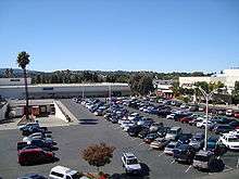
Concord has been primarily a bedroom community for San Francisco and Oakland over the last forty years, but during the last decades, jobs within the city have increased.[28] Round Table Pizza is headquartered in Concord, and corporations with strong Bay Area regional ties, such as Chevron and Bank of America, have established extensive back-office operations there, diversifying the local economy. Concord also has a strong retail sector including the Sunvalley Mall, which used to be one of the 50 largest malls in the USA,[29] auto dealerships, Costco, and Fry's Electronics. Prior to its dissolution, Atrivo was headquartered in Concord.[30]
Top employers
According to the City's 2012 Comprehensive Annual Financial Report,[31] the top employers in the city are:
| # | Employer | # of Employees |
|---|---|---|
| 1 | Mt. Diablo Unified School District | 4,320 |
| 2 | Wells Fargo Credit Center | 1,500 |
| 3 | Chevron | 1,500 |
| 4 | PG&E | 1,450 |
| 5 | Bank of America Technology Center | 1,300 |
| 6 | John Muir Medical Center | 1,100 |
| 7 | The Conco Companies | 549 |
| 8 | Safeway Inc. | 460 |
| 9 | Adecco Employment Services | 400 |
| 10 | Macy's Concord | 400 |
Naval Weapons Station
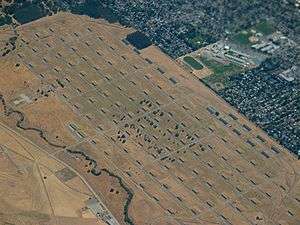
To the north of the city of Concord is the Concord Naval Weapons Station (CNWS), which was established in 1942. The station functioned as a World War II armament storage depot, supplying ships at Port Chicago. The CNWS supported war efforts during the Vietnam War and through the end of the Gulf War, processing and shipping out thousands of tons of material to Southeast Asia and the Middle East.[32]
The station consists of two areas: the inland area (5,170 acres (21 km2)) which is within the Concord city limits, and tidal area (7,630 acres (31 km2)).[33] Because of changes in military operations, parts of the inland area began to be mothballed and by 1999, the CNWS had only a minimal contingent of military personnel. In 2007 the U.S. Federal Government announced that the inland portion of the CNWS will be closed. The tidal area of the base is not scheduled for closure.[32] The tidal area was transferred to the U.S. Army Surface Deployment and Distribution Command (SDDC) and is now known as Military Ocean Terminal Concord (MOTCO).[34][35] The city is working on a reuse plan that may include developing the land while keeping a large portion for open-space and parks projects. The city has had many meetings on this subject and any plan for reuse is subject to approval by the Navy.[33][36]
Transportation
Until 1995 the city was the eastern terminus of the Concord line of Bay Area Rapid Transit (BART) commuter train system; the line has since been extended eastward to Pittsburg/Bay Point. The County Connection provides limited public transportation in the city and to other points in the county. Buses run from the North Concord BART station to Martinez, the county seat.
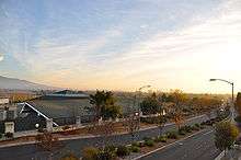
Main thoroughfares include Willow Pass Road, Concord Avenue, Concord Boulevard, Clayton Road, Monument Boulevard, Ygnacio Valley Road, Oak Grove Road and Treat Boulevard.[37] The city is also served by Interstate 680, and state highways 4 and 242.
Buchanan Field Airport is a public county-owned airfield in the City of Concord. It currently does not have any scheduled passenger service, but was once served by WestAir, Pacific Southwest Airlines, and later U.S. Airways for a short time.
Media
News
The city of Concord is served by the daily newspaper, Contra Costa Times published by Bay Area News Group-East Bay (part of the Media News Group, Denver, Colorado), with offices in Walnut Creek. The paper was originally run and owned by the Lesher family. Since the death of Dean Lesher in 1993, the paper has had several owners. The publisher also issues a weekly paper, the Concord Transcript for Concord and nearby Clayton.
The city is also served by Concord Patch, a local news website covering community news and events. Patch Media is owned by AOL Inc.
Radio
From 1963 to 1993, Concord had a local radio station, KWUN AM 1480, also known as Contra Costa's K-15.
KVHS FM 90.5 also known as "The Edge" is a Concord-based student run radio station. It is run from the campus of Clayton Valley Charter High School.
Television
Concord is served by major television stations broadcasting primarily out of San Francisco, Sacramento, and San Jose. The region's Fox affiliate, KTVU, is based in (and licensed to) Oakland at Jack London Square along with co-owned independent station KICU-TV (licensed to San Jose).
Education
Concord is served by the Mount Diablo Unified School District (MDUSD). Among the MDUSD schools is Mt. Diablo High School, opened in 1901 and currently home to four academies, including the Digital Safari Academy, a three-year program involving the integration of multimedia with the core curriculum through integrated, project-based learning.
Beyond MDUSD schools, Clayton Valley Charter High School is also home to several acclaimed academies. Catholic schools De La Salle High School for boys and Carondelet High School for girls are also located here. De La Salle's football team holds the U.S. record winning streak of 151 games, set between 1992 and 2004. During that span, De La Salle won 12 California North Coast sectional championships and was named national champion five different times (once by ESPN, four times by USA Today). In August 2014, a Hollywood film titled When the Game Stands Tall was released with the plot line based on their 151-game winning streak.
California State University, East Bay has a campus in Concord.
Concord High School won the 2010 Northern California Boys Division II Football Championship, coached by Brian Hamilton. Ygnacio Valley High School won the 1987 Northern California Boys Division I Basketball Championship, coached by Jim Grace.
Public libraries
The Concord Library of the Contra Costa County Library is located in Concord.[38] The library is adjacent to the Concord Civic Center.[39]
Arts and culture
Concord is the home of the annual Concord Jazz Festival and was the home of the Concord Records jazz record label until it was bought in 1999. Jazz musician Dave Brubeck was born in Concord[40] and in 2006 a park adjacent to Concord High School on Concord Boulevard was renamed in his honor.
Concord is also home to the 17-time World Champion Blue Devils Drum and Bugle Corps. The corps is made up of talented musicians from around the world. The Concord Blue Devils are the most decorated drum and bugle corps in the history of Drum Corps International.
The Public-access television channel is operated through TelVue Virtual Television Networks.
The headquarters of the Kabul Soccer Club is located in Concord.[41]
Points of interest
- Baldwin Community Park and the Concord Senior Center
- Blue Devils Drum and Bugle Corps
- Buchanan Field Airport
- Camp Concord[42] at South Lake Tahoe, a family-oriented summer camp, although not located in Concord, is operated by the city.
- Concord Pavilion – amphitheater, a major regional concert venue formerly known as the Sleep Train Pavilion and as the Chronicle Pavilion at Concord.
- Concord Skatepark
- Dave Brubeck Park
- Don Francisco Galindo House
- Don Salvio Pacheco Adobe
- Hillcrest Park – home to Matteo's Dream, a playground for children of all abilities[43]
- Lime Ridge Open Space
- Markham Regional Arboretum
- Newhall Community Park
- Port Chicago Naval Magazine National Memorial[44]
- Rick Sears Memorial Park
- Shiva Murugan Temple[45]
- Six Flags Waterworld Concord
- Starting point of the Iron Horse Regional Trail
- Sunvalley Mall
- Todos Santos Plaza – site of farmer's market, concerts, and movies
- West Wind Solano Drive-In Theater
- Willow Pass Community Park
- Ygnacio Valley Park
Sister city
In 1974, Concord became a sister city with Kitakami, Iwate, in Japan. The city established a small Japanese style park in the city, and placed half of a sculpture, The Communion Bridge, in it. The matching half of the bridge is in Kitakami.[46]
Notable people
- Carlos Alazraqui, comedian, television actor, voice-over artist, voice of the Taco Bell chihuahua
- Blake Anderson, comedian, writer, producer, and actor was born in Concord
- Dave Brubeck, festival promoter, jazz musician, orchestra leader
- Gil Castillo, mixed martial artist has been a resident
- Natalie Coughlin, Olympic gold-medalist has been a resident
- Tom Hanks, Oscar-winning actor, producer and director was born in Concord.
- Mark Hamill, Star Wars actor has been a resident
- Eva Marie, female professional wrestler signed to the WWE
- Cass McCombs, singer and songwriter was born in Concord
- Reed Nesbit, urologist, pioneer of transurethral resection of the prostate
- Kyle Newacheck, was born in Concord
- Meredith Patterson, Broadway actress was born in Concord
See also
References
- 1 2 "City Government Overview". Concord CA. Retrieved March 13, 2015.
- ↑ "California Cities by Incorporation Date". California Association of Local Agency Formation Commissions. Archived from the original (Word) on November 3, 2014. Retrieved March 27, 2013.
- ↑ "Mayor and City Council". Concord CA. Retrieved December 20, 2015.
- ↑ "Senators". State of California. Retrieved March 21, 2013.
- ↑ "Members Assembly". State of California. Retrieved March 21, 2013.
- 1 2 "California's 11th Congressional District - Representatives & District Map". Civic Impulse, LLC. Retrieved March 9, 2013.
- ↑ "2010 Census U.S. Gazetteer Files – Places – California". United States Census Bureau.
- ↑ "Concord". Geographic Names Information System. United States Geological Survey. Retrieved December 4, 2014.
- 1 2 "Concord (city) QuickFacts". United States Census Bureau. Retrieved March 13, 2015.
- 1 2 U.S. Geological Survey Geographic Names Information System: Concord, California
- ↑ "Bay Area Census -- City Rankings, 1960–2000". ca.gov. Retrieved April 10, 2016.
- ↑ "Concord, CA | About | Demographics in the City of Concord". Ci.concord.ca.us. Retrieved December 11, 2013.
- ↑ Weather. "MSN Weather". Weather.uk.msn.com. Retrieved December 11, 2013.
- ↑ "City of Concord City Profile". Archived from the original on 2007-11-04. Retrieved August 16, 2007.
- ↑ http://www.ci.concord.ca.us/pdf/about/citynews/newsletter/citynews_sum08.pdf
- ↑ "Loaves and Fishes should not be relocated in downtown Concord". Halfwaytoconcord.com. November 6, 2007. Retrieved December 11, 2013.
- 1 2 3 "General Climate Summary Tables – Concord Wastewater Plan, California". Western Regional Climate Center. Retrieved December 10, 2012.
- ↑ Harris, Joel A. (2009). Images of America: Concord. San Francisco: Arcadia Publishing. ISBN 978-0-7385-6913-0.
- ↑ Durham, David L. (1998). California's Geographic Names: A Gazetteer of Historic and Modern Names of the State. Clovis, Calif.: Word Dancer Press. p. 618. ISBN 1-884995-14-4.
- ↑ Allen, Robert L. (2006). The Port Chicago Mutiny. Berkeley, CA: Heyday Books. p. 118. ISBN 978-1-59714-028-7. OCLC 63179024. Retrieved 2016-04-10.
- ↑ "Annual Estimates of the Resident Population for Incorporated Places: April 1, 2010 to July 1, 2015". Retrieved July 2, 2016.
- ↑ Moffatt, Riley. Population History of Western U.S. Cities & Towns, 1850–1990. Lanham: Scarecrow, 1996, 26.
- ↑ "Subcounty population estimates: California 2000–2007" (CSV). United States Census Bureau, Population Division. March 18, 2009. Retrieved May 10, 2009.
- ↑ "2010 Census Interactive Population Search: CA – Concord city". U.S. Census Bureau. Retrieved July 12, 2014.
- ↑ "Demographic Profile Bay Area Census".
- ↑ "American FactFinder". United States Census Bureau. Archived from the original on September 11, 2013. Retrieved January 31, 2008.
- ↑ "Statewide Database". UC Regents. Retrieved November 30, 2014.
- ↑ City of Concord demographics. Accessed August 13, 2007
- ↑ "50 Largest US Shopping Malls". Storymaps.esri.com. Retrieved December 11, 2013.
- ↑ Krebs, Brian. "Report Slams U.S. Host as Major Source of Badware." The Washington Post. August 28, 2008. Retrieved on August 31, 2009.
- ↑ Zenoni, William (June 30, 2012). "City of Concord CAFR" (PDF). cityofconcord.org. City of Concord. Retrieved June 17, 2013.
- 1 2 "Concord Naval Weapons Station Reuse Information Portal". Archived from the original on 2007-09-27. Retrieved August 13, 2007.
- 1 2 About the City of Concord Community Reuse Project, official city web site'. Retrieved August 13, 2007
- ↑ "SDDC officially accepts former U.S. Navy real estate". Retrieved March 13, 2015.
- ↑ "Military Ocean Terminals play strategic role in defense". Retrieved March 13, 2015.
- ↑ "Concord Naval Weapons Station" Archived March 18, 2009, at the Wayback Machine.. Contra Costa Times website collection of articles. Retrieved August 13, 2007
- ↑ http://www.cityofconcord.org/pdf/dept/planning/generalplan/ch5-transportation.pdf
- ↑ "Concord Library." Contra Costa County Library. Retrieved on March 31, 2010.
- ↑ "Concord Library." City of Concord. Retrieved on March 31, 2010.
- ↑ "Reception honors Concord native son, jazz great Dave Brubeck". Archived from the original on 2007-09-28. Retrieved January 15, 2007.
- ↑ "Kabul Soccer Club". Kabulsoccerclub.8m.com. Retrieved July 5, 2013.
- ↑ "Official Camp Concord homepage". Ci.concord.ca.us. November 26, 2013. Retrieved December 11, 2013.
- ↑ "Matteo's Dream". City of Concord. Retrieved February 26, 2014.
- ↑ "Port Chicago Naval Magazine". nps.gov. Retrieved September 21, 2015.
- ↑ "Home » Shiva Murugan Temple". temple.org. Retrieved April 10, 2016.
- ↑ "City of Concord Sister City". Archived from the original on 2008-09-21. Retrieved August 16, 2007.
External links
- Official website
- U.S. Geological Survey Geographic Names Information System: Concord, California
- One Concord Center – conference and event facility
 |
Martinez • Pacheco | Port Chicago Clyde |
Bay Point • Pittsburg | |
| Pleasant Hill | |
Clayton | ||
| ||||
| | ||||
| Walnut Creek |
| Bodies of water |
|  |
|---|---|---|
| Counties | ||
| Major cities | ||
| Cities and towns 100k–250k | ||
| Cities and towns 50k–99k | ||
| Cities and towns 25k-50k | ||
| Cities and towns 10k–25k |
| |
| Sub-regions | ||
Operational military installations of California | |||||||||||||||||||||||||||
|---|---|---|---|---|---|---|---|---|---|---|---|---|---|---|---|---|---|---|---|---|---|---|---|---|---|---|---|
| Army |
|  | |||||||||||||||||||||||||
| Marines |
| ||||||||||||||||||||||||||
| Navy |
| ||||||||||||||||||||||||||
| Air Force |
| ||||||||||||||||||||||||||
| National Guard |
| ||||||||||||||||||||||||||
| Coast Guard |
| ||||||||||||||||||||||||||
| |
^* Mayor selected from city council
|