Malda district
| Malda district মালদা জেলা | |
|---|---|
| District of West Bengal | |
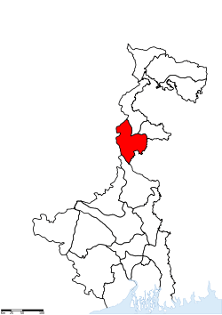 Location of Malda district in West Bengal | |
| Country | India |
| State | West Bengal |
| Administrative division | Jalpaiguri |
| Headquarters | English Bazar |
| Government | |
| • Lok Sabha constituencies | Maldah Uttar, Maldah Dakshin |
| • Assembly seats | Habibpur, Gazole, Chanchal, Harishchandrapur, Malatipur, Ratua, Manikchak, Maldah, English Bazar, Mothabari, Sujapur, Baisnabnagar |
| Area | |
| • Total | 3,733 km2 (1,441 sq mi) |
| Population (2011) | |
| • Total | 3,997,970 |
| • Density | 1,100/km2 (2,800/sq mi) |
| • Urban | 240,915 |
| Demographics | |
| • Literacy | 62.71 per cent |
| • Sex ratio | 939 |
| Major highways | NH 81 |
| Website | Official website |
Malda district (Pron: maːld̪aː) (Bengali: মালদা জেলা) (also spelled as Maldah or Maldaha) is a district in West Bengal, India. It lies 347 km (215 miles) north of Kolkata, the state capital. Mango, jute and silk are the most notable products of this district. The special variety of mango produced in this region, popularly known by the name of the district, is exported across the world and is acclaimed internationally. The folk culture of gombhira is a feature of the district, being a unique way of representation of joy and sorrow of daily life of the common people, as well as the unique medium of presentation on national and international matters. According to the National Investigation Agency Malda is believed to be a hub of a fake currency racket.[1][2][3] It is reported that 90 per cent of the fake currency that enters India from Pakistan via Bangladesh comes in from Malda which borders the neighbouring country.[4][5]
District headquarters is English Bazar, also known as Malda, which was once the capital of Bengal. The district maintains the traditions of the past in culture and education. Old Malda, the town which lies just east of the confluence of the Mahananda and Kalindi rivers, is part of the English Bazar urban agglomeration. The town rose to prominence as the river port of the old capital of Pandua. During the 18th century it was the seat of prosperous cotton and silk industries. It remains an important distributing centre for rice, jute, and wheat. The area between the historical monument of Jame Masjid (1566) and the landmark of Nimasarai tower across the river Mahananda, constituted a municipality in 1867. Rice, jute, legumes, and oilseed are the chief crops in the surrounding area. Malda is the largest producer of excellent quality of jute in India. Mulberry plantations and mango orchards occupy large areas; mango trade and silk manufacture are the main economic activities. The Independence Day of Malda is 17 August 1947.
History
Pre-Gour Era
Pāṇini mentioned a city named Gourpura, which by strong reason may be identified as the city of Gouda, ruins of which are situated in this district. Examples are legion of the relics of a predecessor kingdom being used in the monuments of the successor kingdoms.
It had been within the limits of ancient Gour and Pandua (Pundrabardhana). These two cities had been the capital of Bengal in ancient and medieval ages and are equidistant, north and south, from English Bazar town (once known as Engelzavad established by the British rulers).
The boundary of Gour was changed in different ages since the 5th century BC, and its name can be found in Puranic texts. Pundranagara was the provincial capital of the Maurya Empire. Gour and Pundravardhana formed parts of the Mourya empire as is evinced from the inscriptions, Brahmi script on a seal discovered from the ruins of Mahasthangarh in the Bogra District of Bangladesh. Xuanzang saw many Ashokan stupas at Pundravardhana.
The inscriptions discovered in the district of undivided Dinajpur and other parts of North Bengal, along with the Allahabad pillar inscriptions of Samudragupta, clearly indicate that the whole of North Bengal as far east as Kamrup formed a part of the Gupta Empire.
After the Guptas in the beginning of 7th century AD Sasanka, the king of Karnasubarna as well as the king of Gauda ruled independently for more than three decades. From the middle of the 8th century to the end of the 11th century the Pala dynasty ruled Bengal, the kings were devoted to Buddhism. It was during their reign that the Jagadalla Vihara (monastery) in Barindri flourished paralleling with Nalanda, Vikramshila and Devikot.
Gour Era
The Pala empire yielded to the emergence of Sen Dynasty, the Sen rulers were Tantrik Bauddha's, and in the habit of moving from place to place within their kingdom. During this time, Buddhism went on the defensive. It eventually disappeared from the demographic map of Bengal. At the time of Lakshman Sen Goud was known as Lakshmanabati. The Sen kings ruled Bengal till Bakhtiyar Khalji conquered Bengal in 1204 AD.
Thereafter the Muslim rule started. The name Mal Daha was coined (Mal= riches, Daha= lake). Sultan Ilyas Shah, Firuz Shah, Sikandar Shah, Raja Ganesha, Alauddin Hussain Shah and Nasiruddin Nasrat Shah are the notable rulers of medieval age. Afghan warrior Sher Shah Suri invaded Gour and was repelled by Mughal emperor Humayun. Humayun, loving the mango of Gour, named the place as Jannatabad (garden of heaven). Firuz Shah Tughlaq, Ghiyasuddin and Mughal army invaded Gour to suppress rebellion several time. Relics of Muslim structures are present as Firuz minar, Adina Mosque (the largest mosque of South Asia then), Qutwali gate etc. During the Mughal rule, the capital was removed to Dhaka due to a course change of the river Ganges. Muslim rule ended in 1757. Koch army invasion increased during the downfall of Gour.
Post-Gour Era

The British rule started in 1757. The English traders settled in the southern bank of the river Mahananda. Some indigo plant chambers, trade centre and offices were established. William Carey worked here. But the glorious days were gone.

This district was formed out of some portions of outlying areas of Purnia, Dinajpur and Rajshahi districts in 1813. At the time of Dr. B. Hamilton (1808–09), the present thanas of Gazole, Malda, Bamongola, and part of Habibpur were included in the district of Dinajpur and the thanas of Harischandrapur, Kharba, Ratua, Manikchak, and Kaliachak were included in the district of Purnia. In 1813, in consequence of the prevalence of serious crimes in the Kaliachak and Sahebganj thanas and also on the rivers, a Joint Magistrate and Deputy Collector was appointed at English Bazar, with jurisdiction over a number of police stations centring that place and taken from the two districts. Thus the district of Malda was born. The year 1832 saw the establishment of separate treasury and the year 1859 the posting of a full-fledged magistrate and collector.
Up to 1876, this district formed part of Rajshahi Division and between 1876 and 1905, it formed part of Bhagalpur Division. In 1905, it was again transferred to Rajshahi Division and until 1947, Malda remained in this division. During the first Partition of Bengal of 1905, this district was attached with the newly created province of Eastern Bengal and Assam. Malda has a history of Indigo movement led by Rafique Mondal. The santhals got insurgent and captured historic Adina Mosque in support of Jeetu. Again in August 1947 this district was affected by partition. Between 12–15 August 1947, the fate of the district as to which side it should go, to Pakistan or to India, was undecided because the announcement of the partition award of Sir Radcliffe did not make this point clear. During these few days the district was under a Magistrate of East Pakistan. When the details of the Radcliffe Award were published, the district came over to West Bengal on 17 August 1947. However, the sub-division of Nawabganj was severed from Malda and was given to East Pakistan as a sub-division of the Rajshahi district.
Geography
The latitude range is 24°40’20" N to 25°32’08" N, and the longitude range is 87°45’50" E to 88°28’10" E. The district covers an area of 3,733.66 square kilometres (1,441.6 sq mi). The total population (as of 2001 Census) was recorded as 3,290,160.
Malda is called the gateway of North Bengal. It was once the capital of Gour-Banga with its 3,733 square kilometres (1,441 sq mi) lay of the land classified into Tal, Diara, and Barind.
To the south is Murshidabad district, to the north are North Dinajpur district and South Dinajpur district. To the east is the international border with Bangladesh. To the west is Santhal Parganas of Jharkhand and Purnea of Bihar.
Malda Town
Malda, the district headquarters which lends its name to the district, during its early days grew up only near the side of the river Mahananda, and now the place is known as Phulbari. Some of the oldest houses can be found here. The city started to grow since 1925-1930. Now nearly a half-million people live in this city, and it is one of the biggest cities of West Bengal. It is a part of the former Gour. The town is recognised as the English Bazaar municipality. Its notable railway station is named as Malda Town.
Economy
In 2006 the Ministry of Panchayati Raj named Malda one of the country's 250 most backward districts (out of a total of 640).[6] It is one of the eleven districts in West Bengal currently receiving funds from the Backward Regions Grant Fund Programme (BRGF).[6]
Divisions
Administrative subdivisions
The district comprises two subdivisions: Chanchal and Malda Sadar. Chanchal consists of six community development blocks: Chanchal–I, Chanchal–II, Ratua–I, Ratua–II, Harishchandrapur–I and Harishchandrapur–II. Malda Sadar subdivision consists of Old Malda municipality, English Bazar municipality and nine community development blocks: English Bazar, Gazole, Habibpur, Kaliachak–I, Kaliachak–II, Kaliachak–III, Manickchak, Old Malda and Bamangola.[7] English Bazar is the district headquarters. There are 11 police stations,[8] 15 development blocks, 2 municipalities, 146 gram panchayats and 3,701 villages in this district.[7][9]
Other than municipality areas, each subdivision contains community development blocs, which in turn, are divided into rural areas and census towns.[10] In total there are 10 urban units, 2 municipalities and 3 census towns. English Bazar and Old Malda form an urban agglomeration.
Chanchal subdivision
- Chanchal I (Community development block) consists of rural areas (8 gram panchayats) and town Chanchal,(second largest town in Malda).
- Chanchal II (Community development block) consists of rural areas only (7 gram panchayats).
- Ratua I (Community development block) consists of rural areas only (10 gram panchayats).
- Ratua II (Community development block) consists of rural areas only (8 gram panchayats).
- Harishchandrapur I (Community development block) consists of rural areas only (7 gram panchayats).
- Harishchandrapur II (Community development block) consists of rural areas only (9 gram panchayats).
Malda Sadar subdivision
- English Bazar: municipality
- Old Malda: municipality
- English Bazar (Community development block) consists of rural areas only (11 gram panchayats).
- Gazole (Community development block) consists of rural areas only (15 gram panchayats).
- Habibpur, Malda (Community development block) consists of rural areas (11 gram panchayats) and three census towns: Kachu Pukur, Kendua and Aiho.
- Kaliachak I (Community development block) consists of rural areas only (14 gram panchayats).
- Kaliachak II (Community development block) consists of rural areas only (9 gram panchayats).
- Kaliachak III (Community development block) consists of rural areas only (14 gram panchayats).
- Manikchak (Community development block) consists of rural areas only (11 gram panchayats).
- Old Malda (Community development block) consists of rural areas only (6&nbsiooip;gram panchayats).
- Bamangola (Community development block) consists of rural areas only (6 gram panchayats).
Demographics
According to the 2011 census Malda district has a population of 3,997,970,[12] roughly equal to the nation of Liberia[13] or the US state of Oregon.[14] This gives it a ranking of 58th in India (out of a total of 640).[12] The district has a population density of 1,071 inhabitants per square kilometre (2,770/sq mi) .[12] Its population growth rate over the decade 2001-2011 was 21.5%.[12] Malda has a sex ratio of 939 females for every 1000 males,[12] and a literacy rate of 62.71%.[12]
Nearly 32,90,160 people live in Malda. Malda has a large diversity of demographics. Various classes and tribes like Polia, Shersabadia, Khotta, Panjhra, Santhals live here.
Northern part of the district has dominantly Hindu 53% population; Muslims are 46%. Tribesman and Christian people also live here.
Southern Malda is dominated by 59% Muslim population. Sujapur Idgah is one of the largest in India. Hindus are 40% in this part.
Over all Malda district (North Malda & South Malda together) Muslims are 51%, Hindus are 48%, Others are 1%.
Assembly constituency wise religious population in malda district according to 2001 census[/B]
| Assembly constituency | Total population2001 | Hindus | Muslims | Hindu% | Muslim% |
|---|---|---|---|---|---|
| Habibpur | 272667 | 244498 | 13076 | 89.67% | 04.80% |
| Gazole | 294715 | 222610 | 65650 | 75.53% | 22.28% |
| Chanchal | 266179 | 87347 | 175226 | 32.81% | 65.83% |
| Harishchandrapur | 268433 | 83586 | 184498 | 31.13% | 68.73% |
| Malatipur | 248560 | 68034 | 178692 | 27.37% | 71.89% |
| Ratua | 297023 | 93446 | 202968 | 31.46% | 68.33% |
| Manikchak | 278308 | 154525 | 122671 | 55.52% | 44.08% |
| Maldah | 266206 | 201886 | 57853 | 75.84% | 21.72% |
| English Bazar | 294651 | 209926 | 83902 | 71.25% | 28.48% |
| Mothabari | 255241 | 73607 | 181518 | 28.84% | 71.12% |
| Sujapur | 267100 | 30823 | 236090 | 11.54% | 88.39% |
| Baisnabnagar | 284376 | 148358 | 135654 | 52.17% | 47.70% |
This district is predominantly Bengali linguistically.
Culture
Malda has special cultural sorts like Gombhira, Alkap, Kavigan etc.
Festivals
Almost all of the major religious festivals are clebrated, like
- Durga puja
- Kali Puja
- Id-ul-Fitr
- Id-ul-Azha
- Guru Nanak Jayanti, Especially in Old Malda
- X-mas
- Malda Festival
Fairs
Some of the mostly reputed cultural fairs of the district are
- Kahala Urush at Mothabari
- Kahala Durga Puja Fair .
- Ramkeli Fair, Gour
- Dariapur Urush at Dariapur, Kaliachak
- Gazole Utsab
- Kartik puja Fair
- Charu Babu Mela
- Charak Fair
- Piran-e-Pir fair
- Chobbish (24) Prahor at Shingabad and Rishipur
Book fair and Expo are organised yearly.
Places of interest
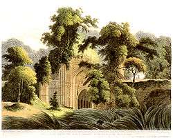
- Adina Relics
- Adina Mosque
- Gol ghar
- Eklakhi mosque
- Adina deer park
- Relics of Gour
- Firoz minar
- Chika Masjid
- Qutwali Gate
- 12-gated mosque
- Qudm-e-Rasul, shrine believed to contain footprint of the Prophet
- Nimai Sarai Tower
- Jami Masjid
- Pandua Shrine
- Piran-e-Pir Shrine.
- Lost monastery of Jagjivanpur
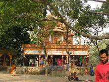
- Temple of Ramakrishna Mission
- Temple of Jahura Kali (Local avatar of Goddess Chandi)
- Chanchal palace
- Aquatic Bengal
Education
Though Malda is one of the least educated districts of West Bengal, it contains some of the élite schools of the state.
These are some of the most reputed schools of the district.
- Malda Zilla School
- Ramakrishna Mission Vivekananda Vidyamandir
- Barlow Girls' High School
- A.C. Institution
- Lalit Mohan Shyam Mohini High School
- Malda Town High School
- Malda C.C. Girls' High School
- Sattari High School
- The St. Xavier's School (English medium)
- St. Mary's School (English medium)
- Jingle Bell School (English medium preparatory school)
- Usha Martin School(English medium)
- Holy Child English Academy
- North Point English Academy
Malda Zilla School is the oldest school in the town and also one of the oldest schools in West Bengal. It was established in 1858 on recommendation of the Hunter commission after the mutiny. Also, there is a Kendriya Vidyalaya (Central School) in the outskirts of Malda located at Maliha, the only school with English and Hindi as medium of studies. This was established in the year 1982-83 by then Union railway minister from Malda, A. B. A. Ghani Khan Choudhury. This is the only school in Malda where Bengali is not a medium of studies and is affiliated to C.B.S.E.. It was established for the education of children of Indian Railways, BSF, PowerGrid and other central govt. employees who are mostly in transferable jobs across India. Usha Martin group is coming up with its flagship chain of schools "Usha Martin School" with all the ultra modern facilities and an air-conditioned hostel facility on main NH-31.
Malda College was also in the top league among the North Bengal University affiliated colleges. Now it has its own university, the University of Gour Banga with several affiliated colleges of the district and the neighbouring districts of South and North Dinajpur. The district also has an engineering college, a few private technical institutions (mostly for computer-related professional courses), and an medical college.
Also, there were the trams plying through the roads in Malda, during the British period, but was gradually removed for the sake of convenience. The population of the people consists mainly of Hindus, and some minorities of Muslims, Christians, etc.
Colleges and universities
- University of Gour Banga
- Govt. Teachers' Training College, Which is the only Government College in Malda having highest number of intake capacity among the colleges
- Malda College, established on 23 July 1944
- IMPS College of Engineering and Technology, established - 2003
- Malda Polytechnic
- ITI, Malda
- Malda Medical College and Hospital, established - 2011
- G.K.C.I.E.T
Ghani Khan Choudhury Institute of Engineering & Technology, established - 2010 - Malda Women's College
- Gour Mahavidyalaya
- Manikchak College
- Gazole Mahavidyalaya
- Kaliachak College
- Chanchal College
- Harishchandrapur College
- Samsi College
- South Malda College
- Pakuahat college
A foundation stone was laid on 29 January 2011 for a new polytechnic college at Samsi named Ratua Satyendranath Bose Govt. Polytechnic College.
See also
References
- ↑ http://timesofindia.indiatimes.com/city/kolkata/Malda-gateway-of-fake-currencies/articleshow/48950199.cms
- ↑ "Malda, India's fake currency capital, is feeling the demonetisation pinch".
- ↑ http://www.oneindia.com/india/why-does-fake-currency-come-from-west-bengal-1788096.html
- ↑ http://www.ndtv.com/india-news/malda-violence-was-bsf-vs-people-claims-mamata-banerjee-1263898
- ↑ http://indiatoday.intoday.in/story/fake-currency-seized-from-malda/1/497978.html
- 1 2 Ministry of Panchayati Raj (8 September 2009). "A Note on the Backward Regions Grant Fund Programme" (PDF). National Institute of Rural Development. Retrieved 27 September 2011.
- 1 2 "Directory of District, Sub division, Panchayat Samiti/ Block and Gram Panchayats in West Bengal, March 2008". West Bengal. National Informatics Centre, India. 19 March 2008. Retrieved 10 November 2008.
- ↑ "Census of India 2001, Final Population Totals, West Bengal, Rural Frame". West Bengal. Directorate of census operations. Retrieved 10 November 2008.
- ↑ "District Profile". Official website of the Malda district. Retrieved 10 November 2008.
- ↑ "Population, Decadal Growth Rate, Density and General Sex Ratio by Residence and Sex, West Bengal/ District/ Sub District, 1991 and 2001". West Bengal. Directorate of census operations. Retrieved 10 November 2008.
- ↑ "West Bengal Districts - Religion 2011". Census 2011. Retrieved 16 November 2015.
- 1 2 3 4 5 6 "District Census 2011". Census2011.co.in. 2011. Retrieved 30 September 2011.
- ↑ US Directorate of Intelligence. "Country Comparison:Population". Retrieved 1 October 2011.
Liberia 3,786,764 July 2011 est.
- ↑ "2010 Resident Population Data". U. S. Census Bureau. Retrieved 30 September 2011.
Oregon 3,831,074
External links
| Wikimedia Commons has media related to Malda district. |
 |
Katihar district, Bihar | North Dinajpur district | South Dinajpur district | |
| Sahebganj district, Jharkhand | |
Bangladesh | ||
| ||||
| | ||||
| Murshidabad district |
Cities, towns and locations in Maldah district | |||||||
|---|---|---|---|---|---|---|---|
| Cities, municipal and census towns |
| ||||||
| Locations other than cities and towns | |||||||
| Related topics |
| ||||||
Coordinates: 25°00′N 88°09′E / 25.00°N 88.15°E