| [3] |
Name on the Register |
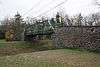
Image |
Date listed[4] |
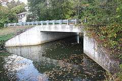
Location |
City or town |
Description |
|---|
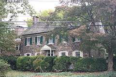
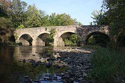
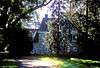
| 1 |
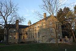
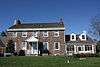
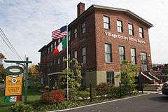
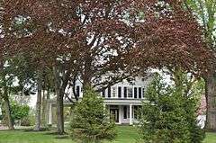
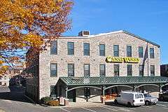
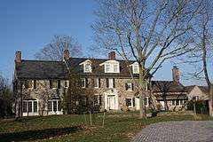
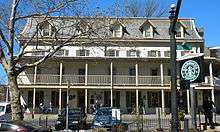
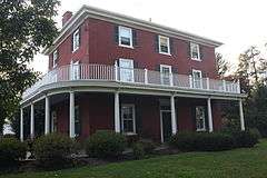
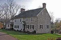
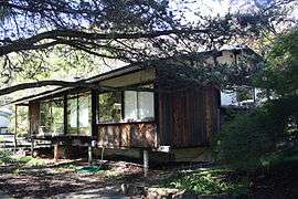
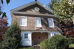
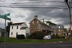
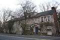
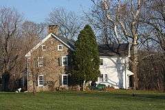
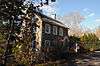
Andalusia |
|
000000001966-11-13-0000November 13, 1966
(#66000649) |
1.4 miles (2.3 km) north of Philadelphia on U.S. Route 13
40°03′53″N 74°57′31″W / 40.0647°N 74.9586°W / 40.0647; -74.9586 (Andalusia) |
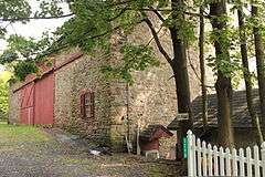
Bensalem Township |
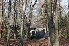
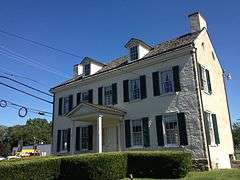
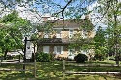
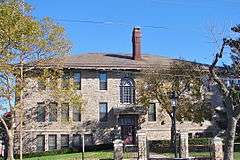
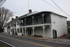
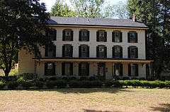
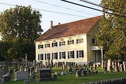
1794 estate, modified several times later, was home to Nicholas Biddle
|
| 2 |
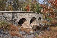
Atkinson Road Bridge |
|
000000002002-03-20-0000March 20, 2002
(#02000222) |
Atkinson Road and Pidcock's Creek
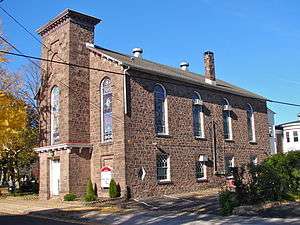
40°19′38″N 74°58′44″W / 40.3272°N 74.9789°W / 40.3272; -74.9789 (Atkinson Road Bridge) |
Solebury Township |
|
| 3 |
Belmont |
|
000000001988-05-03-0000May 3, 1988
(#88000460) |
3779 Bristol Road
40°08′27″N 74°57′05″W / 40.1408°N 74.9514°W / 40.1408; -74.9514 (Belmont) |
Bensalem Township |
|
| 4 |
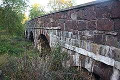
Bridge in Buckingham Township |
|
000000001988-06-22-0000June 22, 1988
(#88000786) |
Forest Grove Road over Mill Creek
40°16′53″N 75°01′19″W / 40.2814°N 75.0219°W / 40.2814; -75.0219 (Bridge in Buckingham Township) |
Buckingham Township |
|
| 5 |
Bridge in Solebury Township |
|
000000001988-06-22-0000June 22, 1988
(#88000783) |
Carversville Road over Paunacussing Creek
40°23′09″N 75°03′50″W / 40.3858°N 75.0639°W / 40.3858; -75.0639 (Bridge in Solebury Township) |
Solebury Township |
|
| 6 |
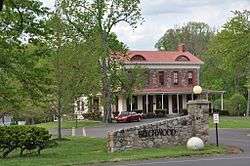
Bridge in Tinicum Township |
|
000000001988-06-22-0000June 22, 1988
(#88000814) |
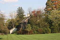
Legislative Route 920 over Pennsylvania Canal
40°25′24″N 75°03′55″W / 40.4233°N 75.0653°W / 40.4233; -75.0653 (Bridge in Tinicum Township) |
Tinicum Township |
|
| 7 |
Bridge in Yardley Borough |
|
000000001988-06-22-0000June 22, 1988
(#88000770) |
Reading Avenue over VanHorn Creek
40°14′03″N 74°50′02″W / 40.2342°N 74.8339°W / 40.2342; -74.8339 (Bridge in Yardley Borough) |
Yardley |
|
| 8 |
Bridge Valley Bridge |
|
000000001984-05-10-0000May 10, 1984
(#84003120) |
Spans Neshaminy Creek north of Jamison
40°16′34″N 75°05′01″W / 40.2761°N 75.0836°W / 40.2761; -75.0836 (Bridge Valley Bridge) |
Warwick Township |
|
| 9 |
Bristol Historic District |
|
000000001987-04-30-0000April 30, 1987
(#87000665) |
Roughly bounded by Pond, Cedar, E. Lincoln Streets, the Delaware River, and E. Mill Street
40°05′53″N 74°51′10″W / 40.0981°N 74.8528°W / 40.0981; -74.8528 (Bristol Historic District) |
Bristol |
|
| 10 |
Bristol Industrial Historic District |
|
000000001987-11-16-0000November 16, 1987
(#87002016) |
Roughly bounded by Pennsylvania Canal, Jefferson Avenue, Canal Street, Pennsylvania Railroad and Beaver Street
40°06′07″N 74°51′15″W / 40.1019°N 74.8542°W / 40.1019; -74.8542 (Bristol Industrial Historic District) |
Bristol |
|
| 11 |
Brownsburg Village Historic District |
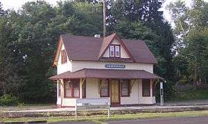
|
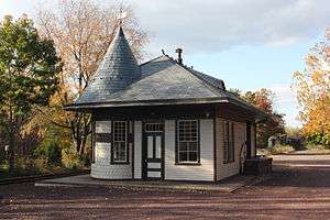
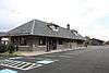
000000001994-05-26-0000May 26, 1994
(#94000445) |
Junction of River and Brownsburg Rds.
40°19′07″N 74°55′12″W / 40.3186°N 74.92°W / 40.3186; -74.92 (Brownsburg Village Historic District) |
Upper Makefield Township |
|
| 12 |
Buckingham Friends Meeting House |
|
000000001997-03-28-0000March 28, 1997
(#97000291) |
5684 Lower York Road
40°20′56″N 75°02′27″W / 40.3489°N 75.0408°W / 40.3489; -75.0408 (Buckingham Friends Meeting House) |
Buckingham Township |
|
| 13 |
Buckmanville Historic District |
|
000000002002-03-20-0000March 20, 2002
(#02000224) |
Street Road between Windy Bush and Buckmanville Roads
40°18′51″N 74°58′33″W / 40.314167°N 74.975833°W / 40.314167; -74.975833 (Buckmanville Historic District) |
Upper Makefield Township |
|
| 14 |
John Burroughs Homestead |
|
000000001984-03-05-0000March 5, 1984
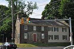
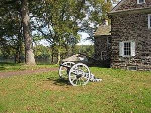
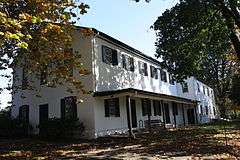
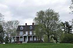
(#84003163) |
Wrightstown-Taylorsville Road
40°17′04″N 74°54′02″W / 40.284444°N 74.900556°W / 40.284444; -74.900556 (John Burroughs Homestead) |
Upper Makefield Township |
|
| 15 |
Byecroft Farm Complex |
|
000000001983-09-09-0000September 9, 1983
(#83002219) |
Off U.S. Route 202
40°20′13″N 75°02′20″W / 40.336944°N 75.038889°W / 40.336944; -75.038889 (Byecroft Farm Complex) |
Buckingham Township |
|
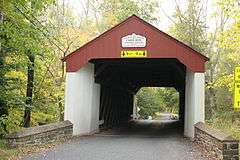
| 16 |
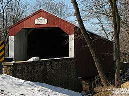
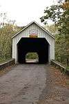
Cabin Run Covered Bridge |
|
000000001980-12-01-0000December 1, 1980
(#80003443) |
South of Tinicum on Legislative Route 09099
40°14′33″N 75°06′45″W / 40.2425°N 75.1125°W / 40.2425; -75.1125 (Cabin Run Covered Bridge) |
Plumstead Township |
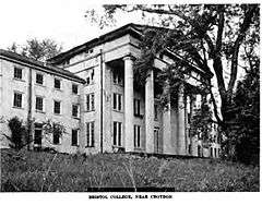
|
| 17 |
Campbell's Bridge |
|
000000001988-06-22-0000June 22, 1988
(#88000733) |
Allentown Road over Unami Creek
40°25′42″N 75°23′54″W / 40.428333°N 75.398333°W / 40.428333; -75.398333 (Campbell's Bridge) |
Milford Township |
|
| 18 |
Carversville Historic District |
|
000000001978-12-13-0000December 13, 1978
(#78003418) |
Off Pennsylvania Route 32
40°23′09″N 75°03′35″W / 40.385833°N 75.059722°W / 40.385833; -75.059722 (Carversville Historic District) |
Solebury Township |
|
| 19 |
Center Bridge Historic District |
|
000000001985-03-26-0000March 26, 1985
(#85000673) |
Bounded by Ely and Laurel Roads on River Road
40°24′02″N 74°58′48″W / 40.400556°N 74.98°W / 40.400556; -74.98 (Center Bridge Historic District) |
Solebury Township |
|
| 20 |
Chalfont Historic District |
|
000000002006-12-18-0000December 18, 2006
(#06001148) |
Roughly bounded by Chestnut Street Park Avenue, Main Street, Butler Avenue and Sunset Avenue
40°17′25″N 75°12′38″W / 40.290278°N 75.210556°W / 40.290278; -75.210556 (Chalfont Historic District) |
Chalfont |
|
| 21 |
John Chapman House |
|
000000001974-01-24-0000January 24, 1974
(#74001757) |
South of New Hope off Pennsylvania Route 232 on Eagle Road
40°18′46″N 74°56′57″W / 40.312778°N 74.949167°W / 40.312778; -74.949167 (John Chapman House) |
Upper Makefield Township |
|
| 22 |
Churchville Historic District |
|
000000001995-07-21-0000July 21, 1995
(#95000887) |
Roughly along Bristol Road, Bustleton Pike and Cornell and Knowles Avenues, in Northampton and Upper Southampton Townships
40°10′56″N 75°00′49″W / 40.182222°N 75.013611°W / 40.182222; -75.013611 (Churchville Historic District) |
Northampton and Upper Southampton Townships |
|
| 23 |
Cintra |
|
000000001985-03-06-0000March 6, 1985
(#85000460) |
181 W. Bridge Street
40°21′50″N 74°57′35″W / 40.363889°N 74.959722°W / 40.363889; -74.959722 (Cintra) |
New Hope |
|
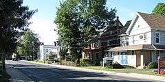
| 24 |
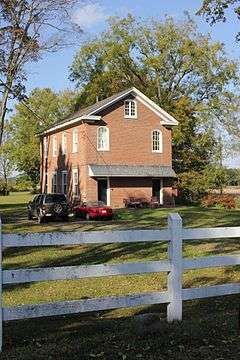
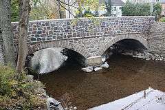
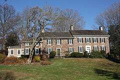
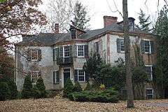
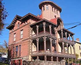
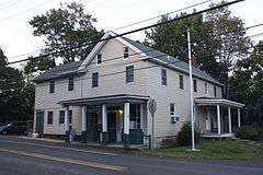
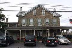
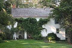
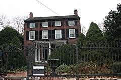
Gershom Craft House |
|
000000001986-10-16-0000October 16, 1986
(#86002892) |
105 Barnsley Avenue
40°12′08″N 74°47′25″W / 40.202222°N 74.790278°W / 40.202222; -74.790278 (Gershom Craft House) |
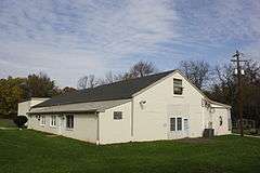
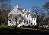
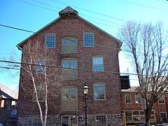
Morrisville |
|
| 25 |
Craven Hall |
|
000000002007-10-11-0000October 11, 2007
(#07001078) |
599 Newtown Road
40°11′29″N 75°04′26″W / 40.191389°N 75.073889°W / 40.191389; -75.073889 (Craven Hall) |
Warminster Township |
|
| 26 |
Cuttalossa Valley Historic District |
|
000000002002-06-27-0000June 27, 2002
(#02000705) |
Cuttalossa Road from Sugan Road to the Delaware River
40°23′38″N 75°01′26″W / 40.393889°N 75.023889°W / 40.393889; -75.023889 (Cuttalossa Valley Historic District) |
Solebury Township |
|
| 27 |
Delaware Division of the Pennsylvania Canal |
|
000000001974-10-29-0000October 29, 1974
(#74001756) |
Parallels the west bank of the Delaware River from Easton to Bristol
40°41′17″N 75°12′18″W / 40.688056°N 75.205°W / 40.688056; -75.205 (Delaware Division of the Pennsylvania Canal) |
Bristol |
Extends into Northampton County
|
| 28 |
Dolington Village Historic District |
|
000000001994-05-26-0000May 26, 1994
(#94000444) |
Junction of Pennsylvania Route 532 and Mt. Eyre Road (Washington Crossing Road)
40°15′58″N 74°53′46″W / 40.266111°N 74.896111°W / 40.266111; -74.896111 (Dolington Village Historic District) |
Lower and Upper Makefield Townships |
|
| 29 |
Dorrance Mansion |
|
000000001986-10-16-0000October 16, 1986
(#86002891) |
300 Radcliffe Street
40°05′45″N 74°51′15″W / 40.095833°N 74.854167°W / 40.095833; -74.854167 (Dorrance Mansion) |
Bristol |
|
| 30 |
Doylestown Historic District |
|
000000001985-05-10-0000May 10, 1985
(#85001012) |
Roughly bounded by Union, Cottage and E. Ashland Streets, Hillside Avenue and S. and N. West Streets
40°18′35″N 75°08′14″W / 40.309722°N 75.137222°W / 40.309722; -75.137222 (Doylestown Historic District) |
Doylestown |
|
| 31 |
Pugh Dungan House |
|
000000001980-03-20-0000March 20, 1980
(#80003430) |
33 W. Court Street
40°18′37″N 75°07′54″W / 40.310278°N 75.131667°W / 40.310278; -75.131667 (Pugh Dungan House) |
Doylestown |
|
| 32 |
Durham Mill and Furnace |
|
000000001976-11-21-0000November 21, 1976
(#76001608) |
Durham Road
40°34′35″N 75°13′27″W / 40.576389°N 75.224167°W / 40.576389; -75.224167 (Durham Mill and Furnace) |
Durham Township |
|
| 33 |
Dyerstown Historic District |
|
000000001987-01-15-0000January 15, 1987
(#86003574) |
Along Old Easton Road near the junction of Stony Lane
40°20′28″N 75°07′34″W / 40.341111°N 75.126111°W / 40.341111; -75.126111 (Dyerstown Historic District) |
Plumstead Township |
|
| 34 |
Eagle Tavern |
|
000000001978-04-20-0000April 20, 1978
(#78002353) |
South of New Hope
40°17′29″N 74°56′24″W / 40.291389°N 74.94°W / 40.291389; -74.94 (Eagle Tavern) |
Upper Makefield Township |
|
| 35 |
John Eakin Farm |
|
000000002005-02-24-0000February 24, 2005
(#05000100) |
3298 Pennsylvania Route 212, Main Street, Springtown
40°33′05″N 75°16′57″W / 40.551389°N 75.2825°W / 40.551389; -75.2825 (John Eakin Farm) |
Springfield Township |
|
| 36 |
Edgemont |
|
000000001977-12-16-0000December 16, 1977
(#77001126) |
North of Langhorne on Bridgetown Road
40°11′30″N 74°55′25″W / 40.191667°N 74.923611°W / 40.191667; -74.923611 (Edgemont) |
Middletown Township |
|
| 37 |
Joshua Ely House |
|
000000001985-03-06-0000March 6, 1985
(#85000463) |
Rittenhouse Circle
40°21′21″N 74°57′30″W / 40.355833°N 74.958333°W / 40.355833; -74.958333 (Joshua Ely House) |
New Hope |
|
| 38 |
Erwinna Covered Bridge |
|
000000001980-12-01-0000December 1, 1980
(#80003434) |
North of Erwinna on Legislative Route 09098
40°30′09″N 75°04′29″W / 40.5025°N 75.074722°W / 40.5025; -75.074722 (Erwinna Covered Bridge) |
Erwinna |
|
| 39 |
Fallsington Historic District |
|
000000001972-06-19-0000June 19, 1972
(#72001099) |
South of U.S. Route 1, east of New Tyburn Road
40°08′40″N 74°48′58″W / 40.1444°N 74.8161°W / 40.1444; -74.8161 (Fallsington Historic District) |
Falls Township |
|
| 40 |
Fonthill |
|
000000001972-06-01-0000June 1, 1972
(#72001094) |
E. Court Street at the intersection of Pennsylvania Route 313
40°19′16″N 75°07′26″W / 40.321111°N 75.123889°W / 40.321111; -75.123889 (Fonthill) |
Doylestown |
|
| 41 |
Fonthill, Mercer Museum and Moravian Pottery and Tile Works |
|
000000001985-02-04-0000February 4, 1985
(#85002366) |
Court Street and Swamp Road and Pine and Ashland Streets
40°19′01″N 75°07′30″W / 40.316944°N 75.125°W / 40.316944; -75.125 (Fonthill, Mercer Museum and Moravian Pottery and Tile Works) |
Doylestown |
|
| 42 |
Fordhook Farm |
|
000000001987-04-30-0000April 30, 1987
(#87000674) |
105 New Britain Road
40°17′52″N 75°09′01″W / 40.297778°N 75.150278°W / 40.297778; -75.150278 (Fordhook Farm) |
Doylestown Township |
|
| 43 |
Forest Grove Historic District |
|
000000001982-04-20-0000April 20, 1982
(#82003765) |
Forest Grove and Lower Mountain Roads
40°17′34″N 75°03′39″W / 40.292778°N 75.060833°W / 40.292778; -75.060833 (Forest Grove Historic District) |
Buckingham Township |
|
| 44 |
Fountain House |
|
000000001972-03-16-0000March 16, 1972
(#72001095) |
State and Main Streets
40°18′36″N 75°07′51″W / 40.31°N 75.130833°W / 40.31; -75.130833 (Fountain House) |
Doylestown |
|
| 45 |
Frankenfield Covered Bridge |
|
000000001980-12-01-0000December 1, 1980
(#80003444) |
North of Tinicum on Township 421
40°28′32″N 75°05′59″W / 40.475556°N 75.099722°W / 40.475556; -75.099722 (Frankenfield Covered Bridge) |
Tinicum Township |
|
| 46 |
Jacob Funk House and Barn |
|
000000002007-02-07-0000February 7, 2007
(#07000030) |
3609 Pennsylvania Route 212
40°33′32″N 75°16′04″W / 40.558889°N 75.267778°W / 40.558889; -75.267778 (Jacob Funk House and Barn) |
Springfield Township |
|
| 47 |
Gardenville-North Branch Rural Historic District |
|
000000001991-11-07-0000November 7, 1991
(#91000954) |
Roughly bounded by Durham Road, Point Pleasant Pike, Valley Park Road and North Branch Neshaminy Creek
40°22′35″N 75°06′57″W / 40.3764°N 75.1158°W / 40.3764; -75.1158 (Gardenville-North Branch Rural Historic District) |
Plumstead Township |
|
| 48 |
General Stores and Mold Loft Building-Harriman Yard of the Merchant Shipbuilding Corporation |
|
000000002003-07-31-0000July 31, 2003
(#03000722) |
1414 Radcliffe Street
40°06′15″N 74°50′29″W / 40.1041°N 74.8414°W / 40.1041; -74.8414 (General Stores and Mold Loft Building-Harriman Yard of the Merchant Shipbuilding Corporation) |
Bristol |
|
| 49 |
Thomas and Lydia Gilbert Farm |
|
000000001989-05-05-0000May 5, 1989
(#89000351) |
5042 Anderson Road
40°20′14″N 75°03′36″W / 40.337222°N 75.06°W / 40.337222; -75.06 (Thomas and Lydia Gilbert Farm) |
Buckingham Township |
|
| 50 |
Green Hills Farm |
|
000000001974-02-27-0000February 27, 1974
(#74001755) |
Southwest of Dublin on Dublin Road
40°21′36″N 75°13′11″W / 40.36°N 75.219722°W / 40.36; -75.219722 (Green Hills Farm) |
Hilltown Township |
|
| 51 |
Grundy Mill Complex |
|
000000001986-01-09-0000January 9, 1986
(#86000013) |
Western corner of Jefferson Avenue and Canal Street
40°06′15″N 74°51′08″W / 40.104167°N 74.852222°W / 40.104167; -74.852222 (Grundy Mill Complex) |
Bristol |
|
| 52 |
Half-Moon Inn |
|
000000001977-12-06-0000December 6, 1977
(#77001128) |
101 and 105 Court Street
40°13′40″N 74°56′11″W / 40.227778°N 74.936389°W / 40.227778; -74.936389 (Half-Moon Inn) |
Newtown |
|
| 53 |
Oscar Hammerstein II Farm |
|
000000001988-11-17-0000November 17, 1988
(#88002374) |
70 East Road
40°18′35″N 75°06′45″W / 40.309722°N 75.1125°W / 40.309722; -75.1125 (Oscar Hammerstein II Farm) |
Doylestown |
|
| 54 |
Hampton Hill |
|
000000001973-04-02-0000April 2, 1973
(#73001594) |
1269 Second Street Pike
40°13′25″N 75°00′34″W / 40.223611°N 75.009444°W / 40.223611; -75.009444 (Hampton Hill) |
Northampton Township |
|
| 55 |
Harewood and Beechwood |
|
000000001980-02-01-0000February 1, 1980
(#80003436) |
East of Langhorne off Pennsylvania Route 213
40°10′43″N 74°54′45″W / 40.1786°N 74.9125°W / 40.1786; -74.9125 (Harewood and Beechwood) |
Middletown Township |
|
| 56 |
Harriman Historic District |
|
000000001987-04-30-0000April 30, 1987
(#87000673) |
Roughly bounded by Trenton Avenue, Cleveland and McKinley Streets, Farragut Avenue, and West Circle
40°06′29″N 74°50′42″W / 40.108056°N 74.845°W / 40.108056; -74.845 (Harriman Historic District) |
Bristol |
Neighborhood mostly built to house workers at nearby shipyard during World War I
|
| 57 |
Hayhurst Farm |
|
000000001974-02-12-0000February 12, 1974
(#74001759) |
Northeast of Wrightstown on Eagle Road
40°17′24″N 74°56′43″W / 40.29°N 74.945278°W / 40.29; -74.945278 (Hayhurst Farm) |
Upper Makefield Township |
|
| 58 |
Holicong Village Historic District |
|
000000001980-03-20-0000March 20, 1980
(#80003435) |
U.S. Route 202 and Holicong Road
40°20′09″N 75°02′55″W / 40.335833°N 75.048611°W / 40.335833; -75.048611 (Holicong Village Historic District) |
Buckingham Township |
|
| 59 |
Honey Hollow Watershed |
|
000000001969-08-04-0000August 4, 1969
(#69000155) |
2.5 miles (4.0 km) south of the Delaware River on Pennsylvania Route 263
40°22′11″N 75°20′45″W / 40.369722°N 75.345833°W / 40.369722; -75.345833 (Honey Hollow Watershed) |
New Hope |
|
| 60 |
John and Phineas Hough House |
|
000000001992-12-24-0000December 24, 1992
(#92001721) |
20 Moyer Road
40°13′43″N 74°50′01″W / 40.2286°N 74.8336°W / 40.2286; -74.8336 (John and Phineas Hough House) |
Lower Makefield Township |
|
| 61 |
Hulmeville Historic District |
|
000000001986-07-17-0000July 17, 1986
(#86001677) |
2-4 Beaver Street, 946-1101 Bellevue Avenue, 1-111 Green, 4 Hulme, 3-342 Main Streets, 1-131 Trenton Avenue, and 2-9 Water Street
40°08′34″N 74°54′35″W / 40.1428°N 74.9097°W / 40.1428; -74.9097 (Hulmeville Historic District) |
Hulmeville |
|
| 62 |
Ivyland Historic District |
|
000000002002-03-21-0000March 21, 2002
(#02000225) |
Bounded by Jacksonbille Road, Wilson, Greeley, and Chase Aves.
40°12′31″N 75°04′25″W / 40.208556°N 75.073556°W / 40.208556; -75.073556 (Ivyland Historic District) |
Ivyland |
|
| 63 |
Morgan James Homestead |
|
000000001977-12-27-0000December 27, 1977
(#77001127) |
Northwest of New Britain on Ferry Road
40°18′19″N 75°12′04″W / 40.3053°N 75.2011°W / 40.3053; -75.2011 (Morgan James Homestead) |
New Britain Township |
|
| 64 |
James-Lorah House |
|
000000001972-10-17-0000October 17, 1972
(#72001096) |
132 N. Main Street
40°18′46″N 75°07′52″W / 40.312778°N 75.131111°W / 40.312778; -75.131111 (James-Lorah House) |
Doylestown |
|
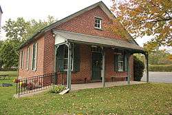
| 65 |
Jefferson Avenue School |
|
000000001985-07-18-0000July 18, 1985
(#85001569) |
Jefferson Avenue and Pond Street
40°06′02″N 74°50′43″W / 40.100556°N 74.845278°W / 40.100556; -74.845278 (Jefferson Avenue School) |
Bristol |
|
| 66 |
Jefferson Land Association Historic District |
|
000000001987-11-05-0000November 5, 1987
(#87001994) |
Bounded by Spring Street, Jefferson Avenue, Garden, and Mansion Streets, and Beaver Dam Road
40°06′24″N 74°51′17″W / 40.106667°N 74.854722°W / 40.106667; -74.854722 (Jefferson Land Association Historic District) |
Bristol |
|
| 67 |
Keith House-Washington's Headquarters |
|
000000001978-11-14-0000November 14, 1978
(#78002356) |
East of Pineville on Pineville Road
40°17′44″N 74°56′49″W / 40.295556°N 74.946944°W / 40.295556; -74.946944 (Keith House-Washington's Headquarters) |
Upper Makefield Township |
|
| 68 |
William Kitchen House |
|
000000001985-03-06-0000March 6, 1985
(#85000464) |
332 S. Sugan Road
40°21′06″N 74°57′50″W / 40.351667°N 74.963889°W / 40.351667; -74.963889 (William Kitchen House) |
New Hope |
|
| 69 |
Knecht's Mill Covered Bridge |
|
000000001980-12-01-0000December 1, 1980
(#80003432) |
Northeast of Springtown on Township 424
40°34′11″N 75°15′04″W / 40.569722°N 75.251111°W / 40.569722; -75.251111 (Knecht's Mill Covered Bridge) |
Springfield Township |
|
| 70 |
Gen. John Lacey Homestead |
|
000000001980-12-02-0000December 2, 1980
(#80003448) |
Forest Grove Road
40°16′57″N 75°01′15″W / 40.2825°N 75.020833°W / 40.2825; -75.020833 (Gen. John Lacey Homestead) |
Buckingham Township |
|
| 71 |
Langhorne Historic District |
|
000000001987-11-20-0000November 20, 1987
(#87001993) |
Summit and Marshall Avenues, Pine Street, Richardson Avenue, and Green Street
40°10′33″N 74°55′16″W / 40.175833°N 74.921111°W / 40.175833; -74.921111 (Langhorne Historic District) |
Langhorne |
|
| 72 |
Langhorne Library |
|
000000001986-01-09-0000January 9, 1986
(#86000038) |
160 W. Maple Avenue
40°10′31″N 74°55′24″W / 40.175278°N 74.923333°W / 40.175278; -74.923333 (Langhorne Library) |
Langhorne |
|
| 73 |
Langhorne Manor School |
|
000000002008-06-10-0000June 10, 2008
(#08000518) |
618 Hulmeville Avenue
40°09′52″N 74°55′16″W / 40.164444°N 74.921111°W / 40.164444; -74.921111 (Langhorne Manor School) |
Langhorne Manor |
|
| 74 |
David Leedom Farm |
|
000000001976-01-01-0000January 1, 1976
(#76001609) |
Southwest of Newtown off Richboro Road
40°13′19″N 74°57′25″W / 40.2219°N 74.9569°W / 40.2219; -74.9569 (David Leedom Farm) |
Newtown Township |
|
| 75 |
Liberty Hall |
|
000000001978-01-26-0000January 26, 1978
(#78002358) |
1237 W. Broad Street
40°26′34″N 75°21′07″W / 40.4428°N 75.3519°W / 40.4428; -75.3519 (Liberty Hall) |
Quakertown |
|
| 76 |
Little Jerusalem AME Church |
|
000000001980-12-03-0000December 3, 1980
(#80003429) |
1200 Bridgewater Road
40°05′57″N 74°55′26″W / 40.0992°N 74.9239°W / 40.0992; -74.9239 (Little Jerusalem AME Church) |
Bensalem Township |
|
| 77 |
Longland |
|
000000001999-12-20-0000December 20, 1999
(#99001498) |
2909 Holicong Road
40°20′37″N 75°03′26″W / 40.3436°N 75.0572°W / 40.3436; -75.0572 (Longland) |
Buckingham Township |
|
| 78 |
Loux Covered Bridge |
|
000000001980-12-01-0000December 1, 1980
(#80003442) |
Southeast of Pipersville on Legislative Route 09060
40°25′21″N 75°07′41″W / 40.4225°N 75.128056°W / 40.4225; -75.128056 (Loux Covered Bridge) |
Plumstead Township |
|
| 79 |
Lumberville Historic District |
|
000000001984-08-09-0000August 9, 1984
(#84003165) |
Fleecy Dale, Carversville, River, and Green Hill Roads
40°24′15″N 75°02′14″W / 40.404167°N 75.037222°W / 40.404167; -75.037222 (Lumberville Historic District) |
Solebury Township |
|
| 80 |
Makefield Meeting |
|
000000001974-01-18-0000January 18, 1974
(#74001758) |
Northeast of Newtown at Mt. Eyre Road and Dolington Road
40°15′57″N 74°53′14″W / 40.2658°N 74.8872°W / 40.2658; -74.8872 (Makefield Meeting) |
Upper Makefield Township |
|
| 81 |
Mechanicsville Village Historic District |
|
000000001989-01-04-0000January 4, 1989
(#88003049) |
Junction of Mechanicsville Road and Pennsylvania Route 413
40°20′40″N 75°04′36″W / 40.344444°N 75.076667°W / 40.344444; -75.076667 (Mechanicsville Village Historic District) |
Buckingham Township |
|
| 82 |
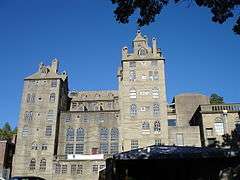
Mercer Museum |
|
000000001972-03-16-0000March 16, 1972
(#72001097) |
Pine and Ashland Streets
40°18′28″N 75°07′38″W / 40.307778°N 75.127222°W / 40.307778; -75.127222 (Mercer Museum) |
Doylestown |
|
| 83 |
Moland House |
|
000000001989-05-19-0000May 19, 1989
(#89000352) |
1641 Old York Road
40°14′10″N 75°05′34″W / 40.236111°N 75.092778°W / 40.236111; -75.092778 (Moland House) |
Warwick Township |
|
| 84 |
Moravian Pottery and Tile Works |
|
000000001972-06-01-0000June 1, 1972
(#72001098) |
Court Street and Pennsylvania Route 313
40°19′23″N 75°07′25″W / 40.323056°N 75.123611°W / 40.323056; -75.123611 (Moravian Pottery and Tile Works) |
Doylestown |
|
| 85 |
George Nakashima House, Studio and Workshop |
|
000000002008-08-14-0000August 14, 2008
(#08000782) |
1847 and 1858 Aquetong Road
40°20′23″N 74°57′19″W / 40.339722°N 74.955278°W / 40.339722; -74.955278 (George Nakashima House, Studio and Workshop) |
Solebury Township |
|
| 86 |
New Hope Village District |
|
000000001985-03-06-0000March 6, 1985
(#85000462) |
Old Mill Road, Stockton Avenue, Ferry, Bridge, Mechanic, Randolph, Main, Coryell, and Waterloo Streets
40°21′30″N 74°57′09″W / 40.358333°N 74.9525°W / 40.358333; -74.9525 (New Hope Village District) |
New Hope |
|
| 87 |
Newtown Creek Bridge |
|
000000001988-06-22-0000June 22, 1988
(#88000787) |
Richboro Road over Newtown Creek
40°13′40″N 74°56′20″W / 40.227778°N 74.938889°W / 40.227778; -74.938889 (Newtown Creek Bridge) |
Newtown |
|
| 88 |
Newtown Friends Meetinghouse and Cemetery |
|
000000001977-07-21-0000July 21, 1977
(#77001129) |
Court Street
40°13′32″N 74°56′10″W / 40.225556°N 74.936111°W / 40.225556; -74.936111 (Newtown Friends Meetinghouse and Cemetery) |
Newtown |
|
| 89 |
Newtown Historic District |
|
000000001979-12-17-0000December 17, 1979
(#79002174) |
Pennsylvania Routes 332 and 413; also the eastern side of Sycamore St. from Frost Ln. to St. Andrew's Catholic Church; also parts of Congress, Chancellor and Liberty Sts. north of Washington Ave., and Chancellor St. south of Penn St. to S. State St.
40°13′39″N 74°56′11″W / 40.2275°N 74.936389°W / 40.2275; -74.936389 (Newtown Historic District) |
Newtown |
Second and third sets of boundaries represent boundary increases of 000000001986-02-25-0000February 25, 1986 and 000000001986-10-28-0000October 28, 1986
|
| 90 |
Newtown Presbyterian Church |
|
000000001987-07-16-0000July 16, 1987
(#87001212) |
Sycamore Street
40°13′56″N 74°56′20″W / 40.232222°N 74.938889°W / 40.232222; -74.938889 (Newtown Presbyterian Church) |
Newtown |
|
| 91 |
Amos Palmer House |
|
000000001988-11-18-0000November 18, 1988
(#88002661) |
Township Line Road
40°12′44″N 74°52′53″W / 40.212222°N 74.881389°W / 40.212222; -74.881389 (Amos Palmer House) |
Lower Makefield Township |
|
| 92 |
Isaiah Paxson Farm |
|
000000001984-08-23-0000August 23, 1984
(#84003167) |
Along River Road across from its junction with Laurel Road[5]
40°24′14″N 74°59′22″W / 40.4039°N 74.9894°W / 40.4039; -74.9894 (Isaiah Paxson Farm) |
Solebury Township |
|
| 93 |
Phineas Pemberton House |
|
000000001971-09-28-0000September 28, 1971
(#71000684) |
Holly Drive in Levittown
40°09′37″N 74°50′23″W / 40.1603°N 74.8397°W / 40.1603; -74.8397 (Phineas Pemberton House) |
Bristol Township |
|
| 94 |
Penn's Park General Store Complex |
|
000000001985-01-08-0000January 8, 1985
(#85000072) |
2310-2324 Second Street Pike
40°15′57″N 74°59′56″W / 40.2658°N 74.9989°W / 40.2658; -74.9989 (Penn's Park General Store Complex) |
Wrightstown Township |
|
| 95 |
Penns Park Historic District |
|
000000001986-03-13-0000March 13, 1986
(#86000349) |
Intersection of Second Street Pike and Penns Park Road
40°15′59″N 74°59′50″W / 40.2664°N 74.9972°W / 40.2664; -74.9972 (Penns Park Historic District) |
Wrightstown Township |
|
| 96 |
Pennsbury Manor |
|
000000001969-10-28-0000October 28, 1969
(#69000154) |
On the Delaware River south of Bordentown Road
40°08′00″N 74°46′12″W / 40.1333°N 74.77°W / 40.1333; -74.77 (Pennsbury Manor) |
Falls Township |
|
| 97 |
Perkasie Park Camp Meeting |
|
000000002016-08-29-0000August 29, 2016
(#16000571) |
200 S. 9th St.
40°22′26″N 75°18′05″W / 40.373759°N 75.301350°W / 40.373759; -75.301350 (Perkasie Park Camp Meeting) |
Perkasie |
|
| 98 |
Phillips Mill Historic District |
|
000000001983-06-30-0000June 30, 1983
(#83002220) |
River Road between Limeport and Chapel Road
40°22′58″N 74°58′10″W / 40.3828°N 74.9694°W / 40.3828; -74.9694 (Phillips Mill Historic District) |
Solebury Township |
|
| 99 |
Pine Valley Covered Bridge |
|
000000001980-12-01-0000December 1, 1980
(#80003437) |
North of New Britain on Township 340
40°18′19″N 75°11′16″W / 40.305278°N 75.187778°W / 40.305278; -75.187778 (Pine Valley Covered Bridge) |
New Britain Township |
|
| 100 |
Point Pleasant Historic District |
|
000000001989-10-05-0000October 5, 1989
(#89001652) |
River Road and Point Pleasant Pike
40°25′20″N 75°03′58″W / 40.422222°N 75.066111°W / 40.422222; -75.066111 (Point Pleasant Historic District) |
Plumstead and Tinicum Townships |
|
| 101 |
Quakertown Historic District |
|
000000002011-04-20-0000April 20, 2011
(#11000200) |
Roughly bounded by Main and Broad Streets; Hellertown, Tichikon, and Park Avenues
40°26′30″N 75°20′30″W / 40.441667°N 75.341667°W / 40.441667; -75.341667 (Quakertown Historic District) |
Quakertown |
|
| 102 |
Quakertown Passenger and Freight Station |
|
000000002000-04-14-0000April 14, 2000
(#00000382) |
Front and E. Broad Streets
40°26′23″N 75°20′04″W / 40.439722°N 75.334444°W / 40.439722; -75.334444 (Quakertown Passenger and Freight Station) |
Quakertown |
|
| 103 |
Red Hill Church and School |
|
000000001978-05-22-0000May 22, 1978
(#78002355) |
Durham Road
40°28′09″N 75°09′27″W / 40.469167°N 75.1575°W / 40.469167; -75.1575 (Red Hill Church and School) |
Tinicum Township |
|
| 104 |
Rhoads Homestead |
|
000000001996-08-08-0000August 8, 1996
(#85003655) |
102-106 W. Bridge Street
40°22′13″N 74°57′28″W / 40.370278°N 74.957778°W / 40.370278; -74.957778 (Rhoads Homestead) |
New Hope |
|
| 105 |
Joseph Richardson House |
|
000000001985-12-26-0000December 26, 1985
(#85003159) |
Bellevue and Maple Avenues
40°10′33″N 74°55′12″W / 40.175833°N 74.92°W / 40.175833; -74.92 (Joseph Richardson House) |
Langhorne |
|
| 106 |
Ridge Valley Rural Historic District |
|
000000001992-07-24-0000July 24, 1992
(#92000944) |
Roughly all of Sheep Hole Road and parts of Headquarters, Geigel Hill, Red Hill, Tabor and Bunker Hill Roads
40°28′31″N 75°08′29″W / 40.475278°N 75.141389°W / 40.475278; -75.141389 (Ridge Valley Rural Historic District) |
Tinicum Township |
|
| 107 |
Benjamin Riegel House |
|
000000001987-01-06-0000January 6, 1987
(#86003569) |
29 Delaware Road
40°35′41″N 75°11′35″W / 40.594722°N 75.193056°W / 40.594722; -75.193056 (Benjamin Riegel House) |
Riegelsville |
|
| 108 |
Riverside Farm |
|
000000001988-04-21-0000April 21, 1988
(#88000461) |
River and Headquarters Roads
40°30′01″N 75°04′06″W / 40.500278°N 75.068333°W / 40.500278; -75.068333 (Riverside Farm) |
Erwinna |
|
| 109 |
Enoch Roberts House |
|
000000001986-04-24-0000April 24, 1986
(#86000856) |
1226 W. Broad Street
40°26′32″N 75°21′07″W / 40.442222°N 75.351944°W / 40.442222; -75.351944 (Enoch Roberts House) |
Quakertown |
|
| 110 |
St. Elizabeth's Convent |
|
000000001978-03-21-0000March 21, 1978
(#78002352) |
1663 Bristol Pike
40°04′23″N 74°57′26″W / 40.0731°N 74.9572°W / 40.0731; -74.9572 (St. Elizabeth's Convent) |
Bensalem Township |
Now the Saint Katharine Drexel Shrine
|
| 111 |
Shaw Historic District |
|
000000001979-12-17-0000December 17, 1979
(#79002172) |
Bounded by S. Main, Ashland, Bridge, and S. Clinton Streets
40°18′25″N 75°07′48″W / 40.306944°N 75.13°W / 40.306944; -75.13 (Shaw Historic District) |
Doylestown |
|
| 112 |
Sheard's Mill Covered Bridge |
|
000000001980-12-01-0000December 1, 1980
(#80003445) |
East of Quakertown on Legislative Route 09129
40°27′17″N 75°16′44″W / 40.454722°N 75.278889°W / 40.454722; -75.278889 (Sheard's Mill Covered Bridge) |
East Rockhill and Haycock Townships |
|
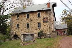
| 113 |
Levi Sheard Mill |
|
000000002006-12-20-0000December 20, 2006
(#06001149) |
8308 Covered Bridge Road
40°27′24″N 75°16′40″W / 40.456667°N 75.277778°W / 40.456667; -75.277778 (Levi Sheard Mill) |
East Rockhill Township |
|
| 114 |
Shelly School |
|
000000002011-02-22-0000February 22, 2011
(#11000037) |
130 Richlandtown Pike (Pennsylvania Route 212)
40°27′10″N 75°19′36″W / 40.452639°N 75.326528°W / 40.452639; -75.326528 (Shelly School) |
Richland Township |
|
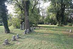
| 115 |
Slate Hill Cemetery |
|
000000001992-04-28-0000April 28, 1992
(#92000397) |
Junction of Yardley-Morrisville Road and Mahlon Drive
40°13′56″N 74°49′39″W / 40.232222°N 74.8275°W / 40.232222; -74.8275 (Slate Hill Cemetery) |
Lower Makefield Township |
|
| 116 |
Smith Family Farmstead |
|
000000001978-01-30-0000January 30, 1978
(#78002354) |
South of New Hope on River Road
40°19′06″N 74°55′39″W / 40.318333°N 74.9275°W / 40.318333; -74.9275 (Smith Family Farmstead) |
Upper Makefield Township |
|
| 117 |
William Smith House |
|
000000001977-04-13-0000April 13, 1977
(#77001131) |
Mud and Penns Park Road
40°15′56″N 74°59′08″W / 40.265556°N 74.985556°W / 40.265556; -74.985556 (William Smith House) |
Wrightstown Township |
|
| 118 |
Sotcher Farmhouse |
|
000000001977-12-27-0000December 27, 1977
(#77001125) |
335 Trenton Road
40°10′41″N 74°51′27″W / 40.1781°N 74.8575°W / 40.1781; -74.8575 (Sotcher Farmhouse) |
Falls Township |
|
| 119 |
South Perkasie Covered Bridge |
|
000000001980-12-01-0000December 1, 1980
(#80003441) |
South of Perkasie in Lenape Park, South Perkasie
40°22′03″N 75°17′43″W / 40.3675°N 75.295278°W / 40.3675; -75.295278 (South Perkasie Covered Bridge) |
Perkasie |
|
| 120 |
Southampton Baptist Church and Cemetery |
|
000000001978-09-18-0000September 18, 1978
(#78002359) |
2nd Street Pike and Maple Avenue
40°11′01″N 75°02′10″W / 40.183611°N 75.036111°W / 40.183611; -75.036111 (Southampton Baptist Church and Cemetery) |
Upper Southampton Township |
|
| 121 |
Spinner House |
|
000000001979-06-22-0000June 22, 1979
(#79002175) |
Spinnerstown and Sleepy Hollow Rds.
40°26′20″N 75°26′16″W / 40.438889°N 75.437778°W / 40.438889; -75.437778 (Spinner House) |
Milford Township |
|
| 122 |
Spring Valley Historic District |
|
000000001988-01-07-0000January 7, 1988
(#88000140) |
Mill Road and U.S. Route 202
40°19′07″N 75°04′59″W / 40.318611°N 75.083056°W / 40.318611; -75.083056 (Spring Valley Historic District) |
Buckingham Township |
|
| 123 |
Springdale Historic District |
|
000000001985-03-06-0000March 6, 1985
(#85000461) |
Mechanic Street, Old York, S. Sugan, and Stoney Hill Roads
40°21′43″N 74°57′50″W / 40.3619°N 74.9639°W / 40.3619; -74.9639 (Springdale Historic District) |
New Hope |
|
| 124 |
Springhouse Farm |
|
000000002007-08-08-0000August 8, 2007
(#07000796) |
2184 Springhouse Lane
40°31′44″N 75°16′27″W / 40.528889°N 75.274028°W / 40.528889; -75.274028 (Springhouse Farm) |
Springfield Township |
|
| 125 |
Springtown Historic District |
|
000000002008-01-10-0000January 10, 2008
(#07001379) |
Main Street between Drifting Drive and Springtown Hill Road
40°33′24″N 75°17′16″W / 40.556667°N 75.287778°W / 40.556667; -75.287778 (Springtown Historic District) |
Springfield Township |
|
| 126 |
Stover Mill |
|
000000001979-10-18-0000October 18, 1979
(#79002173) |
Pennsylvania Route 32
40°29′48″N 75°04′06″W / 40.496667°N 75.068333°W / 40.496667; -75.068333 (Stover Mill) |
Erwinna |
|
| 127 |
Isaac Stover House |
|
000000001990-04-26-0000April 26, 1990
(#90000702) |
River Road south of Geigel Hill Road
40°29′49″N 75°04′07″W / 40.496944°N 75.068611°W / 40.496944; -75.068611 (Isaac Stover House) |
Erwinna |
|
| 128 |
Stover-Myers Mill |
|
000000001978-09-13-0000September 13, 1978
(#78002357) |
North of Pipersville on Dark Hollow Road
40°26′15″N 75°07′26″W / 40.4375°N 75.123889°W / 40.4375; -75.123889 (Stover-Myers Mill) |
Bedminster Township |
|
| 129 |
Lewis Summers Farm |
|
000000001991-08-27-0000August 27, 1991
(#91001124) |
60 Headquarters Road
40°28′08″N 75°09′01″W / 40.468889°N 75.150278°W / 40.468889; -75.150278 (Lewis Summers Farm) |
Tinicum Township |
|
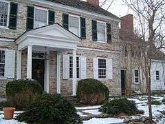
| 130 |
Summerseat |
|
000000001971-07-17-0000July 17, 1971
(#71000685) |
Clymer Street and Morris Avenue
40°12′28″N 74°46′48″W / 40.207778°N 74.78°W / 40.207778; -74.78 (Summerseat) |
Morrisville |
|
| 131 |
Tabor Home for Needy and Destitute Children |
|
000000001987-07-16-0000July 16, 1987
(#87001207) |
601 New Britain Road
40°17′32″N 75°07′47″W / 40.292222°N 75.129722°W / 40.292222; -75.129722 (Tabor Home for Needy and Destitute Children) |
Doylestown Township |
|
| 132 |
Benjamin Taylor Homestead |
|
000000001975-12-06-0000December 6, 1975
(#75001622) |
Northeast of Newtown off Pennsylvania Route 532
40°15′26″N 74°54′43″W / 40.257222°N 74.911944°W / 40.257222; -74.911944 (Benjamin Taylor Homestead) |
Lower Makefield Township |
|
| 133 |
Peter Taylor Farmstead |
|
000000001989-05-05-0000May 5, 1989
(#89000353) |
229 Wrights Road
40°15′16″N 74°56′07″W / 40.254444°N 74.935278°W / 40.254444; -74.935278 (Peter Taylor Farmstead) |
Newtown Township |
|
| 134 |
Teller Cigar Factory |
|
000000001987-01-06-0000January 6, 1987
(#86003567) |
340 N. Main Street
40°21′43″N 75°18′48″W / 40.361944°N 75.313333°W / 40.361944; -75.313333 (Teller Cigar Factory) |
Sellersville |
|
| 135 |
John Thompson House |
|
000000001973-07-16-0000July 16, 1973
(#73001595) |
1925 Second Street Pike
40°14′44″N 75°00′32″W / 40.245556°N 75.008889°W / 40.245556; -75.008889 (John Thompson House) |
Northampton Township |
|
| 136 |
Tomlinson-Huddleston House |
|
000000001983-11-10-0000November 10, 1983
(#83004200) |
109 W. Maple Avenue
40°10′34″N 74°55′17″W / 40.176111°N 74.921389°W / 40.176111; -74.921389 (Tomlinson-Huddleston House) |
Langhorne |
|
| 137 |
Trenton City/Calhoun Street Bridge |
|
000000001975-11-20-0000November 20, 1975
(#75001621) |
Spans the Delaware River between Trenton, New Jersey and Morrisville
40°13′11″N 74°46′42″W / 40.219722°N 74.778333°W / 40.219722; -74.778333 (Trenton City/Calhoun Street Bridge) |
Morrisville |
|
| 138 |
Trevose Manor |
|
000000001976-05-24-0000May 24, 1976
(#76001607) |
5408 Neshaminy Valley Road
40°08′45″N 74°56′01″W / 40.1458°N 74.9336°W / 40.1458; -74.9336 (Trevose Manor) |
Bensalem Township |
Also known as Growden Mansion
|
| 139 |
Twin Trees Farm |
|
000000001975-06-05-0000June 5, 1975
(#75001623) |
905 2nd Street Pike
40°12′41″N 75°00′39″W / 40.211389°N 75.010833°W / 40.211389; -75.010833 (Twin Trees Farm) |
Northampton Township |
|
| 140 |
Twining Farm |
|
000000001982-07-01-0000July 1, 1982
(#82003766) |
Buck Road
40°13′09″N 74°56′22″W / 40.219167°N 74.939444°W / 40.219167; -74.939444 (Twining Farm) |
Newtown Township |
|
| 141 |
George F. Tyler Mansion |
|
000000001987-07-16-0000July 16, 1987
(#87001210) |
Western side of Swamp Road/Pennsylvania Route 313
40°14′22″N 74°58′09″W / 40.239444°N 74.969167°W / 40.239444; -74.969167 (George F. Tyler Mansion) |
Newtown |
|
| 142 |
Uhlerstown Historic District |
|
000000001994-05-26-0000May 26, 1994
(#94000517) |
Roughly bounded by the Delaware River, Jugtown Hill Road, and the Delaware Canal
40°31′44″N 75°04′20″W / 40.528889°N 75.072222°W / 40.528889; -75.072222 (Uhlerstown Historic District) |
Tinicum Township |
|
| 143 |
Uneek Havana Cigar Company |
|
000000002007-11-07-0000November 7, 2007
(#07001160) |
1259 Pennsylvania Route 113
40°22′07″N 75°15′02″W / 40.368611°N 75.250694°W / 40.368611; -75.250694 (Uneek Havana Cigar Company) |
Hilltown Township |
|
| 144 |
Upper Aquetong Valley Historic District |
|
000000001987-07-30-0000July 30, 1987
(#87001216) |
Meeting House and Aquetong Roads, between U.S. Route 202 and Sugan Road
40°21′44″N 75°00′07″W / 40.362222°N 75.001944°W / 40.362222; -75.001944 (Upper Aquetong Valley Historic District) |
Solebury Township |
|
| 145 |
Van Sant Covered Bridge |
|
000000001980-12-01-0000December 1, 1980
(#80003438) |
South of New Hope on Township 392
40°19′37″N 74°57′29″W / 40.326944°N 74.958056°W / 40.326944; -74.958056 (Van Sant Covered Bridge) |
Solebury Township |
|
| 146 |
Vansant Farmhouse |
|
000000001977-08-02-0000August 2, 1977
(#77001130) |
North of Rushland on Ceder Lane
40°16′14″N 75°01′08″W / 40.270556°N 75.018889°W / 40.270556; -75.018889 (Vansant Farmhouse) |
Wrightstown Township |
|
| 147 |
Village of Edgewood Historic District |
|
000000001980-11-28-0000November 28, 1980
(#80003433) |
Yardley, Langhorne, Edgewood and Stony Hill Roads
40°13′22″N 74°52′31″W / 40.2228°N 74.8753°W / 40.2228; -74.8753 (Village of Edgewood Historic District) |
Lower Makefield Township |
|
| 148 |
Waldenmark |
|
000000002001-08-30-0000August 30, 2001
(#01000924) |
1280 and 1300 Wrightstown Road
40°16′32″N 74°58′13″W / 40.275556°N 74.970278°W / 40.275556; -74.970278 (Waldenmark) |
Wrightstown Township |
|
| 149 |
Walt Disney Elementary School |
|
000000002007-08-30-0000August 30, 2007
(#07000889) |
200 Lakeside Drive N., Levittown
40°09′13″N 74°49′08″W / 40.1537°N 74.8189°W / 40.1537; -74.8189 (Walt Disney Elementary School) |
Tullytown |
|
| 150 |
Isaiah Warner Farmstead |
|
000000002004-08-20-0000August 20, 2004
(#04000883) |
60 Thompson Mill Road
40°17′16″N 74°58′40″W / 40.287778°N 74.977778°W / 40.287778; -74.977778 (Isaiah Warner Farmstead) |
Wrightstown Township |
|
| 151 |
Washington's Crossing |
|
000000001966-10-15-0000October 15, 1966
(#66000650) |
Between Yardley and New Hope, on the Delaware River
40°17′57″N 74°52′07″W / 40.299167°N 74.868611°W / 40.299167; -74.868611 (Washington's Crossing) |
Yardley |
|
| 152 |
White Hall of Bristol College |
|
000000001984-01-12-0000January 12, 1984
(#84003177) |
701-721 Shadyside Avenue
40°04′48″N 74°54′08″W / 40.080000°N 74.902222°W / 40.080000; -74.902222 (White Hall of Bristol College) |
Bristol Township |
|
| 153 |
Willow Mill Complex |
|
000000002002-05-09-0000May 9, 2002
(#02000476) |
570, 559, and 569 Bustleton Pike
40°11′58″N 75°00′38″W / 40.199444°N 75.010556°W / 40.199444; -75.010556 (Willow Mill Complex) |
Northampton Township |
|
| 154 |
Wrightstown Friends Meeting Complex |
|
000000001975-10-29-0000October 29, 1975
(#75001624) |
Pennsylvania Route 413
40°15′55″N 74°59′00″W / 40.265278°N 74.983333°W / 40.265278; -74.983333 (Wrightstown Friends Meeting Complex) |
Wrightstown Township |
|
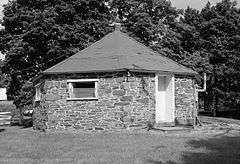
| 155 |
Wrightstown Octagonal Schoolhouse |
|
000000002007-11-09-0000November 9, 2007
(#07000586) |
2091 Second Street Pike
40°15′24″N 75°00′23″W / 40.256667°N 75.006389°W / 40.256667; -75.006389 (Wrightstown Octagonal Schoolhouse) |
Wrightstown Township |
|
| 156 |
Wycombe Village Historic District |
|
000000001985-01-31-0000January 31, 1985
(#85000177) |
Roughly bounded by township line, Mill Creek and Forest Grove Roads, Cherry Lane, Washington and Park Avenues
40°16′57″N 75°01′07″W / 40.2825°N 75.018611°W / 40.2825; -75.018611 (Wycombe Village Historic District) |
Buckingham and Wrightstown Townships |
|
| 157 |
Yardley Historic District |
|
000000002005-05-10-0000May 10, 2005
(#05000417) |
Roughly bounded by Main Street, Afton Avenue, Letchworth Avenue, Canal Street, S. Edgewater Avenue, and the Delaware Canal
40°14′34″N 74°50′11″W / 40.242778°N 74.836389°W / 40.242778; -74.836389 (Yardley Historic District) |
Yardley |
|
%2C_Andalusia_(Bucks_County%2C_Pennsylvania).jpg)

.jpg)


.jpg)


%2C_Morrisville_(Bucks_County%2C_Pennsylvania).jpg)