List of heritage sites in Wynberg, Cape Town
This is a list of the heritage sites in Wynberg Magisterial District in Cape Town, as recognized by the South African Heritage Resources Agency.[1]
| SAHRA identifier | Site name | Description | Town | District | NHRA status | Coordinates | Image |
|---|---|---|---|---|---|---|---|
| 9/2/111/0144 | Old Organ (1897), Moravian Church, Bridgetown, Athlone | Athlone | Wynberg | 
| |||
| 9/2/111/0024 | "Sonnenhof", Homestead Avenue, Bergvliet, Cape Town | Bergvliet | Wynberg |
| |||
| 9/2/111/0050 | Bergvliet Farm, Bergvliet, Cape Town | Type of site: Farm Complex. The Cape Dutch house on this historic farmyard dates from 1769. The ring-wall and outbuildings were erected in about the middle of the nineteenth century. The farm Bergvliet originally formed part of Simon van der Stel's farm Constantia. | Cape Town, Bergvliet | Wynberg | Provincial Heritage Site | 34°02′45″S 18°27′15″E / 34.045833°S 18.454167°E | 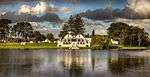 |
| 9/2/111/0126 | Dreyersdal Farm, Dreyersdal Road, Bergvliet, Cape Town | Bergvliet | Wynberg | 34°03′21″S 18°27′22″E / 34.055720°S 18.456128°E |
| ||
| 9/2/111/0060 | Van Riebeeck's Hedge, Bishopscourt, Cape Town | Bishopscourt | Wynberg | 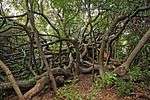 | |||
| 9/2/111/0060/002 | Van Riebeeck's Hedge, Bishopscourt, Cape Town | This Wild almond hedge was planted in 1660 on the instructions on Jan van Riebeeck to mark the boundaries of the settlement at the Cape. The two portions of the hedge which escaped destruction are the oldest declared national monuments in South Africa. | Cape Town, Bishopscourt | Wynberg | Provincial Heritage Site | 33°59′42″S 18°26′44″E / 33.994875°S 18.445593°E |
|
| 9/2/111/0145 | Bishops Court, Wynberg District | Bishopscourt | Wynberg |
| |||
| 9/2/111/0045 | Church of the Good Shepherd, Kirstenbosch Drive, Bishopscourt, Cape | Bishopscourt | Wynberg | 33°59′11″S 18°26′13″E / 33.986493°S 18.436946°E |
| ||
| 9/2/111/0060/001 | Van Riebeeck's Hedge, Kirstenbosch Botanical Garden, Cape Town | Type of site: Hedge, Fortification. | Bishopscourt | Wynberg | Provincial Heritage Site | 33°59′15″S 18°25′58″E / 33.987562°S 18.432766°E | 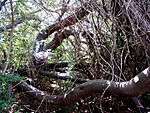 |
| 9/2/111/0134 | Botanical Gardens, Kirstenbosch, Cape Town | Bishopscourt | Wynberg | 33°59′15″S 18°25′58″E / 33.987523°S 18.432786°E | 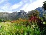 | ||
| 9/2/111/0077 | CLAREMONT, GENERAL, CAPE TOWN | Claremont | Wynberg |
| |||
| 9/2/111/0117 | St Saviour's Church, Main Road, Claremont, Cape Town | The nucleus of this neo-Gothic church was designed and erected by Sophia Gray in 1850. The bell tower, the two bays for the nave and the north-west porch were added in honour of Bishop Gray and his wife Sophia who died in 1872 and 1871, respectively. Fur Type of site: Church Current use: Church : Anglican. The nucleus of this neo-Gothic church was designed and erected by Sophia Gray in 1850. The bell tower, the two bays for the nave and the north-west porch were added in honour of Bishop Gray and his wife Sophia who died in 1872 and 1871, respectively. Fu | Cape Town, Claremont | Wynberg | Provincial Heritage Site | 33°57′24″S 18°28′17″E / 33.956568°S 18.471363°E | 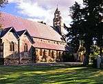 |
| 9/2/111/0143 | Palmyra Homestead, 7 Montrose Street, Claremont, Cape Town | The earlier wing of the house is exceptionally old, originally being a simple four roomed cottage, probably dating to the 18th century, when the property formed part of the Weltevreden Estate. Very few such early structures are known to exist in the subu | Cape Town, Claremont | Wynberg | Register | 33°58′55″S 18°28′08″E / 33.981844°S 18.468801°E |
|
| 9/2/111/0027 | 65 Bowwood Road, Claremont, Cape Town | Claremont | Wynberg | 33°59′14″S 18°27′14″E / 33.987103°S 18.453764°E |
| ||
| 9/2/111/0032 | Vredenhof, Keurboom Road, Claremont, Cape Town | Cape Town, Claremont | Wynberg | Provincial Heritage Site | 33°58′21″S 18°28′25″E / 33.972553°S 18.473542°E | 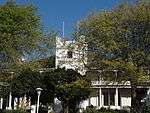 | |
| 9/2/111/0034 | Herschel Memorial Obelisk, Grove Primary School, Feldhausen Road, Claremont, Cape Town | Beyond Newlands lies the suburb of Claremont. The Herschel monument stands in Grove Avenue on what was formerly the Feldhausen property.
Sir John F. W. Herschel (1792-1871) was a famous British astronomer, the only son of an equally famous astronomer, Sir Type of site: School. |
Cape Town, Claremont | Wynberg | Provincial Heritage Site | 33°56′47″S 18°28′20″E / 33.946345°S 18.472217°E | 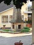 |
| 9/2/111/0040 | 15 Feldhausen Avenue, Claremont, Cape Town | Claremont | Wynberg | 33°58′52″S 18°27′33″E / 33.981226°S 18.459278°E |
| ||
| 9/2/111/0054 | Arderne Public Gardens, Main Road, Claremont, Cape Town | These gardens were established by Ralph Henry Arderne in 1845 and with the help of his son, Henry Mathew, he developed them into one of the most imported gardens of the Victorian era. These gardens are of great botanical, scientific and environmental impo Type of site: Botanical Garden. | Cape Town, Claremont | Wynberg | Provincial Heritage Site | 33°57′24″S 18°28′17″E / 33.956568°S 18.471363°EArderne Public Gardens, Main Road, Claremont, Cape Town) | 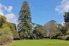 |
| 9/2/111/0069 | Congregational Church, Main Road, Claremont, Cape Town | The original part of the church building dates from 1877. The church itself is closely associated with the history of the southern suburbs of Cape Town Type of site: Church Current use: Church : Congregational. | Cape Town, Claremont | Wynberg | Provincial Heritage Site | 33°57′24″S 18°28′17″E / 33.956568°S 18.471363°E |  |
| 9/2/111/0150 | Rochford, 5 Montrose Avenue, Claremont, Cape Town | This early to mid 19th century cottage together with the neighbouring Palmyra homestead constitute a fine example of the original settlement in Claremont and are the key to the ambiance of this road. The building is well maintained and retains much of its | Cape Town, Claremont | Wynberg | Register | 33°58′54″S 18°28′07″E / 33.981592°S 18.468731°E |
|
| 9/2/111/0153 | Burial Vaults, cnr Bishoplea and Feldhausen, Claremont | Claremont | Wynberg | 33°58′56″S 18°27′34″E / 33.982194°S 18.459545°E |
| ||
| 9/2/111/0014 | CONSTANTIA MUNICIPAL AREA GENERAL, WYNBERG DISTRICT | Constantia | Wynberg |
| |||
| 9/2/111/0003 | Alphen, Constantia, Cape Town | The Alphen property was granted to Theunis van Schalkwyk in 1714. The historic homestead dates back to the middle of the 18th century, although the upper storey was probably added only later. Architecturally, Alphen is a square double-storeyed manor house. Type of site: Farmstead. | Cape Town, Constantia | Wynberg | Provincial Heritage Site | 34°00′57″S 18°27′01″E / 34.015829°S 18.450298°E | 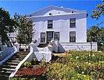 |
| 9/2/111/0015 | Groot Constantia, Constantia, Wynberg District | Main article: Groot Constantia The road to Constantia swings to the right in Wynberg to enter Constantia, one of the most picturesque valleys in South Africa. Here we find some of the best examples of Cape Dutch architecture, and the best known of them is Groot Constantia. On 31 July 1685, the High Commissioner, Hendrik Adriaan van Reede, granted a farm of 762 hectares, which was to become known as Constantia, to Simon van der Stel. The origin of the name is not known. Various additions were made to the original grant fr Type of site: Farmstead. The Groot Constantia State Estate previously formed part of the farm Constantia, which was granted to Simon van der Stel in 1685 and was subdivided after his death in 1712. The farm Constantia with the Cape Dutch manor house thereon was acquired in 1885. |
Cape Town, Constantia | Wynberg | Provincial Heritage Site | 34°01′33″S 18°25′23″E / 34.025761°S 18.423079°E | 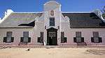 |
| 9/2/111/0015/007 | Hoop op Constantia, Constantia, Wynberg District | Hoop op Constantia is only a short distance from Groot Constantia and is most easily reached on foot from there. Hoop op Constantia was originally a part of Simon van der Stel’s estate Constantia. After his death his executrix, Johanna Wessels, Frans van Type of site: Farm Complex. The Groot Constantia State Estate previously formed part of the farm Constantia, which was granted to Simon van der Stel in 1685 and was subdivided after his death in 1712. The farm Constantia with the Cape Dutch manor house thereon was acquired in 1885. | Cape Town, Constantia | Wynberg | Provincial Heritage Site | 34°01′33″S 18°25′23″E / 34.025761°S 18.423079°E |  |
| 9/2/111/0015/1 | Jonkershuis complex, Groot Constantia, Constantia, Wynberg District | Constantia | Wynberg | 34°01′50″S 18°25′09″E / 34.030659°S 18.419072°E | 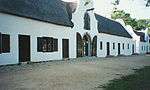 | ||
| 9/2/111/0015/2 | Bertram wine cellar, Groot Constantia, Constantia, Wynberg District | Constantia | Wynberg |
| |||
| 9/2/111/0015/3 | Old wine cellar, Groot Constantia, Constantia, Wynberg District | Constantia | Wynberg | 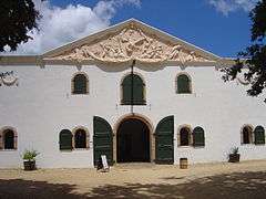 | |||
| 9/2/111/0015/4 | Cloete cemetery, Groot Constantia, Wynberg District | Constantia | Wynberg | 34°00′58″S 18°26′28″E / 34.016133°S 18.440991°E |
| ||
| 9/2/111/0015/5 | Colyn burial vault, Groot Constantia, Constantia, Wynberg District | Constantia | Wynberg |
| |||
| 9/2/111/0015/6 | Main house, Groot Constantia, Constantia, Wynberg District | Constantia | Wynberg | 34°01′47″S 18°25′15″E / 34.029691°S 18.420806°E |
| ||
| 9/2/111/0065 | Timour Hall, Constantia, Cape Town | Type of site: House. This historic building is built in an interesting mixture of eighteenth and nineteenth century architectural styles. The large property on which it stands also contributes considerably to the character of the urban area in which it is situated. | Cape Town, Constantia | Wynberg | Provincial Heritage Site | 34°01′15″S 18°27′52″E / 34.020784°S 18.464362°E |
|
| 9/2/111/0065/1 | Constantia Glen, cnr Lochner & Martin Roads, Constantia, Wynberg | Constantia | Wynberg | 34°01′23″S 18°27′28″E / 34.023099°S 18.457759°E |
| ||
| 9/2/111/0087 | Conway Redoubt, Constantia Nek, Wynberg District | Constantia | Wynberg |
| |||
| 9/2/111/0091 | Hohenhort, Claasenbosch, Constantia, Wynberg District | Constantia | Wynberg | 34°00′07″S 18°26′04″E / 34.001902°S 18.434524°E |
| ||
| 9/2/111/0094 | Nova Constantia, Constantia, Wynberg District | Nova Constantia originally formed part of the Groot Constantia estate and the house probably dates from the first quarter of the 19th century. The homestead is U-shaped and is regarded, mainly because of its impressive gables and its setting, as one of the Type of site: Farmstead. | Cape Town, Constantia | Wynberg | Provincial Heritage Site | 34°01′33″S 18°25′23″E / 34.025761°S 18.423079°E |  |
| 9/2/111/0109 | Goedgeloof, Provence Avenue, Constantia, Cape Town | Goedgeloof stands side by side with the larger more impressive Bel Ombre. It was possibly a guesthouse to the main building. The house, which originally had no hearth, was upgraded during the later part of 19th century. This possibly happened while DR. H The farm which originally included both the properties, Belle Ombre and Goedgeloof was granted in 1728 to two brothers named Beck.
In 1744 the farm, which was by now known as Goedgeloef, was bought by Jacob van Reenen. In 1775 it came into the joint own Type of site: House Current use: House. |
Cape Town, Constantia | Wynberg | Provincial Heritage Site | 34°00′46″S 18°25′49″E / 34.012865°S 18.430165°E |
|
| 9/2/111/0130 | Oran Cayen graveyard, Tokai Road, Constantia, Wynberg District | Constantia | Wynberg |
| |||
| 9/2/111/0131 | Parish Road cemetery, Constantia, Wynberg District | Constantia | Wynberg |
| |||
| 9/2/111/0142 | Klein Constantia, Klein Constantia Road, Constantia | Constantia | Wynberg | 34°02′21″S 18°24′47″E / 34.039066°S 18.412958°E |
| ||
| 9/2/111/0159 | Kramat, Erf 2610, Islam Hill, Constantia | Constantia | Wynberg |
| |||
| 9/2/111/0011 | HOUT BAY MUNICIPAL AREA GENERAL, WYNBERG DISTRICT | Hout Bay | Wynberg |
| |||
| 9/2/111/0141 | Chapmans Peak Scenic Drive, Wynberg District | Hout Bay | Wynberg | 34°03′28″S 18°21′58″E / 34.057729°S 18.366071°E | 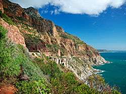 | ||
| 9/2/111/0026 | West Battery (West Fort), Hout Bay, Cape Town | The Dutch East India Company, and later the British government, were interested in Hout Bay not only because of its forests, but also because it could serve as an alternative anchorage when Table Bay was unsafe, and above all because it offered a possible... Type of site: Battery. | Cape Town, Hout Bay | Wynberg | Provincial Heritage Site | 34°03′20″S 18°20′52″E / 34.055599°S 18.347686°E |
|
| 9/2/111/0048 | East Fort and Battery, Hout Bay, Cape Town | The Dutch East India Company, and later the British government, were interested in Hout Bay not only uecause of its forests, but also because it could serve as an alternative anchorage when Table Bay was unsafe, and above all because it offered a possible Type of site: Fort Previous use: Fortification. Current use: Vacant. | Cape Town, Hout Bay | Wynberg | Provincial Heritage Site | 34°02′00″S 18°21′00″E / 34.033333°S 18.350000°E |  |
| 9/2/111/0049 | Kronendal, Main Road, Hout Bay, Cape Town | In the very year that he arrived at the Cape, Jan van Riebeeck sent woodsmen to Hout Bay to look for timber and in July, 1653, he went to investigate the forests in the “Houtbayken” for himself. In his journal he wrote:
“The forests were the finest in the Type of site: Farmstead. Kronendal was built in 1800 and is a very fine example of the old Cape Architecture. |
Cape Town, Hout Bay | Wynberg | Provincial Heritage Site | 34°02′20″S 18°21′31″E / 34.038898°S 18.358491°E | 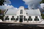 |
| 9/2/111/0012 | "Southern Cross", Bloemerf, Valley Road, Hout Bay, Wynberg District | Hout Bay | Wynberg |
| |||
| 9/2/111/0068 | Old Hout Bay Post Office, Main Road, Hout Bay | Hout Bay | Wynberg | 34°02′33″S 18°21′33″E / 34.042408°S 18.359147°E |
| ||
| 9/2/111/0075 | Oak Villa, Baviaanskloof Road, Hout Bay, Cape Town | Oak Villa is one of the first townhouses in Hout Bay and the first to be erected in the Baviaanskloof area. The original portion of this cottage, consisting of three rooms, was erected in 1850 by the then owner Mr. Trautman as a second dwelling house. It Type of site: House. The core of this fisherman's cottage, in the typical vernacular style, dates from the 1850s. Additions were made in 1878. | Cape Town, Hout Bay | Wynberg | Provincial Heritage Site | 34°02′39″S 18°21′56″E / 34.044095°S 18.365567°E |
|
| 9/2/111/0089 | Groot Moddergat, Main Road, Hout Bay | Hout Bay | Wynberg |
| |||
| 9/2/111/0140 | Nooitgedacht Barn, cnr Lentedal & Valley Roads, Hout Bay | Hout Bay | Wynberg |
| |||
| 9/2/111/0149 | Historic Oak Avenue, Erf 4029, Hout Bay | Hout Bay | Wynberg |
| |||
| 9/2/111/0007 | Long Kloof, Main Road, Hout Bay, Cape Town | The land on which Langkloof stands was granted to Christopher Bird, Colonial Secretary of the Cape, in 1821. By 1885 the property belonged to P.O. Boonzaaier who built Moddergat of which Langkloof was the wine cellar. | Cape Town, Hout Bay | Wynberg | Provincial Heritage Site | 34°02′20″S 18°21′31″E / 34.038898°S 18.358491°E | 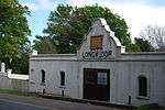 |
| 9/2/111/0009 | Hout Bay Hotel, Hout Bay, Wynberg District | Hout Bay | Wynberg | 34°02′35″S 18°21′38″E / 34.043185°S 18.360574°E |
| ||
| 9/2/111/0021 | KENILWORTH, GENERAL, CAPE TOWN | Kenilworth | Wynberg |
| |||
| 9/2/111/0013 | Pelyn, Ascot Road, Kenilworth, Cape Town | Type of site: House. This house and garden is an important example of British Colonial architecture at the turn of the century and is notable as the home of the architect F K Kendall. | Cape Town, Kenilworth | Wynberg | Provincial Heritage Site | 33°59′45″S 18°28′41″E / 33.995846°S 18.478052°E |  |
| 9/2/111/0023 | "Bedford", cnr Melbourne & Stamford Roads, Kenilworth, Cape Town | Kenilworth | Wynberg | 33°59′41″S 18°27′38″E / 33.994814°S 18.460419°E |
| ||
| 9/2/111/0056 | Stellenberg, Oak Avenue, Kenilworth, Cape Town | Type of site: Farmstead. Stellenberg is one of the finest and most historical of the Cape Dutch gabled houses. It dates from the second half of the eighteenth century. | Cape Town, Kenilworth | Wynberg | Provincial Heritage Site | 33°59′41″S 18°27′52″E / 33.994819°S 18.464455°E | 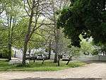 |
| 9/2/111/0058 | Highlands, 36 Tennant Road, Kenilworth, Cape Town | Kenilworth | Wynberg | 33°59′49″S 18°27′49″E / 33.997045°S 18.463492°E |
| ||
| 9/2/111/0074 | Ascot House, 5 Ascot Road, Kenilworth, Cape Town | Cape Town, Kenilworth | Wynberg | Provincial Heritage Site | 33°59′54″S 18°28′33″E / 33.998206°S 18.475941°E | 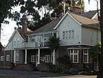 | |
| 9/2/111/0084 | Beau Soleil, Salisbury Road, Kenilworth, Cape Town | The property on which this late nineteenth century home was bought in 1877 by Mr. Dirk Cloete and the house was built during the same year. In 1920 it was sold to Mr. John G Rose.
The house is a gentlemen’s residence in the neo-Gothic style. Later additio The original portion of this double-storeyed manor house with its neo-Gothic and Victorian characteristics was built in 1877 by Dirk Cloete. Further additions, as well as the redbrick coach house with its elegant rustication, were made at the turn of the . |
Cape Town, Kenilworth | Wynberg | Provincial Heritage Site | 33°59′58″S 18°28′16″E / 33.999347°S 18.471110°E |
|
| 9/2/111/0088 | Banksia, 2 Pine Street, Kenilworth, Cape Town | Kenilworth | Wynberg | 33°59′27″S 18°28′13″E / 33.990713°S 18.470218°E |
| ||
| 9/2/111/0111 | 15 Alexander Road, Kenilworth, Cape Town | Cape Town, Kenilworth | Wynberg | Provincial Heritage Site | 33°58′40″S 18°30′16″E / 33.9776888888°S 18.5044111111°E |
| |
| 9/2/111/0120 | Kenilworth Clinic, Kenilworth Road, Kenilworth, Cape Town | Kenilworth | Wynberg | 33°59′43″S 18°28′20″E / 33.995167°S 18.472279°E |
| ||
| 9/2/111/0138 | 2 Richmond Road/20 Kenilworth Road, Kenilworth, Cape Town | Kenilworth | Wynberg | 33°59′44″S 18°28′16″E / 33.995505°S 18.471244°E |
| ||
| 9/2/111/0138/1 | 2 Richmond Road, Kenilworth, Cape Town | Kenilworth | Wynberg | 33°59′44″S 18°28′16″E / 33.995505°S 18.471244°E |
| ||
| 9/2/111/0161 | KHAYELITSHA LOCAL AREA GENERAL, WYNBERG DISTRICT | Khayelitsha | Wynberg |
| |||
| 9/2/111/0158 | Langa Local Area, General | Langa | Wynberg |
| |||
| 9/2/111/0128/1 | Conservation areas, Mowbray, Rosebank, Rondebosch and Silwood, Wynberg | Wynberg |
| ||||
| 9/2/111/0064 | Mostert's Mill Complex, Mowbray, Cape Town | Mowbray | Wynberg |  | |||
| 9/2/111/0064/001 | Welgelegen Cemetery, Cape Town | Type of site: Graveyard Current use: Graveyard. | Cape Town, Mowbray | Wynberg | Provincial Heritage Site | 33°56′46″S 18°28′34″E / 33.946111°S 18.476111°E |
|
| 9/2/111/0064/002 | Welgelegen Homestead, Mowbray, Cape Town | Approached through werf, avenue of oaks from north, central gable, central front door with fanlight over (from Civil Service Club) flanked by 2 small windows, tiled roof FINISH THIS ex CDC 2001. The original house on the historic Welgelegen property was drastically altered from 1899 to 1902 according to a design by Sir Herbert Baker. The rebuilt house in the pseudo Cape Dutch style was thereafter made available by Cecil John Rhodes to the Curry f Type of site: House. | Cape Town, Mowbray | Wynberg | Provincial Heritage Site | 33°56′47″S 18°28′26″E / 33.946377°S 18.473918°E | 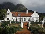 |
| 9/2/111/0064/003 | De Meule, Mowbray, Cape Town | Type of site: Farmhouse. | Cape Town, Mowbray | Wynberg | Provincial Heritage Site | 33°56′47″S 18°28′26″E / 33.946377°S 18.473918°E |  |
| 9/2/111/0064/004 | Mostert's Mill, Mowbray, Cape Town | Type of site: Wind Mill Previous use: Mill. | Cape Town, Mowbray | Wynberg | Provincial Heritage Site | 33°56′47″S 18°28′26″E / 33.946377°S 18.473918°E |  |
| 9/2/111/0064/005 | Welgelegen Gateposts, Mowbray, Cape Town | In addition to Mostert’s Mill which has already been mentioned, there are other very interesting buildings on the Welgelegen estate which was granted to Cornelis Stevensz Botma in 1676. Just below the Mill there is a T-shaped house. This is probably the o Type of site: Gate. | Cape Town, Mowbray | Wynberg | Provincial Heritage Site | 33°56′47″S 18°28′26″E / 33.946377°S 18.473918°E |
|
| 9/2/111/0121 | Vredenburg, Mowbray, Cape Town | Type of site: Farmstead. | Cape Town, Mowbray | Wynberg | Provincial Heritage Site | 33°57′04″S 18°28′38″E / 33.951075°S 18.477314°E |
|
| 9/2/111/0061 | NEWLANDS, GENERAL, CAPE TOWN | Newlands | Wynberg |
| |||
| 9/2/111/0028 | Tabora, Boshof Avenue, Newlands, Cape Town | Type of site: House. | Cape Town, Newlands | Wynberg | Provincial Heritage Site | 33°58′49″S 18°26′54″E / 33.980146°S 18.448262°E |
|
| 9/2/111/0031 | Mill House, Boundary Road, Newlands, Cape Town | The Mill House was originally built in 1840’s by Jacob Letterstedt for use by the engineer foreman of the adjoining Josephine watermill. In 1862 Letterstedt died and the house was passed to J. Letterstedt and Company, but the engineer continued to live th Type of site: Mill House. The Mill House with its garden forms an integral part of the historic Josephine Mill complex. | Cape Town, Newlands | Wynberg | Provincial Heritage Site | 33°58′12″S 18°28′05″E / 33.969876°S 18.468083°E | 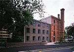 |
| 9/2/111/0033 | Vineyard Hotel, Newlands, Cape Town | The original part of the Vineyard Hotel was built in the Adam style between 1799 and 1800 by Andrew Barnard and his wife, Lady Anne, as a country residence.
It was named "The Vineyard" by the Barnards. The natural beauty of the grounds still reflects the Type of site: Hotel. |
Cape Town, Newlands | Wynberg | Provincial Heritage Site | 33°58′30″S 18°28′03″E / 33.975125°S 18.467379°E |
|
| 9/2/111/0037 | Paradise, Ruins of Lady Anne Barnard's Cottage, Newlands, Cape Town | Newlands | Wynberg |
| |||
| 9/2/111/0039 | Glass Bottle Dump, Newlands, Cape Town | Newlands | Wynberg |
| |||
| 9/2/111/0047 | Michaelis House, Boys Hostel, Newlands Avenue, Newlands, Cape Town | Newlands | Wynberg |
| |||
| 9/2/111/0062 | Mount Pleasant, 10 Newlands Avenue, Newlands, Cape Town | Type of site: House. | Cape Town, Newlands | Wynberg | Provincial Heritage Site | 33°58′45″S 18°27′00″E / 33.979167°S 18.450000°E |
|
| 9/2/111/0066 | Old St Andrew's Church, Palmboom Road, Newlands, Cape Town | At the corner which is formed by Palmboom Road and Newlands Avenue stands the charming little church of St. Andrew. It is a small building but its style of architecture gives it a distinction which pleases and impresses the passer-by. The low, thick walls Type of site: Church Previous use: Church. Current use: Residential. This attractive little church has considerable architectural merit and was built in about 1857. | Cape Town, Newlands | Wynberg | Provincial Heritage Site | 33°58′45″S 18°27′00″E / 33.979167°S 18.450000°E | 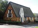 |
| 9/2/111/0067 | St. Andrews Church in the Oaks, 77 Kildare Road, Newlands, Cape Town | Newlands | Wynberg | 33°58′26″S 18°27′22″E / 33.973897°S 18.456084°E |
| ||
| 9/2/111/0076 | Montebello Stables, 31 Newlands Avenue, Newlands, Cape Town | Newlands | Wynberg | 33°58′13″S 18°27′27″E / 33.970273°S 18.457431°E |
| ||
| 9/2/111/0079 | Josephine Mill, Newlands, Cape Town | The property known as the Josephine Mill and occasionally Letterstedt’s Mill in Boundary road, Newlands, came into the ownership of the Historical Society of Cape Town in 1975 by Deed of Gift from Miss I East s has owned it for twenty years. It is singula Type of site: Water Mill Current use: Mill / Museum. The Josephine Mill, a watermill built by Jacob Letterstedt in 1840, has close historical links with the nearby brewery, whose original building this same Letterstedt erected in 1859. The historical interest of the Josephine Mill is, moreover, enhanced by | Cape Town, Newlands | Wynberg | Provincial Heritage Site | 33°58′30″S 18°28′03″E / 33.975125°S 18.467379°E | |
| 9/2/111/0086 | Albion Springs, Main Road, Newlands, Cape Town | Newlands | Wynberg | 33°58′03″S 18°28′02″E / 33.967407°S 18.467102°E |
| ||
| 9/2/111/0096 | 50 Palmboom Road, Newlands, Cape Town | Newlands | Wynberg | 33°58′26″S 18°27′31″E / 33.973981°S 18.458552°E |
| ||
| 9/2/111/0104 | The Red House, Hiddingh Avenue, Newlands, Cape Town | The rear part of The Red House is believed to have been built before 1729 while the remainder of the house definitely dates from the early nineteenth century. The Red House is consequently one of the oldest houses in Cape Town's southern suburbs. Type of site: House Current use: Residential. The rear part of The Red House is believed to have been built before 1729 while the remainder of the house definitely dates from the early nineteenth century. The Red House is consequently one of the oldest houses in Cape Town's southern suburbs. | Cape Town, Newlands | Wynberg | Provincial Heritage Site | 33°58′44″S 18°27′11″E / 33.979021°S 18.453104°E |
|
| 9/2/111/0106 | Boshof house and gateway, Paradise Road, Newlands, Cape Town | Newlands | Wynberg | 33°58′43″S 18°27′00″E / 33.978495°S 18.450020°E | 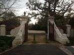 | ||
| 9/2/111/0106/001 | Boshof gateway, Paradise Road, Newlands, Cape Town | Adjoining historic Rondebosch lies Newlands, named so by Ryk Tulbagh when he built a new country residence for the Governor and ploughed up “new lands” there. In 1666 the land that lay in the fork formed by the “old wagon road to the forest” and the main Type of site: Gateway, House. | Cape Town, Newlands | Wynberg | Provincial Heritage Site | 33°58′42″S 18°27′00″E / 33.978384°S 18.450021°E | 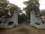 |
| 9/2/111/0106/002 | Boshof, Boshof Avenue, Newlands, Cape Town | The property on which this house is situated originally formed part of the historic Boshof farm owned by Alexander van Breda. The building, the original portion of which dates from the early nineteenth century, was enlarged and Victorianised during the 18 . | Cape Town, Newlands | Wynberg | Provincial Heritage Site | 33°58′48″S 18°26′54″E / 33.980039°S 18.448412°E |
|
| 9/2/111/0113 | Long Cottage, Newlands Avenue, Newlands, Cape Town | Cape Town, Newlands | Wynberg | Provincial Heritage Site | 33°58′45″S 18°27′00″E / 33.979167°S 18.450000°E |
| |
| 9/2/111/0125 | Athenaeum, 154 Campground Road, Newlands, Cape Town | Newlands | Wynberg | 33°58′34″S 18°28′03″E / 33.976010°S 18.467596°E |
| ||
| 9/2/111/0132 | Newlands Spring, Newlands, Cape Town | Newlands | Wynberg |
| |||
| 9/2/111/0133 | South African Breweries, 3 Main Road, Newlands, Cape Town | Type of site: Brewery. | Cape Town, Newlands | Wynberg | Provincial Heritage Site | 33°58′21″S 18°27′54″E / 33.972616°S 18.465115°E |
|
| 9/2/111/0137 | Montebello House, Newlands Avenue, Newlands, Cape Town | Newlands | Wynberg | 33°58′13″S 18°27′27″E / 33.970273°S 18.457431°E |
| ||
| 9/2/111/0146 | Kelvin Grove, Campground Road, Newlands | Newlands | Wynberg | 33°58′16″S 18°28′13″E / 33.971160°S 18.470215°E |
| ||
| 9/2/111/0147 | Fernwood Newlands, Wynberg District | Newlands | Wynberg | 33°58′45″S 18°26′48″E / 33.979224°S 18.446574°E |
| ||
| 9/2/111/0156 | House Raynham, 16 Boshof Avenue, Newlands | Newlands | Wynberg | 33°58′49″S 18°26′52″E / 33.980380°S 18.447697°E |
| ||
| 9/2/111/0148 | NYANGA/CROSSROADS LOCAL AREA, GENERAL | Nyanga | Wynberg |
| |||
| 9/2/111/0162 | PHILIPPI LOCAL AREA GENERAL, WYNBERG DISTRICT | Philippi | Wynberg |
| |||
| 9/2/111/0152 | Evangelical Lutheran Church, Philippi, Wynberg District | Philippi | Wynberg |
| |||
| 9/2/111/0160 | PLUMSTEAD LOCAL AREA GENERAL, WYNBERG DISTRICT | Plumstead | Wynberg |
| |||
| 9/2/111/0005 | Eaton Rehabilitation Hospital, Main Road, Plumstead, Cape Town | Plumstead | Wynberg |
| |||
| 9/2/111/0018 | Meyerhof, Meyer Street, Plumstead, Cape Town | Cape Town, Plumstead | Wynberg | Provincial Heritage Site | 34°01′36″S 18°28′13″E / 34.026544°S 18.470184°E |
| |
| 9/2/111/0078 | Burial Vault of John George Ratherfelder, Selby Road, Plumstead, Cape | Plumstead | Wynberg |
| |||
| 9/2/111/0063 | RETREAT, GENERAL, CAPE TOWN | Retreat | Wynberg |
| |||
| 9/2/111/0041 | RONDEBOSCH, CAPE TOWN, GENERAL | Rondebosch | Wynberg |
| |||
| 9/2/111/0029 | Old Masonic Temple, Main Road, Rondebosch, Cape Town | Rondebosch | Wynberg |
| |||
| 9/2/111/0030 | Old Sasko Building, Belmont Road, Rondebosch, Cape Town | Rondebosch | Wynberg |
| |||
| 9/2/111/0035 | Rondebosch Railway Station, Rondebosch, Cape Town | Rondebosch | Wynberg | 33°57′44″S 18°28′21″E / 33.962200°S 18.472447°E |
| ||
| 9/2/111/0036 | Rondebosch Fountain, Main Road, Rondebosch, Cape Town | On a traffic island where Belmont Road meets the main road in the centre of Rondebosch stands one of the best-known landmarks in that suburb. It is known as “The Fountain”, but it is actually an ornamental trough for watering horses. It consists of a roun Type of site: Fountain. The" Fountain ' a drinking-trough for horses, is an interesting curiosity and a well-known landmark in Rondebosch dating back to 1891. | Cape Town, Rondebosch | Wynberg | Provincial Heritage Site | 33°58′37″S 18°27′53″E / 33.976983°S 18.464760°E | 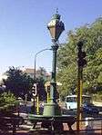 |
| 9/2/111/0038 | Rhodes Recreation Grounds, Chapel Road, Rondebosch, Cape Town | Rondebosch | Wynberg | 33°57′14″S 18°28′06″E / 33.953991°S 18.468217°E |
| ||
| 9/2/111/0042 | Rustenburg Girls Primary School, Rondebosch, Cape Town | Rondebosch | Wynberg | 33°57′24″S 18°28′44″E / 33.956552°S 18.478755°E |
| ||
| 9/2/111/0043 | 6 Glade Road, Rondebosch, Cape Town | Rondebosch | Wynberg | 33°57′52″S 18°28′25″E / 33.964379°S 18.473548°E |
| ||
| 9/2/111/0057 | University of Cape Town, Rondebosch, Cape Town | Main article: University of Cape Town This unique group of buildings in the Classical Revival style, together with the open spaces, constitute the original Campus Plan as designed by, the architect J. M. Solomon in 1918. |
Cape Town, Rondebosch | Wynberg | Provincial Heritage Site | 33°57′28″S 18°27′40″E / 33.957652°S 18.461199°E | |
| 9/2/111/0057/001 | The Summer House, Belvedere, Middle Campus, University of Cape Town, Rondebosch, Cape Town | This Summer House with the benches on either side, was built by the Dutch East India Company on the Rustenburg Estates. It is amongst the oldest existing buildings in South Africa. Type of site: Folly. | Cape Town, Rondebosch | Wynberg | Provincial Heritage Site | 33°57′29″S 18°27′50″E / 33.9580506°S 18.4639044°E |  |
| 9/2/111/0057/2 | Arts Block, University of Cape Town, Rondebosch, Cape Town | Rondebosch | Wynberg | 33°57′30″S 18°27′40″E / 33.958289°S 18.461246°E |
| ||
| 9/2/111/0070 | Felday, 4 Erin Road, Rondebosch, Cape Town | Rondebosch | Wynberg | 33°57′38″S 18°28′36″E / 33.960539°S 18.476799°E |
| ||
| 9/2/111/0072 | Groote Schuur Estate, Rondebosch, Cape Town | Rondebosch | Wynberg | 33°58′08″S 18°28′25″E / 33.968933°S 18.473721°E | 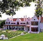 | ||
| 9/2/111/0072/001 | Groote Schuur, Rondebosch, Cape Town | Main article: Groote Schuur Type of site: House Current use: House. |
Cape Town, Rondebosch | Wynberg | Provincial Heritage Site | 33°57′47″S 18°28′04″E / 33.963125°S 18.467900°E | 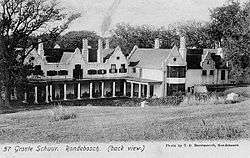 |
| 9/2/111/0072/002 | Contents of Groote Schuur, Rondebosch, Cape Town | Cape Town, Rondebosch | Wynberg | Heritage Object |
| ||
| 9/2/111/0072/003 | Kleine Schuur, Groote Schuur Estate, Rondebosch, Cape Town | Type of site: House Current use: House. | Cape Town, Rondebosch | Wynberg | Provincial Heritage Site | 33°57′44″S 18°28′21″E / 33.962125°S 18.472400°E |
|
| 9/2/111/0072/004 | Genadendal, Groote Schuur Estate, Rondebosch, Cape Town | Type of site: House Current use: House. | Cape Town, Rondebosch | Wynberg | Provincial Heritage Site | 33°57′44″S 18°28′21″E / 33.962125°S 18.472400°EGenadendal, Groote Schuur Estate, Rondebosch, Cape Town) |
|
| 9/2/111/0072/5 | Groote Schuur Zoo Site, Cape Town | Rondebosch | Wynberg | 33°57′40″S 18°27′35″E / 33.961109°S 18.459623°E |  | ||
| 9/2/111/0101 | Rustenburg House, Rondebosch, Cape Town | When Jan van Riebeeck granted land at ""het ronde doornbosje"" in 1657 to the first free burghers, he reserved a piece of land for an orchard for the use of the Company. It extended from the Liesbeek River right across the old wagon road up to what is now Type of site: Cape House. This unique group of buildings in the Classical Revival style, together with the open spaces, constitute the original Campus Plan as designed by, the architect J. M. Solomon in 1918.
The Summer House, also known as Belvedere, was built by the Dutch East I |
Cape Town, Rondebosch | Wynberg | Provincial Heritage Site | 33°57′44″S 18°28′21″E / 33.962125°S 18.472400°E | 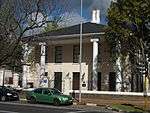 |
| 9/2/111/0102 | Rondebosch Common, Rondebosch, Cape Town | The Rondebosch Common is situated almost opposite the Rustenburg estate and fully two kilometres east of the Liesbeek River. In 1805, during the preparations for defending the Cape against a British attack, General Janssens’s Batavian force was camped on Type of site: Common. HISTORICAL INTEREST
This land served as a camping ground for Batavian and british troops during the eighteenth and nineteenth centuries. Later it was reserved for the use of the public for recreation purposes. In 1870 it was transferred to the Municipality |
Cape Town, Rondebosch | Wynberg | Provincial Heritage Site | 33°57′22″S 18°28′57″E / 33.956153°S 18.482521°E |  |
| 9/2/111/0105 | St Paul's Church, Church Street, Rondebosch, Cape Town | The land on which St. Pau?s Church was erected, was granted by Governor Sir Lowry Cole on 30 August 1832 and is one of the earliest land grants to an Anglican Parish in South Africa. The site was consecrated by Bishop Daniel Wilson on 5 September 1832. B Type of site: Church Current use: Church : Anglican. The land on which this church building was erected was granted by Governor Sir Lowry Cole on 30 August 1832. The original neo-Gothic church was opened on 16 February 1834. In 1845 a gallery was added. Thereafter the church was considerably enlarged and th | Cape Town, Rondebosch | Wynberg | Provincial Heritage Site | 33°57′44″S 18°28′09″E / 33.962110°S 18.469110°E | 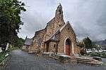 |
| 9/2/111/0110 | Woolsack, Rondebosch, Cape Town | This residence, with its interesting mixture of Cape Dutch and neo-classical features, was rebuilt by Sir Herbert Baker for the use of poets and artists on the instructions of Cecil John Rhodes. Rudyard Kipling and his family stayed here during the summer Type of site: House. This residence, with its interesting mixture of Cape Dutch and neo-classical features, was rebuilt by Sir Herbert Baker for the use of poets and artists on the instructions of Cecil John Rhodes. Rudyard Kipling and his family stayed here during the summer | Cape Town, Rondebosch | Wynberg | Provincial Heritage Site | 33°57′19″S 18°28′04″E / 33.955245°S 18.467839°E | 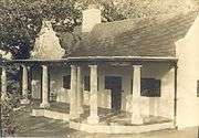 |
| 9/2/111/0118 | Glenara, Rondebosch, Cape Town | This impressive Victorian double-storeyed house was designed by the architect A. W. Ackerman and built by one Mannix for Lewis Anthony Vintcent from 1882 to 1883.The building has been used since 1925 as the official residence for principals of the Univers Type of site: House. This impressive Victorian double-storeyed house was designed by the architect A. W. Ackerman and built for Lewis Anthony Vintcent from 1882 to 1883.The building has been used since 1925 as the official residence for principals of the University of Cape Town | Cape Town, Rondebosch | Wynberg | Provincial Heritage Site | 33°57′28″S 18°28′12″E / 33.957848°S 18.469971°E |
|
| 9/2/111/0119 | Rondebosch Boys' Preparatory School, Campground Road, Rondebosch, Cape | Rondebosch | Wynberg | 33°57′52″S 18°28′31″E / 33.964473°S 18.475323°E | 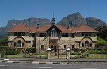 | ||
| 9/2/111/0123 | Rhodes Memorial, Rondebosch, Cape Town | Rondebosch | Wynberg | 33°57′09″S 18°27′34″E / 33.952458°S 18.459426°E | 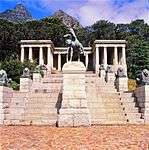 | ||
| 9/2/111/0124 | Marsh Memorial homes, Norton Way, Rondebosch, Cape Town | Rondebosch | Wynberg | 33°57′54″S 18°29′36″E / 33.964885°S 18.493241°E |
| ||
| 9/2/111/0129 | ROSEBANK, CAPE TOWN, GENERAL | Rosebank | Wynberg |
| |||
| 9/2/018/0089 | Whitby House, 3 Barry Avenue, Rosebank, Cape Town | Type of site: House. | Cape Town, Rosebank | Wynberg | Provincial Heritage Site | 33°57′12″S 18°28′15″E / 33.9533°S 18.470875°E |
|
| 9/2/111/0082 | 19 Annerley Road, Rosebank, Cape Town | Rosebank | Wynberg | 33°58′13″S 18°27′27″E / 33.970273°S 18.457431°E |
| ||
| 9/2/111/0083 | 38 Sawkins Road, Rosebank, Cape Town | Rosebank | Wynberg | 33°57′06″S 18°28′58″E / 33.951767°S 18.482874°E |
| ||
| 9/2/111/0135 | 43 Liesbeeck Road, Rosebank, Cape Town | Rosebank | Wynberg | 33°57′07″S 18°28′41″E / 33.951932°S 18.478093°E |
| ||
| 9/2/111/0136 | Irma Stern Museum, Cecil Road, Rosebank, Cape Town | Rosebank | Wynberg | 33°57′11″S 18°28′10″E / 33.952930°S 18.469325°E |
| ||
| 9/2/111/0071 | Tokai Manor House, Porter Reformatory, Tokai, Constantia, Wynberg District | Tokai is situated almost due south of Groot Constantia up against the Steenberg mountain, on a portion of Simon van der Stel’s former grazing lands. Tokai Road runs in a direct line from the main road to this stately old farm.
The farm was first granted Type of site: Farmstead. HISTORICAL INTEREST The Manor House was built shortly after 1792 by Jan Andreas Rauch and is one of the most famous examples of Cape dutch architecture. |
Cape Town, Tokai | Wynberg | Provincial Heritage Site | 34°03′34″S 18°25′00″E / 34.059536°S 18.416592°E | 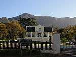 |
| 9/2/111/0017 | Tokai Arboretum, Tokai Forest, Wynberg District | The South African forest industry had its beginnings on this site when Joseph Storr Lister, Conservator of Forests of the Western Conservancy of the Cape Colony, laid out this impressive arboretum in 1885. The arboretum is world-famous among botanists. | Cape Town, Tokai | Wynberg | Provincial Heritage Site | 34°03′45″S 18°26′30″E / 34.062500°S 18.441667°E | 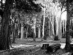 |
| 9/2/111/0019 | Silviculturist Dwellings Nos 1 & 535, Tokai Forest, Wynberg District | Tokai | Wynberg |
| |||
| 9/2/111/0001 | Old Cemeteries, Wynberg, Cape Town | Wynberg | Wynberg | 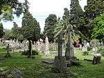 | |||
| 9/2/111/0001/001 | Dutch Reformed Church Cemetery, Wynberg, Cape Town | Type of site: Graveyard Current use: Graveyard. | Cape Town, Wynberg | Wynberg | Provincial Heritage Site, War grave | 34°00′17″S 18°28′17″E / 34.004778°S 18.471317°E | |
| 9/2/111/0001/2 | St John's Anglican Cemetery, Wynberg, Cape Town | Wynberg | Wynberg |
| |||
| 9/2/111/0001/3 | Garden of Remembrance, D R Church, Wynberg, Cape Town | Wynberg | Wynberg | 34°00′17″S 18°27′43″E / 34.004632°S 18.462067°E |
| ||
| 9/2/111/0001/4 | Methodist Cemetery, Church Street, Wynberg | Wynberg | Wynberg | 34°00′15″S 18°28′01″E / 34.004145°S 18.466979°E |
| ||
| 9/2/111/0002-001 | Leather Bottle, 7 Standard Lane, Wynberg, Cape Town | Modern rebuild after fire. Free-standing single storey cottage with attic; full hipped roof, unpainted modern stock casement windows, dormers and French doors; extensive brick paving. New extension with parapet and plaster mouldings; modern stock sash Type of site: House Current use: House. | Cape Town, Wynberg | Wynberg | Provincial Heritage Site | 34°00′21″S 18°27′46″E / 34.005710°S 18.462904°E |
|
| 9/2/111/0002-010 | The Armoury, 14 Wolfe Street, Wynberg, Cape Town | Free-standing single storey cottage with attic; opens onto sidewalk; double pitched roof with IBR sheeting and bargeboards; sash windows (24 panes) and louvred shutters; solid panelled door with small fanlight above. Type of site: House Current use: House. | Cape Town, Wynberg | Wynberg | Provincial Heritage Site | 34°00′27″S 18°27′49″E / 34.007588°S 18.463648°E | 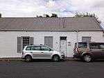 |
| 9/2/111/0002-011 | 49-51 Durban Road, Wynberg, Cape Town | Free-standing single storey cottage with attic, now subdivided into two units; short setback from sidewalk; half hipped corrugated iron roof; unpainted modern stock sash windows (24 panes) and panelled doors. Type of site: House Current use: House. | Cape Town, Wynberg | Wynberg | Provincial Heritage Site | 34°00′30″S 18°27′49″E / 34.008457°S 18.463591°E |
|
| 9/2/111/0002-015 | 5 Wolfe Street cnr Camp Road, Wynberg, Cape Town | Single storey semi-detached building now used as a shop; double pitched roof with asbestos cement sheeting and bargeboards; ashlared plasterwork. Projecting portion: new fixed shopfront windows (4 panes); a typical glazed Victorian double leafed panelled Type of site: Commercial Current use: Personal services. | Cape Town, Wynberg | Wynberg | Provincial Heritage Site | 34°00′28″S 18°27′46″E / 34.007745°S 18.462645°E |
|
| 9/2/111/0002-016 | Prince Alfred House, Wynberg, Cape Town | This double-storeyed house is built in the Georgian style and dates from the fifties of the nineteenth century. It is one of the most important houses in the historic centre of Wynberg. | Cape Town, Wynberg | Wynberg | Provincial Heritage Site | 34°00′17″S 18°28′17″E / 34.004778°S 18.471317°E |
|
| 9/2/111/0002-017 | Laundry Cottage, Durban Road, Wynberg, Cape Town | Free-standing single storey l-shaped cottage with low stoep wall; almost matches 'Oak Cottage' in detailing (F & C); full hipped thatch roof; early sash windows (24 panes) and half window height louvred shutters; double leaf front door with small paned Type of site: House Current use: House. | Cape Town, Wynberg | Wynberg | Provincial Heritage Site | 34°00′27″S 18°27′46″E / 34.007364°S 18.462875°E |
|
| 9/2/111/0002-019 | 13 Durban Road, Wynberg, Cape Town | Free-standing single storey cottage now subdivided into two dwellings; double pitched roof with Canadian pattern asbestos cement sheeting and bargeboards; unpainted modern stock sash windows (12 panes) and French doors; original stoep now enclosed; high Type of site: House Current use: House. | Cape Town, Wynberg | Wynberg | Provincial Heritage Site | 34°00′21″S 18°27′44″E / 34.005720°S 18.462360°E |
|
| 9/2/111/0002-020 | Prince Alfred Arms and Prince Alfred Cottage, 14 and 16 Durban Road, Wynberg, Cape Town | Semi-detached single storey vernacular cottage together with no 2.15; originally the tavern to no 2.13; full hipped corrugated iron roof; gable with plaster moulding at splayed corner added later; sash window and louvred shutters to east end; Type of site: House Current use: House. | Cape Town, Wynberg | Wynberg | Provincial Heritage Site | 34°00′20″S 18°27′44″E / 34.005673°S 18.462282°E |  |
| 9/2/111/0002-021 | Chelsea Gardens, 65 Durban Road, Wynberg, Cape Town | Modern double storey block of flats. Type of site: House Current use: Flats. | Cape Town, Wynberg | Wynberg | Provincial Heritage Site | 34°00′20″S 18°27′44″E / 34.005552°S 18.462313°E |
|
| 9/2/111/0002-022 | Klein Maynard, 59 Wolfe Street, Wynberg, Cape Town | Free-standing single storey vernacular cottage; double pitched full hipped corrugated iron roof; stippled plaster walls with quoining at corners and moulding around front door; double casement windows with fanlights and louvred shutters; Victorian sash Type of site: House Current use: House. | Cape Town, Wynberg | Wynberg | Provincial Heritage Site | 34°00′18″S 18°27′49″E / 34.005033°S 18.463544°E |  |
| 9/2/111/0002-023 | Clarence, 3 Victoria Street, Wynberg, Cape Town | Free-standing extensively altered single storey cottage with attic; full hipped thatched roof; sash windows with leaded lights and solid shutters; double casement dormer windows; all joinery unpainted and appears to be modern stock; raised stoep with end Type of site: House Current use: House. | Cape Town, Wynberg | Wynberg | Provincial Heritage Site | 34°00′31″S 18°27′46″E / 34.008505°S 18.462649°E |  |
| 9/2/111/0002-024 | Albert, 5 Victoria Street, Wynberg, Cape Town | Semi-detached single storey cottage with various additions; full hipped thatched roof with a double pitched projecting bay on the east side and a parapet with flat roof behind on the west side; sash windows (12 panes) and louvred shutters; solid panelled Type of site: House Current use: House. | Cape Town, Wynberg | Wynberg | Provincial Heritage Site | 34°00′31″S 18°27′46″E / 34.008499°S 18.462646°E |  |
| 9/2/111/0002-025 | Victoria, 7 Victoria Street, Wynberg, Cape Town | Semi-detached single storey cottage with various additions; full hipped thatched roof with a double pitched projecting bay on the east side and a parapet with flat roof behind on the west side; sash windows (12 panes) and louvred shutters; solid panelled Type of site: House Current use: House. | Cape Town, Wynberg | Wynberg | Provincial Heritage Site | 34°00′31″S 18°27′46″E / 34.008616°S 18.462698°E | |
| 9/2/111/0002-026 | Fiamma's Restaurant, 23 Wolfe Street, Wynberg, Cape Town | Single storey building with attic, now subdivided into a restaurant and two dwellings; intermediate entrance level on Riebeeck Street; full hipped corrugated iron roof; large double casement dormer windows; possibly enclosed stoep with malthoid roof; Type of site: House Current use: House. | Cape Town, Wynberg | Wynberg | Provincial Heritage Site | 34°00′23″S 18°27′49″E / 34.006472°S 18.463474°E |  |
| 9/2/111/0002-027 | The Muse, 43 Wolfe Street, Wynberg, Cape Town | Semi-detached double storey dwelling probably Victorianised. Full hipped corrugated iron roof; plaster quoining around upper floor openings; and a plaster band at position of removed verandah; sash windows of later Victorian type, lower floor probably mo Type of site: House Current use: House. | Cape Town, Wynberg | Wynberg | Provincial Heritage Site | 34°00′18″S 18°27′49″E / 34.005122°S 18.463693°E | 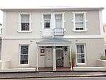 |
| 9/2/111/0002-028 | Waterloo Edge, Young Lane, Wynberg, Cape Town | Semi-detached single storey vernacular cottage; full hipped roof with asbestos cement tiles. Facade facing Durban Road: sash windows (12 panes) and louvred shutters; double leafed modern stock French door; intrusive unpainted modern garage door; Type of site: House Current use: House. | Cape Town, Wynberg | Wynberg | Provincial Heritage Site | 34°00′18″S 18°27′45″E / 34.005096°S 18.462495°E | 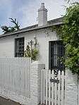 |
| 9/2/111/0002-029 | 3 Moore Road, Wynberg, Cape Town | Cape Town, Wynberg | Wynberg | Provincial Heritage Site | 34°00′31″S 18°27′47″E / 34.008689°S 18.463087°E |
| |
| 9/2/111/0002-030 | 5 Moore Road, Wynberg, Cape Town | Cape Town, Wynberg | Wynberg | Provincial Heritage Site | 34°00′31″S 18°27′47″E / 34.008691°S 18.463075°E |
| |
| 9/2/111/0002-031 | 7 Moore Road, Wynberg, Cape Town | Cape Town, Wynberg | Wynberg | Provincial Heritage Site | 34°00′31″S 18°27′47″E / 34.008697°S 18.463102°E |
| |
| 9/2/111/0002-032 | 9 Moore Road, Wynberg, Cape Town | Cape Town, Wynberg | Wynberg | Provincial Heritage Site | 34°00′31″S 18°27′47″E / 34.008691°S 18.463095°E |
| |
| 9/2/111/0002-033 | Riebeeck House, Riebeeck Street, Wynberg, Cape Town | Free-standing single storey vernacular cottage; half-hipped patent metal 'tile' roof; sash windows (24 panes); modern stock satble door with fanlight; raised stoep on street edge with low stoep walls at ends and wrought iron railing infill. Type of site: House Current use: House. | Cape Town, Wynberg | Wynberg | Provincial Heritage Site | 34°00′30″S 18°27′58″E / 34.008446°S 18.466182°E |  |
| 9/2/111/0002-034 | Quellerie Cottage, Riebeeck Street, Wynberg, Cape Town | Single storey dwelling attached to the old 'Municipal Offices'; half-hipped malthoid roof; ashlared plasterwork; sash windows (24 panes); modern stock unpainted timber louvred shutters; modern stock unpainted door with canvas canopy over front door; raise Type of site: House Current use: House. | Cape Town, Wynberg | Wynberg | Provincial Heritage Site | 34°00′24″S 18°27′45″E / 34.006652°S 18.462607°E |
|
| 9/2/111/0002-035 | Delfshaven, Waterloo Road, Wynberg, Cape Town | Semi-detached double storey vernacular house; full hipped Welsh slate roof. Facade facing Lonsdale Street: sash windows (24 panes) double leafed panelled door with small paned glazing at splayed corner; steel posts supporting a corrugated iron roof Type of site: House Current use: House. | Cape Town, Wynberg | Wynberg | Provincial Heritage Site | 34°00′30″S 18°27′43″E / 34.008401°S 18.462008°E |
|
| 9/2/111/0002/004 | Kleine Oude, 1 Durban Road, Wynberg, Cape Town | Free-standing single storey vernacular cottage with attic; thatched roof: half-hip facing Carr's Hill and full hip facing Waterloo Road; Various modern casement windows, some with leaded lights; double casement dormer windows; doors with leaded lights; Type of site: House Current use: House. | Cape Town, Wynberg | Wynberg | Provincial Heritage Site | 34°00′33″S 18°27′52″E / 34.009166°S 18.464442°E |  |
| 9/2/111/0002/006 | Building, corner of Lonsdale and Wolfe Street, Wynberg, Cape Town | Semi-detached double storey Victorian commercial building with splayed corner treatment and a corner turret with pressed steel tiles; typical Victorian plaster detailing with elaborate moulding around windows and pronounced eaves treatment; typical timber Type of site: Commercial Current use: Offices. The historic Old Wynberg Village is an area of considerable character, as well as being of historical, architectural and environmental importance. It is one of the few areas close to the City of Cape Town which have retained their historical character. | Cape Town, Wynberg | Wynberg | Provincial Heritage Site | 34°00′25″S 18°27′48″E / 34.006818°S 18.463338°E |  |
| 9/2/111/0002/007 | Beauchamps Place, 5 and 7 Riebeeck Street cnr 27 Wolfe Street, Wynberg, Cape Town | Double storey flats; full hipped corrugated iron roof; small-paned double casement windows with fanlights to ground floor; unpainted typical Victorian sash windows (4 panes) and louvred shutters to upper floor; double storey plastered solid verandah Type of site: House Current use: Flats. | Cape Town, Wynberg | Wynberg | Provincial Heritage Site | 34°00′23″S 18°27′49″E / 34.006439°S 18.463496°E | 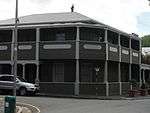 |
| 9/2/111/0002/009 | Falcon House, 21 Durban Road, Wynberg, Cape Town | Free-standing single storey cottage with attic; a large full hipped corrugated iron roof; sash windows (12 panes) and casement windows to attic; double leafed door with fanlight; curved verandah roof removed on front facade but precast concrete columns Type of site: House Current use: House. | Cape Town, Wynberg | Wynberg | Provincial Heritage Site | 34°00′20″S 18°27′44″E / 34.005622°S 18.462285°E |  |
| 9/2/111/0002/010 | 3-4 Riebeeck Street, Wynberg, Cape Town | Free-standing single storey vernacular cottage; full hipped corrugated iron roof behind a parapet wall; sash windows with leaded lights; modern stock stable door; stoep enclosed creating two projecting wings and a recessed entrance doorway; low plastered Type of site: House Current use: House. | Cape Town, Wynberg | Wynberg | Provincial Heritage Site | 34°00′23″S 18°27′47″E / 34.006458°S 18.463071°E | 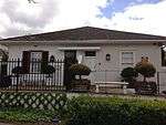 |
| 9/2/111/0002/011 | Osborne House, Wolfe Street, Wynberg, Cape Town | Free-standing single storey partly Victorianised cottage on large piece of ground well set back from the street; full hipped thatch roof; simple plaster frame moulding around doors and windows; earlier sashes (c. 1850) in rear of building; double leaf door Type of site: House Current use: House. | Cape Town, Wynberg | Wynberg | Provincial Heritage Site | 34°00′25″S 18°27′48″E / 34.006818°S 18.463338°E |
|
| 9/2/111/0002/012 | Drew House, Durban Road, Wynberg, Cape Town | Free-standing single stately house now subdivided into smaller units; low pitched full hipped welsh slate roof; possibly original sash windows (24 panes); double leafed panelled door with unsuitable modern 'period' timber door surround; raised open stoep Type of site: House Current use: House. | Cape Town, Wynberg | Wynberg | Provincial Heritage Site | 34°00′27″S 18°27′46″E / 34.007364°S 18.462875°E | 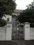 |
| 9/2/111/0002/014 | 1 Carr Hill, Wynberg, Cape Town | Attached double storey vernacular dwelling; double pitched corrugated iron roof with bargeboards; ashlar plaster decoration to walls; all joinery unpainted. Ground floor: 3-bays; modern stock timber sash windows (12 panes); plaster quoining around window Type of site: Commercial Current use: Offices. | Cape Town, Wynberg | Wynberg | Provincial Heritage Site | 34°00′30″S 18°27′58″E / 34.008446°S 18.466182°E | 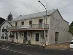 |
| 9/2/111/0002/015 | 50 Wolfe Street, Wynberg, Cape Town | Cape Town, Wynberg | Wynberg | Provincial Heritage Site | 34°00′18″S 18°27′49″E / 34.005025°S 18.463721°E |
| |
| 9/2/111/0002/016 | 29 Wolfe Street, Wynberg, Cape Town | Free-standing single storey vernacular cottage; stepped parapet wall with plaster mouldings and full hipped corrugated iron roof behind; sash windows (12 panes); unpainted timber window frames and shutters; unpainted panelled door with fanlight and small Type of site: House Current use: House. | Cape Town, Wynberg | Wynberg | Provincial Heritage Site | 34°00′23″S 18°27′48″E / 34.006351°S 18.463335°E | 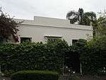 |
| 9/2/111/0002/017 | 37 Waterloo Road, Wynberg, Cape Town | Free-standing single storey cottage set well back from street, with internal floor below external ground level; parapet wall with elaborate plaster mouldings and IBR behind; typical Victorian sash windows (4 panes) and louvred shutters; various garden Type of site: House Current use: House. | Cape Town, Wynberg | Wynberg | Provincial Heritage Site | 34°00′04″S 18°27′44″E / 34.001015°S 18.462261°E |
|
| 9/2/111/0002/019 | 5-7 Durban Road, Wynberg, Cape Town | Semi-detached single storey dwellings; parapet wall with plaster mouldings; stippled plaster to walls; painted steel casement windows; stable doors with glazing; new partially enclosed arched porches; low boundary hedge; two adjoining garages. Type of site: House Current use: House. | Cape Town, Wynberg | Wynberg | Provincial Heritage Site | 34°00′21″S 18°27′44″E / 34.005705°S 18.462285°E | 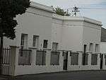 |
| 9/2/111/0002/020 | Vredenhof, 59 Durban Road, Wynberg, Cape Town | Free-standing vernacular cottage with outbuildings behind with quite extensive alterations having taken place at various stages; facade facing Durban Road single storey becoming double storey at back; full hipped corrugated iron roof; plaster quoining on Type of site: House Previous use: Residential. Current use: House. | Cape Town, Wynberg | Wynberg | Provincial Heritage Site | 34°00′20″S 18°27′44″E / 34.005562°S 18.462312°E |
|
| 9/2/111/0002/021 | India House and Durban House, 32-36 Durban Road, Wynberg, Cape Town | Single storey semi-detached vernacular building; half hipped thatched fanlight to Idoville and glazed Victorian door to Durban House; raised stoep with a low plastered wall and plastered brick columns supporting a timber pergola; Original outbuildings Type of site: House Current use: House. | Cape Town, Wynberg | Wynberg | Provincial Heritage Site | 34°00′26″S 18°27′46″E / 34.007164°S 18.462746°E |  |
| 9/2/111/0002/023 | Glebe Cottage, Waterloo Road, Wynberg, Cape Town | Probably erected shortly after the second British occupation by the “Royal Engineers” and used as a chapel. In 1836 Lady D’Urban started a School of Industry in the building. From 1841 to 1845 it was used as the Wynberg Boys School.It has had various c . | Cape Town, Wynberg | Wynberg | Provincial Heritage Site | 34°00′24″S 18°27′43″E / 34.006667°S 18.461890°E |
|
| 9/2/111/0002/024 | 18 and 20 Durban Road, Wynberg, Cape Town | Free-standing single storey cottage with attic presently being extended and replastered; half hipped roof with IBR sheeting; plaster mouldings around openings on front facade; sash windows (24 panes), inappropriate unpainted shutters and new casement. Type of site: House Current use: House. | Cape Town, Wynberg | Wynberg | Provincial Heritage Site | 34°00′20″S 18°27′44″E / 34.005627°S 18.462283°E |  |
| 9/2/111/0002/025 | Long Cottage, 53 Durban Road, Wynberg, Cape Town | Free-standing L-shaped single storey cottage regarded as one of the finest and least-altered in old Wynberg; building well set back from street; full hipped thatch roof; possibly original sash windows (24 panes) and double leafed panelled door with glazi Type of site: House Current use: House. | Cape Town, Wynberg | Wynberg | Provincial Heritage Site | 34°00′20″S 18°27′44″E / 34.005560°S 18.462306°E | 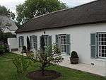 |
| 9/2/111/0002/026 | Kent and Albany, 4-6 Victoria Street, Wynberg, Cape Town | Semi-detached single storey vernacular cottage representing a later type of Wynberg dwelling; full hipped stepped thatched roof with a sharp hipped angle on Wolfe Street; possibly original sash windows and louvred shutters; panelled stable door; thatched Type of site: House Current use: House. | Cape Town, Wynberg | Wynberg | Provincial Heritage Site | 34°02′37″S 18°29′29″E / 34.043692°S 18.491385°E |  |
| 9/2/111/0002/027 | The Old Bakery, 23 Durban Road, Wynberg, Cape Town | Free-standing single storey vernacular cottage with later attic additions; well set back from street; traditional corrugated iron roof; sash windows (12 panes) and casements; re-used Cape Dutch windows and unpainted shutters; panelled doors. Type of site: Bakery Current use: House. | Cape Town, Wynberg | Wynberg | Provincial Heritage Site | 34°00′20″S 18°27′44″E / 34.005602°S 18.462296°E |
|
| 9/2/111/0002/028 | Erin Cottage, 21 Wolfe Street, Wynberg, Cape Town | Single storey cottage attached to no. 2.6-a; full hipped corrugated iron roof; sash windows (24 panes); stable door with small-paned glazing; most of joinery is possibly original; low boundary wall of plastered brick piers and cast iron railings; Type of site: Commercial Previous use: Residential. Current use: Shop/Gallery/Tea room. | Cape Town, Wynberg | Wynberg | Provincial Heritage Site | 34°00′25″S 18°27′47″E / 34.006835°S 18.463132°E | 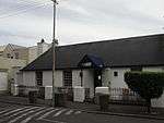 |
| 9/2/111/0002/029 | Pink Cottage, Young Lane, Wynberg, Cape Town | Free-standing single storey vernacular cottage on street edge; double pitched roof with aluminium strip sheeting and end bargeboards; possibly original sash windows (12 panes) with partly original glass; stable door with small-paned glazing; low stoep Type of site: House Current use: House. | Cape Town, Wynberg | Wynberg | Provincial Heritage Site | 34°00′18″S 18°27′45″E / 34.005096°S 18.462495°E | 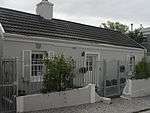 |
| 9/2/111/0002/030 | Parbhoo complex, 11 and 13 Wolfe Street, Wynberg, Cape Town | Single storey terraced shops; parapet wall with plaster moulding and painted urns; plastered quoining at corners and between shops; single pitched roof behind; glazed timber shopfronts on ceramic base (south end) and timber base (north end); Type of site: Commercial Current use: Personal services. | Cape Town, Wynberg | Wynberg | Provincial Heritage Site | 34°00′24″S 18°27′48″E / 34.006535°S 18.463451°E |  |
| 9/2/111/0002/031 | Church Hill, 10 Young Lane, Wynberg, Cape Town | Modern free-standing single storey cottage opening directly onto sidewalk; full hipped mazista slate roof; facebrick walls; sash windows (12 panes) and louvred shutters; recessed front door with small paned glazing; all joinery modern stock. Type of site: House Current use: House. | Cape Town, Wynberg | Wynberg | Provincial Heritage Site | 34°00′19″S 18°27′47″E / 34.005148°S 18.463122°E |
|
| 9/2/111/0002/032 | Clover, Wolfe Street, Wynberg, Cape Town | Semi-detached single storey vernacular cottages well set back from street; full hipped corrugated iron roof; Victorian sash windows; panelled door with sidelights and fanlights in the Victorian tradition to 'Clover Cottage'; adjoining the building. Type of site: House Current use: House. | Cape Town, Wynberg | Wynberg | Provincial Heritage Site | 34°00′25″S 18°27′48″E / 34.006818°S 18.463338°E |  |
| 9/2/111/0002/033 | Boot Inn, 6 Standard Lane, Wynberg, Cape Town | Free-standing single storey vernacular cottage; double pitched corrugated iron roof with gable ends; sash windows (12 panes) and louvred shutters; solid panelled door with fanlight; all possibly original; plastered boundary wall. Type of site: Dwelling, Hotel Current use: House. | Cape Town, Wynberg | Wynberg | Provincial Heritage Site | 34°00′20″S 18°27′46″E / 34.005540°S 18.462877°E |  |
| 9/2/111/0002/034 &59 | Dunkling, 43a Wolfe Street, Wynberg, Cape Town | Semi-detached double storey dwelling probably Victorianised. Full hipped corrugated iron roof; plaster quoining around upper floor openings; and a plaster band at position of removed verandah; sash windows of later Victorian type. Type of site: House Current use: House. | Cape Town, Wynberg | Wynberg | Provincial Heritage Site | 34°00′30″S 18°27′45″E / 34.008234°S 18.462440°E |  |
| 9/2/111/0002/035 | In Fin Art Shop, 9 Wolfe Street, Wynberg, Cape Town | Free-standing double storey shop, now modernised, double pitched corrugated iron roof with bargeboards. Ground floor: traditional timber shopfront with modernised entrance and door on Wolfe Street; Modern fixed large windows (4 panes) on Durban Road; Type of site: Commercial Current use: Personal services. | Cape Town, Wynberg | Wynberg | Provincial Heritage Site | 34°00′26″S 18°27′47″E / 34.007171°S 18.462953°E | 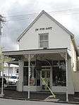 |
| 9/2/111/0002/036 | 1, 2, 3, 4 and 5 Standard Lane, Wynberg, Cape Town | Terraced single storey vernacular coattages opening onto sidewalk; full hipped corrugated iron roof with projecting eaves over front facades; various modern stock doors, windows, and louvred shutters, unpainted joinery to no 1.27; high boundary wall to Type of site: House Current use: House. The historic Old Wynberg Village is an area of considerable character, as well as being of historical, architectural and environmental importance. It is one of the few areas close to the City of Cape Town that have retained their historical character. | Cape Town, Wynberg | Wynberg | Provincial Heritage Site | 34°00′20″S 18°27′47″E / 34.005551°S 18.462942°E |  |
| 9/2/111/0002/037 | Little Marlow, Wolfe Street, Wynberg, Cape Town | Semi-detached single storey vernacular cottages well set back from street; full hipped corrugated iron roof; Victorian sash windows; panelled door with sidelights and fanlights in the Victorian tradition to 'Clover Cottage'; adjoining the building and a Type of site: House Current use: House. | Cape Town, Wynberg | Wynberg | Provincial Heritage Site | 34°00′25″S 18°27′48″E / 34.006818°S 18.463338°E |
|
| 9/2/111/0002/038 | 15 Wolfe Street, Wynberg, Cape Town | Single storey terraced shops; low pitched roof with large overhang; small-paned modern timber shop fronts on ceramic tiled base with splayed corners; recessed entrance doorways to shops. Double storey behind: double pitched fluted galvanised iron sheeting. Type of site: Commercial Current use: Personal services. | Cape Town, Wynberg | Wynberg | Provincial Heritage Site | 34°00′23″S 18°27′48″E / 34.006519°S 18.463466°E |  |
| 9/2/111/0002/039 | 7a, 7b Durban Road cnr Wolfe Street, Wynberg, Cape Town | Double storey Victorian business with splayed corner treatment; gables and parapet with decorative plaster moulding and balusters with a full hipped corrugated iron roof behind; plaster quoining at corners; typical shopfronts to ground floor and sash Type of site: Commercial Current use: Personal services. | Cape Town, Wynberg | Wynberg | Provincial Heritage Site | 34°00′22″S 18°27′44″E / 34.006160°S 18.462222°E |  |
| 9/2/111/0002/040 | Somerset House, 31 Wolfe Street, Wynberg, Cape Town | Type of site: House Previous use: Shop. Current use: House. | Cape Town, Wynberg | Wynberg | Provincial Heritage Site | 34°00′23″S 18°27′49″E / 34.006332°S 18.463560°E |  |
| 9/2/111/0002/041 | Elim Row, 69-75 Durban Road, Wynberg, Cape Town | Cape Town, Wynberg | Wynberg | Provincial Heritage Site | 34°00′20″S 18°27′44″E / 34.005540°S 18.462322°E |  | |
| 9/2/111/0002/042 | Mercury House, Riebeeck Street, Wynberg, Cape Town | Free-standing single storey cottage altered to represent a Cape Dutch facade; full hipped corrugated iron roof behind a moulded parapet wall; modern unpainted sash window (32 panes)and unpainted two panelled front door with small-paned fanlight. Type of site: House Current use: House. | Cape Town, Wynberg | Wynberg | Provincial Heritage Site | 34°00′24″S 18°27′45″E / 34.006652°S 18.462607°E |  |
| 9/2/111/0002/043 | Waterloo Close, 9 Durban Road, Wynberg, Cape Town | Semi-detached single storey vernacular cottage; full hipped roof with asbestos cement tiles. Facade facing Durban Road: sash windows (12 panes) and louvred shutters; double leafed modern stock French door; intrusive unpainted modern garage door; Type of site: House Current use: House. | Cape Town, Wynberg | Wynberg | Provincial Heritage Site | 34°00′21″S 18°27′44″E / 34.005699°S 18.462282°E |
|
| 9/2/111/0002/045 | Casa Nara, 41 Wolfe Street, Wynberg, Cape Town | Free-standing single storey Victorian building now subdivided into two shops with a dwelling attached; full hipped corrugated iron roof; evidence of ashlar plasterwork on facade facing Standard Lane; sash windows (4 panes); typical bay window and splayed Type of site: House Current use: House. | Cape Town, Wynberg | Wynberg | Provincial Heritage Site | 34°00′18″S 18°27′49″E / 34.005122°S 18.463694°E |  |
| 9/2/111/0002/046 | Lord Nelson Cottage, 7 Lonsdale Street, Wynberg, Cape Town | Free-standing single storey vernacular cottage; double pitched roof with patent metal 'tiles' and bargeboards; sash windows (12 panes) and louvred shutters; single leaf panelled door; raised stoep with timber posts and curved brackets built into low Type of site: House Current use: House. | Cape Town, Wynberg | Wynberg | Provincial Heritage Site | 34°00′33″S 18°27′48″E / 34.009040°S 18.463197°E |  |
| 9/2/111/0002/047 | Spes Bona and Unicorn House, cnr Durban and Victoria Road, Wynberg, Cape Town | Free-standing single storey Victorianised house with attic now sub-divided into two dwellings with later additions; double pitched corrugated asbestos cement roof with decorative bargeboards. Facade facing Durban Road: two projecting wings with verandah Type of site: House Current use: House. | Cape Town, Wynberg | Wynberg | Provincial Heritage Site | 34°02′10″S 18°29′16″E / 34.036235°S 18.487744°E | 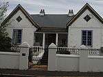 |
| 9/2/111/0002/049 | 11 Durban Road, Wynberg, Cape Town | Cape Town, Wynberg | Wynberg | Provincial Heritage Site | 34°00′21″S 18°27′44″E / 34.005705°S 18.462277°E |  | |
| 9/2/111/0002/050 | Chelsea Cloisters, 48 -54 Durban Road, Wynberg, Cape Town | Modern double storey block of maisonettes; double pitched roof with bargeboards; modern stock painted steel casement windows and timber doors with concrete ledge above; low facebrick boundary wall. Type of site: House Current use: Maisonettes. | Cape Town, Wynberg | Wynberg | Provincial Heritage Site | 34°00′11″S 18°27′28″E / 34.003110°S 18.457784°E |  |
| 9/2/111/0002/051 | Fig Tree Cottage, Cruse Lane, Wynberg, Cape Town | Free-standing single storey vernacular cottage with projecting side wings; double pitched corrugated iron roof with bargeboards; remains of ashlar plasterwork evident; sash windows (24 panes) and louvred shutters; small bay window extension on north side Type of site: House Current use: House. | Cape Town, Wynberg | Wynberg | Provincial Heritage Site | 34°00′22″S 18°27′48″E / 34.005990°S 18.463386°E |
|
| 9/2/111/0002/053 | Rembrandt, 9 Victoria Street, Wynberg, Cape Town | Free-standing single storey vernacular cottage consisting of 'two parallel units each with a half hipped thatched roof; the intervening narrow passage in which the front door is set, is roofed over with a flat roof'; sash windows (24 panes); Type of site: House Current use: House. | Cape Town, Wynberg | Wynberg | Provincial Heritage Site | 34°00′30″S 18°27′47″E / 34.008397°S 18.462980°E |  |
| 9/2/111/0002/055 | Withens, 3 Carr Hill, Wynberg, Cape Town | Free-standing double storey house at right angles to street; full hipped roof with asbestos cement slates; marmoran finish to walls; painted steel casement windows; double leaf modern stock door. Type of site: House Current use: House. | Cape Town, Wynberg | Wynberg | Provincial Heritage Site | 34°00′16″S 18°27′46″E / 34.004452°S 18.462644°E |
|
| 9/2/111/0002/057 | 9 Lonsdale Street, Wynberg, Cape Town | Free-standing single storey l-shaped cottage; double pitched roof with asbestos cement tiles and bargeboards; plaster moulding around openings; various windows; modern stock door with sidelights; unpainted timber picket fence on boundary. Type of site: House Current use: House. | Cape Town, Wynberg | Wynberg | Provincial Heritage Site | 34°00′33″S 18°27′46″E / 34.009060°S 18.462903°E |
|
| 9/2/111/0002/058 | Petersklip, Piers Road; 49 & 51 Durban Road; The Armoury, Wolfe Street and The Coach House, Piers Road, Wynberg, Cape Town | The historic Old Wynberg Village is an area of considerable character, as well as being of historical, architectural and environmental importance. It is one of the few areas close to the City of Cape Town that have retained their historical character. | Cape Town, Wynberg | Wynberg | Provincial Heritage Site | 34°00′28″S 18°27′47″E / 34.0077722222°S 18.4631583333°E | 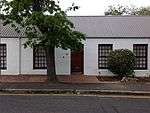 |
| 9/2/111/0002/062 | The Bell House, Roos Lane, Wynberg, Cape Town | Free-standing single storey vernacular cottage at right angles to street; double pitched corrugated iron with timberbarge boards; sash windows (24 panes); new unpainted stock louvred shutters inappropriate to windows; unpainted door with decorative fanlight. Type of site: House Current use: House. | Cape Town, Wynberg | Wynberg | Provincial Heritage Site | 33°58′10″S 18°28′30″E / 33.969535°S 18.475121°E |
|
| 9/2/111/0002/063 | Oak Cottage and The Cottage, 27 and 29 Durban Road, Wynberg, Cape Town | Semi-detached single storey dwelling with new dormers; thatched roof, half-hipped on south end and gable on north end; early sash windows (12 panes); new double casement dormer windows; half full window height louvred shutters. ' Oak Cottage' and full Type of site: House Current use: House. | Cape Town, Wynberg | Wynberg | Provincial Heritage Site | 34°00′20″S 18°27′44″E / 34.005592°S 18.462306°E | 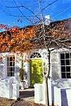 |
| 9/2/111/0002/064 | Hodi Mihi, 2 Carr Hill, Wynberg, Cape Town | Free-standing single storey vernacular cottage with attic. Full hipped thatch roof; Victorian sashes (4 panes) to ground floor are probably replacements of original casements; double casement dormer windows new but single casement said to be original; Type of site: House Current use: House. | Cape Town, Wynberg | Wynberg | Provincial Heritage Site | 34°00′16″S 18°27′47″E / 34.0045666666°S 18.4631055555°E | 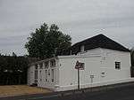 |
| 9/2/111/0002/50 | Chelsea Cloisters, 48 Durban Road, Wynberg | Wynberg | Wynberg | 34°00′26″S 18°27′46″E / 34.007160°S 18.462768°E |
| ||
| 9/2/111/0002/60 | The Coach House and the Armory, Wolfe Street, Wynberg | Wynberg | Wynberg |
| |||
| 9/2/111/0004 | Victoria Hospital, Wynberg, Cape Town | Wynberg | Wynberg | 34°00′45″S 18°27′32″E / 34.012377°S 18.458780°E |
| ||
| 9/2/111/0006 | WYNBERG MUNICIPAL AREA GENERAL | Wynberg | Wynberg | 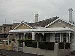 | |||
| 9/2/111/0006-002 | 1 Brian Mansergh Close, Wynberg, Cape Town | Cape Town, Wynberg | Wynberg | Provincial Heritage Site | 34°00′31″S 18°27′50″E / 34.008474°S 18.463795°E | 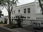 | |
| 9/2/111/0006-011 | Coach House, Piers Road, Wynberg, Cape Town | Type of site: Coach House. | Cape Town, Wynberg | Wynberg | Provincial Heritage Site | 34°00′26″S 18°28′01″E / 34.007158°S 18.466834°E | 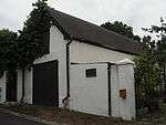 |
| 9/2/111/0006-020 | 14 Langley Road, Wynberg, Cape Town | Cape Town, Wynberg | Wynberg | Provincial Heritage Site | 34°00′36″S 18°28′03″E / 34.010054°S 18.467369°E | 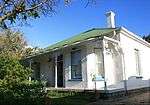 | |
| 9/2/111/0006-030 | 23 Wellington Road, Wynberg, Cape Town | Cape Town, Wynberg | Wynberg | Provincial Heritage Site | 34°00′34″S 18°27′56″E / 34.009498°S 18.465497°E | 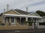 | |
| 9/2/111/0006-038 | 25 Wellington Road, Wynberg, Cape Town | Cape Town, Wynberg | Wynberg | Provincial Heritage Site | 34°00′34″S 18°28′01″E / 34.009422°S 18.466981°E | | |
| 9/2/111/0008 | Trovato, 44 Coach Road, Wynberg, Cape Town | Cape Town, Wynberg | Wynberg | Provincial Heritage Site | 33°59′54″S 18°27′25″E / 33.99825°S 18.4568666666°E |
| |
| 9/2/111/0010 | Winthrop House, 8 Durban Road, Wynberg, Cape Town | Free-standing single storey vernacular cottage with attic; new full hipped thatch roof; presently unpainted sash windows (24 panes) c1830 (F & C); solid panelled door; raised stoep with end seats; pergola with new garage well set back from street. Type of site: House Current use: House. | Cape Town, Wynberg | Wynberg | Provincial Heritage Site | 34°00′19″S 18°27′44″E / 34.005234°S 18.462174°E | 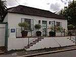 |
| 9/2/111/0016 | 2 Brian Mansergh Close, Wynberg, Cape Town | Cape Town, Wynberg | Wynberg | Provincial Heritage Site | 34°00′31″S 18°27′50″E / 34.008486°S 18.463796°E |
| |
| 9/2/111/002 | WYNBERG VILLAGE, GENERAL | Wynberg | Wynberg |
| |||
| 9/2/111/002/1 | 53-55 Waterloo Road, Wynberg, Cape Town | Wynberg | Wynberg | 34°00′30″S 18°27′44″E / 34.008322°S 18.462279°E |
| ||
| 9/2/111/002/13 | 10-12 Durban Road, Wynberg, Cape Town | Wynberg | Wynberg | 34°00′24″S 18°27′45″E / 34.006791°S 18.462411°E |
| ||
| 9/2/111/002/18 | 9 Riebeeck Street, Wynberg, Cape town | Wynberg | Wynberg | 34°00′24″S 18°27′46″E / 34.006784°S 18.462865°E |
| ||
| 9/2/111/002/2 | 35-43 Durban Road, Wynberg, Cape Town | Wynberg | Wynberg | 34°00′26″S 18°27′46″E / 34.007160°S 18.462766°E |
| ||
| 9/2/111/002/3 | Young Lane, Wynberg, Cape Town (new terrace houses) | Wynberg | Wynberg | 34°00′19″S 18°27′47″E / 34.005167°S 18.463044°E |
| ||
| 9/2/111/002/44 | Chelsea Horse, cnr Wolfe & Riebeeck Streets, Wynberg, Cape Town | Wynberg | Wynberg | 34°00′24″S 18°27′48″E / 34.006556°S 18.463372°E |
| ||
| 9/2/111/002/48 | Ashley, Shirley, Ivanhoe and Mega cottages, Lonsdale Road, Wynberg | Wynberg | Wynberg | 34°00′32″S 18°27′45″E / 34.008979°S 18.462465°E |
| ||
| 9/2/111/002/5 | Chelsea Corner, 59-63 Waterloo Road, Wynberg, Cape Town | Wynberg | Wynberg | 34°00′32″S 18°27′44″E / 34.008842°S 18.462169°E |
| ||
| 9/2/111/002/52 | Hastings Place, Wynberg Village | Wynberg | Wynberg |
| |||
| 9/2/111/002/54 | 5 Riebeeck Street, Wynberg | Wynberg | Wynberg | 34°00′23″S 18°27′47″E / 34.006462°S 18.463169°E |
| ||
| 9/2/111/002/56 | 7 Mortimer Rd, Wynberg | Wynberg | Wynberg | 34°00′28″S 18°27′55″E / 34.007895°S 18.465322°E |
| ||
| 9/2/111/002/61 | Forrester’s Inn, Durban Road, Wynberg | Wynberg | Wynberg |
| |||
| 9/2/111/002/8 | 1 Cornwall Place, Wynberg, Cape Town | Wynberg | Wynberg | 34°00′03″S 18°28′03″E / 34.000710°S 18.467374°E |
| ||
| 9/2/111/0020 | St Michael's Children's Home, Southfield , Cape Town | Southfield | Wynberg | 34°01′00″S 18°28′09″E / 34.016752°S 18.469177°E |
| ||
| 9/2/111/0025 | Sandstone Chapel, Tokai, Cape Town | Type of site: Chapel Current use: Church : Anglican. | Cape Town, Tokai | Wynberg | Provincial Heritage Site | 34°03′45″S 18°26′30″E / 34.062500°S 18.441667°E |  |
| 9/2/111/0044 | 4 Moore Road, Wynberg, Cape Town | Free-standing single storey cottage with projecting bay now extensively altered; double pitched roof Canadian pattern asbestos cement sheeting; plaster quoining and moulding above windows to projecting bay; sash windows; various louvred shutters to Type of site: House Current use: House. | Cape Town, Wynberg | Wynberg | Provincial Heritage Site | 34°00′31″S 18°27′47″E / 34.008722°S 18.462976°E |
|
| 9/2/111/0046 | Wynberg Town Hall, Maynard Road, Maynard Road, Wynberg Cape Town | Wynberg | Wynberg |
| |||
| 9/2/111/0051 | Wynberg Military Base, Wynberg, Cape Town | Wynberg | Wynberg | 34°00′32″S 18°27′41″E / 34.008944°S 18.461381°E |
| ||
| 9/2/111/0051/001 | Officer's Mess, Wynberg Military Camp, Wynberg, Cape Town | The Officers' Mess was built about 1880 or earlier, and is the heart of the Wynberg Military Camp which already existed in 1797. Type of site: Mess. | Cape Town, Wynberg | Wynberg | Provincial Heritage Site | 34°00′17″S 18°28′17″E / 34.004778°S 18.471317°E |
|
| 9/2/111/0053 | Tenderden, 60 Durban Road, Wynberg, Cape Town | Type of site: House. | Cape Town, Wynberg | Wynberg | Provincial Heritage Site | 34°00′20″S 18°27′44″E / 34.005555°S 18.462298°E |  |
| 9/2/111/0055 | Steenberg, Tokai, Cape Town | Steenberg (previously Zwaanswyk), which was granted to Catharina Ustings in 1688 was one of the first farms in the region. The Cape Dutch homestead was erected in about 1740. The verandah and outbuildings date from the beginning of the nineteenth century. | Cape Town, Tokai | Wynberg | Provincial Heritage Site | 34°03′50″S 18°26′41″E / 34.063785°S 18.444811°E |
|
| 9/2/111/0059 | 43-45 Waterloo Road, Wynberg, Cape Town | Single storey Victorian house now subdivided into two dwellings; double pitched corrugated iron roof with bargeboards and timber finial on projecting portion; painted brickwork to north end dwelling; sash windows; double leafed glazed doors and fanlights Type of site: House Current use: House. | Cape Town, Wynberg | Wynberg | Provincial Heritage Site | 34°00′27″S 18°27′46″E / 34.007594°S 18.462646°E |
|
| 9/2/111/0073 | Cape Education Museum, 9 Aliwal Road, Wynberg, Cape Town | Type of site: Educational Previous use: Primary school. Current use: Museum. | Cape Town, Wynberg | Wynberg | Provincial Heritage Site | 34°00′05″S 18°27′59″E / 34.001414°S 18.466457°E |  |
| 9/2/111/0080 | Wittebomen, Wynberg District | Wynberg | Wynberg |
| |||
| 9/2/111/0085 | Block bounded by Piers, Durban, Wolfe Streets, Erf 90986, Wynberg | Wynberg | Wynberg | 34°00′26″S 18°27′47″E / 34.007351°S 18.462984°E |
| ||
| 9/2/111/0085/01 | Petersklip, Piers Road, Wynberg | Wynberg | Wynberg | 34°00′27″S 18°27′52″E / 34.007466°S 18.464326°E |
| ||
| 9/2/111/0085/02 | “West Villa”, 49 & 51 Durban Road, Wynberg | Wynberg | Wynberg | 34°00′28″S 18°27′47″E / 34.007868°S 18.463181°E |
| ||
| 9/2/111/0085/03 | The Armoury, Wolfe Street, Wynberg | Wynberg | Wynberg |
| |||
| 9/2/111/0085/04 | The Coach House, Piers Road, Wynberg | Wynberg | Wynberg |
| |||
| 9/2/111/0090 | Wynberg Park, Wynberg, Cape Town | Wynberg | Wynberg | 34°00′05″S 18°27′12″E / 34.001409°S 18.453305°E | 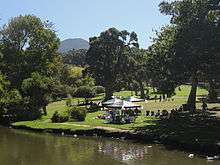 | ||
| 9/2/111/0092 | Dunheved, 14 Main Road, Wynberg, Cape Town | Wynberg | Wynberg | 34°00′11″S 18°28′09″E / 34.002980°S 18.469245°E |
| ||
| 9/2/111/0093 | La Plaisance, 2 Main Road, Wynberg, Cape Town | Wynberg | Wynberg | 34°00′10″S 18°28′09″E / 34.002905°S 18.469229°E |
| ||
| 9/2/111/0095 | Wynberg Station precinct, Wynberg, Cape Town | Wynberg | Wynberg | 34°00′15″S 18°27′54″E / 34.004111°S 18.464876°E |
| ||
| 9/2/111/0097 | 4 Bexhill Road, Wynberg, Cape Town | Wynberg | Wynberg | 34°00′19″S 18°28′19″E / 34.005340°S 18.471967°E |
| ||
| 9/2/111/0099 | Reference see 9/2/111/0127 | Wynberg |
| ||||
| 9/2/111/0100 | Dutch Reformed Mission Church, Aliwal Road, Wynberg, Cape Town | Wynberg | Wynberg | 34°00′14″S 18°27′50″E / 34.003858°S 18.464023°E |
| ||
| 9/2/111/0103 | Dutch Reformed Church, Carr Hill Road, Wynberg, Cape Town | Church halls: Two parallel rectangular halls; double pitched roof with asbestos cement slates to earlier hall and cement tiles to new addition; Steel casement windows; standard modern stock doors. A Dutch Reformed Church was built here in 1831. In 1899 it was replaced by the present fine building.
For more than a century and a half most of the inhabitants of this remote area belonged to the mother congregation in Cape Town. It was difficult for th Type of site: Church Current use: Church : Dutch Reformed. HISTORICAL INTEREST. A Dutch Reformed Church was built here in 1831. In 1899 it was replaced by the present fine building. |
Cape Town, Wynberg | Wynberg | Provincial Heritage Site | 34°00′16″S 18°27′46″E / 34.004452°S 18.462644°E | 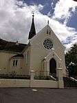 |
| 9/2/111/0107 | Hawthornden, Herschell Walk, Wynberg, Cape Town | The core of this double-storeyed house probably dates from 1683. The house was rebuilt in its present French Victorian style in 1881 by Capt. John Spence. Sir J. B. Robinson bought Hawthornden in 1891 and lived there until his death in 1927. Count Natale Type of site: House. The core of this double-storeyed house probably dates from 1683. The house was rebuilt in its present French Victorian style in 1881 by Capt. John Spence. Sir J. B. Robinson bought Hawthornden in 1891 and lived there until his death in 1927. Count Natale | Cape Town, Wynberg | Wynberg | Provincial Heritage Site | 33°59′53″S 18°27′28″E / 33.997989°S 18.457808°E |  |
| 9/2/111/0112 | Monterey, Klaasens Road, Wynberg, Cape Town | Type of site: House. | Cape Town, Wynberg | Wynberg | Provincial Heritage Site | 33°59′45″S 18°26′32″E / 33.995714°S 18.442142°E |
|
| 9/2/111/0114 | 34 and 36 Wellington Road, Wynberg, Cape Town | Cape Town, Wynberg | Wynberg | Provincial Heritage Site | 34°00′34″S 18°28′02″E / 34.009431°S 18.467187°E | 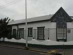 | |
| 9/2/111/0115 | 34 Wellington Road, Wynberg, Cape Town | Cape Town, Wynberg | Wynberg | Provincial Heritage Site | 34°00′33″S 18°28′01″E / 34.009300°S 18.466962°E |  | |
| 9/2/111/0115 | 36 Wellington Road, Wynberg, Cape Town | Cape Town, Wynberg | Wynberg | Provincial Heritage Site | 34°00′33″S 18°28′01″E / 34.009300°S 18.466962°E | 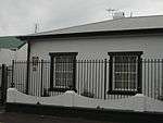 | |
| 9/2/111/0116 | 47 Cogill Road, Wynberg, Cape Town | Type of site: House. | Cape Town, Wynberg | Wynberg | Provincial Heritage Site | 34°00′33″S 18°28′01″E / 34.009284°S 18.467056°E |
|
| 9/2/111/0127 | WYNBERG MAGISTERIAL DISTRICT, GENERAL | Wynberg | Wynberg |
| |||
| 9/2/111/0128 | Conservation areas, Wynberg District | Wynberg | Wynberg |
| |||
| 9/2/111/0128/2 | Conservation Velley conservation areas, Wynberg District | Wynberg | Wynberg |
| |||
| 9/2/111/0139 | The Homestead, 23 Constantia Road, Wynberg, Cape Town | The building dates from the 1820s , possibly as a farmhouse to supply the garrison at Wynberg. It retains many original features, including internal and external joinery. Significant remodelling however occurred in the later Victorian period and further | Cape Town, Wynberg | Wynberg | Register | 34°00′52″S 18°27′57″E / 34.014546°S 18.465766°E | 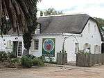 |
| 9/2/111/0151 | Springfield Convent Complex, Wynberg | Wynberg | Wynberg | 34°00′10″S 18°27′27″E / 34.002813°S 18.457587°E |
| ||
| 9/2/111/0154 | Battswood School Complex, Wynberg | Wynberg | Wynberg | 34°00′43″S 18°30′09″E / 34.011908°S 18.502622°E |
| ||
| 9/2/111/0155 | Maynardville, Block bounded by Wolfe, Church, Glaven and Piers Streets, Wynberg | Wynberg | Wynberg | 34°00′20″S 18°27′57″E / 34.005659°S 18.465706°E | 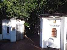 | ||
| 9/2/111/0157 | Wynberg Relief Road, Wynberg District | Wynberg | Wynberg |
|
References
- ↑ "Western Cape Provincial Heritage Sites (previously National Monuments)" (PDF). 19 September 2002. Retrieved 2013-01-28.
| Wikimedia Commons has media related to Cultural heritage monuments in Wynberg, Cape Town. |
Lists of South African Heritage Resources | ||||||||||||||||||||||||||||||||||||
|---|---|---|---|---|---|---|---|---|---|---|---|---|---|---|---|---|---|---|---|---|---|---|---|---|---|---|---|---|---|---|---|---|---|---|---|---|
| SAHRA Heritage sites |
| |||||||||||||||||||||||||||||||||||
| World heritage sites | ||||||||||||||||||||||||||||||||||||