National Register of Historic Places listings in Santa Fe County, New Mexico
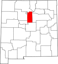
Location of Santa Fe County in New Mexico
This is a list of the National Register of Historic Places listings in Santa Fe County, New Mexico.
This is intended to be a complete list of the properties and districts on the National Register of Historic Places in Santa Fe County, New Mexico, United States. Latitude and longitude coordinates are provided for many National Register properties and districts; these locations may be seen together in a map.[1]
There are 82 properties and districts listed on the National Register in the county, including 7 National Historic Landmarks.
- This National Park Service list is complete through NPS recent listings posted December 16, 2016.[2]
| Bernalillo – Catron – Chaves – Cibola – Colfax – Curry – De Baca – Doña Ana – Eddy – Grant – Guadalupe – Harding – Hidalgo – Lea – Lincoln – Los Alamos – Luna – McKinley – Mora – Otero – Quay – Rio Arriba – Roosevelt – San Juan – San Miguel – Sandoval – Santa Fe – Sierra – Socorro – Taos – Torrance – Union – Valencia |
Current listings
| [3] | Name on the Register[4] | Image | Date listed[5] | Location | City or town | Description |
|---|---|---|---|---|---|---|
| 1 | Acequia System of El Rancho de las Golondrinas | 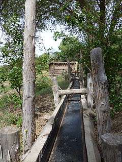 |
(#80002572) |
12 miles southeast of Santa Fe 35°34′28″N 106°06′33″W / 35.574444°N 106.109167°W |
Santa Fe | |
| 2 | Ricardo Alarid House | Upload image | (#84003054) |
534 Alarid St. 35°40′56″N 105°57′07″W / 35.682222°N 105.951944°W |
Santa Fe | |
| 3 | Allison Dormitory | 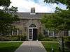 |
(#84000431) |
433 Paseo de Peralta 35°41′34″N 105°56′11″W / 35.692778°N 105.936389°W |
Santa Fe | |
| 4 | Apache Canyon Railroad Bridge | _Side.jpg) |
(#79001553) |
3 miles (4.8 km) northeast of Lamy over Galisteo Creek 35°30′49″N 105°51′17″W / 35.513611°N 105.854722°W |
Lamy | |
| 5 | Archbishop Lamy's Chapel |  |
(#88000897) |
Bishop's Lodge Rd. 35°43′50″N 105°54′32″W / 35.730556°N 105.908889°W |
Santa Fe | |
| 6 | Arroyo Hondo Pueblo | Upload image | (#07000950) |
Address Restricted |
Santa Fe | |
| 7 | Bandelier National Monument | 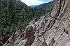 |
(#66000042) |
12 miles (19 km) south of Los Alamos on State Road 4 35°46′32″N 106°19′06″W / 35.775556°N 106.318333°W |
Los Alamos | Extends into Los Alamos and Sandoval Counties; includes Tsankawi detached portion. Boundary was increased 12/10/14 |
| 8 | Barrio de Analco Historic District | 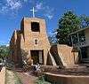 |
(#68000032) |
Roughly bounded by E. De Vargas and College Sts. 35°41′00″N 105°56′11″W / 35.683333°N 105.936389°W |
Santa Fe | Contributing buildings |
| 9 | Jane and Gustave Baumann House and Studio | 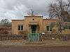 |
(#12000875) |
409 Camino de Las Animas 35°40′39″N 105°56′13″W / 35.677487°N 105.936904°W |
Santa Fe | |
| 10 | Alfred M. Bergere House | 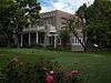 |
(#75001166) |
135 Grant Ave. 35°41′21″N 105°56′22″W / 35.689167°N 105.939444°W |
Santa Fe | |
| 11 | Jean Bouquet Historic/Archeological District | Upload image | (#83001628) |
Address Restricted |
Pojoaque | |
| 12 | Camino del Monte Sol Historic District | 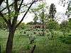 |
(#88000440) |
Roughly bounded by Acequia Madre, Camino del Monte Sol, El Caminito, and Garcia St. 35°40′41″N 105°55′46″W / 35.678056°N 105.929444°W |
Santa Fe | Contributing buildings |
| 13 | Camino Real-Canon de las Bocas Section | Upload image | (#11000170) |
Address Restricted |
Santa Fe vicinity | part of the Camino Real in New Mexico, AD 1598-1881 Multiple Property Submission |
| 14 | Camino Real-La Bajada Mesa Section | 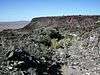 |
(#11000168) |
Address Restricted |
Santa Fe vicinity | part of the Camino Real in New Mexico, AD 1598-1881 Multiple Property Submission |
| 15 | Connor Hall | 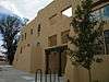 |
(#88001561) |
1060 Cerrillos Rd. at the New Mexico School for the Deaf 35°40′34″N 105°57′25″W / 35.676111°N 105.956944°W |
Santa Fe | |
| 16 | Gregorio Crespin House | 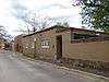 |
(#75001167) |
132 E. De Vargas St. 35°41′02″N 105°56′19″W / 35.683889°N 105.938611°W |
Santa Fe | |
| 17 | Randall Davey House | Upload image | (#70000409) |
Upper Canyon Rd. Coordinates missing |
Santa Fe | |
| 18 | Delgado Street Bridge | 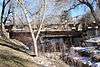 |
(#15000494) |
Delgado St. over the Santa Fe River 35°41′04″N 105°55′52″W / 35.6844°N 105.9311°W |
Santa Fe | |
| 19 | Digneo-Valdes House | 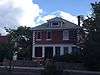 |
(#78001827) |
1231 Paseo de Peralta 35°40′53″N 105°56′22″W / 35.681389°N 105.939444°W |
Santa Fe | |
| 20 | Dodge-Bailey House | Upload image | (#07000414) |
3775 Old Santa Fe Trail 35°43′26″N 105°54′01″W / 35.723889°N 105.900278°W |
Santa Fe | |
| 21 | Don Gaspar Bridge | 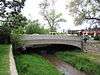 |
(#02001163) |
Don Gaspar Ave. crossing over the Santa Fe River between Alameda and E. De Vargas Sts. 35°41′06″N 105°56′22″W / 35.685°N 105.939444°W |
Santa Fe | |
| 22 | Don Gaspar Historic District | 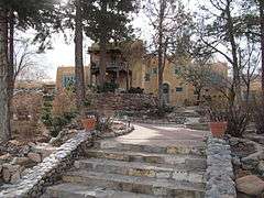 |
(#83001629) |
Roughly bounded by the Old Santa Fe Trail, Paseo de Peralta, Don Cubero and Houghton 35°40′42″N 105°56′28″W / 35.678333°N 105.941111°W |
Santa Fe | |
| 23 | El Puente de Los Hidalgos | 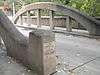 |
(#01000771) |
Grant Ave. approximately 50 yards north of its junction with Paseo de Peralta 35°41′34″N 105°56′20″W / 35.692778°N 105.938889°W |
Santa Fe | |
| 24 | El Rancho de las Golondrinas Section--El Camino Real de Tierra Adento | Upload image | (#13000774) |
Address Restricted |
Santa Fe | Part of the Camino Real in New Mexico, AD 1598-1881 MPS |
| 25 | El Santuario de Chimayo | 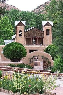 |
(#70000412) |
1 mile northwest of the Santa Cruz Reservoir Dam 35°59′23″N 105°55′38″W / 35.989722°N 105.927222°W |
Chimayo | |
| 26 | El Zaguan |  |
(#08000732) |
545 Canyon Rd. 35°40′56″N 105°55′47″W / 35.682137°N 105.92963°W |
Santa Fe | |
| 27 | Fairview Cemetery | 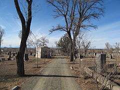 |
(#04001517) |
1134 Cerrillos Rd. 35°40′38″N 105°57′33″W / 35.677222°N 105.959167°W |
Santa Fe | |
| 28 | Federal Building | 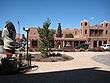 |
(#74001207) |
Cathedral Pl. at Palace St. 35°41′13″N 105°56′11″W / 35.686944°N 105.936389°W |
Santa Fe | Now the Museum of Contemporary Native Arts |
| 29 | Fort Marcy Officer's Residence | 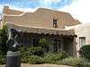 |
(#75001168) |
116 Lincoln Ave. 35°41′19″N 105°56′17″W / 35.688611°N 105.938056°W |
Santa Fe | |
| 30 | Fort Marcy Ruins | 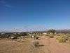 |
(#75001169) |
Off State Road 475 35°41′23″N 105°55′48″W / 35.689722°N 105.93°W |
Santa Fe | |
| 31 | Hayt-Wientge House | 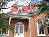 |
(#77000929) |
620 Paseo de la Cuma 35°41′39″N 105°56′21″W / 35.694167°N 105.939167°W |
Santa Fe | |
| 32 | Hospital | Upload image | (#88001562) |
1060 Cerrillos Rd. at the New Mexico School for the Deaf 35°40′37″N 105°57′23″W / 35.676944°N 105.956389°W |
Santa Fe | |
| 33 | J.B. Jackson House | Upload image | (#99000598) |
268 Los Pinos Rd. 35°34′54″N 106°06′12″W / 35.581667°N 106.103333°W |
Santa Fe | |
| 34 | Everret Jones House | Upload image | (#03001411) |
210 Brownell Howland Rd. 35°43′26″N 105°54′01″W / 35.723889°N 105.900278°W |
Santa Fe | |
| 35 | Daniel T. Kelly House | 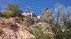 |
(#05001182) |
531 E. Palace Ave. 35°41′14″N 105°55′44″W / 35.687222°N 105.928889°W |
Santa Fe | |
| 36 | K'uuyemugeh | Upload image | (#15000496) |
Address Restricted |
Cuyamungue vicinity | |
| 37 | La Armeria de Santa Fe | Upload image | (#11000530) |
1050 Old Pecos Tr. 35°40′24″N 105°56′13″W / 35.673457°N 105.937033°W |
Santa Fe | |
| 38 | La Bajada Mesa Agricultural Site | Upload image | (#83004178) |
Address Restricted |
La Bajada | |
| 39 | La Cieneguilla South Section--El Camino Real de Tierra Adento | Upload image | (#13000775) |
Address Restricted |
La Cienega vicinity | Part of the Camino Real in New Mexico, AD 1598-1881 MPS |
| 40 | La Iglesia de Santa Cruz and Site of the Plaza of Santa Cruz de la Canada | 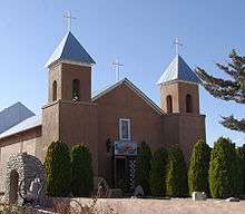 |
(#73001148) |
100 block of Santa Cruz Plaza 35°59′26″N 106°02′50″W / 35.990556°N 106.047222°W |
Espanola | |
| 41 | Laboratory of Anthropology | Upload image | (#83001630) |
708 Camino Lejo 35°39′52″N 105°55′28″W / 35.664444°N 105.924444°W |
Santa Fe | |
| 42 | Lamy Junction Archeological District | Upload image | (#16000388) |
Address Restricted |
Lamy vicinity | |
| 43 | Las Acequias | Upload image | (#08000697) |
22A Rancho Las Acequias 35°53′45″N 105°59′40″W / 35.89583°N 105.994508°W |
Santa Fe | part of the Buildings Designed by John Gaw Meem Multiple Property Submission |
| 44 | Lujan-Ortiz House | Upload image | (#99001680) |
1 mile from State Road 502 on County Road 84 35°53′11″N 106°03′31″W / 35.886389°N 106.058611°W |
Jaconita | |
| 45 | Madrid Historic District | 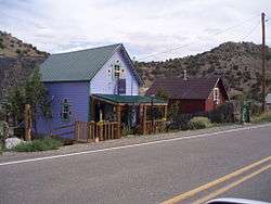 |
(#77000928) |
25 miles southwest of Santa Fe on State Road 14 35°24′24″N 106°09′11″W / 35.406667°N 106.153056°W |
Madrid | |
| 46 | National Park Service Southwest Regional Office | 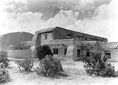 |
(#70000067) |
Old Santa Fe Trail 35°40′01″N 105°55′21″W / 35.666944°N 105.9225°W |
Santa Fe | |
| 47 | Navawi |  |
(#82001052) |
On a bluff above State Route 4, 1.8 miles north of the Rover Boulevard intersection[6] 35°50′53″N 106°12′51″W / 35.847926°N 106.214172°W |
White Rock | |
| 48 | New Mexico Supreme Court Building |  |
(#01001468) |
237 Don Gaspar Ave. 35°41′04″N 105°56′21″W / 35.684444°N 105.939167°W |
Santa Fe | |
| 49 | Nuestra Senora de Luz Church and Cemetery |  |
(#95001452) |
13 miles southeast of Santa Fe, north of an Interstate 25 frontage road 35°32′58″N 105°49′32″W / 35.549444°N 105.825556°W |
Canoncito | |
| 50 | Otowi Historic District |  |
(#75001170) |
25 miles north of Santa Fe, on State Road 4 in the Rio Grande valley 35°52′31″N 106°08′31″W / 35.875278°N 106.141944°W |
Santa Fe | |
| 51 | Otowi Suspension Bridge | |
(#97000730) |
State Road 4 over the Rio Grande 35°52′29″N 106°08′29″W / 35.874722°N 106.141389°W |
San Ildefonso Pueblo | |
| 52 | Palace of the Governors |  |
(#66000489) |
Palace Avenue at Santa Fe Plaza 35°41′16″N 105°56′15″W / 35.687778°N 105.9375°W |
Santa Fe | |
| 53 | Petroglyph Hill | Upload image | (#15000851) |
Address Restricted |
Galisteo vicinity | |
| 54 | Pflueger General Merchandise Store and Annex Saloon |  |
(#87000519) |
State Road 41 35°28′51″N 105°52′48″W / 35.480833°N 105.88°W |
Lamy | Now houses the Lamy Railroad and History Museum |
| 55 | Plaza del Cerro | Upload image | (#72000810) |
Southwest of the junction of State Roads 4 and 76 35°53′19″N 105°56′00″W / 35.888611°N 105.933333°W |
Chimayo | |
| 56 | Pueblo of Nambe |  |
(#74001208) |
About 16 miles off State Road 4 35°53′05″N 105°57′52″W / 35.884722°N 105.964444°W |
Nambé Pueblo | |
| 57 | Pueblo of Tesuque |  |
(#73001149) |
About 8 miles north of Santa Fe on the western bank of the Tesuque River 35°48′10″N 105°58′31″W / 35.802778°N 105.975278°W |
Tesuque | |
| 58 | Reredos of Our Lady of Light |  |
(#70000411) |
Christo Rey Church, Canyon Rd. and Cristo Rey St. 35°40′43″N 105°55′00″W / 35.678611°N 105.916667°W |
Santa Fe | Removed from the old Military Chapel on the Santa Fe Plaza, now demolished. |
| 59 | Route 66 and National Old Trails Road Historic District at La Bajada | |
(#05000633) |
Approximately 0.5 miles northeast of the northern terminus of State Road 16 35°33′31″N 106°13′35″W / 35.558611°N 106.226389°W |
La Bajada | |
| 60 | Ignacio Roybal House | Upload image | (#86000227) |
County Road 84 west of State Road 4 and U.S. Routes 84/285 35°53′27″N 106°02′28″W / 35.890833°N 106.041111°W |
Jacona | |
| 61 | St. John's College-Santa Fe, New Mexico |  |
(#15000495) |
1160 Camino Cruz Blanca 35°40′00″N 105°54′45″W / 35.6667°N 105.9124°W |
Santa Fe | |
| 62 | San Ildefonso Pueblo |  |
(#74001206) |
Southwest of Espanola off State Road 4 35°53′29″N 106°07′05″W / 35.891389°N 106.118056°W |
San Ildefonso Pueblo | |
| 63 | San Jose Hall |  |
(#15000264) |
5637 NM 41 35°23′45″N 105°56′48″W / 35.3957°N 105.9467°W |
Galisteo | |
| 64 | San Lazaro | Upload image | (#66000490) |
Address Restricted |
Santa Fe | |
| 65 | San Marcos Pueblo | Upload image | (#82003326) |
Address Restricted |
Capitan | |
| 66 | Santa Fe Historic District |  |
(#73001150) |
Roughly bounded by Camino Cabra, Camino de las Animas, W. Manhattan Ave., S. St. Francis Dr., and Griffin St. 35°41′13″N 105°56′06″W / 35.686944°N 105.935°W |
Santa Fe | |
| 67 | Santa Fe National Cemetery | 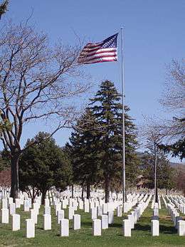 |
(#16000588) |
501 N. Guadalupe St. 35°42′03″N 105°56′50″W / 35.700833°N 105.947222°W |
Santa Fe | |
| 68 | Santa Fe Plaza | 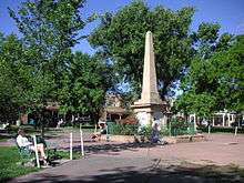 |
(#66000491) |
Santa Fe Plaza 35°41′14″N 105°56′15″W / 35.687222°N 105.9375°W |
Santa Fe | |
| 69 | Santa Fe River Park Channel |  |
(#08001181) |
Santa Fe River Park Coordinates missing |
Santa Fe | |
| 70 | Santa Fe Trail--Apache Canyon Bridge Site | Upload image | (#12000912) |
Across Galisteo Cr. Coordinates missing |
Glorieta vicinity | Part of the Santa Fe Trail MPS |
| 71 | Albert Schmidt House and Studio | Upload image | (#03000691) |
1505 A and B Bishop's Lodge Rd. 35°45′21″N 105°55′25″W / 35.755833°N 105.923611°W |
Tesuque | |
| 72 | School Building Number 2 | Upload image | (#88001560) |
1060 Cerrillos Rd. at the New Mexico School for the Deaf 35°40′35″N 105°57′24″W / 35.676389°N 105.956667°W |
Santa Fe | |
| 73 | Scottish Rite Cathedral | 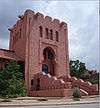 |
(#87000424) |
463 Paseo de Peralta 35°41′30″N 105°56′09″W / 35.691667°N 105.935833°W |
Santa Fe | |
| 74 | Second Ward School | 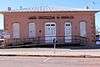 |
(#78001828) |
312 Sandoval St. 35°41′09″N 105°56′37″W / 35.685833°N 105.943611°W |
Santa Fe | |
| 75 | Seton Village |  |
(#66000492) |
6 miles south of Santa Fe off U.S. Route 84 35°35′56″N 105°55′54″W / 35.598889°N 105.931667°W |
Santa Fe | |
| 76 | Eugenie Shonnard House | Upload image | (#75001171) |
Address Restricted |
Santa Fe | Former residence of artist Eugenie Shonnard. |
| 77 | Spiegelberg House |  |
(#73001151) |
237 E. Palace St. 35°41′13″N 105°56′00″W / 35.686944°N 105.933333°W |
Santa Fe | |
| 78 | Superintendent's Residence | Upload image | (#88001563) |
1060 Cerrillos Rd. at the New Mexico School for the Deaf 35°40′37″N 105°57′17″W / 35.676944°N 105.954722°W |
Santa Fe | |
| 79 | Pinckney R. Tully House |  |
(#74001209) |
136 Grant Ave. 35°41′26″N 105°56′24″W / 35.690556°N 105.94°W |
Santa Fe | |
| 80 | U.S. Courthouse |  |
(#73001152) |
Federal Pl. 35°41′27″N 105°56′12″W / 35.690833°N 105.936667°W |
Santa Fe | |
| 81 | Carlos Vierra House |  |
(#79001554) |
1002 Old Pecos Trail 35°40′28″N 105°56′12″W / 35.674444°N 105.936667°W |
Santa Fe | |
| 82 | Donaciano Vigil House | 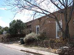 |
(#72000811) |
518 Alto St. 35°41′16″N 105°56′45″W / 35.687778°N 105.945833°W |
Santa Fe | |
| 83 | Wheelwright Museum of the American Indian | 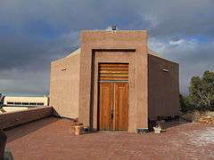 |
(#90001917) |
704 Camino Lejo 35°39′45″N 105°55′38″W / 35.6625°N 105.927222°W |
Santa Fe |
See also
| Wikimedia Commons has media related to National Register of Historic Places in Santa Fe County, New Mexico. |
- List of National Historic Landmarks in New Mexico
- National Register of Historic Places listings in New Mexico
References
- ↑ The latitude and longitude information provided in this table was derived originally from the National Register Information System, which has been found to be fairly accurate for about 99% of listings. For about 1% of NRIS original coordinates, experience has shown that one or both coordinates are typos or otherwise extremely far off; some corrections may have been made. A more subtle problem causes many locations to be off by up to 150 yards, depending on location in the country: most NRIS coordinates were derived from tracing out latitude and longitudes off of USGS topographical quadrant maps created under the North American Datum of 1927, which differs from the current, highly accurate WGS84 GPS system used by most on-line maps. Chicago is about right, but NRIS longitudes in Washington are higher by about 4.5 seconds, and are lower by about 2.0 seconds in Maine. Latitudes differ by about 1.0 second in Florida. Some locations in this table may have been corrected to current GPS standards.
- ↑ "National Register of Historic Places: Weekly List Actions". National Park Service, United States Department of the Interior. Retrieved on December 16, 2016.
- ↑ Numbers represent an ordering by significant words. Various colorings, defined here, differentiate National Historic Landmarks and historic districts from other NRHP buildings, structures, sites or objects.
- ↑ National Park Service (2008-04-24). "National Register Information System". National Register of Historic Places. National Park Service.
- ↑ The eight-digit number below each date is the number assigned to each location in the National Register Information System database, which can be viewed by clicking the number.
- ↑ Location derived from its GNIS feature record; the NRIS lists the site as "Address Restricted".
Municipalities and communities of Santa Fe County, New Mexico, United States | ||
|---|---|---|
| Cities | | |
| Town | ||
| CDPs |
| |
| Unincorporated communities | ||
| Indian reservation | ||
| Footnotes | ‡This populated place also has portions in an adjacent county or counties | |
| Topics | |
|---|---|
| Lists by states |
|
| Lists by insular areas | |
| Lists by associated states | |
| Other areas | |
| |
This article is issued from Wikipedia - version of the 9/25/2016. The text is available under the Creative Commons Attribution/Share Alike but additional terms may apply for the media files.