New Orleans metropolitan area
| New Orleans Metropolitan Area | |
|---|---|
| New Orleans-Metairie-Kenner | |
 | |
| Country | United States |
| State(s) | Louisiana |
| Largest city | New Orleans |
| Other cities |
Kenner Metairie, Louisiana (unincorporated) |
| Area | |
| • Total | 3,755.2 sq mi (9,726 km2) |
| Highest elevation | <200 ft (<62 m) |
| Lowest elevation | -7 ft (-2 m) |
| Population | |
| • Total | 1,251,849(2014)[1][2][3] |
| • Rank | 45th in the U.S. |
| • Density | 311/sq mi (120/km2) |
New Orleans–Metairie-Kenner Metropolitan Statistical Area, or the Greater New Orleans Region (as it is often called by the Louisiana Tourism Commission) is a metropolitan area designated by the United States Census encompassing eight parishes (the Louisiana equivalent of other states' counties) in the state of Louisiana, centering on the city of New Orleans.
As of the April 1, 2012, estimate, the metropolitan statistical area (MSA) had a population of 1,227,096. The New Orleans-Metairie-Hammond Combined Statistical Area (CSA), a nine-parish area, had a population of 1,452,502.[2]
The metropolitan area was hit by Hurricane Katrina – once a Category 5 hurricane, but a Category 3 storm at landfall – in August 2005. Within the city of New Orleans proper, multiple breaches and structural failures occurred in the system of levees and flood walls designed under Federal government auspices.
The resulting decline in the city's population negatively impacted population numbers for the entire metro area, for which a population of 1.3 million was recorded in the 2000 Census. Most of the decline in population is accounted for by the decline experienced in the city of New Orleans proper (coterminous with Orleans Parish); the Census Bureau estimates that the city's population dropped from 453,728 prior to the storm (July 1, 2005) to 369,250, the estimate for 2012.[4]
Definitions


The New Orleans–Metairie–Bogalusa Combined Statistical Area (CSA) is made up of nine parishes. The CSA includes two metropolitan area and one micropolitan areas.
Components
- Metropolitan Statistical Areas (MSAs)
- Hammond (Tangipahoa Parish)
- New Orleans–Metairie–Kenner MSA: (Jefferson, Orleans, Plaquemines, St. Bernard, St. Charles, St. John the Baptist, and St. Tammany Parishes)
- Micropolitan Statistical Areas (μSAs)
Parishes
For U.S. Census purposes, the New Orleans-Metairie-Kenner MSA includes eight parishes: Jefferson, Orleans (coterminous with the city of New Orleans), Plaquemines, St. Bernard, St. Tammany, St. Charles, St. James and St. John the Baptist.[5]
The Census Bureau's CSA (combined statistical area) adds Washington and Tangipahoa Parishes, to make nine parishes.
The New Orleans region's chamber of commerce, GNO, Inc.[6] (formerly Metrovision) includes the nine parishes of the Census Bureau's CSA plus St. James Parish. This wider 10-parish region had a population of 1.32 million as of July 1, 2008.
The Louisiana state legislature created a commission, the Regional Planning Commission, to be responsible for the planning and development of the New Orleans metropolitan area. The five parishes covered by the commission are: Jefferson, Orleans, Plaquemines, St. Bernard, and St. Tammany. Additionally, St. Charles and St. John the Baptist are associate members of the Regional Planning Commission.

The Center for Cultural and Eco-Tourism at the University of Louisiana at Lafayette has designated the New Orleans metropolitan area as the Greater New Orleans region[7] This region includes just four parishes: Jefferson, Orleans, Plaquemines, and St. Bernard.
History
The New Orleans metropolitan area was first defined in 1950. Then known as the New Orleans Standard Metropolitan Area (New Orleans SMA), it consisted of three parishes – Orleans, Jefferson, and St. Bernard – and had a population of 685,405.[8][9] Following a term change by the Bureau of the Budget (present-day Office of Management and Budget), the New Orleans SMA was called the New Orleans Standard Metropolitan Statistical Area (New Orleans SMSA).[10] By the census of 1960, the population had grown to 868,480, a 27% increase over the previous census.[9]
St. Tammany Parish was added the New Orleans SMSA in 1963.[11] The four-parish area had a combined population of 899,123 in 1960 and 1,045,809 in 1970.[9] By the 1980 census, the population had increased by 14% to 1,187,073.[9]
In 1983, the official name was shortened to the New Orleans Metropolitan Statistical Area (New Orleans MSA).[10] Two more parishes, St. Charles and St. John the Baptist, were added to the MSA the same year, making a six-parish MSA.[12] The newly defined area had a total of 1,256,256 residents in 1980, but that number had declined to 1,238,816 in 1990.[9]
The New Orleans MSA expanded to eight parishes in 1993 with the inclusion of Plaquemines and St. James.[13] The eight-parish area had a combined population of 1,285,270 at the 1990 census and 1,337,726 in 2000.
The MSA was renamed the New Orleans–Metairie–Kenner Metropolitan Statistical Area in 2003. St. James Parish was removed from the defined metropolitan area. A total of 1,316,510 people lived in the seven parishes of Greater New Orleans in 2000.
The City of Kenner is the largest incorporated city located in Jefferson Parish, just west of the City of New Orleans.
Geographic Terms
In the New Orleans metropolitan area, the following geographic terms are used: Eastbank, Westbank, Northshore (or North Shore), and River Parishes.
"Eastbank" and "Westbank"
The Mississippi River, running from north to south, divides the United States into eastern and western halves. In southeast Louisiana, though, newcomers are frequently confused by the terms "East Bank" and "West Bank" since, due to the curves of the Mississippi River, what is called the "East bank" is sometimes located geographically to the west of what is called the "West bank" and vice versa. The banks also lie to the north and south of the river throughout most of the region. In southeast Louisiana, the term "East bank" is often used to refer to any area that lies on the eastern half of the United States, as established by its location on the eastern bank of the Mississippi River, while the term "West bank" is often used to refer to areas along the opposite side of the river. These terms are used in urban, suburban, and rural parishes that are bisected by the Mississippi River, which include St. John the Baptist, St. Charles, Jefferson, Orleans, and Plaquemines.

In the New Orleans metropolitan area, the term "Eastbank" is a blanket term used to refer to all portions of metropolitan New Orleans south of Lake Pontchartrain and situated on the "eastern" bank of the river, while the term "Westbank" is used to refer to all portions of metropolitan New Orleans south of Lake Pontchartrain and situated on the "western" bank of the river. Somewhat perversely, while New Orleanians would never describe a neighborhood as being located north or south of the river, the West bank is, in fact, as a whole located to the south of the Mississippi River, while the East bank as a whole is located to the north – and is itself wedged between the Mississippi River and the southern shore of Lake Pontchartrain (the East bank's northern boundary). The majority of the population of metropolitan New Orleans resides on the East bank.
The Eastbank of Greater New Orleans includes the portion of Jefferson Parish (including the suburbs of Metairie, Kenner, River Ridge, Harahan, Elmwood, and Jefferson) that lies on the eastern bank of the river and most of Orleans Parish (including the majority of the city of New Orleans). Also, further down the Mississippi River are those suburbs of New Orleans that are located in St. Bernard Parish, which include Arabi, Chalmette, and Meraux as well as Violet and Poydras. All of St. Bernard Parish is located east of the river, extending from the eastern bank of the river back into the marshlands.

The Westbank of suburban New Orleans includes the portion of Jefferson Parish (including the suburbs of Waggaman, Avondale, Bridge City, Nine Mile Point, Westwego, Marrero, Harvey, Gretna, Terrytown, Jean Lafitte, Lafitte, Crown Point, Barataria, Estelle, Timberlane, and Woodmere) that lies on the western bank of the river and a portion of Orleans Parish (including the New Orleans communities of Algiers and English Turn). Further down the Mississippi River is the suburb of Belle Chasse, which is located on the western bank of Plaquemines Parish. Plaquemines Parish both encompasses and is bisected by the final leg of the Mississippi River before it enters the Gulf of Mexico. Downriver from Belle Chasse, Plaquemines Parish has numerous rural communities scattered along both banks of the river, but none of these communities have a population greater than 5,000. It should be noted that the terms "Eastbank" and "Westbank" are spelled as one word in local/official terminology when being applied to the Greater New Orleans area.
"Northshore"
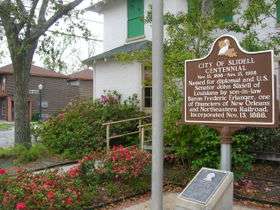
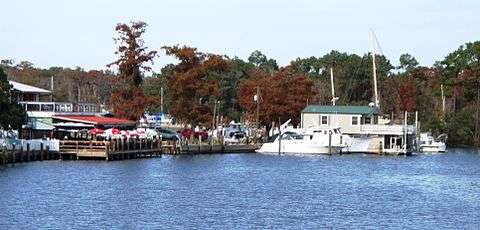
The term "Northshore" or "North Shore" refers to areas that lie on the northern shore of Lake Pontchartrain and includes St. Tammany Parish. The Northshore includes the communities of Mandeville, Covington, Madisonville, Abita Springs, Lacombe, Eden Isle and Slidell. Hammond and Ponchatoula, in Tangipahoa Parish, and Bogalusa and Franklinton, in Washington Parish, are also considered to have economic ties to Greater New Orleans although those parishes are frequently not included in the statistics for the New Orleans Metropolitan Area. The Northshore region is also part of the Florida Parishes, dating back to the time when the Spanish territory known as Florida extended westward all the way to the Mississippi River, including portions of what are now Alabama, Mississippi and Louisiana. St. Tammany Parish is the most affluent parish in metropolitan New Orleans and is also the most politically conservative.
"River Parishes"
The term "River Parishes" refers to those parishes along the Mississippi River between New Orleans and Baton Rouge. The two River Parishes nearest to New Orleans are St. Charles (including the cities of Destrehan, Luling, St. Rose and Hahnville) and St. John the Baptist (including the cities of Laplace and Reserve).
Urban areas of the region
| Population rank | Urbanized area | 2010 population |
|---|---|---|
| 49 | New Orleans, LA | 899,703 |
| 318 | Slidell, LA | 91,151 |
| 327 | Mandeville--Covington, LA | 88,925 |
Cities and census designated places
Principal city
Satellite Cities (Places with over 50,000 inhabitants)
Places between 10,000 and 50,000 inhabitants |
Places with fewer than 10,000 inhabitants |
Economy
Greater New Orleans is home to one of the busiest ports in the world. Greater New Orleans' single Fortune 500 company is Entergy. Other companies headquartered in the area include, Globalstar, Smoothie King, Receivables Exchange, Tidewater Marine, and Intralox.
Demographics
According to the 2010 Census, the overall racial composition of the New Orleans metropolitan area was as follows:[14]
- White or Caucasian: 58.2%
- Black or African American: 32.5%
- American Indian: 0.8%
- Asian: 3.5%
- Some other race: 2.8%
- Two or more races: 2.0%
- Hispanic or Latino (of any race): 8.6%
- Non-Hispanic White: 52.8%
For those under 18, the majority are minority, with only 45.2% being non-Hispanic whites.
As of the census[15] of 2000, there were 1,316,510 people, 498,537 households, and 335,531 families residing within the MSA. The racial makeup of the MSA was 57.4% White, 37.4% African American, 0.4% Native American, 2.2% Asian, <0.1% Pacific Islander, 1.2% from other races, and 1.4% from two or more races. Hispanics or Latinos of any race were 4.4% of the population.
The median income for a household in the MSA was $38,880, and the median income for a family was $44,771. Males had a median income of $36,759 versus $23,927 for females. The per capita income for the MSA was $18,126.
Transportation
Louis Armstrong New Orleans International Airport is located to the west of downtown, in the city of Kenner. The airport is currently served by fifteen airlines.[16] Domestic nonstop service is provided to Atlanta, Austin, Baltimore, Birmingham, Boston, Branson, Charlotte, Chicago (O'Hare and Midway), Cincinnati, Columbus, Dallas (DFW and Love Field), Denver, Detroit, Ft. Lauderdale, Houston (Bush Intercontinental and Hobby), Indianapolis, Kansas City, Las Vegas, Los Angeles, Miami, Milwaukee, Minneapolis, Nashville, New York (JFK, LaGuardia, and Newark), Oakland, Orlando (Orlando International and Sanford), Pensacola, Philadelphia, Phoenix, Salt Lake City, San Antonio, San Diego, San Francisco, Seattle, St. Louis, Tampa, and Washington DC (Reagan National and Dulles). International nonstop service is provided to London, Frankfurt, Cancun, Punta Cana, Panama City, and Toronto.[17]
Major highways in the area include Interstate 10, Interstate 12, Interstate 610, Interstate 310, Interstate 510, Interstate 55, and Interstate 59, as well as U.S. Highway 90 and U.S. Highway 61. The Lake Pontchartrain Causeway, a 24-mile (39 km) span that is the world's longest bridge over water, connects Metairie (on the south shore) to Mandeville on the North Shore.
Metropolitan New Orleans is served by six of the seven Class 1 freight railroads operating in North America.[18] Passenger train service is provided by Amtrak on the Crescent, City of New Orleans, and Sunset Limited routes.
The Port of New Orleans is the 3rd-largest port in the United States, as measured by total bulk tonnage exported.[19] According to the same source, the adjoining Port of South Louisiana is the largest port in the United States when measured by the same factor.
Should metropolitan New Orleans appear to be threatened by a severe hurricane, the Louisiana State Police are prepared to enact a contraflow lane reversal program in order to evacuate the metropolitan area as quickly as possible.
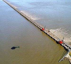
Flood control
The U.S. Army Corps of Engineers is responsible for the design and construction of Greater New Orleans' flood protection system. In 2007, Louisiana voters created a new Southeast Louisiana Flood Protection Authority (SLFPA) to coordinate with the Corps of Engineers regarding flood protection issues.
see also:
- Bonnet Carré Spillway
- Mississippi Valley Division of the United States Army Corps of Engineers
See also
- New Orleans, Louisiana
- Intrastate regions
- Effects of Hurricane Katrina in New Orleans and Reconstruction of New Orleans
- Louisiana census statistical areas
- List of cities, towns, and villages in Louisiana
- List of census-designated places in Louisiana
References
- ↑ "Table 1. Annual Estimates of the Population of Metropolitan and Micropolitan Statistical Areas: April 1, 2000 to July 1, 2009 (CBSA-EST2009-01)". 2009 Population Estimates. United States Census Bureau, Population Division. March 23, 2010. Archived from the original (CSV) on June 15, 2010. Retrieved March 26, 2010.
- 1 2
- ↑
- ↑ "Table 1: Annual Estimates of the Population for Incorporated Places Over 100,000, Ranked by July 1, 2009 Population: April 1, 2000 to July 1, 2009" (CSV). 2009 Population Estimates. U.S. Census Bureau, Population Division. June 22, 2010. Retrieved February 2, 2011.
- ↑ Finn, Kathy (January 2016). "That Silver Lining: Business Outlook is Partly Cloudy". My New Orleans.com. New Orleans Magazine. Retrieved April 20, 2016.
- ↑ Greater New Orleans, Inc. | Regional Economic Development. Gnoinc.org. Retrieved on 2013-07-29.
- ↑ Center for Cultural & Eco-Tourism. Ccet.louisiana.edu. Retrieved on 2013-07-29.
- ↑ "Standard Metropolitan Areas (SMAs) and Components" (TXT). Standard Metropolitan Areas defined by the Bureau of the Budget, October 13, 1950. United States Census Bureau, Population Division. December 14, 2000. Retrieved October 9, 2008.
- 1 2 3 4 5 "Louisiana – Population of Counties by Decennial Census: 1900 to 1990". United States Census Bureau, Population Division. March 27, 1995. Retrieved October 9, 2008.
- 1 2 "About Metropolitan and Micropolitan Statistical Areas". United States Census Bureau, Population Division. Retrieved October 9, 2008.
- ↑ "Standard Metropolitan Statistical Areas (SMSAs) and Components, 1963" (TXT). Standard Metropolitan Statistical Areas defined by Office of Management and Budget, October 18, 1963. United States Census Bureau, Population Division. October 25, 2000. Retrieved October 9, 2008.
- ↑ "Metropolitan Areas and Components, 1983" (TXT). Metropolitan Areas defined by Office of Management and Budget, June 27, 1983. United States Census Bureau, Population Division. March 1, 2001. Retrieved October 9, 2008.
- ↑ "Metropolitan Areas and Components, 1993" (TXT). Metropolitan areas defined by Office of Management and Budget, June 30, 1993. United States Census Bureau, Population Division. April 1, 1999. Retrieved October 9, 2008.
- ↑ http://quickfacts.census.gov/qfd/states/22/2255000.html. Missing or empty
|title=(help) - ↑ "American FactFinder". United States Census Bureau. Archived from the original on September 11, 2013. Retrieved 2008-01-31.
- ↑ Louis Armstrong New Orleans International Airport – "Airline Information". Retrieved on May 25, 2015.
- ↑ Louis Armstrong New Orleans International Airport – "Nonstop Destinations".
- ↑ Greater New Orleans, Inc. : Regional Economic Alliance. Retrieved on June 13, 2009.
- ↑ Ports in Louisiana: New Orleans, South Louisiana, and Baton Rouge. Retrieved on June 12, 2009.